![]()
The Historic Columbia River Highway
in Oregon
![]()
The Historic Columbia River Highway
in Oregon
From the Oregonian September 9, 1914
Old Biggs
By Curt Cunningham
Old Biggs which was a mile downstream from Biggs Junction was the terminus of the Columbia Southern railroad. This was were the railroad had their yard, shops and their interchange with the O. R. & N. mainline. The rail yard at Biggs shut down in 1967 when the line leading south was abandoned. Afterwards the place disappeared. There was a small settlement there that faded away long before the rail yard had shut down. The boat landing for Old Biggs was at Biggs Junction and there was no road leading to Old Biggs and you would have to walk through the sand to reach it, The O. R. & N. depot was established at Old Biggs in 1885. Nothing remains there today except a Grain storage elevator along with a barge shipping facility which serves the grain producers of the area.
Biggs was named after William Harrison Biggs who was born in Belmont county, Ohio, on May 13, 1831. When he was 19 years old in 1850 he crossed the plains with an ox train to California; afterwards he returned to Missouri and subsequently engaged in the commission and forwarding business on the Mississippi river, and later he was a captain and pilot on Mississippi river steamboats. In February of 1880, he came to Sherman county and secured land where Wasco is now.
He was a member of the City Council, and locally was known and revered as the "Father of Wasco." Mr. Biggs had more than a local reputation; he was receiver of the land office at The Dalles for 4 years; was elected a member of the Oregon Legislature in 1886, and was afterwards appointed by Governor Pennoyer as a member of the Railroad Commission. On October 19, 1907 W. H. Biggs passed away and his funeral was attended by many people. It was the largest funeral ever held in Sherman county at the time. Biggs was also a retired farmer and had extensive land holdings in Sherman county.
The town of Biggs, at the terminus of the Columbia Southern railway, was named after him as a compliment to his successful efforts in securing the passage of a bill in the Legislature which compelled the railroads to place sidings where they were needed. During the whole course of his busy and eventful life, Biggs remained a stanch Democrat, but, locally, all political parties claimed him as their friend. He was a very enthusiastic admirer and advocate of President Roosevelt. In all the years no one ever questioned his reputation for absolute honesty.
It was his rugged integrity and the faith he commanded from others that gave him his standing in the community. Everyone trusted Biggs and he never broke his word as he hated liars. In 1859 Biggs was united in marriage to Martha F. Ellis in Missouri. Martha passed away on December 24. 1901. On his deathbed in 1909, his brother, John Biggs who was the only surviving member of the family, came from Missouri to comfort him in his last hours.
Spanish Hollow / Biggs Junction
Biggs Junction was originally called Spanish Hollow and is 20 miles east of The Dalles and about a mile upstream from Old Biggs. This is where Interstate 84 and U. S. Highway 30 cross U. S. Highway 97. In 2010 Biggs Junction had a population of 50 which included 12 families. This busy highway intersection is now home to 3 hotels, 3 gas stations, 2 convenience stores, 7 restaurants, and 3 truck stops. The Pilot Travel Center, The TA Express Travel Center and the EZ Trip Travel Center make Biggs Junction one of the largest truck stops on the Oregon section of Interstate 84.
Spanish Hollow is also the name of a canyon about 10 miles long and opens to the Columbia river at Biggs Junction. From 1870 to the mid 1880's Spanish Hollow was the name of a post office established about 1.5 miles north of Wasco and about a half mile northeast of the Wasco cemetery on the Oregon Trail. This is where Jessie Eaton who was one of the first residents of the area had lived. Eaton's home was also a stage coach stop which was used for coaches using the Oregon Trail between The Dalles and Pendleton. The road to Walla Walla turned northeast from a junction at Pendleton.
In the 1880's Wilson Barnett established a store at his home which was just south of Eaton's place and he took over as the postmaster of Spanish Hollow. He then changed the name to Wasco and in 1888 moved the post office to his new store in the fledgling town which also took the name of Wasco. Later the Spanish Hollow name would be used for the place along the banks of the river now called Biggs Junction.
The May 27, 1881 edition of the Weekly Corvallis Gazette printed a letter written by Spanish Hollow resident A. B. Woolley who was known as "A B" and was once the Corvallis town Marshal had said; "This section lying between the Deschutes and John Day rivers, and extending back 50 miles from the Columbia river is a beautiful prairie country, and I think that soon it will prove to be one of the best grain growing sections in the state. Stockmen will tell you that you cannot raise anything here but hay, but they cannot make any one believe them. They have had their day and will soon have to give way to the able handed farmer."
"The greatest drawback to this country is a scarcity of timber and water, but I think when we get the proper tools for boring, we can get water where ever desired. Wood can be bought at the Columbia river for $5 per cord, and lumber for $15 per thousand, and with a little work we can make good roads where ever wanted. There was quite an acreage of grain sown this spring and it will compare well with grain in the valley at this season of the year. There is plenty of good land to be taken yet. Your humble writer has taken a half section of good land and was fortunate enough to get a piece with a good spring on it."
"I think if those people in the valley that are renting and have no permanent home would come up here and take a homestead, and stay with it, in a few years they could be independent. Spanish Hollow has a post office, one store, one blacksmith shop, and a school house. We have Sabbath and singing school each Sabbath, and preaching twice a month. Society is a little rough, however, on account of so many old bachelors. If a lot of those good looking maidens in the valley would, come to this part of the state, what a revolution in society they could make."
A Trip to Spanish Hollow
The Weekly Corvallis Gazette of December 8, 1882 had an article about a trip to Spanish Hollow. That was when Henry Elliott had returned to Corvallis from his trip to the country between the Deschutes and John Day rivers. He was very pleased with the country and said they have a nice valley there about 50 miles long and extending back from the Columbia river which was about 27 miles wide. The land is high rolling land without timber and he remained there a while with his brother-in-law, A. B. Woolley who was well and favorably known in and about Corvallis as a good jolly fellow.
Elliott said that "A B" had a fine ranch at Spanish Hollow and lived there from 1881 to 1904 and was well pleased with the country. In 1904 "A B" and his wife sold their property and moved to St. Helens. Sadly "A B" died on December 10, 1905 after he had a seizure and fell. He was taken to St. Vincent's hospital at 3am Sunday December 10th where he died at 10pm the next day. "A B" served throughout the Civil war as a Union soldier, and was a member of W. T. Sherman G. A. R. post of Wasco. He was an honest, upright man who never drank alcohol, and during his time spent in Benton county as well as in Wasco, he was esteemed and honored by all who knew him.
Elliott brought back to Corvallis some different varieties of vegetables which were raised about 10 miles back from the Columbia river in the high rolling land. One item was a large onion that measured 16 inches in circumference and raised from the seed by John Burge who had once lived about 4 miles from Corvallis down the river on the Linn county side before moving to Spanish Hollow. Elliot also had with him a couple of ears of corn raised by Woolley, of the white dented kind which were perfectly tilled clear out to the point, and measured 7 inches round and 7.25 inches in length, and a potato measuring 16 inches around.
These samples were not even the largest raised but were simply picked as average samples of the crop. The country around Spanish Hollow was settling up rapidly in 1881 and all seemed to be well pleased with the locality. Before leaving Elliott took a piece of land under the timber culture act. He said Woolley would travel to Corvallis in the fall of 1882 to see his old friends and acquaintances.
Spanish Hollow in 1882
In the January 27, 1882 edition of the Willamette Farmer, James D. Gibson gave a description of the area. Gibson who lived about 4 miles south of the river in the Spanish Hollow canyon said the following; "Spanish Hollow is 25 miles east of The Dalles, between Deschutes and John Day's river. This is a beautiful, rolling, bunch grass prairie; it has been the home of a few stockmen for about 20 years, but is now being settled by good, solid farmers, who are turning the bunch-grass plains into waving wheat fields."
"Last year saw the first grain harvested here and the result was quite satisfactory. Vegetables of all kinds do well here. This year the acreage cultivated will be more than triple what it was last year, and if the season is favorable you may look out for some big yields from this part next harvest. Our settlement extends from the Columbia river south, about 18 miles; beyond that is equally as good a grain country yet to be settled, only lying further from transportation; but that will not be a drawback very long, as it is the general opinion that there will be a railroad through this country before long."
"I have never known a new settlement where every one was so well pleased as they are here. No one appears to find any fault with the country. We have as good society as can be found in Oregon, and the only fault that I find with our good people is that they do not all take the Farmer; but I think they can all be led to believe and realize that it is their friend and guide. I enclose you one new subscription, and hope to be able to get more in the future. We are having a splendid Winter; all kinds of stock are in splendid condition."
A brief History of Sherman County
The Dalles Times-Mountaineer issue of January 1, 1898 was a souvenir edition and is a history of Sherman and Wasco counties. In the issue it said that the first person to settle between the John Day and Deschutes rivers was Samuel Price. He came from somewhere about 1858, and settled at the place that was known as Love Grove. He and his aged companion still live in Sherman county, proud to witness the wonderful development of the country in which they are the oldest pioneers.
Price put the first horses on the range, and soon he was followed by others, until the number of horses and cattle in this county alone amounted to no less than 100,000 head. Price was followed by Jesse Eaton, who settled in Spanish Hollow canyon, and whose family still lived on the old home place in 1898. Eaton came in the early 1860's, and was closely followed by Mr. Leonard, who built and operated Leonard's bridge across the John Day river. At this early time there were only 3 houses between the rivers.
How did Spanish Hollow and China Hollow Get Their Names
There are 2 conflicting stories of how Spanish Hollow got its name, one by C. F. Fulton and the other by Charles Maskiker. The first story about Spanish Hollow was told by C. F. Fulton of Sherman county in 1920, and said that; "Spanish Hollow, which comes out near Biggs, on the Columbia River Highway, was named after some Mexican packers years ago. The packers camped there for a few days and that was long enough for the hollow to get its name. Masiker's story is below in the "More about Biggs" section.
Fulton continued his story and said that; "connecting with Spanish Hollow, is China Hollow. In the 1860s when The Dalles was a wild and woolly town, a couple of Chinese people left The Dalles to go to Walla Walla to open a laundry. They carried their equipment slung on poles across their shoulders. Some bad men of The Dalles decided the Chinese had money, so when they were camped in what is now China Hollow the outlaws robbed and then murdered them. Thereafter it became known as China Hollow."
The Columbia & Southern Railroad
The Columbia and Southern railroad was incorporated on March 4, 1897, for the purpose of operating a railroad from Biggs to Prineville, but it only made it as far as Shaniko. The railroad traversed the rich wheat fields of Sherman county and the stock and wool districts in Wasco county. Surveying the line commenced on March 23, 1897 and construction began on June, 19, 1897. By October 6, 1897 it was completed to Wasco. The line was first-class and standard gauge, being laid with 56 lb. rails, and 7x8 ties, the ties were laid 3,000 to the mile, and the equipment of the line in every respect was complete.
At Biggs a connection was made with the O. R. & N. Co., with which a general interchange of traffic was made. After completion of the line to Wasco, it became a busy traffic tributary hauling wheat, lumber, coal, wood, machinery and merchandise. Wheat was sent out and the other commodities were brought in. The incorporators of the company were: E. E. Lytle, J. M. Murchie, Walter Moore, and D. C. O'Reilly. E. E. Lytle, was the president of the road, and was a railroad man who had almost 20 years experience.
The line was completed to Wasco on October 6, 1897 and was extended to Moro on January 13, 1899 and to Grass Valley on March 27, 1900. The terminus was supposed to be at Prineville but they only made as far as Shaniko, which was opened on May 13, 1900. On December 23, 1910 the railroad was absorbed into the new O. W. R. & N. In 1936 both lines were absorbed by the Union Pacific railroad. The line between Shaniko and Kent was abandoned in 1943, and the rest of the old line between Kent and Biggs was abandoned in 1967.
Biggs The Desolate its Drifting Sand
Printed in the Hood River Glacier issued on September 23, 1909 is an article about a description of Biggs, and titled Biggs the Desolate its Drifting Sand. This was where several prominent people of Oregon made their start, and was uniquely and unfavorably described by newspaperman Colonel John H. Cradlebaugh, who was the first editor of the Hood River Glacier. The article reads in full; "Perhaps the most desolate place in Oregon, for that matter anywhere is Biggs. The most dreary, sand-blown desert camp in Nevada or Arizona is a beauty spot compared to Biggs, its only advantage over them being except for it is on the bank of the Columbia, and that is always beautiful."
"But turn your back to the river and the place is desolation. Everybody has heard of Biggs, simply because it is a railroad junction, the northern terminus of the Columbia Southern, built by E. E. Lytle and Walter Moore in 1897. I was going to say it boasts of half a dozen houses, but it doesn't. It has that many, but it doesn't boast about them. Biggs is located at the mouth of a canyon about 10 miles long, up which the Columbia Southern climbs to the magnificent wheat fields of Sherman county, 1,200 or 1,500 feet above it."
"There is more sand to the square rod at Biggs than anywhere in the world, and it is a restless, roving hobo sand, as well. Originally it no doubt came from the faraway Snake river, and got piled up on the Oregon shore at Celilo, by the Columbia. As the river recedes, the west wind sweeping up along its course, carries the sand back along the beach and a never-ending sheet of it, drifting like fine dry snow, up the longer slopes of the big sand drifts, to be deposited on the steep downwind side of them."
Thus slowly these big drifts travel, ever eastward during the Fall and Spring, carried up the slope, deposited on the other aide, moving by indistinguishable degrees, but always moving. The inconsistencies have caused the O. R. & N, officials more trouble and worry than all the floods and fires and other things that ever happened to it. It crawled onto the tracks and stayed there, and though the little grains were not larger than mustard seed, they were more powerful than the great moguls, and stopped all traffic. The traveling public swore at the railroad company, and waited impatiently for trains that never came."
"The railroad management damned the public for its refusal and accept the inevitable, and the company laid awake for nights on end trying to devise some way to stop the encroachments of the infinitesimal bits of rock, and incidentally to make light the burden to the section bosses, who, in turn growled at the section crews as they lifted their tiny shovels laden with the resistless yellow stuff, in vain opposition to the tireless west wind. Other places on the road had sand and plenty of it but Biggs was unreasonable."
"The railroad company built sand fences, regular billboards, set at an angle of about 45 degrees to the track, to change the course of the sand stream. For miles on either side of the road, but a few feet apart, their fences line the track looking for all the world like the backbone of some mighty fish 15 or 20 miles long might look, the road representing the spine, and the fences the lines of parallel ribs. This plan proved of great benefit, and is still in use, as being the best, in fact, the only thing that accomplished anything."
"It helped some, even at Biggs, but there every day is a holiday for the sand, and it does just as it pleases. During a little quiet spell, when the West wind was on a vacation and the river was high, someone built a two-story hotel there and painted it white. The sand dunes whispered the story to each other and waited. By and by the water went down, and miles of sand beach were uncovered. Then the West wind came sweeping up the river to see what had been going on while it was away, and then the sand dunes woke up and got busy."
"They found that house and proceeded to toy with it. The wind whipped the yellow sand until it went flying against that doomed house. In a week it was as bare of paint as an actress after a Turkish bath. Then the sand got ashamed of it and began to bury it. it made a fine object for the wind to whip the sand around and drop much of its load as it was weary of playing with. In 2 weeks that hotel looked like a dugout in a hillside. One gable was buried, the others only visible above the bottom of the upper story windows."
"The misguided and disgusted owner had moved out long before, and made a bee line for Indiana, whence he came, preferring the solidity of the quagmire, the sibilant song of "Down on the Wabash" a humming in continuous vaudeville by the mosquito, and the "shake" three times a week, and every other Sunday, to that softly whispering ever moving, resistless, ubiquitous sand. He sold the house for a song, and let the wind sing that; and inside of a month the wind changed, and the house blew out, again as good as ever, only it was shy on paint."
"The new owner was a man of resources, and a stay'er. He put wheels on his cook stove and heavy furniture, and stayed with it. If the sand piled up too thick, he hitched onto his stuff, dragged it out and camped in Biggs' canyon until the wind changed and blew the house out again. The traveler who visited Sherman county never knew whether there was a hotel at Biggs or not, that is, he never knew of it was alive and running, or dead and bulled; it all depended on the wind. Its bill of fare bore the notice "weather permitting."
"The well was a driven one, sometimes it was 18 feet deep, sometimes it was 60, It was made of 2 inch pipe and screwed together in 6 foot sections. As the sand piled up, a section of pipe was screwed on and the well was 6 feet deeper. When the place was abandoned the well would be left how it was at the time, and when it was time to move back the well would be sticking up in the air 30 or 40 feet and would have to be unscrewed and lowered. The telegraph lines, one would think were safe from these little busy grains of sand, but there was nothing too high for it to tackle."
"The drifts piled up and up, about them, always leaving an encouraging little hole, or depression around the pole as though they were going to leave it, but they were only joking, and directly the sand was up to the sagging wires. Other poles were spliced onto the first and the wires raised, but still the sand tenacious of purpose of principle climbed after them. This meant more poles, and there the joke came in. The wind would change and try a cross section survey for a while."
"Then the wires would have to come down. There was a gang of linemen busy all the time, like a contractor on a newly paved street, either continually taking something up or putting something down. That is the kind ot a place Biggs was and it was named after William H. Biggs, one of the finest, bighearted old men that ever encouraged a bull team across the plains with cheering, even though somewhat italicized language, Biggs was a 49er, and he told the writer that if he had known water would run down hill, or if the balance of the gang had known enough to have told him, they would all have been millionaires."
"He said they dug the gravel upon the bars, packed it to the river, dipped up water with a can and rocked out a yard of dirt in a day, when if they had turned the stream over the bar it would have all washed away while they were getting a drink. Maybe it was on account of his name that the town of Biggs acted this way. Biggs was too good a man, too much of a stay'er, to have that moving picture of a town named after him. He had been a member of the Oregon Legislature."
"The people of Wasco county had probably heard of the wisdom he displayed in mining California, and realized he was the right man to represent them as lawmaker. He introduced and had passed an act compelling railroads to build a sidetrack wherever anyone built a warehouse. Then he went home and built a warehouse at the mouth of the canyon down which the road wound from Wasco. The O. R. & N. as the law requited, built a sidetrack, which the sand promptly buried. Then Governor Pennoyer appointed him Railroad Commissioner, and the railroad management liked him worse than it did before his warehouse sidetrack law."
"They wanted to do something mean to him, and they did. They named the place Biggs. It was low down sarcasm, for the place was little and could never hope to be comparatively bigger. It had plenty of sand, but that was its only resource, though it never quit blowing about. For a time great quantities of wheat were hauled down to Biggs and thousands of sacks were piled there for shipment, but the wind and the sand stopped this. it was discovered on one occasion that the wheat had blown out of innumerable sacks and the sand had blown in. That was one of the peculiarities of the Biggs sand."
"One could never tell what it would do next. Then the farmers began hauling their grain to a little town further east, where vegetation grew and the sand was not. Some facetious railroader called it Rufus, because the wind was always whistling there, but that has nothing to do with Biggs, neither has anything else that can avoid it. E. E. Lytle started the Columbia Southern railroad from Biggs, probably thinking that anything that could, would start from Biggs and keep on going."
"It appealed to Lytle; they were similar in their tastes. Neither of them ever quit moving, and all either of them had as stock in trade was sand; but they both had plenty of that. All Lytle had to do was to raise the wind, He did. He raised more, Walter Moore. The ranchers wanted the road, and they turned out with their big teams and graded 10 miles of road for him, while he hustled the O. R. & N. for rails and ties and a 16 candle-power engine, and finally be blew into Wasco, the county seat of Sherman county, and tapped the finest wheat belt along the Columbia."
"He had 3,000,000 bushels of wheat to handle on a down-hill grade to Biggs. Then he bonded his little dinky road and built 18 miles more of it with the money, Walter Moore and some others standing with him, until he had Moro on his line, and it connected with Wasco and also with Biggs. Then, like the sand, Lytle rested a little while, but in the Spring he extended the road to Grass Valley where Hill and Harriman are now at swords' points, and then on to Kent and finally to Shaniko, 70 miles from no place, that is from Biggs."
"Shaniko is the exact opposite of Biggs; there is no sand there. It is down to bed rook and too poor to afford it. The wind blew just as hard, and just as steadily, but there was nothing for it to show that was loose; that had already blown away all except the pungent odor of sheep. That was indigenous; it was blown in the bed rock and couldn't blow out. Like Biggs, Shaniko was better than it looked, it had to be to well no matter why, and it was much bigger than Biggs."
"It is built around a square, that is, it is partly built around it; the houses are some distance apart. They are located that way so there would be enough of them to go around the square. Shaniko is all right, but the square is a misfit; it needs some tucks taken in it, but the town will grow up to it sometime. The Hotel Shaniko and a dandy little hotel it is, to stand at the northwest cornet of the plaza. There is a saloon at the southeast corner of the southeast quarter. It is visible from the hotel, and the trail is "well defined." A big fine country store is on the northeast corner while the southwest corner is open for an engagement, that is, it was when was I was last there in 1902."
"Passing out of that corner to the south you could say then, like Monte Cristo, "the world is mine." You can still say if you hurry, but Jim Hill and Harriman both have designs on it. If you went south a dozen miles you would come to Trout Creek. If you went farther south you would find Hay Creek and the Baldwin Sheep & Land Company, with sheep on a thousand hills, and then some. Some of the hills belong to it. Still farther south Willow Creek and Prineville and Crooked river, and then there is the "desert" where the cattle feed all winter and get fat."
"But this is a digression, we are talking about Biggs. I only mentioned Shaniko to show what a wide awake little railroad could do if it started at Biggs and kept going. The Colombia Southern's headquarters were at Biggs and in the sand, and its hind quarters were at Shaniko and on bed rock, but it ran through a fine wheat country and paid good dividends. That same wheat country was once considered only grazing land, and there are thousands of acres just like it down between Shaniko and Reno, Nevada. Harriman and Hill have both found this out; Lytle showed them."
"That they realize its immense possibilities is shown by the fact that they both want to build a railroad up the Deschutes river to tap it. It is not because they dislike Biggs, or Shaniko, that they did not want to extend the line from Shaniko, but because they did not want to pull the vast products that will soon come from that great empire over the heavy grades at that point, and which could be avoided by a route up the Deschutes. They wanted a water-level grade, and Hill at least has it."
"Biggs isn't kicking about it, The new road will not interfere with its business of taking care of the products of Sherman county. Biggs asks nothing of nobody and gets it. It has the sand to look after itself. It has no push club, no chamber of commerce, no place to put one if it had it, that is, no permanent place where it would not be likely to be sanded under. Biggs is gritty, and like the country newspaperman when he died, "there to stay." It is only 3 miles over to Grants, and that is so much more worse than Biggs, that Biggs feels gas every time Grants is mentioned."
"The wind blows harder at Grants. It has to. The sand is so much coarser and harder to move. In fact, it is gravel, some of it large as hen's eggs, but the wind toys with it just the same. Grants was named alter Bill Grant, of the firm of Murphy, Grant & Co., of San Francisco. Bill was a trifle bigger than the town. He had to be to hold it down and keep it from blowing away. Only a big man could stay there. E. O. McCoy also started in business there. Dutch was bigger himself."
"He has grown since financially, and is now the head of the Wasco Milling Company, of The Dalles, with warehouses all along the road from Biggs to Grass Valley, and a big roller mill that is run by electricity, generated at White river, 30 miles south of The Dalles. I only mention this to show what can be done with anything that will start from Biggs. It is bound to keep on going; nothing can stop it. Lytle started there and so did his railroad; so did Bill Grant and "Dutch" McCoy, and see the result."
"The Columbia Southern started there and only stopped because it arrived at the jumping off place; Lytle started there and is now chasing the tall timber of Tillamook, and hunting the Pacific Ocean; "Dutch" started there and is now running by electricity, having run for the Legislature and got it; Bill Grant started there and is dead, so I can't really say how far he has gone, or what he has reached, but whatever it is it is no worse than Biggs. That is the beauty of Biggs as a starting point; you are bound to improve your surroundings no matter where you get to."
"As a starting place it is unequalled but as a stopping place it is different. Even the sand does not stop there; it just goes on through on its trip east and by rail, and on its way back it takes the river route and goes around it. However, Biggs can't help it that she acts this way. It isn't intentionally that she gives a wrong impression to newcomers about the county back of her. But she does. It is impossible to make a tenderfoot believe that within 10 miles of Biggs are some of the finest wheat fields in the state, and that on top of those big hills between the Deschutes and John Day, 3,000,000 bushels of plump, hard wheat ripen in safety from the sand every year, but it does just the same. The country back of all this is all right; so is Biggs; it is all right, but like the late Ben Butler, it doesn't look that way."
More About Biggs
Now on to the second story about how Spanish Hollow received its name. Printed in the December 9, 1909 issue of the Hood River Glacier, Charles C, Masiker son of George Masiker and stepson of Samuel Price wrote a rebuttal to John Cradlebaugh's article. The letter reads as follows; "I see that John Cradlebaugh has written on "Biggs the Desolate." Suppose I give you a few points on the history of Biggs. I do not know all about Biggs by any means, but 1 do know a great deal more about it than Cradlebaugh does."
"Biggs was first built at the mouth of Spanish Hollow. This hollow was so named because 2 Spanish cows were found ranging in it at the crossing of the old emigrant road, since known as the Eaton place. These cows were supposed to have been lost from a drive on its way from the Willamette valley to Fort Walla Walla, for the use of the garrison, shortly after the close of the Cayuse war in 1855. In 1843 a portion of the emigrant train, that Dr. Whitman piloted across the plains, camped at the mouth of Spanish Hollow and waited there a while on account of sickness."
"Before leaving they buried the remains of one of their women there and in 1894 the winds shifted the sands and these remains were exposed, and Samuel Price, now of Hood River boxed up the bones and gave notice of their finding. During the hard winter of 1861-62 Emmett Miller's stage, running from Walla Walla to The Dalles, was blocked in the snow at Well Springs, and his passengers and other travelers to the number of 16 started from Scott's ferry on the John Day river, and since 1879 it has been known as Leonard's Bridge. The stranded party then began to make their way to The Dalies."
"One of them made his way down Spanish Hollow and thence down the Columbia to the house of William Graham, where the Deschutes station now stands. He reported the others were on the way and as they did not arrive, John Irwin and Charles Poole began to pack up supplies and go find them. At daylight the next morning they each took a saddle horse along with some supplies, (the travelers Were all on foot) and found 2 men at the place where, Biggs was built. These freezing men had reached there some time in the night and found some driftwood to build a fire and waited for daylight."
"Their feet were frozen but they were able to go on without help, and told our friends that some of the party had turned north hoping to reach the Columbia and come down it. The roads were all obliterated and the men became snow-blind and could not keep a course with any accuracy. Irwin end Poole went on up to what was then known as the Columbia bottom, a short distance above Grants, (possibly Rufus) and found 2 more men, who reported that they had been compelled to leave a man a short distance back, who had given his name as Jonathan Mulkey. He was found at Murray's Spring, frozen down to the snow so they had to cut him loose to get him up."
"They then put him on a horse and brought him down to the point of rocks above Biggs. Fearing to trust the footing of the horse coming around the point, Irwin took him on his back got down on all fours and carried him down to Biggs, freezing his own hands in the operation. Mulkey was so badly frozen that he died few days later. Sadly only 9 of the 16 came in. Some of the others were found after the snow had gone the next spring and some were never found."
"After the railroad was built, Henry Heims of Columbus, WA, came over and built a hotel at Biggs. Dixon McDonald, now of Hood River, and his partner Robert Ginn, now of Moro built a platform and warehouse for the handling of wheat. They later kept a store there. The Farmers Cooperative Warehouse Co., also ran a platform and warehouse in the same business. A company comprised of E. O. McCoy, C. E. Bone, now of Hood River, Walter Moore, Henry Moore, and perhaps some others bought the McDonald platform and continued to handle wheat at Biggs, until the Columbia Southern railroad was built to Wasco."
"L. E. Clark now of Hood River built a house on the point just east of the Hollow and kept the Biggs post office. He also handled lumber, wood, shingles, coal and lath. He would at times run a ferry between Biggs and Columbus. He also kept a livery stable. After running the hotel for some time, Heims sold out to Samuel Price who ran the house for some time and then sold to Mrs. Floorer, who after running the house about a year let it fall back to Mr. Price. He ran it again until the Columbia Southern railroad drained the business of the place down to a pretty low point, when he sold out to J. L. Henderson, who after running the house for a time sold to George Hoffman."
"Hoffman moved the building up the hollow onto his ranch and used it for a dwelling. During the time Sam Price ran the hotel, the sand formed against the south side of the house in such bulk as to endanger the south wall. It bulged inward and had to be braced. McDonald took his team and scraper and relieved the pressure at times, and later the writer on several occasions scraped the sand away to prevent the walls from crushing in. One evening while we were at supper, the ceiling in the wash room unable to support the weight of the sand that had sifted through the roof onto it, fell with a crash that startled us."
"Not long after this I was awakened one night by a cracking noise followed by a dull thud, then the voice of Thomas Van Ansdell, late of Hood River, called out, "Jim! Jim!" Receiving no answer from Jim Murphy who was occupying the bed with him. Thomas called to me to come up and bring a light, and he said that Jim was hurt. On reaching the bedroom, I found that the ceiling had fallen with its weight of sand and buried Jim, who was a sound sleeper, and had not awakened, until it was too late to get out of bed."
"Several men set to work vigorously with their hands and soon dug him out. Fortunately the cloth lining on the ceiling came down over his face and kept the sand out of his nostrils. He was not hurt and saying that he was alright went into another room and was sound asleep in about 3 minutes. Price cut a manhole up through the ceiling of the main part of the house the next day and found that there was no weight of sand over the other rooms. All slept soundly after that. But the sand was so bad that the people decided to move the town lower down and I left coming to Hood River."
The Maryhill-Biggs Ferry
In the 1860's a town was established on the Washington side of the Columbia river opposite Biggs. It was founded by Amos Stark who arrived in 1858 and built a cabin about 2 miles east of the Maryhill museum. The town was called Columbus and was officially platted in 1879. In 1859 the Columbus landing came into prominence as a wood landing for the pioneer steamboat Colonel Wright, built by Thompson and Coe, and for many years afterward was practically the only place on the upper Columbia river where wood was available other than driftwood which was cut by Indians along the beach. The steamers used this wood as fuel.
Most of this wood was cut at the headwaters of the Klickitat river, and after a haul of several miles it was thrown down to the beach below from the high bluffs. It was from this landing that the then new steamer Webfoot, an ungainly craft, took on a full load of the cord wood in 1863 for distribution to upper points to be used as fuel for other steamers. Unfortunately the carrier succeeded in consuming the entire cargo before they sold any of the wood. Thousands of tons of grain were shipped annually from this point brought in from the fertile Goldendale valley. After the steamer left the river it was a common sight to see the bank lined with huge stacks of wheat and oats awaiting transportation across the ferry to Grants Station, on the opposite shore.
In 1868 William Hicenbotham established a ferry between Columbus and Spanish Hollow. (Columbus is now known as Maryhill) The landing on the Oregon side was about quarter mile east of the bridge at Biggs Junction and was known as the lower landing. The upper landing was located 2 miles upstream at Grants. This operation lasted until 1880 when the Grants Ferry Co. took over operations and switched the Oregon side of the run to the upper landing at Grants.
Request is Made to Move the Biggs Station to a Good Boat Landing
In the Sunday Oregon Journal issued on January 9, 1913 is an article about Sam Hill proposing to move the Biggs railroad station upstream to Spanish Hollow. Having to walk a mile through the sand every time he wanted to go to Portland from his Maryhill home didn't appeal in the least to him. That January he filed a formal complaint with the state railroad commission against the O. W. R. & N., over whose road he rides when he goes to Oregon's metropolis.
The O. W. R. & N. ran on the Oregon side. So Hill had to cross the river in the launch to reach the railroad. The railroad maintained a station at Biggs, which the ferry couldn't reach because of rapids in the river. At Grants which was further upriver, there was a deserted station which had been abandoned since 1907. Between them was the Shaniko branch. Under present conditions, in order to reach Biggs, Hill said it was necessary to walk about a mile from where the ferry lands. And all the way was through the sand.
So the good roads booster asked the commission to order the railroad company, which had refused to act at his request, to move their station from Biggs to Grant or some other point where the ferry could reach it, He says there were about 4,000 people in the Klickitat valley who would be benefited by the change.
On April 19, 1913 the State Railroad Commission dismissed the suit brought by Samuel Hill to compel the O. W. R. & N. railroad to move their station from Biggs to a more accessible point on the river. The year Hill began plans to establish a ferry between Maryhill and Spanish Hollow.
The Need for a Ferry at Spanish Hollow
In the November 5, 1913 issue of the Oregon Daily Journal Fred Lockley wrote an article about the need of a ferry across the Columbia between Columbus and Spanish Hollow to be a link in the proposed North-south highway which will become U. S. Highway 97. He said that in 1836 Dr. W. H. Gray who came to Oregon with Dr. Marcus Whitman built the Cascadila. which was one of the early steamboats on the Columbia river. He chose Columbus because the timber from the Slmcoe mountains could be brought through the gap at Columbus. It is the lowest point for 30 miles in either direction through the high land along the Columbia, leading back into central Washington.
Directly opposite this gap is Spanish Hollow on the Oregon side. In the old days before the coming of the railroad there was a ferry plying across the river from Columbus. Lockley had a talk with Mr. Robinson, the postmaster of Columbus, and he said: "I have been here since 1883. If you will come down to the river bank I will show you the old posts where the ferry landing used to be. The old ferry house is still there. They used to bring down the lumber, cross at the ferry here and go on into central Oregon by way of Spanish Hollow, but when the railroad went from Biggs to Shaniko they were so anxious to get the road, that they gave up the county road to the railroad and the ferry was abandoned."
"Why Is It," Robinson said to Sam Hill, "That a ferry is not put in here?" "Well, seeing is believing," said Mr. Hill, "I will hire a launch and take you over so you can see for yourself, but first I want to take you for a little drive behind a pair of Morgan mares." W. W. Paris handled the reins and they took a drive over the Maryhill roads and down to the river behind one of the finest stepping teams in the state of Washington. Hill then said; "I am going to have H. C. Richardson, with his automobile, take Mr. Johnson across the river. We will meet him on the other side."
"It is about half a mile across, but to get there they will have to go about 64 miles, as they must go to Dallesport, cross by ferry to The Dalles and come up on the Oregon side. That as you will notice, isn't much encouragement for a person to cross the river. We can sit on our front porch here at Maryhill and look across the river and see trains going back and forth oh the O. W. R. & N. without being able to make any use of them." Hill then hired a launch and they went across the river, landing near the water tank in Spanish Hollow."
The water tank was less than a quarter mile east of Biggs station. Near the water tank was the bridge across Spanish Hollow. Hill said; "a ferry could be operated from Columbus to land at the old ferry landing, about 50 yards from the railroad bridge. The teams and automobiles could go under this bridge and thus avoid all chance of being hurt. If a person comes across now in a launch, he has a quarter of a mile's walk through the sand to the station with his luggage."
It was dangerous for the launch to land at the present station at Biggs as the river there before The Dalles dam was completed broke into rapids over the rocks. "The station of Biggs," said Hill. "is now located just at the curve so that the track in both directions is shut off from sight while if it was located here at the water tank, the cost of moving it would not exceed $2,500 and it could be put between the main track and the side track, making it much safer for the public. It would not inconvenience the railroad, in any way but it would be of incalculable benefit to the public."
"Not only would it not hurt the railroad but it would mean a largely increased revenue from passenger and freight traffic, for the easier you make it for people to travel the more traffic is stimulated. The objection urged to the change is that no one might wish to invest his money in a ferry at this point. I myself, am willing to put in a good ferry and guarantee to run it for a long period if the change is made. It makes no particular difference to me for I have plenty of places where I can live, but it does make a big difference to the people who are on the land here and whose prosperity depends on staying with their ranches."
"If the merchants of Portland realized the benefit that would accrue to Portland from this change, the change would certainly be made." In talking with D. C. Ireland, the editor of the paper at Moro, he said; "There are 4 or 5 stations within a few miles. What the people of Sherman county want is to have the station at Biggs abolished, and to move the station at Grants to where the water tank now is near the site of the old ferry landing, and to leave Sherman where it is." (Sherman was a shipping point located about 2 miles west of Biggs,)
We are afraid that if Biggs is moved the quarter of a mile to the proposed site of the ferry landing, Sherman will be abolished as a transfer point and the railroad will make us to go the new ferry point. Of course, everyone who is familiar with the circumstances will agree that the only logical place for a ferry landing is near the water tank and the bridge, in place of risking the dangerous water near the present station at Biggs. "Until this link is completed," said Mr. Hill, "there is little hope of having an all-the-year-round route from the Okanogan on through Central Washington and Oregon and into California.
"The old saying of the chain being no stronger
than its weakest link would certainly hold good here, for no tourist wants to travel 64 miles around to get across
the river, particularly when there is no reason whatever why a ferry should not be established here."
While they were waiting for a train they visited the recently built school house at Biggs. It
was a beautiful schoolhouse, which cost about $3,500 or $4,000. They found 3 students in attendance,
and the teacher explained there were actually 4 students who were registered but one of them was sick.
When the train arrived they hopped on for a ride to The Dalles, where they rejoined
Richardson and Johnson, who had come from Maryhill
with the automobile. While in The Dalles Hill had a meeting with the county Judge and the county commissioners
and discussed the proposed route of the new road to be built with the $200,000 that Wasco county
would be
bonded for. There was considerable difference of opinion among the citizens of Wasco county, as to how this money
should be spent. Some thought that Wasco county should build its link to the
Columbia River Highway along the Columbia river from which other roads could
be put in as feeders.
In this way they could capitalize the work being done by the government on the Celilo canal and the locks, and would be able to attract a constant stream of tourist travel coming up from Portland as well as the tourists from elsewhere who would come through Portland, and who would want to make the Columbia river trip. Wasco county, without any expense to itself for the building of the government work which had cost millions, and without paying any taxes on it, could capitalize on it by the construction of its link in the extension of the Columbia River Highway up the Columbia and for all time to come it would realize a profit from the money spent by tourists who would make this trip.
Not only that, but tourists could come down from Seattle, Tacoma and other points on the coast to Portland and up the Columbia river, and many would make the trip through Central Oregon and into California on this road, on account of its easier grades and on account of the further fact that the roads would be good all the year around. The other opinion held was that in place of completing Wasco county's part of the Columbia River Highway they should spend their $200,000, for which the county was bonded, to put roads over the hills and back into the farming country.
The Wasco-Biggs Road
On February 7, 1914 the State Highway commission opened bidding for the contract to construct a 10 mile portion of the Central Oregon Highway in Sherman county, from Wasco to Biggs. The principal object in letting the contract was to create employment immediately to relieve the unemployment situation in the state.
When the work of construction began it provided employment for about 300 people. The road followed the survey made by Samuel Hill in 1912 which he had presented to the state. From Wasco north for a distance of 6 miles the road was to be built along the ridge but it appears the road had been built through the valley instead. The road was connected to the Columbia River Highway at Biggs Junction. This new 10 mile road formed the first section in the Central Oregon Highway which is now known in Oregon as the Sherman Highway and the entire route is known as U. S. Highway 97.
Citizens of Hood River were Weary of this New Section
On Monday February 9, 1914 the Hood River Commercial club held a meeting which had a large attendance. Most came to listen to W. L. Clark talk about the construction of the Columbia River Highway from Hood River to eastern Oregon. He said that in the fall of 1913 he received a direct hint that the wealthy good roads enthusiasts of Multnomah county, said that if Hood River did their share in opening up the Columbia River Highway east from their town they would come along and do the rest.
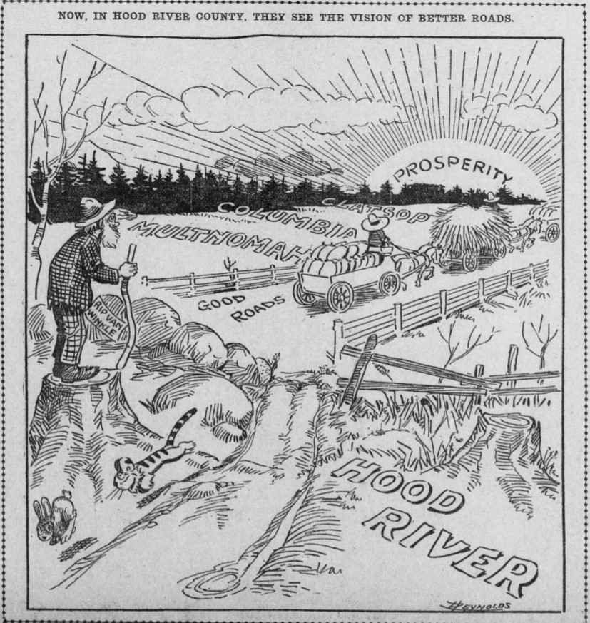
He then said that; "Knowing the nature of the gentlemen who made this offer, I safely consider it a promise, the value of which is little realized by the Hood River people. The survey has been completed as far as the city limits of Hood River and there it has been stopped. Aside from that, not a move has been made toward considering plans to open up the road. In Portland the belief is becoming prevalent that so far as Hood River is concerned, the Columbia River Highway is dead. The cartoon in this Morning's Oregonian shows in what light Portland looks upon us." (This cartoon is located on the side bar of this page.)
He told the audience that the Columbia River Highway was going to stop at the Multnomah county line, unless they did something quickly. The Portland people claimed that up to that point they had secured most of the scenic beauty of the trip. There was to be a ferry service put in operation at that point and the remainder of the journey to the east side of the Cascades would be on the Washington side of the river. Skamania county had authorized $75,000 to complete a link of the North Bank Highway leading into Stevenson and Captain Otis Treiber who was the owner of the Underwood-Hood River ferry system had informed Clark of this fact.
Clark then said; "Now let us take a jump to the eastern end of the highway. Governor West and the Emergency board, which is also the State Highway Commission, have just authorized the spending of $32,000 on a 10 mile stretch of road from Wasco to Biggs. The reason for creating this emergency fund was to give work to the unemployed. But why take the unemployed to that little stretch of road up there at Biggs, when the money could have been spent advantageously nearer Portland."
"From man up a tree, this looks like the answer. Across the river from Biggs is Maryhill. From Maryhill west stretches the famous, Sam Hill road, which is considered one of the finest pieces of road in the United States. (Maryhill Loops) That road was built by Bowlby, the present highway engineer of Oregon. Bowlby suggested the building of that 10 miles of road from Wasco to Biggs. From Biggs there is a ferry to Maryhill. With the completion of that 10 miles of road the farmers of Sherman, Wheeler, Morrow and Grant counties can ferry across from Biggs to Maryhill, go down the Washington side through Stevenson to Vancouver and cross into Portland over the new Portland-Vancouver bridge on the pacific Highway."
"Or from Stevenson they can ferry across the river and drive into Portland over the Columbia River Highway. With Sam Hill behind the project you can rest assured we are going to have a fine highway across the river." Much of the road was already completed and few realized was was going on and what had already accomplished. Dixon McDonald followed with a brief description of the road from Biggs to Wasco; "When I first heard of the construction of this section I wondered what was going on. After listening to Clark now I know."
McDonald then said that he knew every inch of the 10 miles the road which was to be constructed and that the sand problem at the lower end of the road was the worst there was anywhere along the river. He could see no reason for the state to build that remote piece of highway and that there must be some big project behind it, and said it must be the road down the Washington side of the river. McDonald then said; "From Biggs it is but a short ride to the Deschutes river, and Wasco county has just appropriated money to build a fine bridge across the Deschutes, which will connect Biggs with the road up the Deschutes canyon, which is conceded by all to be the best route into California. Sam Hill has always advocated this route as the only feasible one to California."
"Unless we get busy there is the greatest possibility that the California traffic will be diverted to Biggs and cross over and go down the Washington side. This is some traffic when you consider that 1,100 California automobiles registered at The Dalles last year. When I consider the perfectly logical route which we can figure out as being planned as an outlet into Portland for the eastern Oregon and California traffic, it really gives me a chill to think of the excellent possibility of Hood River being left high and dry in this highway business."
In the Wednesday edition of the October 25, 1916 Oregon Daily Journal is a reprinted article from the Moro Observer that said; "The road built by the state from Wasco to the Maryhill ferry, is practically an unused thoroughfare which could be made of considerable benefit to the traveling public if a short stretch of half a mile were built to connect it with the Biggs depot. Biggs is the only station in Sherman county that is open for 24 hours of each day and where accurate train information could be had."
More About the North Bank Route
On April 12, 1914 It was announced that The people of Klickitat county, Washington, were fully aware to the great development that was to follow the completion of the Columbia River Highway. A. S. Benson who had just returned to Portland from a trip to Goldendale said; "They want to assist in the work of providing an alternative route on their side of the river in order to bridge the gap between Multnomah and Sherman counties. In fact they have taken active steps to do so."
"The county commissioners will make an appropriation of $22,000 to grade 2 miles of road between Goldendale and Columbus. The state, I understand, will make an appropriation of $60,000 to build about 7 miles between Lyle and Stevenson. When these gaps are filled there will be a good road all the way from Columbus to Stevenson. This is good news for Portland, as it means that by 1915 we can have a good route into California, even though Hood River county is unable to build its portion of the highway."
"We will not be dependent on that county. At Columbus Samuel Hill is going to install a ferry service to carry the tourist travel across the river to Biggs. I am figuring on providing a ferry near Bonneville to bring the traffic back into Oregon again and put it on the Columbia River Highway. Thus we will have a continuous route from California through central Oregon to Portland. In addition, we will have access to the Klickitat and Yakima valleys. That which adds to the importance of the route is the fact that owing to the climatic conditions, travel to California and to eastern Washington can be maintained the year around." Benson also made a visit to Biggs and viewed the work being done by the state under contract on the road between Biggs and Wasco.
On June 28, 1914 Samuel Hill escorted a party over the entire route of the new Central Oregon Highway. It was said to be next in importance to the Columbia River Highway of which it complemented. Hill said; "When the state highway commission decided to build the 10 mile section between Biggs and Wasco, It undertook a work of practical value that will service a great number of people. A highway through central Oregon is a feasible route to California."
"Owing to climatic conditions. it can be
traveled the year around and owing to topographic conditions if it can be cheaply constructed. There are no
heavy grades to cut or mountains to cross. Most of the way the character
of the soil is such that a good dirt road can easily be maintained. Joining the Columbia
River Highway at
Biggs the Central Oregon Highway with a short grade mounts the Columbia river plateau and runs along the
divide between the John Day and Deschutes canyons over a comparatively level country directly south to Lakeview
and thence to California."
The party consisted of Dr. R. John Hill, of Minneapolis, brother of Samuel Hill, County Judge Bernard Daly, of Lake county. State Highway Engineer Henry L. Bowlby, and a Journal representative. It was a hurried trip as, those familiar with Samuel Hill's methods of travel could readily appreciate. They traveled by day and they traveled by night, snatching on an average 4 hours of sleep.
Leaving Maryhill about noon, the party crossed the Columbia river in a launch to Biggs and then walked up Spanish Hollow over the grade being made by the state for several miles, inspecting the work which they pronounced to be good. The grading was being done in a permanent way and no place did the grade exceed 6%. The sun beat down with intensity upon the canyon and after the party, had gone a short distance Judge Daly, who was a man who when at home did most of his going about either in an automobile or on horseback, began to inquire how much farther it was to the top of the hill. Finally he refused to walk any farther, so a train was flagged and they all rode to Wasco.
The contractors on the Biggs-Wasco section of the highway had the grading over 60% completed that June and expected to finish their contract on August 4, 1914. The advantage in beginning the highway at Biggs was that when the top of the hill was reached, they would be on the summit of the divide between the John Day and the Deschutes canyons, where a road was easily maintained, as there was no crossing of the natural drainage as would be the case in proceeding up either of these canyons. This was an important consideration in road construction, as it was expensive fighting against nature.
The Maryhill-Biggs Ferry Redux
In the February 22, 1915 issue of the Oregon journal is an article about the new ferry that Sam Hill had promised to build. The ferry was launched on February 25th to ply the Columbia river between Maryhill and the old landing at Spanish Hollow. "This ferry boat." said Samuel Hill, "is the last word in economical transportation in that particular line. It is driven by high power engines and has three large water tight compartments, making it practically unsinkable. It is equipped to haul 6 automobiles at a time."
"On top of the cabin is a railing, and here passengers will be taken care of while the automobiles, wagons or stock will drive onto the lower deck. The ferry will be in service at all hours. The craft was built under United States government inspection. Access can be had to the ferry boat from both shores without driving through sand, and it is about the only place on the river, except at Vancouver, where this condition exists. The deck of the boat will be treated with an asphaltic coating, so that the Maryhill road will be extended right onto the boat, greatly lengthening the life of the planks."
"When I proposed the road through central Oregon, I promised the tourists that there would be means provided for them to cross the river. This crossing is the one link that was necessary, and so, to make my word good, I put in the ferry. The boat is to be named the Governor West. This name was suggested by my daughter. Mary Hill, because Governor West's heart and whole interest was for the betterment of Oregon by the building of good roads. It will be christened by my daughter with a bottle of homemade cider. Among the guests at the christening will be the ex-Governor and his wife Mabel West, and I expect to have the farmers for miles on both sides of the river, attend the ceremony."
On February 25, 1915 the Governor West. was launched at 2pm. It was the last link on the all-year-round highway between British Columbia and Mexico. Promptly at 2pm, in the presence of several hundred townspeople and nearby residents, Captain Stewart B. Winslow hoisted the American flag to the masthead. As it fluttered out in the stiff sea breeze it was given 3 hearty cheers. Mary Hill, accompanied by her father, Samuel Hill, Governor West and his wife Mabel and Jean Marte, went aboard, and in the bright sunshine of a perfect spring day the boat was christened by Mary Hill.
Stepping to the prow of the boat she said; "I christen this boat Governor West with the belief that this boat will serve the public as Governor West has served Oregon; that it will make good as Governor West has made good; that the boat will he the connecting link in the great highway between British Columbia and Mexico to be traveled every day in the year. That as the children of Israel passed over the Red Sea on dry land, so by this boat one can pass from one dry state to another, in sunshine or in storm, and always in safety. This boat will render a small service where Governor West rendered a great and lasting service, for under his administration Oregon declared for good roads."
Governor West then handed her the bottle of homemade cider which she broke on the vessel's prow. The blocks were knocked out and the boat slid down the greased ways into the river amid the enthusiastic cheers of those to whom a ferry across the Columbia meant so much. As the boat was being launched Captain Winslow's moving picture machine kept up a rapid-fire clicking like a Maxim in action on the firing line. Alfred H. Barnes, one of the best photographers in the northwest, came down from Tacoma to photograph the launching for lantern slides for Sam Hill. Barnes had made most of Hill's best pictures of the Oregon and Washington scenery.
After the launching, refreshments were served aboard the boat, to which all were invited. Forming a greatly appreciated part of the refreshments was an immense cake, the gift of the Northern Pacific railroad to Samuel Hill. On the face of the cake were the seals of Oregon, Washington and California, below which was the inscription, "To Honorable Samuel Hill. Father and Originator of Good Roads." In speaking of the launching of the Governor West. Captain Winslow said; "Mr. Hill at his own expense forging the last link in the great every-day-in-the-year highway."
"Tourists can now come from British Columbia to Seattle, thence to North Yakima. Goldendale and Maryhill, and cross the river at Spanish Hollow on the Oregon side, and by way of Biggs. Shaniko, Prineville and Lakeview enter California by way of the Pitt River valley, on through to the Sacramento; valley and thence southward to southern California and Mexico. In the past if a tourist or one of our local people wanted to go across into Oregon with his automobile he had to go westward 19 miles and cross at The Dalles, then come back 19 miles, making a trip of 38 miles, 12 miles of which on this side of the river is over heart breaking roads consisting of a steep hill and several miles of sand."
"The only other way to get across was to go 14 miles out of the way by going east to the Arlington ferry. This road is also sandy and is a heavy pull. A farmer can cross here in a few minutes, where if he went by way of Arlington it would take him from 2 to 3 days. The boat Mr. Hill has just launched is of the same type as is used at Umatilla, Wallula and Pasco. It is operated by a 35 horsepower gasoline engine. The boat is 63 feet long, with an 18 foot beam, and a deck room for 6 autos."
"It was built by Chris Roberdine of Portland, formerly a boat builder in government service, and it was completed in 150 days. It will cost between $3,000 and $4,000 when it is ready for service. Its machinery will be installed and it will be ready to make its first trip in 2 weeks or less. Mr. Hill has employed a licensed operator who will be ready for service at any time. The boat has three water tight compartments and is mill built, seaworthy and a safe craft."
"It is interesting to note that in the old days of river navigation Maryhill, then called Columbus, was an important transportation point. A ferry was operated here and on account of its geographical advantages of having a good approach without sand on both sides of the river, and there being a natural grade down to the river on both sides, much of the freighting to and from central Oregon and central Washington was done here. It was also here at Columbus that W. H. Gray, an Oregon pioneer and pioneer river man, built a boat to ply on the upper Columbia. With the forging of the last link in the great highway central Oregon will again come into her own and the land where rain and sunshine meet will be the Mecca of tourists and home seekers."
Trip to Redding, California via the Central Oregon Highway
On June 6, 1915 Henry Bowlby now the ex-State Highway Engineer for Oregon said that; "to drive from Portland to Redding, CA, motorists have the option of taking your car up the Columbia river and then south through Central Oregon. Until the Columbia River Highway is completed to Hood River, the auto must be shipped by boat from Portland to White Salmon, Lyle or The Dalles. On our trip we shipped on the steamer State of Washington, leaving Portland at 11pm. The rate on the auto to White Salmon is $7.50, the fare $1.00 each and 50 cents for a berth."
"A good breakfast was served on board for 50 cents. Arriving at White Salmon at 8am the trip was made through Sleepy Hollow to Lyle, a distance or 33 miles, in 3 and a half hours. From Lyle to the Maryhill ferry, by the town of Goldendale, a distance of 46 miles, was made in 3 hours. A new power ferry is in operation across the Columbia river at Maryhill, which lands at the foot of Spanish Hollow, the Columbia river terminus of the Central Oregon Highway. The State of Oregon last year built a fine road from this point on a 6% grade to Wasco."
"Leaving Maryhill at 5am with a new Hupmobile we passed through Wasco, Shaniko, Antelope, Prineville, La Pine, Silver Lake, Paisley and reached Lakeview, a distance of 348.6 miles from Maryhill, after one day's driving of 18 hours. Prineville, 141 miles from our starting point. From Lakeview to Alturas, a distance of 63 miles, the trip was made in a driving rain in 6 hours. At Alturas is found a good comfortable hotel, the Niles Hotel, and 2 good garages."
"Leaving Alturas the ride to Redding is probably the most scenic of the entire trip. Nineteen miles out the famous Kelley Hot Spring's are passed. Canby Post office at 21 miles and Adin at 46.7 miles. The town of Bieber at 62 miles out; running; time 5 hours. Pittsville at 78.5 miles and Fall River Mills at 87 miles from Alturas. The wonderful gorge of the Pitt river and the Pitt river falls are passed at 91 miles. The town of Burney was reached at 4:40pm, distance from Alturas 107.5 miles; time 9 hours and a half."
"The trip from Burney to Redding, a distance of 66.2 miles, was made in 10 hours. We scraped off the plug from the crank case 6 miles out of Burney and ran 46 miles to Bella Vista without a drop of lubricating oil. At this place an accommodating mechanic with the sawmill company soldered a piece of tin over the hole and the remaining 13 miles to Redding was made in an hour."
The Maryhill Ferry Out of Commission
In the June 18, 1916 issue of the Oregonian is an article about a trip made from Portland to Roosevelt, WA on June 11th which says; "In the "wee small" hours of last Sunday morning when most of Portland was busily sleeping away the effects of a vigorous Rose Festival celebration, Sam Robinson, who sells Reos, Coles and Marmons at the salesroom of the Northwest Auto Company on Broadway and Couch streets, by "Scotchy" McAlpin. was well on his way toward the little town of Roosevelt, where he was going to deliver a beautiful new Cole "Eight" to W. A. Reader, a merchant of that place."
"The Columbia River Highway, over which his course lay, was already dotted with tourists, many of whom were doubtless returning home after the recent festivities. "We, of course, found the highway in its usually excellent condition," said Mr. Robinson in speaking of his trip, "and good roads continued until about 15. miles west of Hood River, where for a short stretch the road was a little rough. We arrived at The Dalles about noon, but at that point had the misfortune to be misdirected, being told to cross the Columbia river at Biggs, some 35 to 40 miles up the river."
"Upon arriving there, we were informed that the ferry plying between Biggs ant Maryhill had not been running for 6 months. We were then compelled to return to The Dalles, where we arrived just 10 minutes too late for the ferry. In this manner we lost practically all of Sunday afternoon and had to pass the night at The Dalles. The next morning, acting under instructions from automobile men who knew the road, we left at 7am for Wasco, traveling over 35 miles of about as perfect roads as I ever saw."
"Beyond Wasco, we found the way more or less hilly and rough. It was interesting to learn, as we crossed the John Day river on the McDonald ferry, that 60 tourists had crossed the river at that point the day before, to the tune of $1 an automobile, and that the average crossing ran about 10 cars a day. From this point to Roosevelt is about 16 miles, but due to the hills, the road winds around a distance of some 30 miles up Rock Creek and down Alkali Canyon to the town of Arlington, from which place we crossed the Columbia directly at Roosevelt about noon."
"The new Cole "Eight" was delivered to its owner, who said he was delighted with his purchase, and at 4pm that afternoon we started back in Mr. Reader's old Buick arriving in Portland at 1:30pm the following afternoon. Mr. Robinson just recently has become a member of the Cole force." "No matter how bad the hill." he declared enthusiastically, "not once did I have to change from high gear, while driving the Cole "Eight" on this trip."
The Maryhill-Biggs Ferry Ends Service.
The Governor West ended service in 1920 after 5 years in operation. It is unknown why the service had ended and it appears a passenger only gas launch was put back into service to the lower landing. This operation ended in 1921 when a new 8 car ferry was put into service on the Maryhill-Grants run. It was advertised that there was no more backing up cars onto the ferry. There was also a new road and railroad crossing to the ferry landing, and the advertisement also said that there was no more sand to drive over.
U. S. Highway 97
On February 6, 1935 two Bills were introduced by Oregon Senator Stelwer directing the state highway commission to proceed with the improvement of the Sherman Highway and the road extending from the upper ferry landing at Grants to its connection with the Sherman Highway a mile east of Biggs. U. S. highway 97 utilized a portion of the Columbia River Highway between Grants and Biggs Junction. This would remain the route Highway 97 until the Bridge was completed in 1962 and crosses the river between Maryhill and Biggs Junction. The Grants ferry was discontinued and the road leading to the landing was abandoned.
The Columbia River Highway Completed
On April 29, 1922 in the Sunday Oregonian, Engineer Whitmore along with A. E. Shearer who was the manager of the Oregon State Motor association took a trip from Portland to Pendleton. Whitmore said that motorists coming from the east to the Pacific Northwest over the Columbia River Highway would no longer be misdirected by signs which were directing them to cross the Columbia river via such and such ferry for the best road to Puget Sound then leaving them to flounder around in an effort find their way north.
The Columbia River Highway was now completed from Pendleton to Portland and there was no need to cross the river until then. Travelers could now travel to Portland on the new road and then cross the river on the Interstate bridge and follow the Pacific Highway north to Seattle and Tacoma. Many of these roads motorists were being directed to use were virtually impassible a good part of the year. These signs were presumably put up by ferrymen or the towns on the Washington side.
Whitmore and Shearer began their journey to Pendleton with a car load of official road signs and had posted everyone of them before they reached their destination. When they finished their task the Columbia River Highway was signed to an extent never before known, and to such an extent as to make it almost impossible for a motorist to lose their way. The Columbia River Highway now had signs at all crossroads with caution signs on both approaches in places where needed. Many of the signs had mileages to points east and west. Practically all the dangerous points were marked using red Niterday road reflectors.
The route from Maryhill to Goldendale was now open, but beyond Goldendale the road was in only fair shape. The best way to go to Maryhill was to ferry at Grants. Shearer had nothing but praise for the condition of the Columbia River Highway. The pavement as far as Seufert, 3 miles beyond The Dalles, was continuous hard pavement except for 4 miles of fair macadam at Rowena, and, of course, was in splendid shape, he then said; "the feature of the drive, however, is the macadam road eastward from Seufert. For miles the highway is a boulevard, level and smooth. In the Umatilla valley some rough road was encountered, due to the fact that large gravel was used in building the road and the fine material is working off. However, this section is being put into shape."
The Samuel Hill Memorial Bridge
The first talk of a bridge to replace the ferry between Grants and Maryhill began on October 14, 1957 when Al Henry of White Salmon and Perry Woodall of Toppenish introduced a bill to the Washington State Legislature. Measure (SB302) authorized the Washington Toil Bridge Authority (TBA) to build the span in conjunction with Klickitat county, the Washington State Highway Commission, Oregon State Highway Commission and Sherman county. The agreement provided that the Washington TBA assume full obligation to operate and collect tolls.
On April 11, 1960 it was reported that the ferry between Grants and Maryhill was suspended by the Coast Guard. The ferry company had been using a tugboat and barge to carry traffic, some of which consisted of heavy trucks. Complaints about the ferry were made and Coast Guardsmen warned that the "troubles" must be corrected. It was not specified as to what the complaints were. The incident may have made the construction of the new bridge over the Columbia at the Biggs rapids that more important.
The Bridge is Completed and Dedicated to Samuel Hill
On November 1, 1962 the bridge across the Columbia river on U. S. Highway 97 between Biggs Junction and Maryhill was completed. The bridge is 2,567 feet long, 26 feet wide and 75 feet above the river. The bridge is named the Samuel Hill Memorial Bridge in honor of Sam Hill. The locals called it the Maryhill bridge. Hill was the son in-law of railroad magnate James Hill. He was the son of Dr. Nathan Hill of Charlotte, NC who was a member of the Quaker religion. Sam Hill was born May 13, 1857 and passed away on February 26, 1931.
Hill arrived in the Pacific Northwest in 1906 and fell in love with the beauty of the Columbia river. In 1907 Hill purchased the the 240 acre Gillenwater ranch near the town of Columbus and renamed it the Maryland ranch. In 1909 Hill purchased another 7,000 acres of land near his ranch and wanted to locate a Quaker colony onto it. Originally he wanted the colony at White Salmon. Hill then established a town he named Maryhill named after his daughter Mary Hill. That year he had the name of the railroad station changed to Maryhill although the post office remained Columbus. The Quaker colony would never become a reality.
In 1910 Hill wanted a road along the north bank of the Columbia river from Vancouver to Maryhill. He initially got support from Governor Hay and was able to use convicts to construct about a mile of this road east of Lyle in the hardest section of the proposed highway. After about a mile was constructed the Governor recalled the prisoners and construction halted. This section was to become State Highway 8 or the Evergreen Highway. After construction ended, plans to build the highway was abandoned. Eventually State Highway 8 was built (without using old convict road) and today is known as State Highway 4. Today you can hike along some of the old convict road which is about a mile east of Lyle above the highway.
In 1911 Hill constructed what is now known as the Maryhill Loops Road. This was an experimental road located east of the museum and can be seen east of Highway 97 which was the first Macadam asphalt road the Washington. It was used as the highway between Maryhill and Goldendale. The road rises 850 feet from the river and has 25 curves which included 8 hairpin turns with a grade of 5%. In 1998 a 3.6 mile section of the old road was refurbished and closed off for everyday use but is open to the public. This section can also be rented for special events such as touring by car, motorcycle, bicycles and skateboards. The road can also be rented for races.
Hill was an important figure in the creation of the Columbia River Highway, the Pacific Highway, and U. S Highway 97 in Oregon and Washington. He built the Maryhill Museum of Art in 1914 which was constructed to be his home and in 1926 it became the famous art museum. He also constructed; the Maryhill Stonehenge replica in 1918 which he dedicated to the Klickitat Veterans of World War I, and the Peace Arch at Blaine, WA in 1920.
In the mid teens. Hill persuaded a group of some wealthy Portland residents to begin the construction of the Columbia River Highway. Opponents had said that the road could not be built. But Hill was man who could accomplish the project, and he recruited; engineer Samuel Lancaster, Simon Benson, John B. Yeon, Amos S. Benson and R. A. Booth. One of the most important success for Oregon which was made by the new highway was to get the state "out of the mud."

Photos of The Oregon Trail 2 Miles West of Biggs Junction taken in 2017
Vintage Photos of Biggs Junction
Biggs Junction and Mattie's Hump - June 9, 2023
A History of William H. Biggs - Find a Grave Memorial
A History John H. Cradlebaugh - Find a Grave Memorial
History of Columbus, Washington - Washington Wiki
Mattie Finley and Mattie's Hump - Sherman County History
The Columbia River a Photographic Journey
Recreating the Old Oregon Trail Highway
Gorge-VR an an Immersive Journey
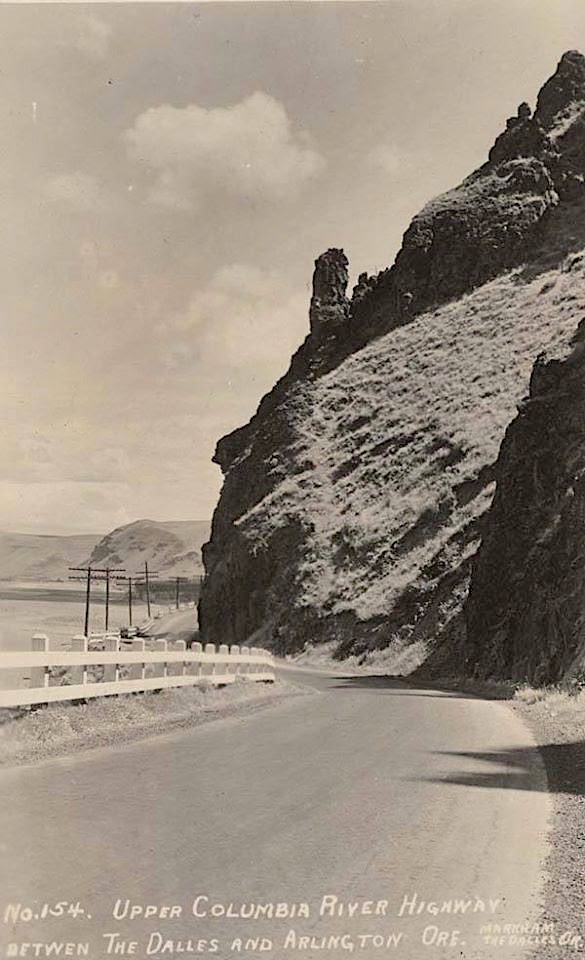
Photo taken from Mattie's Hump east of
Biggs Junction
Photo courtesy Oregon Historical
Society