![]()
The Historic Pacific Highway
in Washington
Cowlitz Prairie
![]()
The Historic Pacific Highway
in Washington
Cowlitz Prairie
The Cowlitz Prairie
By Curt Cunningham
The Cowlitz prairie is situated on the northwest side of the Cowlitz river a few miles north of Toledo. The prairie is about 7 miles long and 2 miles wide. The prairie is a rich agricultural area and the land has been continuously cultivated since 1838. The upper waters of the Cowlitz river irrigate the southeastern portion of Lewis county which includes this prairie.
This area was once the territory of the Lower Cowlitz tribe. In 1818 Simon Plamondon traveled up the Cowlitz river to explore the area and was captured by the Cowlitz at the Landing. Chief Scanewa would spare his life and in 1826 Plamondon married Scanewa's daughter and became a tribal member. In 1838 the Cowlitz farm was established by the Hudson's Bay Company (HBC), and at its peak encompassed over 4,000 acres. In 1838, the Saint Francis mission was built on the prairie to serve the French-Canadian employees of the HBC.
In the summer of 1841 Naval officer and explorer Lt. Charles Wilkes was sent on an expedition to the Northwest to find out what was out there. After a stay at Fort Nisqually, Wilkes traveled down the Cowlitz Trail to Fort Vancouver. The following is from his journal as he passed through the Cowlitz prairie;
"The morning proved beautiful, and one of the finest days succeeded that I ever remember to have seen. Our route lay through alternate woods and prairies, the former composed of large pines and cedars. Several considerable streams of water were passed, whose banks were not so high as those before met with; the latter covered with strawberries, so tempting as to induce us to dismount and feast upon them, and many plants that excited a feeling of interest, and reminded us of home. Among the number was the red honeysuckle, which was in full bloom. After passing extensive camas plains, we reached the Company's farm on the Cowlitz, which occupies an extensive prairie on the banks of that river. They have here six or seven hundred acres enclosed, and under cultivation, with several large granaries, a large farm-house, and numerous out-buildings to accommodate the dairy, workmen, cattle, etc."
Leading north from Toledo the Pacific Highway follows along the route of the old Cowlitz trail toward Olympia. Lacamas creek runs along the northern portion of the prairie and during the wet season the area becomes swampy and frequently floods. The road between Toledo and Jackson hill would become a sea of mud making travel almost impossible.
The old wagon road through the soggy bottoms would be paved using corduroy so the farmers could get through the worst of the muddy places on their way to the market. To make corduroy planking, a log is split in half and laid on top of the mud, flat side down. This was so the the log would not sink too far. This made the road like an old washboard and the journey over them was rather unpleasant. In the 1900's, milled lumber planks that were 8 feet long would begin to be used. The planks made a little smoother ride. After a couple of years these planks would begin to give out and many would be missing. When the planks failed it made driving over the road even more difficult.
The first attempts to make a better road between Chehalis and Toledo was on January 14, 1865, when the Skookum Chuck & Cowlitz Plank Road Company was incorporated. By the 1890's, there were over 40 miles of plank roads leading into Chehalis and Centralia from different points in Lewis county.
The Cowlitz Olympia Road
In the early 1900's before the Pacific Highway, the road between Olympia and the Cowlitz Landing was known as the Cowlitz-Olympia Road. In 1913 when the Pacific Highway was designated through Washington the highway was routed through Napavine and Winlock instead of Toledo. This was because the road between Chehalis and Toledo was in terrible condition and in the winter became impassible for automobiles.
On August 6, 1911, W. H. Chatten, who was a member of the Portland Automobile Club's Touring Committee, had taken a trip from Portland to Seattle and back. He gave a short description of the highway through the soggy bottoms; "Between Toledo and Chehalis there is much plank road in poor condition, many planks being missing. Good roads from Chehalis to Centralia."
The Road is Improved for the Pacific Highway
The first State Highway Department work that was done to the highway in this area was in 1907, when the road between Toledo and Chehalis was graded. In the spring of 1913, work on the road north of Toledo began. From Toledo north a mile of the highway was graded and paved with concrete in June. There were 10 teams and 18 workers employed on the road. In October of 1913 the state highway department officially routed the Pacific Highway between Castle Rock and Chehalis through Toledo. This would hasten the construction through the Cowlitz prairie.
In 1914 the state highway department had secured the right-of-way across the Cowlitz prairie toward Jackson hill.
On August 2, 1914, The Oregon Journal published an article about the condition of the highway between Portland and Seattle. "Motoring to Seattle on a Sunday is a strenuous but pleasant pastime, and leaves little opportunity for other activities. But this 200 mile jaunt serves one good purpose, it converts the most skeptical to the gospel of good roads. Generally speaking, the route divides itself into 2 parts; the first 100 miles between Portland and Chehalis consists in almost all known varieties of bad roads, but the worst sections, those on which actual work for the construction of the Pacific Highway is underway, are accepted most gracefully."
"The second 100 miles from Chehalis into Seattle is a joy for the motorist. From Kelso to Chehalis the distance is 48 miles, according to the Pacific Highway and other signs put up by the Goodrich Tire Co., and included in it, 48 different varieties of highway, from rockbound hillsides and dust laden level stretches to several miles of winding corduroy road, the latter being between Toledo and Chehalis, which route is followed if the motorists cross the Cowlitz river on the upper ferry (Kline's), thus avoiding Winlock and Napavine."
"The picturesque ferryman, whose craft, is operated by current and cable, takes you across the Cowlitz river, drawls in a monotone; 'This is a free ferry in the daytime, operated by Lewis County; after 8pm the fare is 25 cents for each rig.' Upon leaving Toledo, drivers are compelled to make a detour until a stretch of new highway that will provide a more direct route, is completed."
"Soon the tourists reach the long stretch of corduroy, but the bumpy passage thereon is forgotten in an appreciation of the fertile country on either side, which, at this season of the year, exhibits field after field of stubble and grain in the shock. And one is forced to ponder over the benefits to the farmers themselves of the improved highway that will furnish them, an easier and cheaper access to market."
"After a pleasant run through several miles of wooden hills, one comes upon the paved highway that stretches to the southward of Chehalis for six miles. It surely is a relief to bowl along this pike that appears in the distance to the eye like a straight piece of white ribbon. From Chehalis on, the road leading into Seattle will suit the most fastidious driver. Although it is of several varieties, ranging from dirt and gravel to macadam and brick pavement, there is not a mile of the way, but what is pleasant going."
On October 3, 1914, the first mile of 16 foot concrete pavement was opened for traffic and an additional half mile of paving was almost completed. This made the Pacific Highway north of Toledo for 3.5 miles to the old La Camas school a paved concrete road. The La Camas school located at the intersection of the Pacific Highway and Oyler Road still stands today and now is a private residence.
By August of 1918 the highway between Toledo and Chehalis was a good road. There was only 4.18 miles of gravel over Jackson hill on the new grades just completed. In the spring of 1919 work begain on paving the gap over Jackson hill. By the start of winter of 1920 the Pacific Highway between Toledo and Chehalis was concrete paved and opened for traffic.
Photos of the Cowlitz Prairie taken July 1, 2023
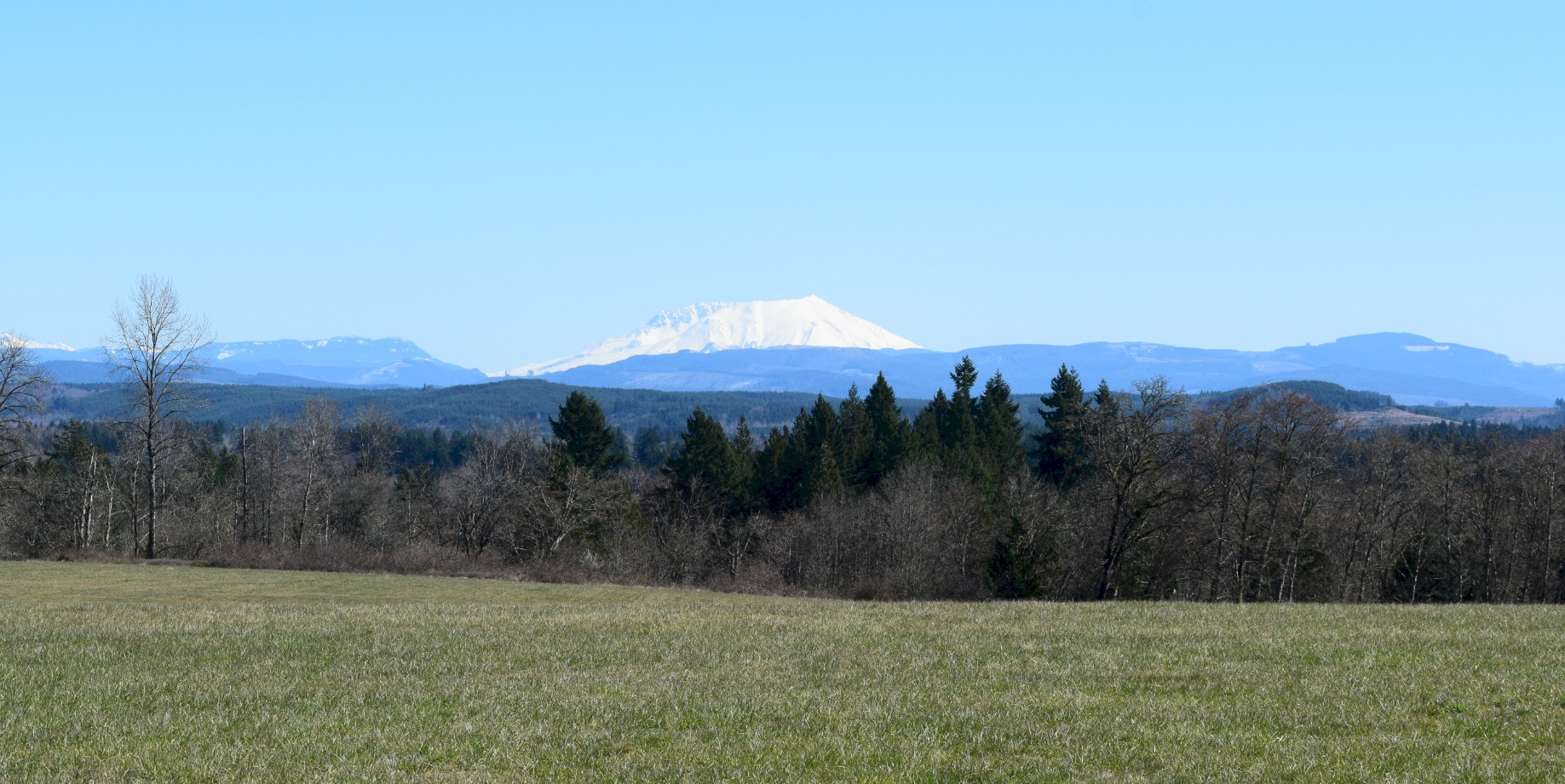
Looking east across the Cowlitz prairie toward Mount St. Helens
Looking south toward Toledo. This road was a section of the first mile of the Pacific Highway which was paved with concrete in 1913.
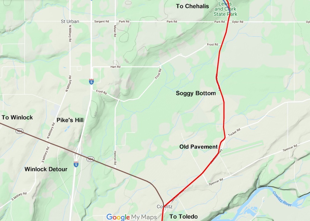
2020 map 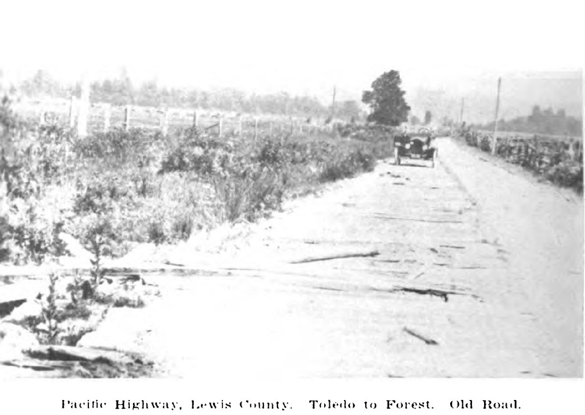
The old plank road 3 miles north of Toledo in 1913 before improvement. Looking north toward Jackson hill. 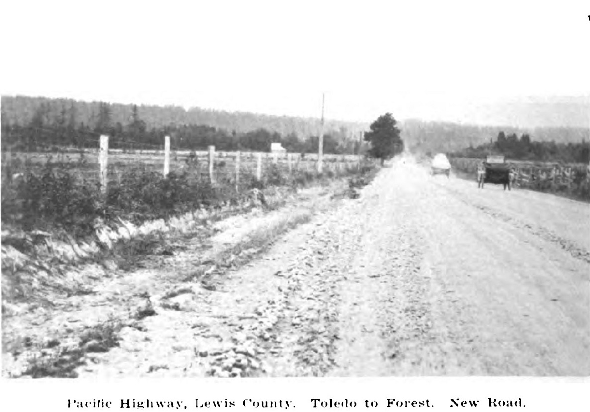
Same place as other photo in 1917. Now it is a gravel highway. 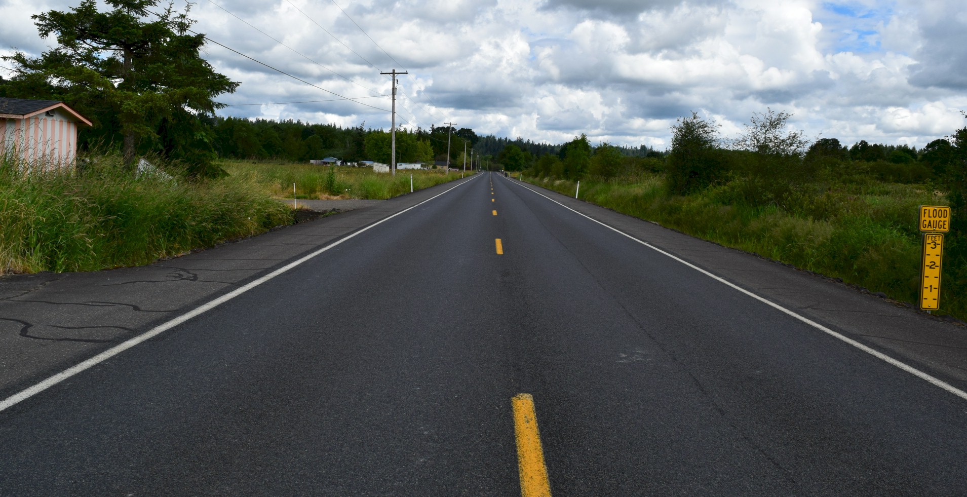
Close to the same place as older photos only 105 years later. This photo was taken in 2022. Looking north toward Jackson hill. |
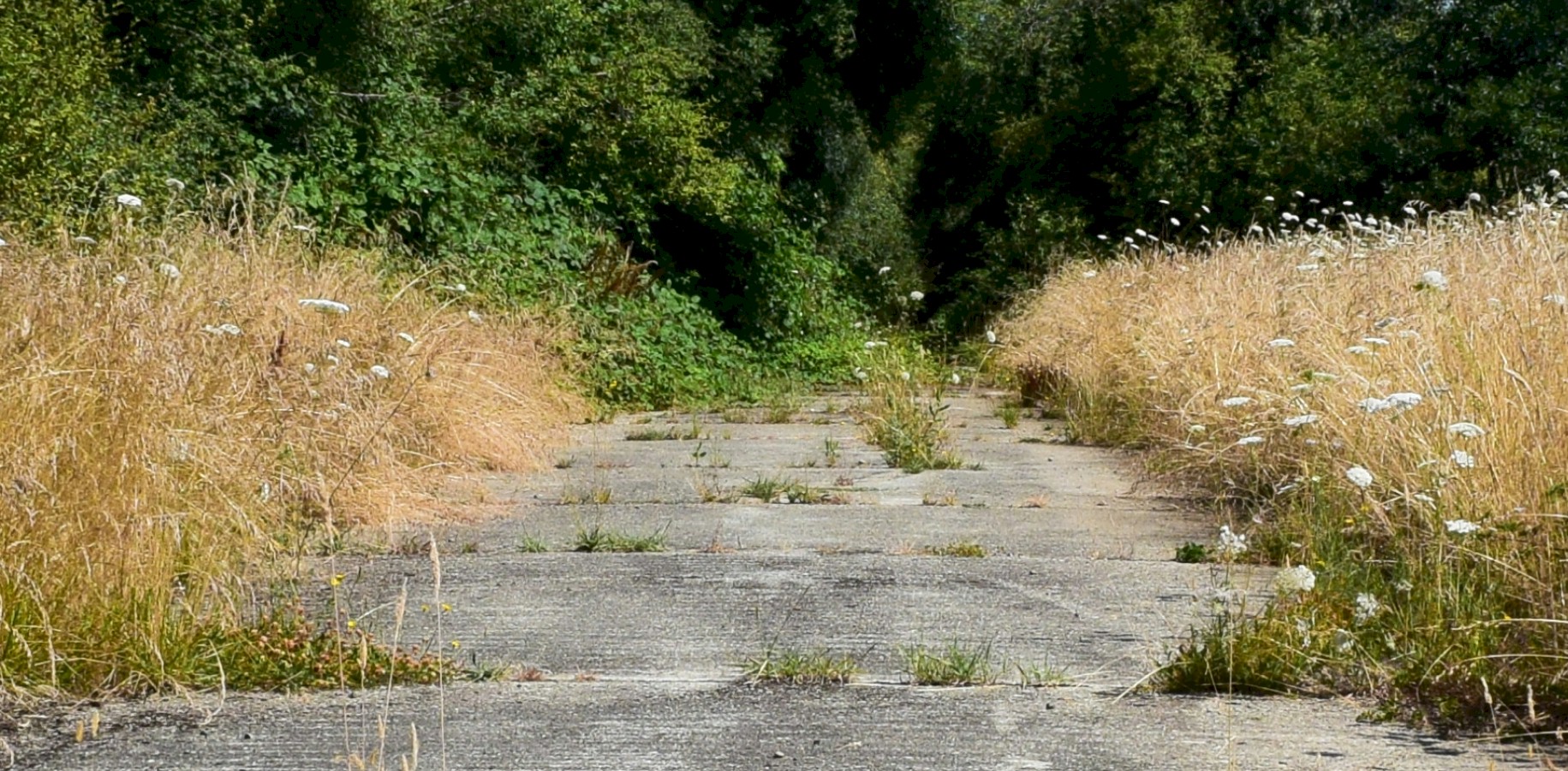
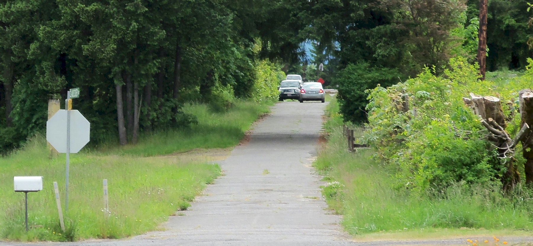
Looking Northbound at the original pavement. Photo taken at the intersection of the Jackson Highway and Buckley Rd. north of Toledo near the airport. 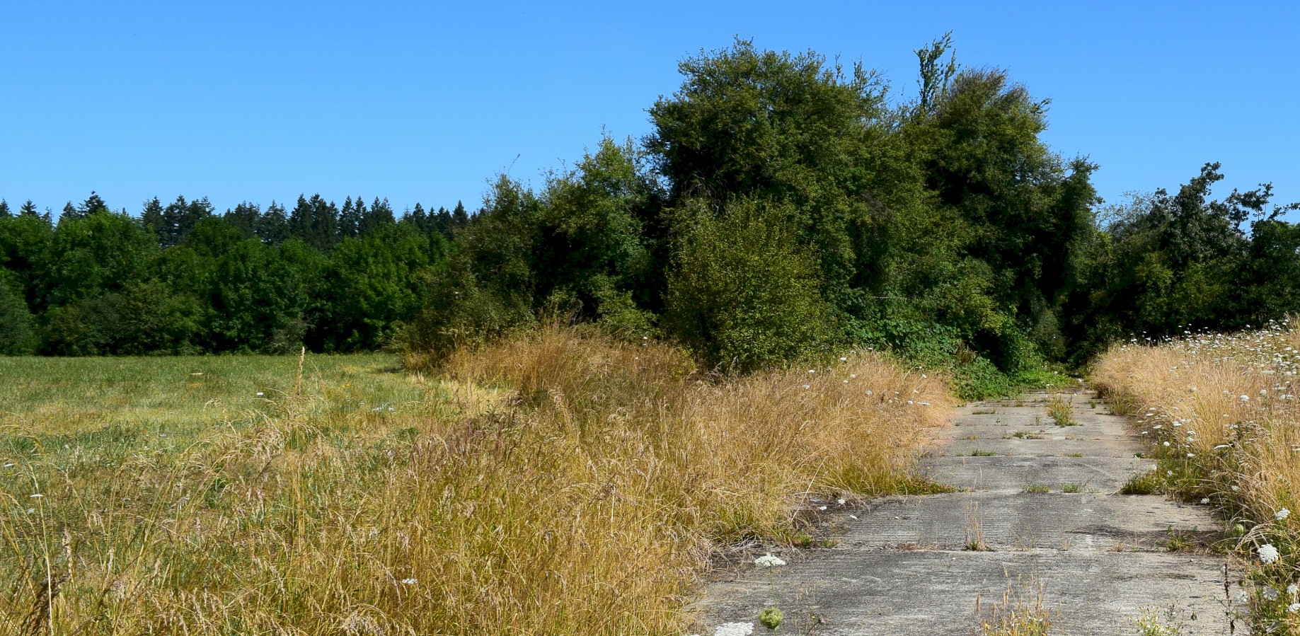
Looking Northbound. 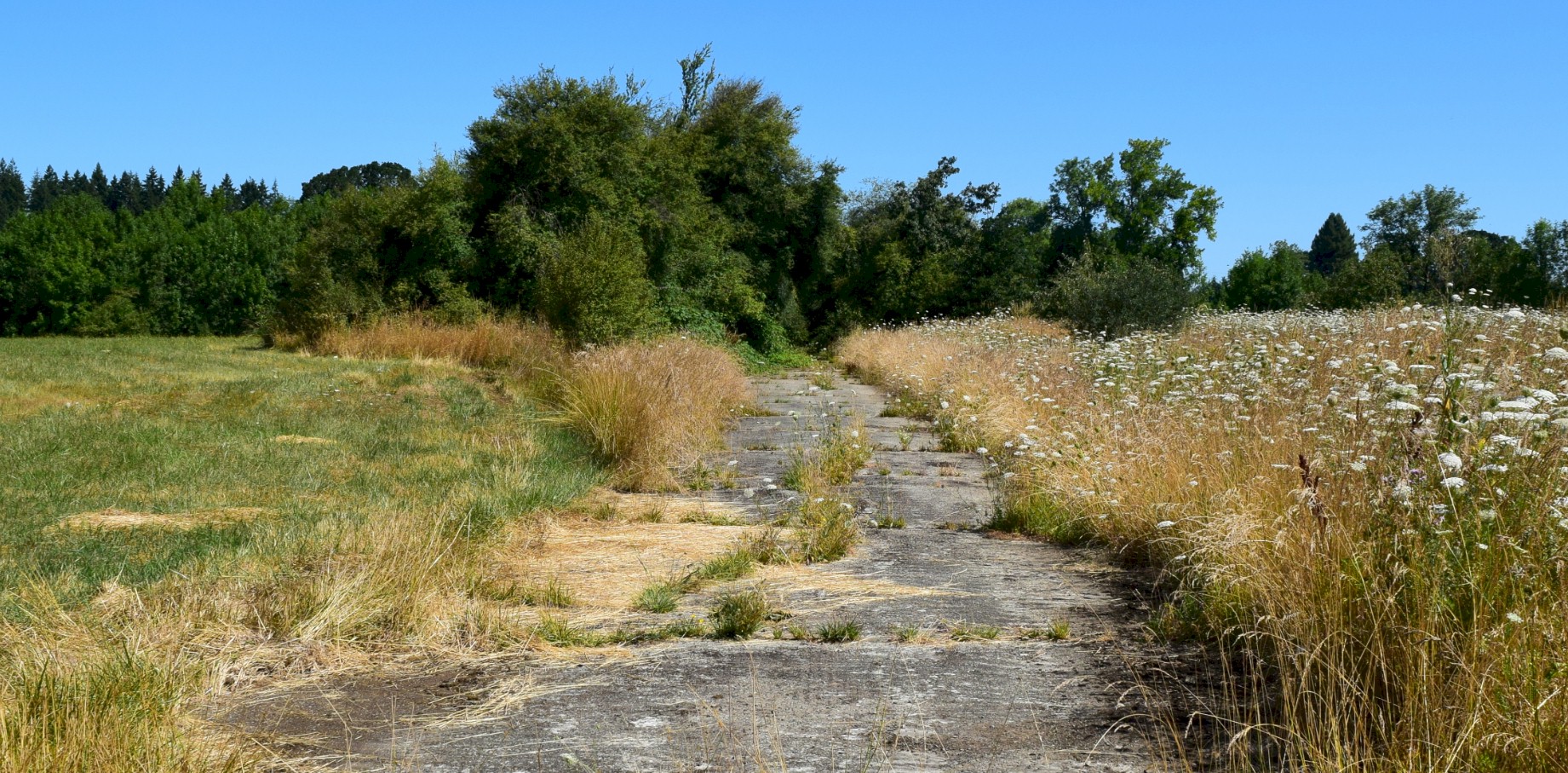
Looking Northbound. 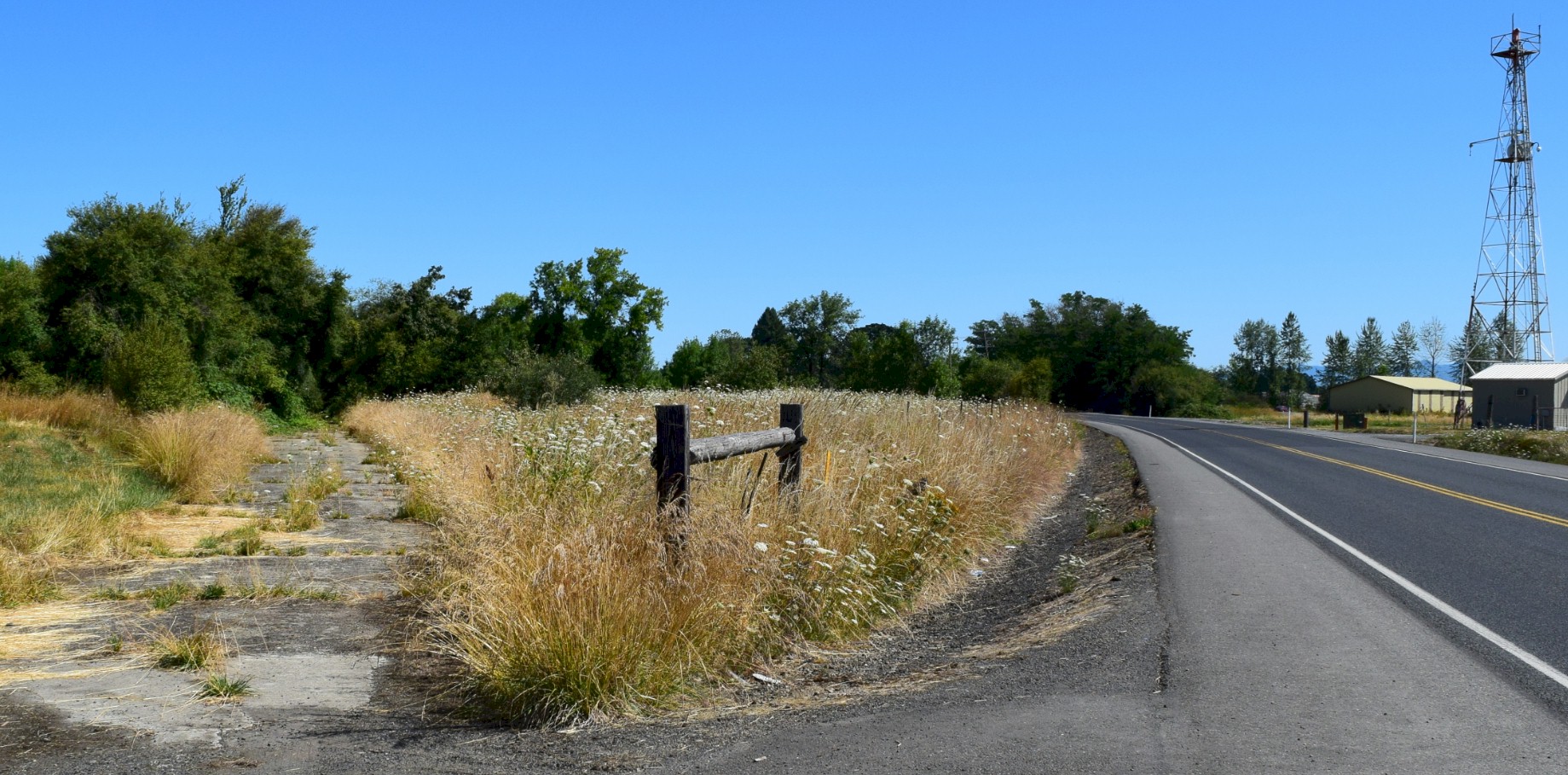
Looking Northbound. The Jackson Highway is on the right. |