![]()
The Historic Pacific Highway
in Washington
Aurora Avenue
![]()
The Historic Pacific Highway
in Washington
Aurora Avenue
Aurora Avenue 1953. Photo courtesy Seattle Municipal Archives #25052
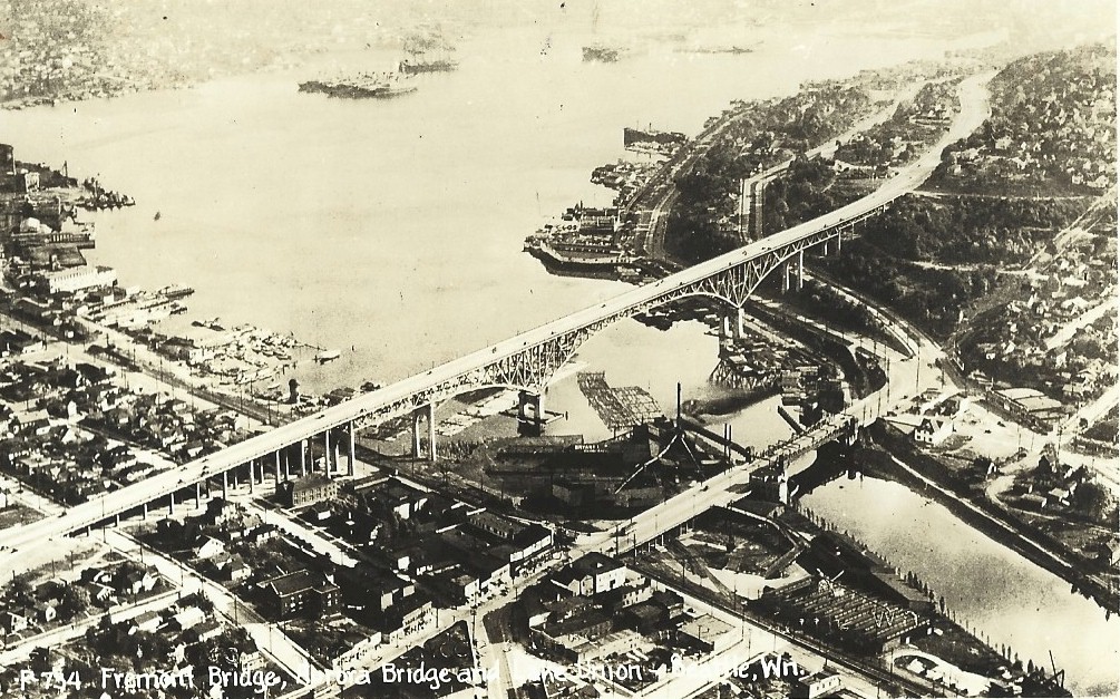
Aurora Bridge and Fremont Bridge
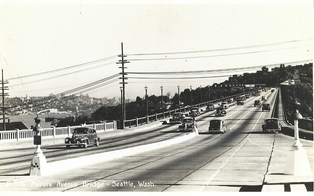
Aurora Bridge looking south
History of Aurora Avenue
By Curt Cunningham
The Fort Steilacoom - Fort Bellingham Military Road
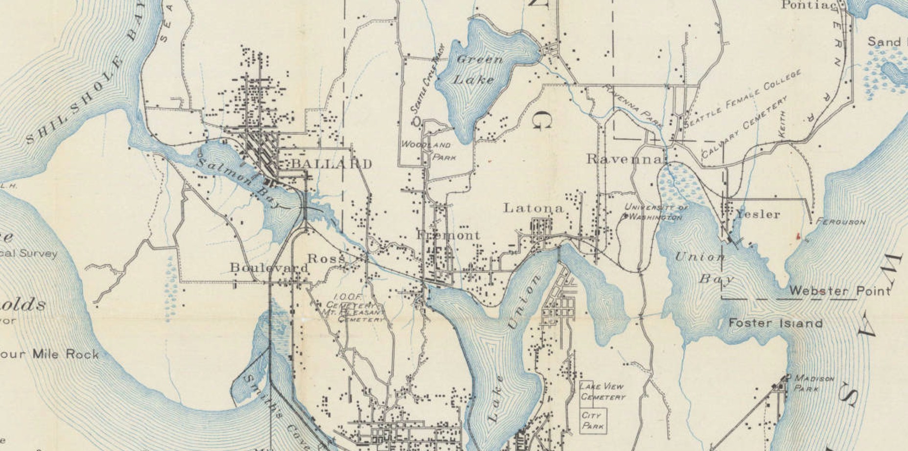
The first wagon road leading north from Seattle was the Fort Steilacoom - Fort Bellingham Military road which was constructed in 1860. This road began at Steilacoom and it ran northward to Yesler's mill which was located at the foot of Yesler Way in Seattle. From the mill, the road continued north over the east side of Queen Anne hill to Fremont. From Fremont it continued north along Phinney Ridge passing Green lake on the west, and just before the Washelli cemetery, the road turned northeast to the Thornton creek crossing near Olympic Hills, which is about a mile northwest of Lake City.
After crossing Thornton creek the road continued northeast toward the bluff overlooking Lake Washington near the Acacia cemetery. Here the road turned northwest to the intersection of N. 168th St. and 25th Avenue. From this point the road followed the ridge to 15th Ave., and then it turned northward to the McAleer creek crossing. After fording the creek, the road passed Lake Ballinger about 3/4ths of a mile to the east, as it continued north through Mountlake Terrace while making its way to Martha Lake.
In 1864 a telegraph line was strung between Vancouver, Washington and New Westminster, British Columbia. The poles were placed along the Military Road between Vancouver and Alderwood Manor. From Alderwood Manor the line turned northwest and followed a trail to the station at Mukilteo. This trail evolved into a wagon road over the years and today it is known as State Route - 525. From the Mukilteo station the line continued along the shoreline toward Everett while making its way north to Canada.
At Alderwood Manor the Military Road continued north to Martha lake where then it turned east around the north end of the lake towards 194th St. SE in Mill Creek. In the early 1880's Seattle Hill Road was constructed from this point to Snohomish, and the Military Road was used to reach this road until the new wagon road from Bothell was completed to Mill Creek in the late 1880's.
From Mill Creek the Military Road continued east to Fiddler's Bluff which is located north of Cathcart, and from here the road started down the hill and across the valley to the ferry at Snohomish. From Snohomish the only work done was the clearing of downed trees and brush on the Indian trail which ran north to Kent's prairie when the U. S. Government discontinued the military road program. Kent's prairie is located about a mile southwest of Arlington.
In 1878 the Military Road which was also known as the Telegraph Road between Fremont and the county line was designated as King County Road #78 or the W. L. Weedin Road. By 1901 the old road would be vacated within the Seattle city limits and replaced by the new city streets.
The first communities to develop north of Seattle were; Ballard, Fremont, Latona, Ravenna, and Yesler. Yesler was located just west of Laurelhurst in Laurel Village. Henry Yesler once owned a sawmill there. The first wagon road to reach these communities from Seattle was County Road #78.
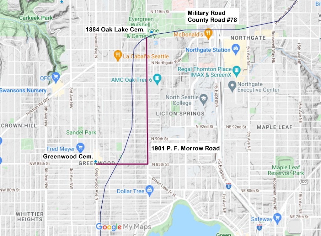
In September of 1884, Oak Lake cemetery was founded by David Denny on the NW corner of 110th and Aurora Avenue. County Road #78 was used to reach this cemetery. In 1893 Denny was forced to sell the place to cover his losses in the stock market crash where he had nearly lost everything. The name of the cemetery was then changed to Washelli by the new owners. In 1919, the Evergreen Cemetery was established, and by 1927, the two cemeteries were merged to become the Evergreen-Washelli Cemetery.
In 1891 the Greenwood cemetery was founded. This small resting place was originally called Woodland cemetery, but was later renamed Greenwood. The name was most likely changed because it conflicted with Woodland Park. The Greenwood cemetery was located at N. 85th St. and Greenwood Avenue. In 1907 the cemetery was relocated and the land was used for building lots. It is said that Greenwood Ave. gets its name from this little forgotten place of rest. This is probably true as Greenwood Ave. originally began at the Greenwood cemetery and continued north to Edmonds. Travelers from Seattle used County Road #78 to reach this road.
By the beginning of the 1890's Seattle's rapid growth north had reached Green lake, and these new additions created many new city streets. It appears that the owners of these new additions did not care to match up the streets they platted with the neighboring additions. This caused some problems for the residents, and petitions were sent to the commissioners to remedy the situation. This was when old County Road #78 would be vacated between Fremont and N. 85th St., and replaced by the new city streets.
One of these road issues happened in the fall of 1890 when County Road #78 became obstructed by the new Denny & Hoyt Addition. This addition was located at the west end of Lake Union in Fremont. The residents who lived in the vicinity of this new addition became upset when the road they used to reach Seattle was narrowed. The petitioners wanted to make the county aware of the outrage which had been perpetrated upon them by the owners or their agents of the Denny & Hoyt Addition to Seattle. County Road #78 began at Lake Union, now called Ewing Ave. and through the new addition it was platted only 20 feet in width, and the houses were built only 40 feet from the road. The law called for a 60 foot right-of-way, which is shown on the records.
They also wanted to let the county know about the franchise which the county had granted to the Interurban Trolley Company along this 40 foot stretch, (Ewing Ave.) as it left little room for ordinary travel. During the winter of 1889 this part of the road was almost impassible. Horses were mired and wagons were stuck in the mud and were broken. The petitioners said that the coming winter it would be much worse as the streets were torn up and cuts were made in the road by the trolley company which left the path in a dangerous condition.
The petitioners also wanted the county to know about the road leading to Woodland Park. This road was platted by the owners or agents of the Denny-Hoyt Addition, and no road was given to the public to replace the old road. They were outraged and said this should not be allowed.
They ended their letter to the commissioners by saying that they wanted the 60 foot road restored to the public or that Lake Ave. be opened and graded in lieu of the county road which was taken by the owners of the Denny & Hoyt Addition and extended through Woodland Park. To appease these citizens, Lake Ave., which is now known as Fremont Ave. was graded and widened from Ewing Ave, to N. 50th Street.
In 1900, a group of business people purchased some property on the west side of County Road #78 at 110th St. near the Washelli cemetery. They subdivided the property and tried to sell lots in their new addition. The scheme ended up failing because the property was too far out of town, and the road was still just a muddy path through the forest.
Early Aurora Avenue
Aurora Avenue first began as a city street in the Denny & Hoyt's addition which was platted in 1890. North of Denny & Hoyts Addition in the R. F. Days Lagrande Addition, the street was called Aurora Ave. and Grand Avenue, and it terminated at about N. 46th Street. By the mid 1890s Aurora Ave, had been extended to the southern boundary of Woodland Park at N. 50th Street. Aurora Avenue would not go through the park until 1932. Aurora Ave. north of Woodland Park would be gradually extended in small sections with each new addition to the city.
In 1901, P. F. Morrow petitioned for a road from the Greenwood cemetery to the Washelli cemetery. This road ran east on N. 85th from Greenwood, and turned left on what will become Aurora Ave., and from there it continued north to the cemetery. County Road #78 or the Military Road would be vacated between N. 85th St. and the Washelli cemetery.
By 1903 Aurora Ave. had been extended to S. 72nd Street where it curved to the right and connected with Woodland Park Ave. which continued north around the west side of Green lake to the city limits and was connected to the P. F. Morrow Road.
The North Trunk Road
By 1909 Aurora Ave. was still just a residential city street and had been extended to N. 96th St. in the Argonne subdivision. This was the same year that King county established the North Trunk road. The North Trunk Road was 6.17 miles long and began at the north end of Woodland Park Ave. at the city limits, and ran due north to the county line at 244th St. SW. This road would become an alternate route for travelers going between Seattle and Everett. The following year the Interurban Trolley was completed between Seattle and Everett and the tracks were built alongside the North Trunk Road.
In 1911, The Firland Sanatorium for tuberculosis patients was established outside the city limits near the county line. It wasn't long before calls were made for a better road leading to the hospital. The narrow lonely road to the cemetery was seeing much more traffic than it had previously, and it was now in need of improvements to make the hospital more accessible for staff and visitors coming from Seattle. Today's Firlands Way was once a section of the North Trunk Road. The calls for improvement were heard by the authorities and plans were made to pave the road from Seattle to the Hospital with brick, and by 1913, the brick road was completed.
In 1921, one of the first auto camps was built by the Seattle Parks Department at Woodland Park. For 50 cents a night a car full of travelers could get hot showers, laundry facilities, a telephone, and enjoy the community building overlooking Green Lake, with its veranda and open-air fireplace. Lodgings targeting motorists were originally called "tourist camps," "auto camps," and, later, "auto courts." Each night, local talent, both amateur and professional, provided concerts, dances, movies, or other entertainment. By 1928, use of auto camps decreased and the site was converted to tennis courts and a bowling green.
In 1925, portions of the North Trunk Road were widened and surfaced, and in some areas the road was rerouted. There is a portion of original brick paving still visible at Ronald Place in Shoreline. By 1928, all the brick paving except for this section had been covered with concrete.
Aurora Avenue and the Pacific Highway
In 1929 construction began on a new 6-lane bridge over the east end of Lake Union. This 70 foot wide 2,945 foot long bridge was built 155 feet above the water. After construction began, the State Highway Department and the "good roads" groups wanted a new highway from the north end of the bridge to carry through traffic on the Pacific Highway, more efficiently through Seattle. On June 30, 1930, the Seattle City Council approved an ordinance extending Aurora Avenue through Woodland Park. The city council had followed the advice of the city and state highway engineers and approved a new 6-lane highway from the north end of Green lake to the new bridge.
In 1930 Woodland Park Ave. north of Green lake officially became Aurora Avenue. Construction of the new 6-lane highway began in 1930 at Denny Way in Seattle and was completed to the north end of Green lake by 1932. The George Washington Memorial Bridge which was the original name of the structure, was opened for traffic on February 22, 1932. During construction cars either used Dexter Ave N. and crossed over the Fremont bridge, or they took the old route over the University bridge at Eastlake.
In September of 1931 a new 4-lane highway from the north end of Green lake to Rucker Ave. in Everett was completed and opened for traffic. Today this section is known as State Route 99, Pacific Avenue and Evergreen Way. The old Bothell Road which had been a part of the Pacific Highway for the past 20 years would become a section of the Bothell branch of the Sunset Highway.
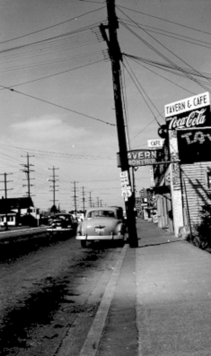
Beginning in the 1940's motels, restaurants, taverns, grocery stores, and gas stations began popping up along the new highway to serve the traffic going between Seattle and Everett. Most of the gas stations in those days were also full service car repair shops.
In 1947, Aurora Avenue was selected as a Blue Star Memorial Highway to honor of World War II veterans.
The Broadway Cutoff
In 1954, freeway construction had reached the Everett area and that year a 3.4 mile section of the new freeway was opened as an expressway. This section was known as the Broadway Cutoff and it began at the intersection of Evergreen Way and Everett Mall Way. The cutoff followed Everett Mall Way as it becomes Broadway, and about a quarter mile north of Beverly Blvd. the road veered to the right onto the freeway's northbound lanes. The cut-off was only 2 lanes until just before 41st Street where it widened to 4 lanes and came out onto Broadway Ave. and continued north through Everett to the Marysville cut-off.
The Alaskan Way Viaduct and the Battery Street Tunnel
In 1953 the Alaskan Way Viaduct was completed. This new elevated roadway allowed traffic on Highway 99 to travel non stop from the Duwamish river, across the waterfront to Western Ave. where the cars were forced to drive through the city streets to reach Aurora Avenue.
In 1956 the Battery Street tunnel was completed, and this tunnel gave Aurora Ave. a direct connection to the viaduct. Motorists could now drive on Highway 99 through Seattle from the Duwamish river to the north end of Green lake with no traffic stops.
In the 1990's the viaduct was deemed unsafe and plans were made to replace the structure along with the Battery St. tunnel with a new longer tunnel under downtown Seattle. This new tunnel was completed and opened for traffic in 2019.
Aurora Avenue continues to be an important route between Seattle and Everett and is still lined with motels and gas stations as well as strip malls, shopping centers, and businesses of all kinds.
Ronald Place Brick Road Photos
Transforming Highway 99 - Edmonds News
North Trunk Road - My Edmonds News
North Trunk Road Map - Google Maps
1901 P. F. Morrow Road
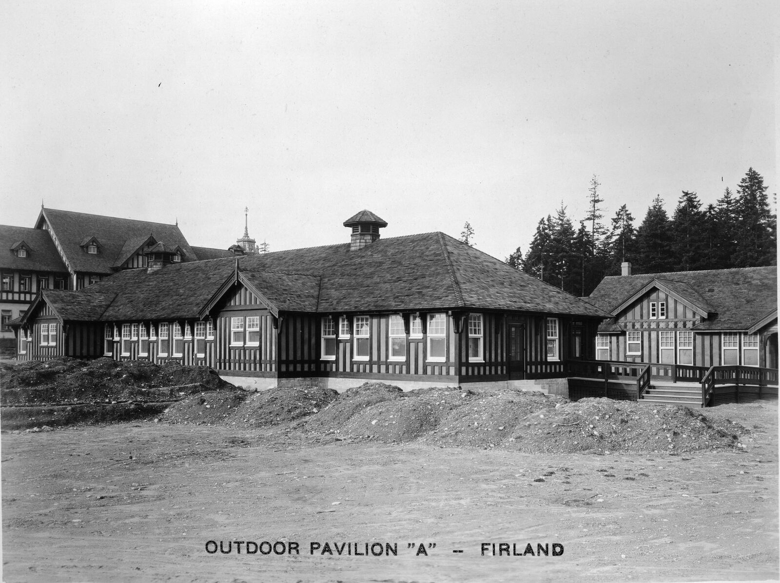
Firland Outdoor Pavilion - 1920
1894 map showing the new road leading north from Fremont which replaced County Road #78. In 1913 the road leading north from Ravenna will become the Bothell Road and the Pacific Highway. 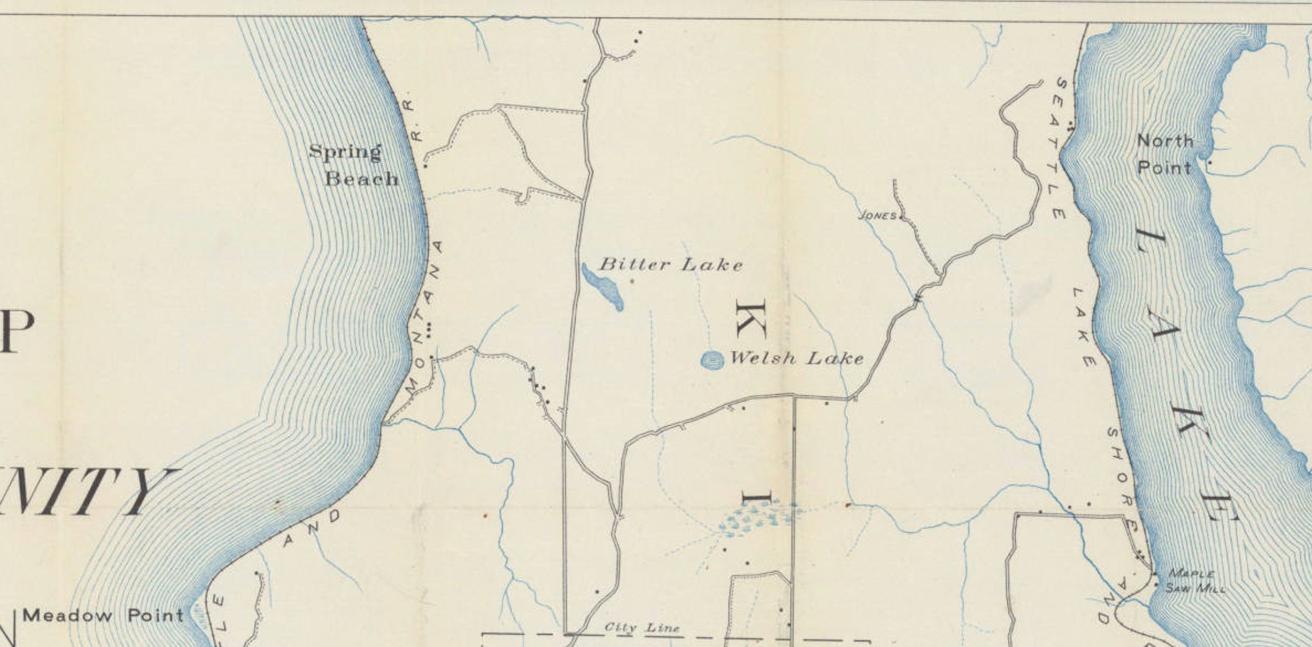
1894 map showing County Road #78 leading northeast from the city limits. Greenwood Ave. is the road going due north. The road going to Carkeek Park is County Road #127. 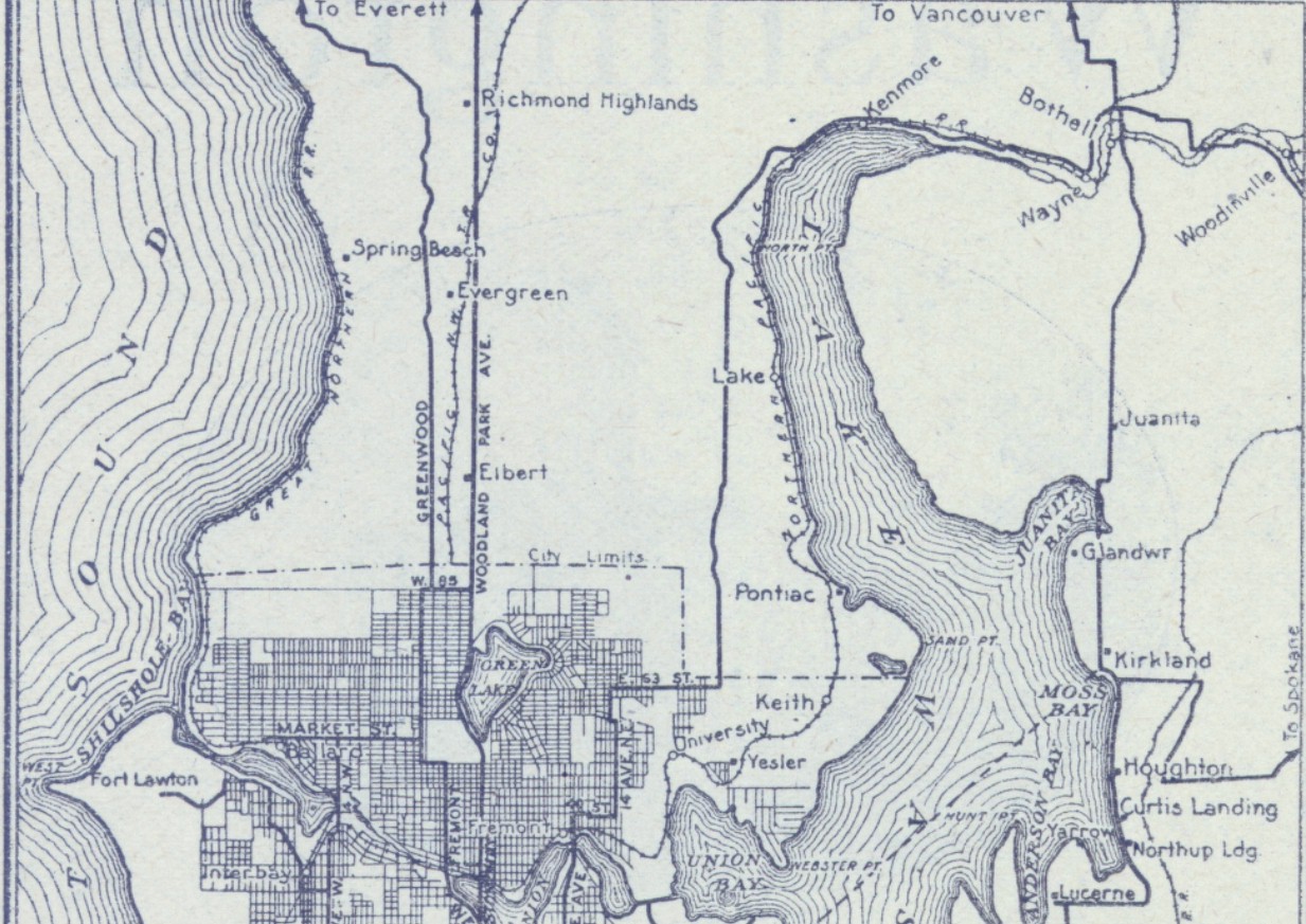
1916 map showing the new highway to Bothell which replaced old County Road #78. 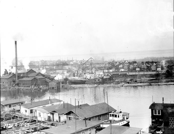
1929 before the Aurora bridge was built. Photo courtesy of the Seattle Municipal Archives #3199 |
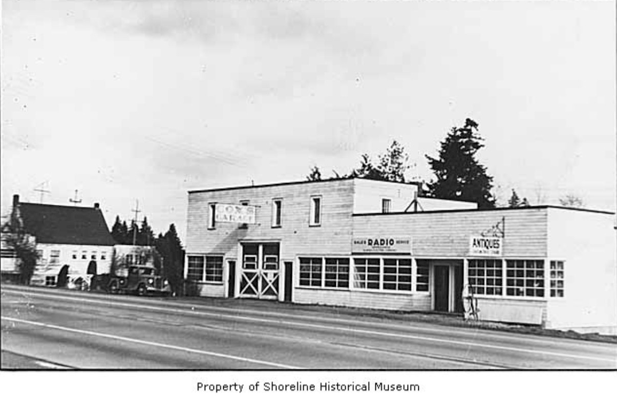
Aurora Ave, at Ronald in 1945. Photo courtesy Museum of History and Industry. 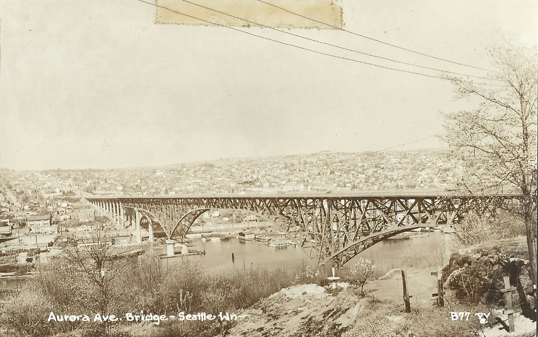
1936 Aurora Bridge 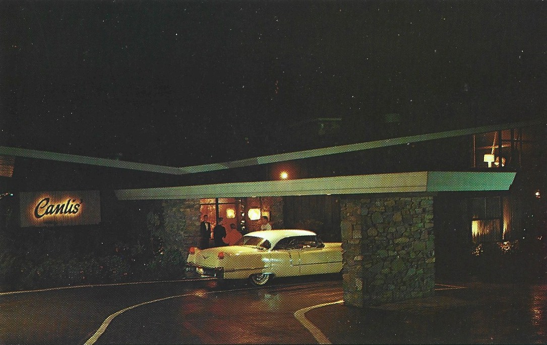
Peter Canlis opened his landmark restaurant north of downtown Seattle on Aurora Ave. in 1950, and it made its mark as a place for fine dining. Recipient of many awards, the restaurant is still operated by the Canlis family over 70 years later. Both the exterior and interior of the building were designed by regional architect Roland Terry early in his career. Photo is from a 1955 postcard. 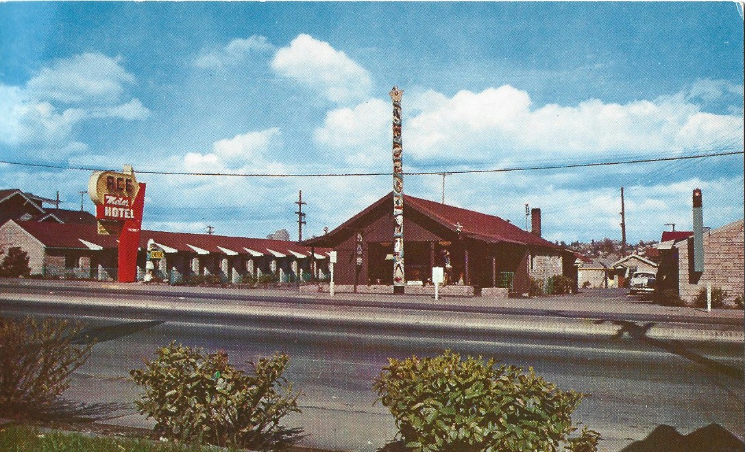
The Ace Motel was located on 8512 Aurora Avenue. They had 30 modern units strategically located on U. S. 99 north. Today the old motel has been replaced by the Travelodge by Wyndham. |
©2011-2022 pacific-hwy.net
All Rights Reserved