![]()
The Historic Pacific Highway
in Washington
Woodland
![]()
The Historic Pacific Highway
in Washington
Woodland
History of Woodland
By Curt Cunningham
The Lewis River Valley where Woodland will be founded was first known as the "Bottoms" by the early settlers of the 1850's. Later in the 1860s, the Bottoms became known as Pekin. The village of Pekin began a few miles south of Woodland near where the Military Road crossed the river. The name Woodland started out as the name of the farm that was owned by Squire and Mildred (Millie) Bozarth. Millie named the farm Woodland, because of the many fir trees that grew there. Some of the early locals had called it "Forest City."
Woodland started out as a single store that opened in 1881 by Christopher Columbus Bozarth, son of Squire Bozarth and was known as "Uncle Chris." The store was on his father’s donation land claim that is located on the west side of the North Fork of the Lewis river west of the horseshoe bend. The store was named "Woodland" after his parents farm. The post office would be established at Uncle Chris' Woodland store on June 9, 1882.
One of today's tourist attractions in Woodland is the Hulda Klager Lilac Gardens. In 1877, Hulda Klager, came to Woodland and started the lilac gardens that are situated around the home that was built in 1889 by Klager’s parents. Klager was an internationally known lilac expert and developed many strains of lilacs. Today the gardens are open for viewing year round. In the spring, the house is opened and lilacs and other gifts are available for purchase.
The name of the bottoms began to change from Pekin to Woodland around 1883. This is when the Pekin Post Office was discontinued and was moved to the Woodland store. This could have been because Pekin was built on stilts as it was on lower ground and prone to flooding. The place would be submerged after the freshets in June every year. The businesses grew tired of the constant flooding and moved to higher ground at Woodland. Pekin suffered the same fate as Monticello. The steamer wharf at Pekin would continue to handle cargo when the river was too low for the regular steamers to reach Woodland and La Center.
The town of Woodland was first platted out in 1889, and lost its post office in the fall of 1890. The post office was moved north about a mile near the grange building built in 1876 on John Bozarth’s claim. This post office was called Kerns. One month later the Woodland post office was re-established by Christopher Bozarth. The Kerns post office lasted until 1906 when Woodland was incorporated.
On June 9, 1894, the Columbia river overflowed its banks and caused major damage to the towns along the river. Captain Gray, of the Lewis River Transportation Company's steamer Mascot, which plied between Portland and towns on the Lewis river said this about the flooding at Woodland; "Down along our route the people in the lowlands have deserted their homes and fled to the hills for safety."
"Woodland, a town of four or five hundred inhabitants, is completely submerged, and has been deserted by all but a few, who remained to save their effects and are now living in the second stories of their houses. Of those who fled, some are camping in the highlands and others are staying, with friends. So far as I could learn, no one was in distress, but that will be an after effect of the flood, as most of these people have lost all, or nearly all, of their worldly possessions."
"Masters of boats plying in the Columbia are doing all in their power to help these people, such as removing their furniture and stores and sometimes livestock to safer localities. We have also rescued a great many people, who remained in their houses until the last minute, when a quaking of the building indicated that the foundation was loosening, and it would soon be swept away. In every case escape by any other way than by boat was entirely cut off, and few of the people had boats."
"Their signals to passing steamers were always heeded, and they were removed to dry land. Their signaling before the houses had been thoroughly shaken from their foundations, and the frequency with which boats pass the inundated district, alone have prevented a possible loss of life. I have been informed that in one case a house was swept away shortly after the family had been taken aboard a steamer."
"All the warehouses and docks along the river, and houses and barns in the lowlands have either been carried away, toppled over or wrecked by the flood. It is a common sight to see a wharf or house come floating down the Columbia, and it is one that I do not think will be witnessed again this century. On the Lewis river, booms of logs have been carried away, and only rafts securely tied have been saved."
"The loss in that section alone will reach, the hundred thousands. This does not include the personal property or livestock, most of which has been saved by steamers. The Mascot alone removed 900 head of cattle and horses to the hills. There are a number of heavy losers by the flood at St. Helen's. Muckle's mill was damaged to an incalculable amount. Mr. Muckle told me this morning that the whole plant was under water and would be nearly a total loss."
"Some of the buildings, he said, had been moved from their foundations, and he thought it would require a great outlay to repair the damage. Two of his rafts of logs were swept away the other night, and one was lost. I captured the other and towed it to Columbia City, and left it there securely moored. Rice's dock at St. Helen's was swept away yesterday morning, shortly after the passage of the steamer Columbia, and will be a total loss."
The Lewis River Bridge
The Lewis River bridge was one of the first connecting links of the Pacific Highway in southwestern Washington and it was a great boon to the traveling public on the great "Appian Way" of western North America.
Calls for a bridge spanning the Lewis river at Woodland began in the spring of 1894 the residents of the Bottoms started making loud demands for a bridge over the Lewis river to unite Clark and Cowlitz counties. On July 20, 1911, The state Legislature had approved funding for a bridge and the Cowlitz County Commissioners had to show their ability to pay their portion which was $15,000. The banks at Woodland and Kelso were satisfied they could repay and agreed to advance the funds to them for the construction of the bridge. Clark county had already paid their $15,000.
The Legislature had approved $60,000 for the bridge, with the state paying $30,000, and the counties $15,000 each. The bridge structure consisted of 4 concrete piers resting on piling driven to a depth of 40 feet below the bed of the river. The contract for the substructure was awarded to Jahn Construction Co. of Seattle. The work on the substructure was completed in October of 1912. The contract for the superstructure was awarded to the Washington Engineering Co. On account of financial difficulties, the company failed to complete the contract and the work, had to be completed by the state.
The actual construction on the bridge began May 10, 1912, and the engineers had a difficult job ahead of them. Excavation for the 4 piers were made below the surface of the water and in each of these, 36 pilings were driven. The excavations were 14 feet deep and the piling was driven 46 feet into the ground. One piling was especially obstinate and was struck more than 650 times with a 4,000 pound steel hammer, dropped from 10 to 20 feet. Concrete was run through pipes to the bottom of each pier, where it "set" underwater. The piers were 68 feet high and reinforcement was unnecessary. The bridge was almost 1,300 feet long, and at 57 feet above the low water mark, there was no need for a drawbridge.
On May 13, 1913, in anticipation of the opening of the new bridge over the Lewis river. The citizens of Woodland and the farmers of the west end of Clark county were enthusiastically making preparations to entertain 2,000 to 3,000 people on May 17, when the Pacific Highway bridge across Lewis river was to be dedicated and opened to the public. For 2 days volunteers were clearing away the brush to produce a public forum at the east end of the bridge, where the public speaking was held.
It was a beautiful open air auditorium
and good
roads boosters from Portland, Seattle, Spokane, Walla Walla and the intermediate
territory gathered there. The scenery in the vicinity of the bridge was
picturesque. From the deck of
the bridge, 57 feet above the surface of the Lewis river, one could see for miles
up and down the Columbia river, and could look over the fertile Columbia river
flats which surrounds Woodland. The town had issued a general invitation to all citizens everywhere who were interested
in good roads and in good bridges to attend the celebration, and free barbecue of the
choicest cattle its pastures could produce. The Pacific Highway bridge belonged to
the state of Washington, and to the counties of Clark and Cowlitz.
Woodland in 1913, was served by 10 passenger trains a day each way, running between Seattle and Portland. The train from Portland reached Woodland in the late morning or afternoon. The last train
for Portland departed Woodland at 9:30pm, just after the evening entertainment. The street parade started at 11am, and
crossed the bridge at 12 noon. The hot roast beef sandwiches were served from 1pm to late in the afternoon.
There was a German army barbecue expert who was the supervisor of the roasting of 2 whole steers in a pit. The Women of the granges of Clark and Cowlitz counties served the coffee from 1,000 tin cups. Arthur Caville, swimming instructor of the Multnomah Amateur Athletic club of Portland, conducted a series of hair raising feats in diving and swimming that startled the guests. Caville was bound hand and foot, tied up in a sack and thrown off the bridge into the Lewis river. While underwater, he released himself from the bindings, swam to the surface, and then to the shore.
During May of 1913, Governor Lister and a party of officials, traveled the Pacific Highway from Olympia to Vancouver inspecting the route of the new highway. On May 23, 1913, the Governor and his party reached Woodland and a large throng of people came out to greet them. The welcome was so overwhelming that the officials had a hard time making their way into the Hotel Martin where a luncheon was waiting for them.
There were also 20 members of the Kelso and Kalama Commercial Clubs, representatives of the Vancouver Commercial Club, the La Center Club and the Ridgefield Club, making a total of 70 good roads boosters who sat down to the dinner. Carl R. Collins was master of ceremonies at the luncheon. Speeches were made by Governor Lister, members of the Commission and representatives of the several Commercial Clubs, after which a short public reception was held at the library, the farmers took a great deal of interest in meeting the Highway Commission and they made their wants known.
State Highway Commissioner Roberts made clear the object of the trip through the country, stating that it was the purpose of the Commission to make a personal inspection of the Pacific Highway from the Pierce County line to Vancouver, and to use the state appropriation of $116,000 on the worst stretches of road. The party found the most difficulty between Woodland and Kalama, but a stretch of almost impossible road lies between Woodland and La Center.
At 2pm the party left for La Center and Vancouver.
At that time, from the east end of the newly dedicated bridge to La
Center, a distance of 7 miles, it was absolutely impassable with automobiles, so the party was taken to La
Center in a horse drawn wagon, where all of the school children, headed by a brass band,
met the distinguished visitors.
Among the visitors outside the official party were William Marshall, Mr. Seacrist, William
Lindsay, Walter Swartz, Mr. Rawson, W. B. Dubois, from Vancouver. From La Center, W. H. McCann, O. B.
Aagaard, James Kane, B. F. Anderson, Curtis Anderson. Toby Robbins, John Fleming.
On June 21, 1913, the east end of the Lewis River bridge had become a popular picnic area and park. The Weinhard Brewery employees were one of the first groups to use the new park grounds after the dedication of the bridge. There was a steamer landing for the river boats, so they could drop off passengers who were going to spend the day at the park.
On August 10, 1913, S. Carl Huston of Portland took a trip north to Canada and back on the new Pacific Highway. The 1,800 mile journey took him about a month to complete. It was early in July when Huston and his wife started out from Portland in a Stearns-Knight six. On their return, they wanted to cross over at Kalama, but Captain Hoven was on the Goble side, so they did not want a delay and decided to continue on the Washington side and take their chances.
Travel over the rough road turned out to be better than they thought as they drove from Kalama to Woodland. From Woodland to La Center it was a completely different story. The car high centered multiple times and there were heavy pitches with loose rock, and the path was so narrow in places it was barely passable for a long wheelbase car to negotiate the curves. There was another way between Woodland and Vancouver that avoided all of the anxiety of that stretch of road.
Instead of turning off at the Woodland bridge, drivers could continue straight through the town, and cross the Lewis river on the Pekin ferry for $1.00. This route was known as the "Low Road." Drivers were advised to inquire at Vancouver and Woodland as the to condition of the "High Road" so they could avoid the terrors of the route. The sanest plan at the time was to pay the $5 and take the Kalama-Goble ferry.
In the spring of 1915, between Woodland and La Center there was 5 miles of good gravel road. The muddy places was planked and protected with guard logs. The road was paved with a gravel surface and traffic began to use the new highway. This took the traffic off the Low Road and the Pekin Ferry.
On October 5, 1919, road construction was completed between Woodland and Martin's Bluff. Engineers had laid out the new course as much on a tangent a possible. Many of the steep grades and bad turns were smoothed out, and the route was shortened a bit. The new fill over the lowland just north of Woodland, cut off nearly a mile, where the old road encircled the meadow.
About 2 miles north of Woodland, a great gash was cut into the hill and the material was used in the fill across the lowlands, smoothing out some of the hollows along the railroad, which parallels the highway from that point on to Martin's Bluff.
Road crews built a cement wall between the railroad and the highway, and guard rails were put up and painted at all turns where the height of the fill would make a slip off the road, a thing to be avoided. The old road could be seen at times, its neglected course was easily traced up the side of a hill, or along the face of a neighboring eminence. To behold its old rusted surface was to feel all the satisfaction that is a characteristic of the feelings one has while enjoying one thing and realizing an inferior article is just within reach.
On January 10, 1920, gravel hauling machinery was installed by W. D. Williams at the upper end of Woodland. Gravel was then taken from the bar across the Lewis river and transferred by cable bucket to the work side. This was the last of the graveling work and was a little more than a mile between Woodland and Martins Bluff. Between Woodland and Martins Bluff there were numerous slides that had to be cleared. By the summer of 1920, the 5 mile stretch between Woodland and Martin's Bluff that was the worst place on the highway was now well packed, with the old road completely eliminated. From La Center to Woodland it was macadam pavement all the way and only slightly rough.
On May 1, 1922, paving began from Woodland to Kalama. Between Woodland and the Lane farm (2.5 miles north of Woodland) there was a detour, and from the Lane farm to Martin's Bluff, the road was paved in 10 foot strips so cars could pass on the other side of the road. The old road was used as a detour between Martin's Bluff and Kalama. George McCoy of Vancouver operated the Pekin ferry that was originally known as the "Davis Crossing," while the highway was paved between Woodland and La Center. The ferry could carry 10 cars at a time and was available 16 hours a day. Pumps were put into operation behind the dikes and the road from the ferry to Woodland could be traveled with ease or so they thought.
At the beginning of June 1922, the Lewis river flooded the valley and the high water forced the Pekin ferry to be tied up until the flooding was over. The river had lowered after about 2 weeks and on Sunday June 18, 1922, more than 300 cars crossed the river on the ferry. But just as soon as they were out of sight of the landing, the autos went into the mud that was up to their axles. Tourists were being advised to take the Rainier or Goble ferry. On August 10, 1922, the paving project between Vancouver and Kalama was completed.
On December 17, 1924, work
began on the re-decking of the Woodland bridge. This work was completed on January 17,
1925 by state day labor.
The traffic count for the Pacific Highway from Woodland north for 1 mile in 1921,
was 501 cars, in 1924, there were 2,363
autos, in 1926, 3,080 cars passed through town. The last year of the report
in 1928, said that a total of 3,895 automobiles were using the Pacific
Highway
through Woodland.
The Woodland Cutoff
The first highway bridge over the East fork of the Lewis river at Woodland was built in 1936, and over the North fork in 1940. This is when construction began on U.S. Highway 99 across the Lewis river bottom between Woodland and Pioneer. This new section of highway was known as the Woodland Cutoff and the 2 lanes were open for traffic in 1940. The cutoff runs in a NW/SE direction that took it directly across the horseshoe bend, and along the east edge of town. This is when the new channel for the Lewis river was dug out cutting off the bend from the river. Today it is called Horseshoe lake.
In 1968, the northbound lanes for the interstate were constructed through Woodland along with 2 new bridges over the East and North fork of the river. This made the 1936 bridge over the East fork, the southbound lanes. In 2020, the old southbound bridge over the East fork was in the process of being replaced. The 82-year-old steel truss bridge carried over 38,000 vehicles a day in 2020.
The New Woodland Bridge
In 1966, the old Woodland bridge which served the public for 53 years was replaced and is the current bridge we drive over today in 2020. This new bridge was built on the south side of the old one.
History of the Lewis River Bottoms
In 1910 the Growth of Woodland Steady and Healthy Since 1882
Away up the North Fork of the Lewis River 1900
Rain Christens Woodland Bridge 1913
Woodland is Rich as Dairy Center 1915
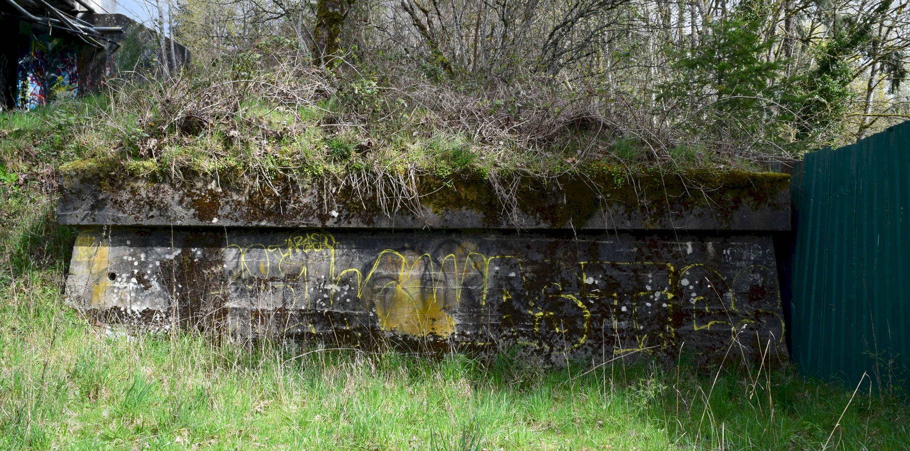
The old 1913 east abutment of the Woodland bridge.
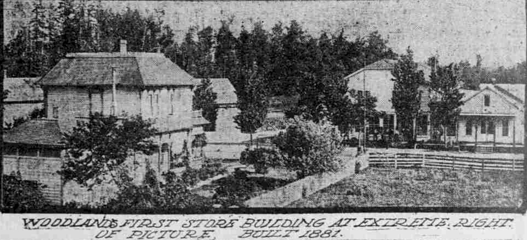
1910 Woodland 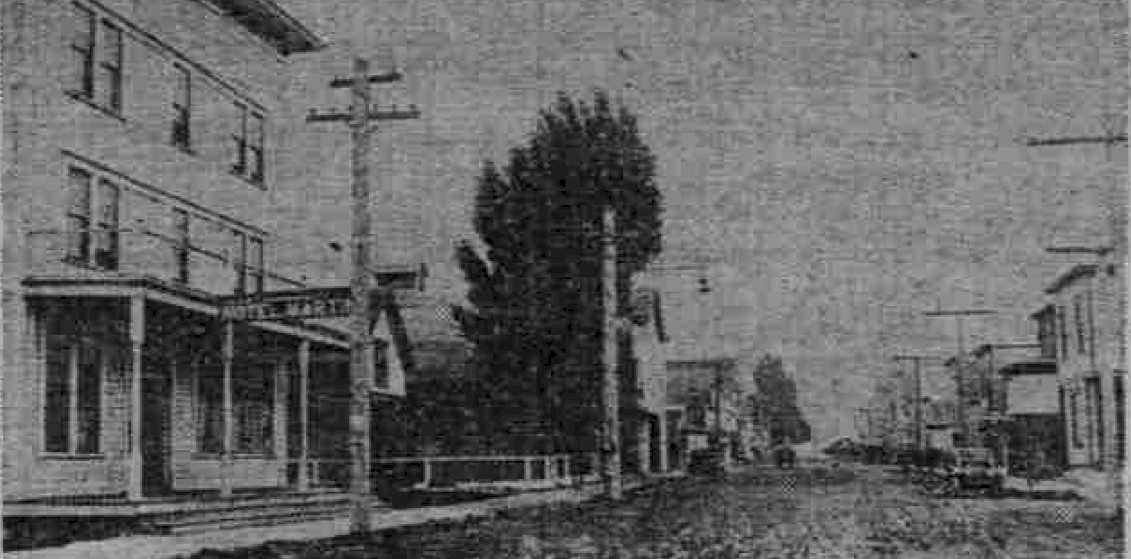
1915 Main Street Woodland. Hotel Martin on the left. 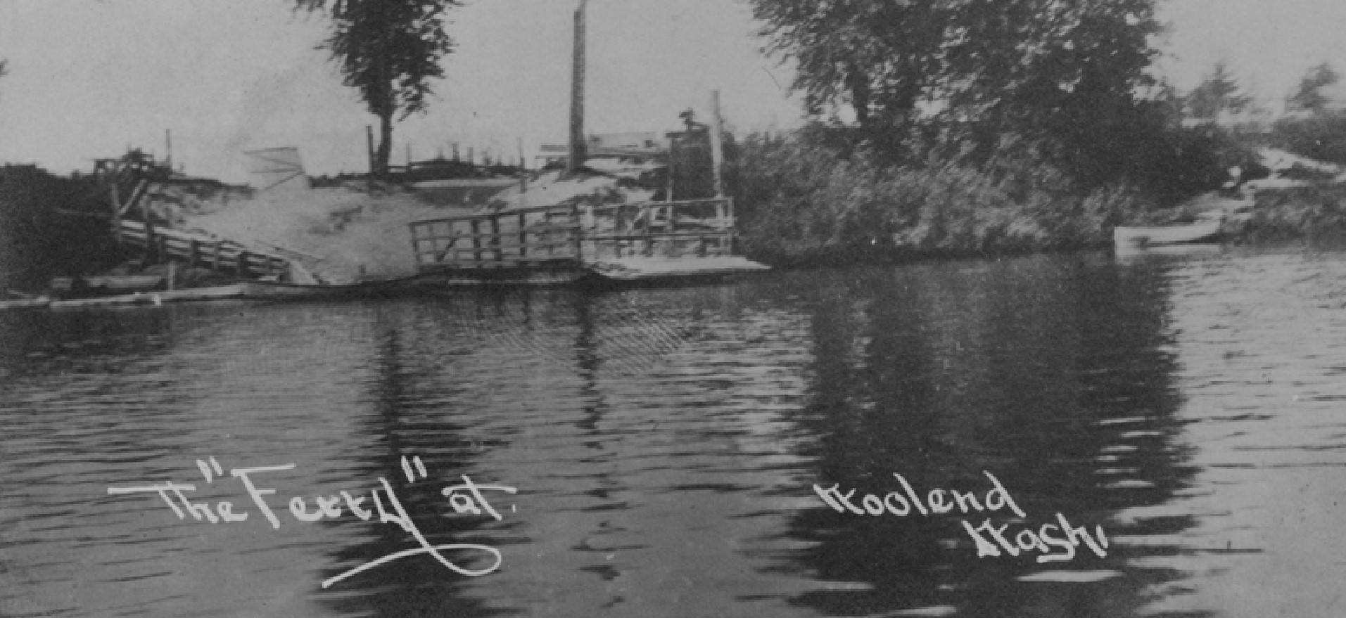
Woodland Ferry was located 300 yards south of the bridge. Photo courtesy Washington Rural heritage 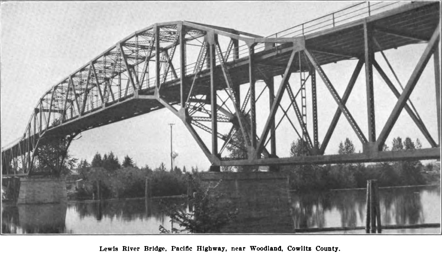
1913 Woodland Bridge |
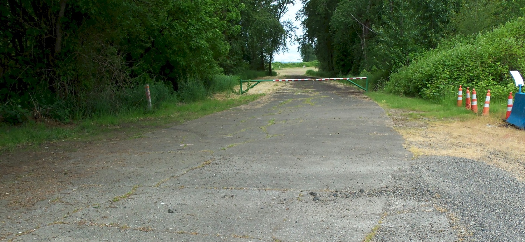
The 1919 highway, 3 miles north of Woodland in 2016. At the end of Cloverdale Road, looking north. This is about where the Lane farm used to be. 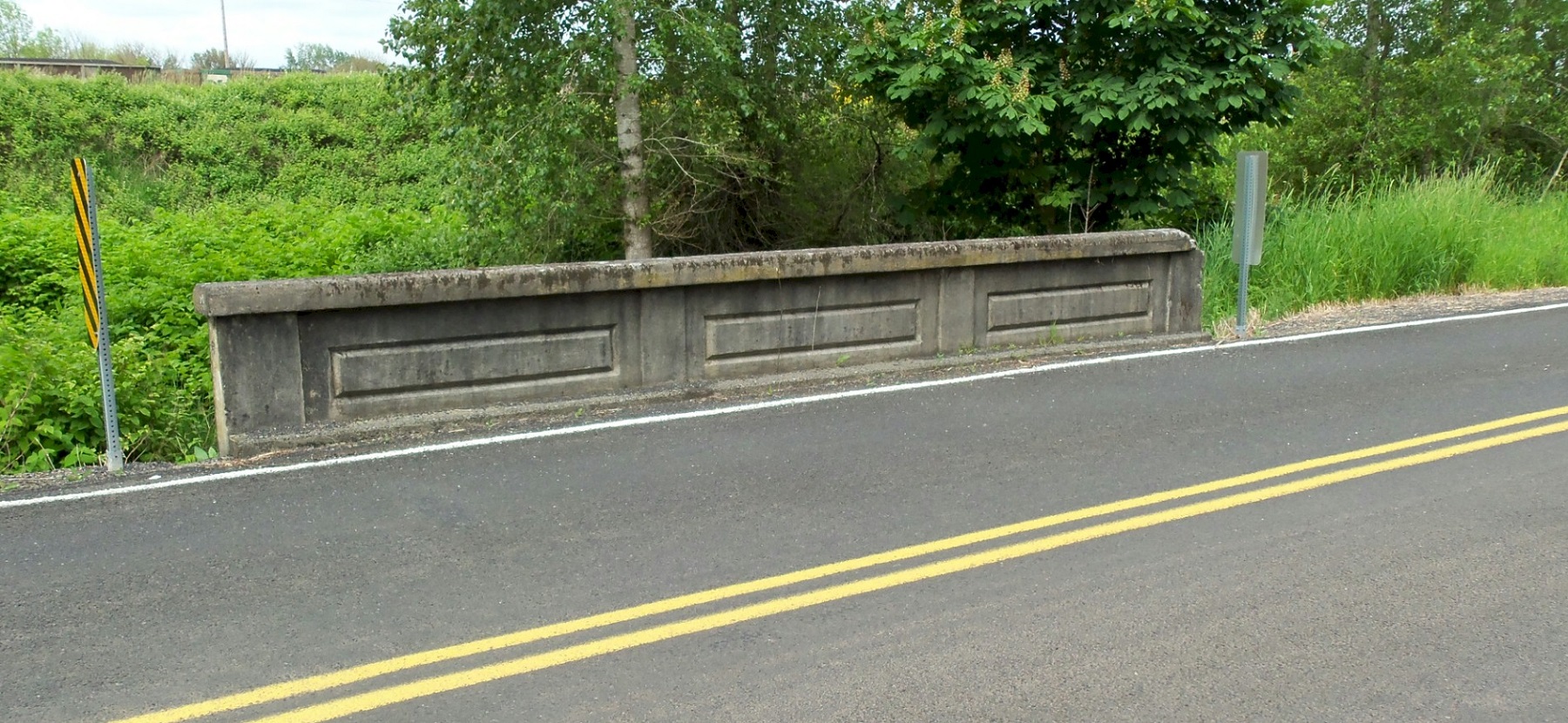
The 1919 highway, 3 miles north of Woodland in 2016. At the end of Cloverdale Road. Looking west. This is north of the Lane farm. 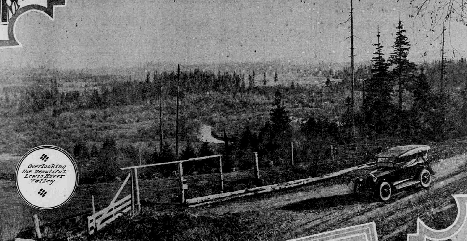
1921 Lewis River Valley 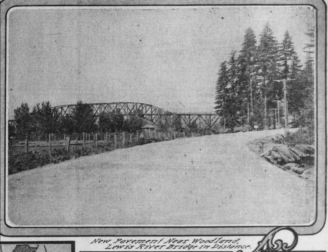
1922, looking north at the Woodland Bridge. |