![]()
The Historic Pacific Highway
in Washington
Tom Brown's Hill
![]()
The Historic Pacific Highway
in Washington
Tom Brown's Hill
Tom Brown's Hill
By Curt Cunningham
Before 1919, traveling north on the old wagon road a mile north of the Toutle river, the traveler had to climb over a steep hill. On the south side of this hill was a 12% grade, and on the north side was an 8% grade. This hill was another one of the many natural barriers to travel on the west side of the Cowlitz river that made travel extremely difficult for the early motorist.
On May 10, 1889, Thomas Brown had settled on 40 acres of hilly terrain north of the Toutle river along the old wagon road. The steep hill on the road became known as Tom Brown's hill, and is located about 4 miles north of Castle Rock, and a mile north of the Toutle river bridge. When the Northern Pacific first built its line through Castle Rock in 1871, they had to build around this hill. In 1910, the railroad dug a large cut through this hill when they laid down their double tracks. Before this section of the old wagon road was improved in 1919, cars would veer off the roadway and drive over the abandoned railroad grade.
On August 23, 1913, the state of Washington began preparations to spend $264,418 on its portion of the Pacific Highway, while individual counties along the route were chipping in as well and raised an additional $500,000 for the highway. This made Washington's total contribution to the cause, during the period of 1914-1916, in excess of $1,250,000. The previous legislative session had appropriated $119,264 for the highway between Auburn and Vancouver plus an additional $14,710 for maintenance.
The policy of the administration in expending this money had been to use it on the worst places. It was hoped that by 1915, when the coast became thronged with Eastern tourists coming to visit the Panama exposition, the Pacific Highway, throughout its entire distance in Washington, would be passable and all heavy grades reduced. More than half of its length was to consist of a finished, graded and drained hard-surface roadway.
Cowlitz county received $50,000 from the state and it was to be used on a number of the worst sections of the highway. One place to be improved was Tom Brown's hill. The heavy grade was to be reduced to 5 percent, the maximum on all public highway work. The Cowlitz county commissioners also tried to convince the state to join with them in improvement of the 6 miles of road between Kelso and Carrolls. The county, which had $21,000 permanent highway money available, proposed to grade and surface the 3 miles out of Kelso and wanted the state to carry the road the rest of the way to Carrolls.
On October 18, 1913, state engineers were busy surveying the route over Tom Brown's hill in preparation to reduce the grade. On account of conflicts in the right-of-way with the Northern Pacific at “Stover Hill” near Ostrander and at “Tom Brown's Hill," the plan for improving these sections was abandoned and the money that was apportioned to Cowlitz county, was spent on the sections from Kalama south and Carrollton north.
During May of 1915, a motorist described the route coming into Castle Rock from the north; "The road is well marked, but is narrow and has many steep grades with short and steep pitches. The road is fairly good. Most of the highway between Chehalis and Castle Rock is a fair dry weather road, and is the shortest route available between these points."
On August 1, 1919, the state highway board opened bids for the clearing and grading of 6.71 miles of the highway from Castle Rock north toward Toledo. This was the last link in the grading of the Pacific Highway in the state of Washington. Construction of the road in Cowlitz county had always been costly on account of the heavy work encountered on the hills. The 6.71 mile section north of Castle Rock was no exception and on August 25, 1919, the contract was awarded to Henry & McFee of Seattle. The abandoned railroad grade was to be used for the new roadway.
The company worked throughout the fall and winter of 1919 keeping the large crew busy. There was a tremendous amount of dirt removed on Tom Brown's hill using steam shovels and dirt trains. The project included some of the heaviest cutting and filling ever undertaken on the Pacific Highway. Tom Brown's Hill being the heaviest cut. The highway remained passable all winter that year.
On January 10, 1920, the Sunday Oregonian ran an article about the construction of the highway through Tom Brown's hill; "The Pacific Highway between Kelso and Castle Rock is now open for traffic without detours. While there are some bad places and the roads are not good, they are passable. The freeze has loosened the graveled soil so that it is hard sledding for autos. Roadmen say that rains will better this condition, as the soil will then pack."
"From Castle Rock north to Chehalis the highway was passable with slight detours, while county work is being done on Tom Brown's hill, which had always been such an obstacle. The hill was graded for temporary use. The contractor will tunnel the hill and when completed, it will be a deep cut. The overhead will be excavated and removed from the interior of the tunnel."
On April 25, 1920, the heavy rains made the highway north of Castle Rock a mud bog several feet deep and getting through was impossible, unless it was behind a team of stout horses. The trip was compared to being sent out to sea in a sinking boat for any motorist who wanted to make the trip between Seattle and Portland. Reports had come in of cars stuck so deep in the mud holes that they had remained there for days. The motorist who was fortunate enough to get towed out had to pay well for the privilege.
A motorist gave his report on the condition of the road that spring; "The worst of it is that a car has to be towed not for a few hundred feet but for a matter of a mile or two. New construction complicated by the long continued rains has left the road in a terrible mess. At Castle Rock we inquired about the roads to Olequa, and were told there was no road, but if we had a toboggan, we could get over the mud without going out of sight. Of course, this was real encouraging, but as I had already gone over some bad roads, I thought they might be exaggerating it a little. If I had known what I do now I would shipped the car from Castle Rock."
On May 8, 1920, motorists bound for Seattle could now travel over the Pacific Highway without having to be towed. The dry weather of the past couple of weeks had dried up the mud holes. While there were many rough places north of Castle Rock, there was no trouble for cars getting through. From Castle Rock north for 7 miles, the heavy construction work was still in progress and the highway was closed and the Westside Highway was used as a detour.
It was along this stretch of road in early April, that so many cars became stuck in the mud and had to be pulled through with horses. All traffic had to be detoured onto the Westside Highway at Castle Rock and Olequa. The detour road between Castle Rock and Olequa was in awful condition during the rainy weather and was practically impassable to automobiles. Now it had dried out, and although rough, it was passable. Cowlitz county road officials had improved it by dragging.
On May 15, 1920, It was no longer necessary for motorists to detour over the Westside road between Castle Rock and Olequa, that was known as the "Logging Road Highway." The Pacific Highway from Castle Rock north to the Cowlitz county line had been opened to travel and was comparatively good except in a few spots, despite the heavy construction work still in progress along this 7 mile stretch. On May 22, 1920, the Pacific Highway was closed at Tom Brown's Hill from 7:30am to 11:30am, and from 12:30 pm to 4:30 pm. Cars were routed back onto the Logging Road Highway.
During June of 1920, heavy rains continued to come down making the highway a muddy mess again and cars became stuck on the road north of Castle Rock. The official advice warned motorists for their own good, to stay off the highway until July 1st, and then only if the weather was dry. The Shriners were having a convention in Portland and the road being in such poor condition, forced many of the attendees from Washington to take the train. Construction was still in progress and the newly completed fills were soft and muddy and many had to have their car pulled by horses over the fills. The Westside road was much worse and drivers who dared to drive despite the conditions, were advised to stay on the main highway.
On December 19, 1920, the 6.71 miles of construction north of Castle Rock including the large cut at Tom Brown's hill was completed and the new grade was thrown open to traffic. Motorists from Seattle and Portland could now plan holiday trips between these cities as the state engineers had given their assurance that the Pacific Highway between Portland and the Sound was now in fair shape with a solid foundation throughout.
There was only one detour near Vancouver and if a motorist took the Goble-Kalama ferry, there would be no detour. About a mile of old road was used, which was easily negotiable, and half a mile of the new grade was planked, making it safe to travel on, but it was rather slow going.
On April 16, 1923, paving work began on the highway between Laughlin's (Toutle river) and Neal's (Gee Cee's Truck Stop). Neal's is where Barnes Drive meets the Jackson Highway at exit 57, and was named for Byron E. Neal, an early homesteader. Contract #692 was awarded to the McHugh Construction Company of Seattle for a 20 foot concrete roadbed. The project was completed on December 22, 1923 and the highway was opened to traffic after the concrete had set. This was one of the final stages in the completion of the Pacific Highway through Washington state.
In 1953 the Castle Rock-Highway 99 expressway was completed between the south end of Castle Rock at Pleasant Hill Road, (exit 46) and Neal's, (exit 57). This new expressway bypassed both Tom Brown's hill and Gumbo hill.
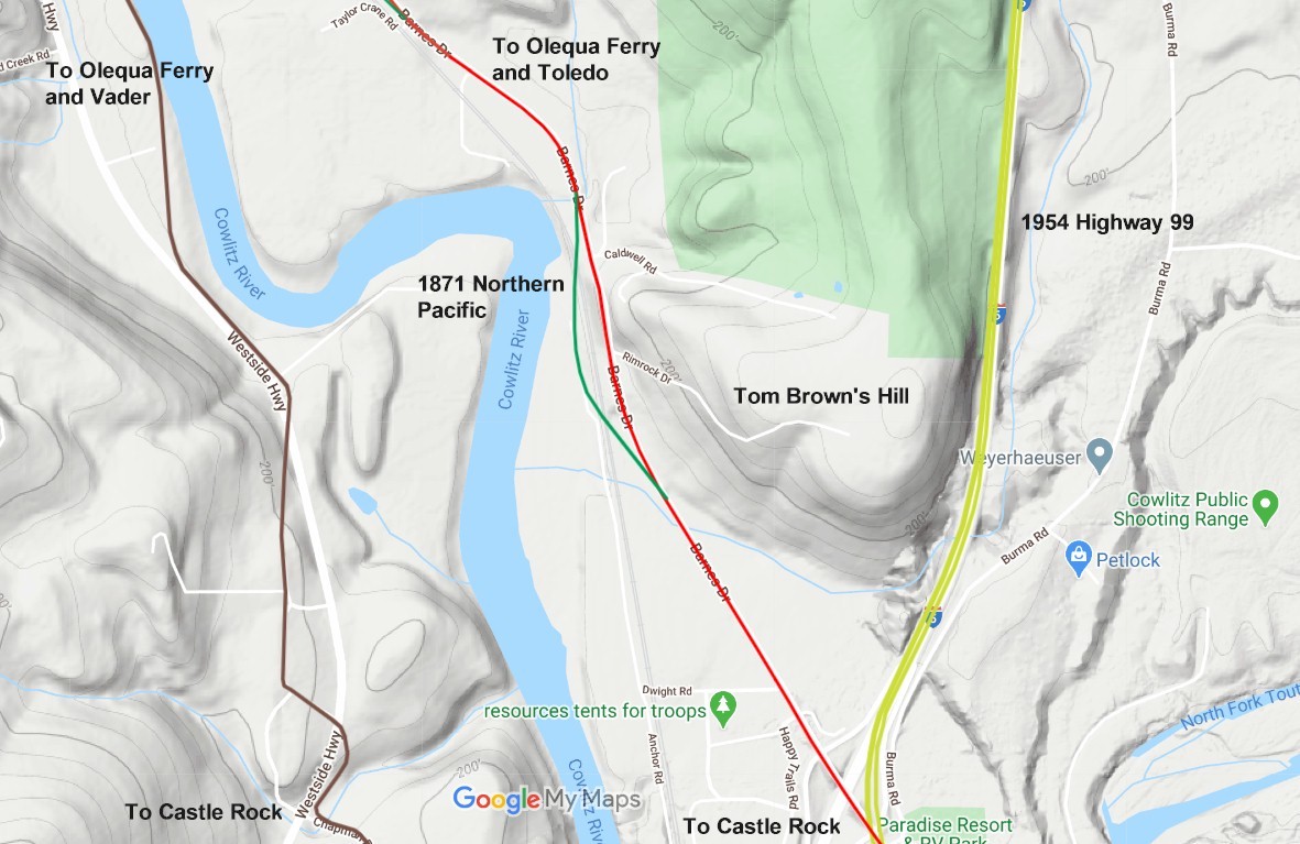
2021 map. The green line is the 1872 Northern Pacific. Red line is the old Pacific Highway. The yellow line is the 1954 Castle Rock Expressway. 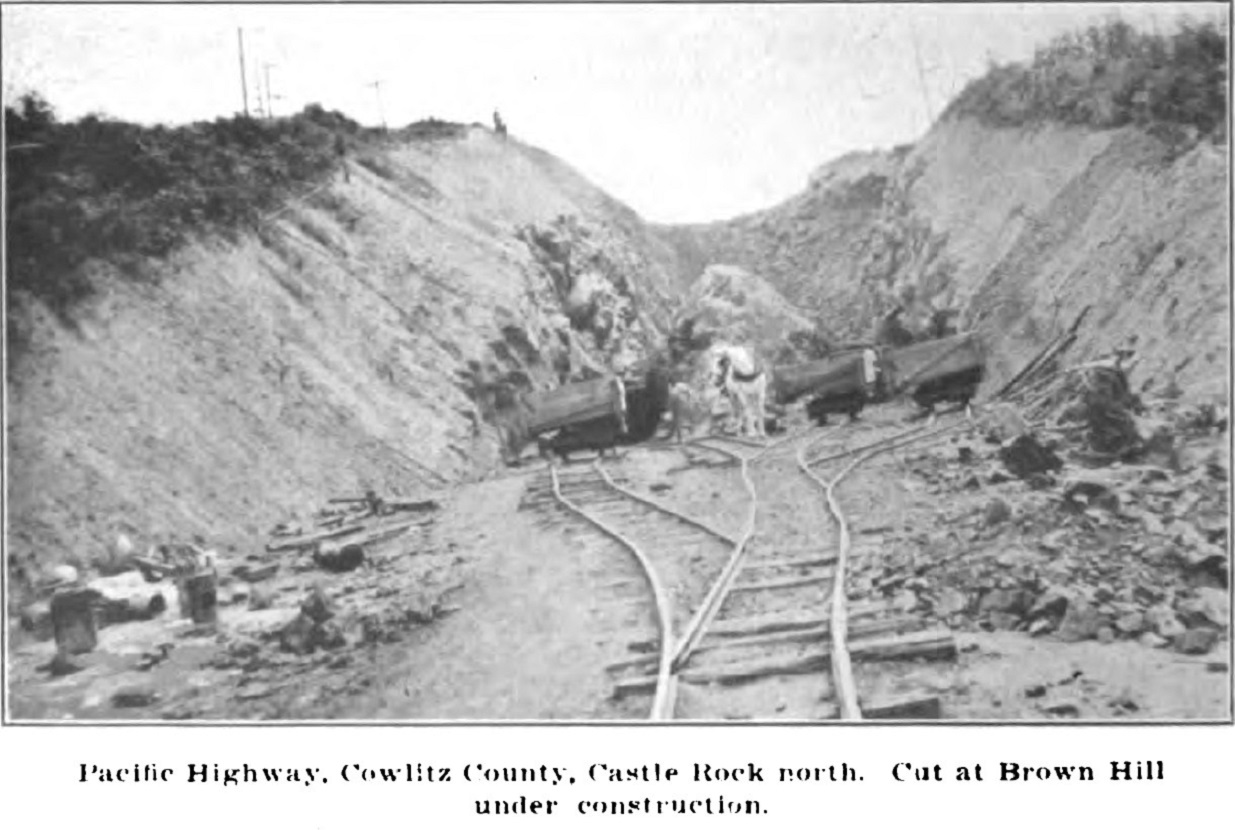
1919 excavation of the hill begins. Looking southbound. 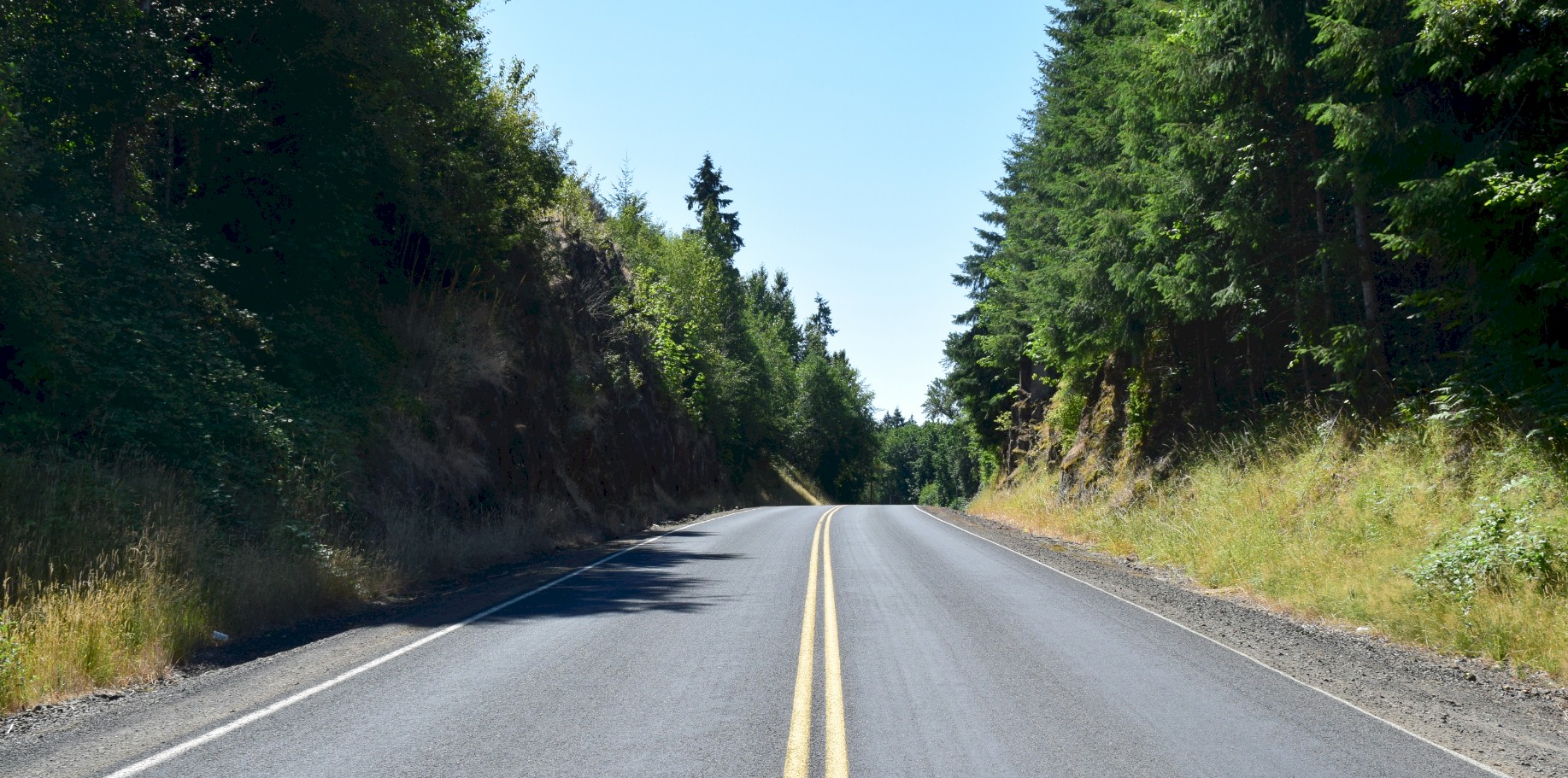
2021 looking southbound at about the same spot as the old photo. 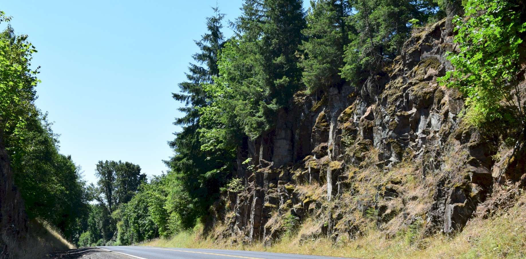
2021 looking south. |
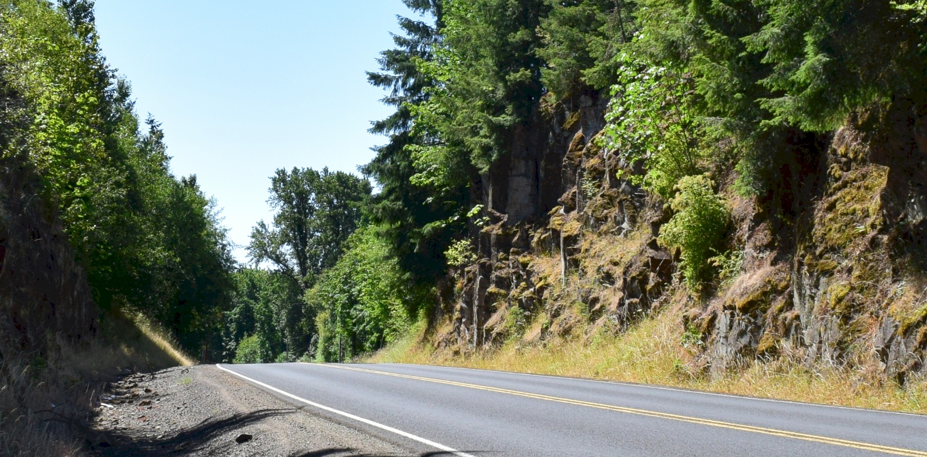
2021 looking south. 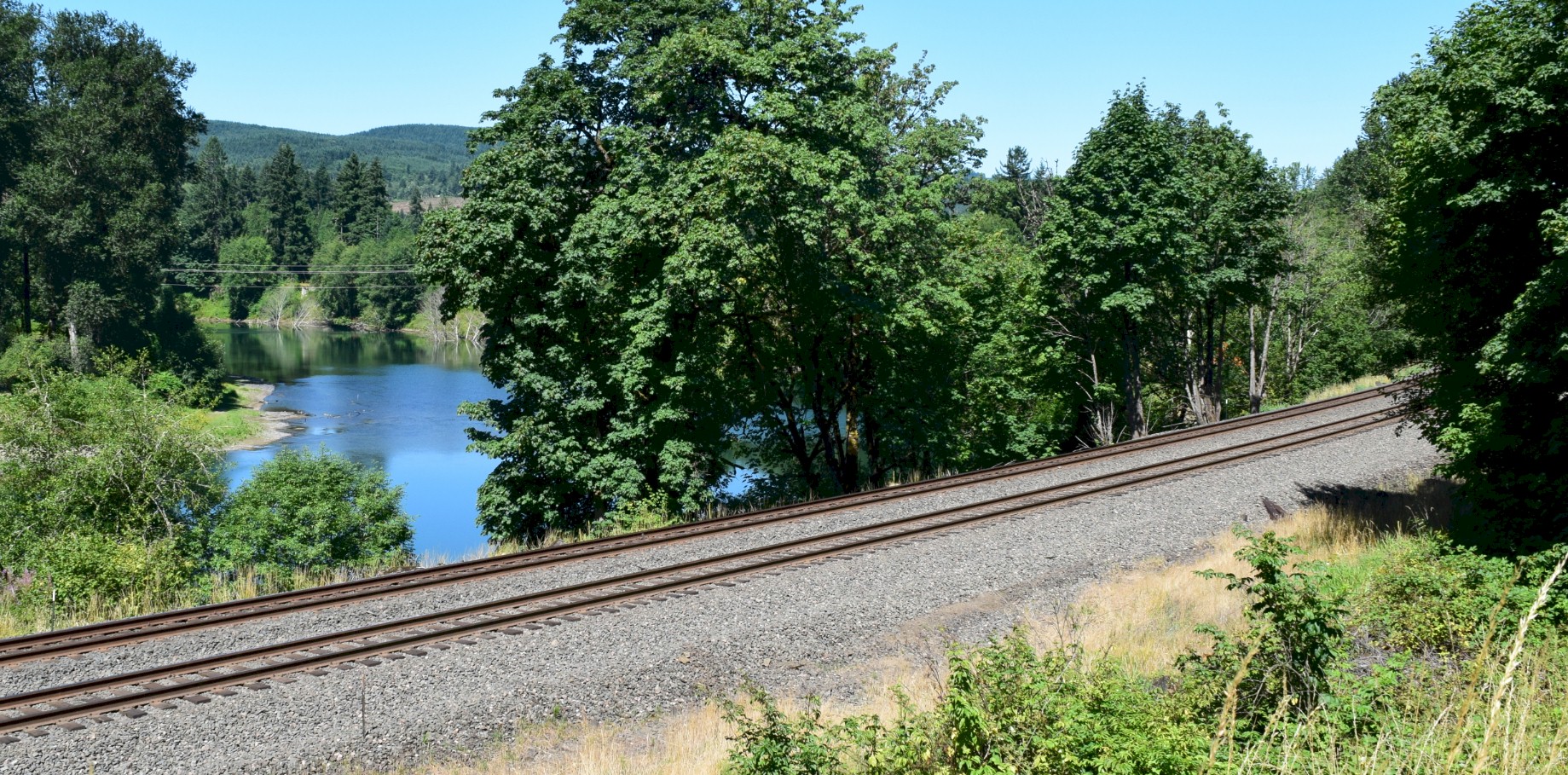
2021 looking west across the tracks at the Cowlitz River. 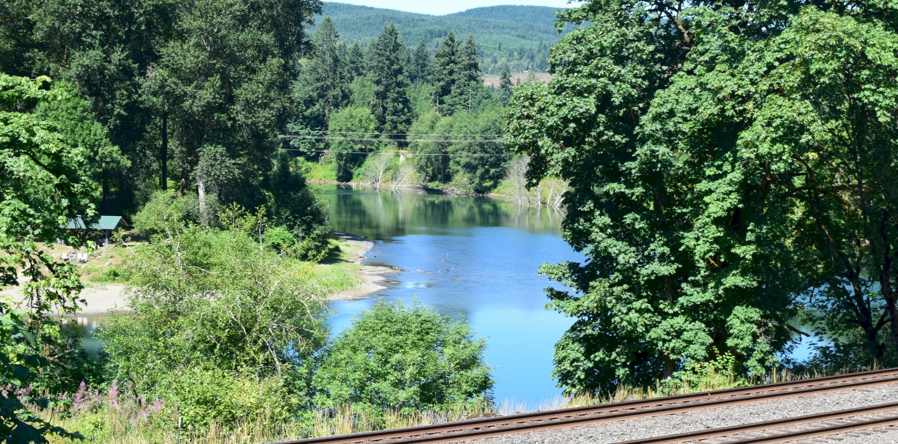
2021 Cowlitz River. 
2021 looking southbound through Tom Brown's Hill on the BNSF mainline built in 1908. |