![]()
The Historic Pacific Highway
in Washington
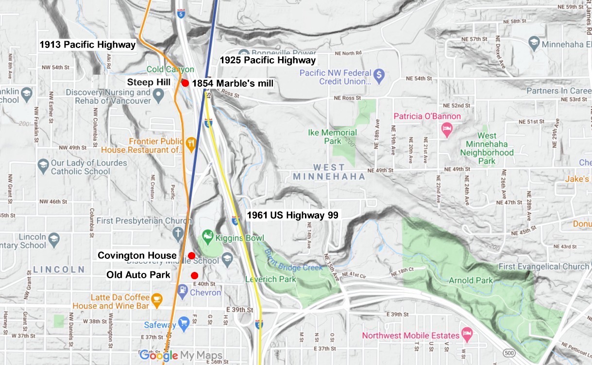
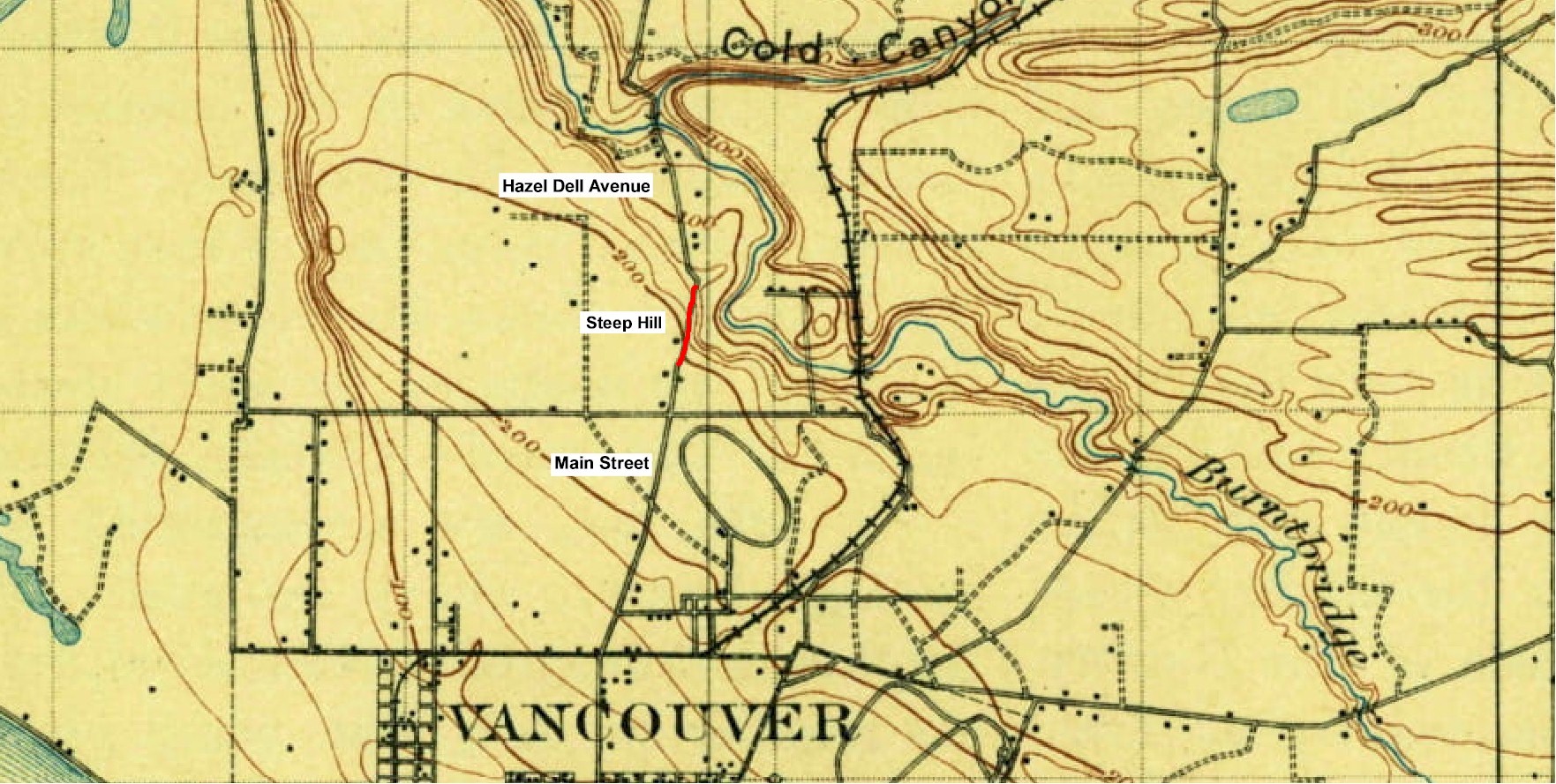
Steep Hill
![]()
The Historic Pacific Highway
in Washington
Steep Hill
Steep Hill
By Curt Cunningham
The Pacific Highway heading north of Vancouver, followed the 1870 Military Road road between that city and Salmon Creek. This early road was narrow and because of the terrain, the crossings of the creeks had steep hills leading down to the fords. Crossing these streams during the high water months could mean life or death and many perished in the cold waters.
The first bridges were built at the bottom of these ravines and only helped the traveler get across the stream eliminating the water danger. Many of the approaches to these bridges had steep hills that were also very dangerous. There have been many accidents that have resulted in people losing their lives for simply trying to cross a bridge. After the auto came on the scene in the 1900's, these steep hills became a great difficulty for these new machines, and the change from the muddy wagon road to a modern highway was now desperately needed.
As the state and counties began to improve the Pacific Highway. The work consisted of straightening out some of the worst curves and grading most of the worst hills. Over time the highway would evolve from an improved wagon road into a modern highway.
In 1913 the Pacific Highway between Vancouver and Salmon Creek was paved in concrete. Although a great improvement for travelers, this new hard surfaced road created another danger to the motorist. This new danger was speed. Now that the road was hard surfaced, cars could drive faster than ever before.
In the 1910's, 8 to 10 miles per hour was the average speed limit in most of the towns. Back in the 1920's, going 30 or 40 miles per hour was considered high speed as that was about the maximum most of the old cars could go. It was difficult and uncomfortable to drive that fast over unimproved dirt roads with plenty of ruts and pot holes, that were about 8 to 16 feet wide for both lanes of traffic. In the 1920's, the rum runners built high speed autos that could reach speeds of 60 to 65 miles per hour.
By going down the hills on this new concrete highway, those old cars could attain higher speeds. One of these places was a hill on the south side of Burnt Bridge Creek that was known as "Steep Hill." What made this hill especially dangerous was at the bottom of the hill after crossing the bridge traveling northbound, the driver would have to make a sharp turn before the road begins its climb up the north side of Cold Canyon.
Driving down this hill, cars would start to gain more speed as the momentum kicks in. If a driver was unaware of the sharp turn at the bottom or if the brakes failed, they would be in for a frightening surprise. The locals probably seen quite a few close calls at the turn. This hazard would remain a problem on the highway until 1925, when the Pacific Highway was realigned to the east bypassing the narrow old highway between Burnt Bridge Creek and Salmon Creek. This bypass is known as the "Salmon Creek Cutoff." The new cutoff entered the city where it meets Hazel Dell Avenue.
Tragedy on Steep Hill
On Saturday, July 27, 1921 at 8pm, Frank Shanty of Camas, WA, and Mrs. A. J. Selph also from Camas, were killed in an auto collision at the bottom of Steep Hill. Shanty was driving north with Mrs. Selph on the Pacific Highway at a terrific pace, and his car gathered great momentum as it tore down Steep hill and crossed Burnt Bridge creek at the foot of the grade, where it was estimated the car was going better than 50 miles an hour.
Just beyond the bridge the road sharply turns and there Shanty collided with another big touring car, driven by Mr. English of Aberdeen. Shanty was thrown from his car when they collided and struck the ground almost 100 feet away. The car which he was driving rolled end over end down the embankment, carrying Mrs. Selph with it. Shanty was instantly killed and Mrs. Selph was so seriously injured she did not survive after attempts to save her at St. Joseph's hospital.
The occupants of the other vehicle were only slightly injured, though shaken up pretty badly, as their car never left the road. Shanty was a widower and left behind several small children. Mrs. Selph was a widow who had lost her husband from an accident at the Camas Paper mill which took his life the previous year. Mrs. Selph left behind 2 small children.
The Prunarians
The Prunarians came together for the purpose of obtaining better prices for the fruit they grew and wanted to bring awareness and tourists to the fruit growing area north of Vancouver. The Prunarians were very active during the construction of the Pacific Highway. The group attended road openings and held touring excursions along the completed sections. The growers also assisted in the creation of the Vancouver Auto Park. On September 13, 1921, the Prunarians drove to Vancouver to welcome the 59th Infantry from their march down the Pacific Highway from Fort Lewis to the Vancouver Barracks.
On January 23, 1910, Some 40 ranchers at Felida had formed the Felida Prune Growers Association with the object of securing better prices for their fruit by forming a union. The association was modeled after the Fruit Growers Association at Hood River. The prunes of all the members were sold through a board of trustees. The Felida organization covered territory from Burnt Bridge Creek to Whipple Creek near Sara, and included the owners of 500 acres of prune orchards.
On May 20, 1920, at a meeting of the Royal Prunarians, a site was chosen for an auto camp. The camp was at the top of Steep Hill on Pacific Highway past 39th Street, on the east side of the highway near Burnt Bridge Creek. On June 22, 1921, the "Prunarian Park" was dedicated with an appropriate ceremony by the Vancouver Prunarians. The site was purchased by Clark County for $250 an acre from the Holmes estate.
There were 26 acres located near where Burnt Bridge Creek flows close to the Pacific Highway and at noon on the 22nd, the Prunarians went to the site and the women of the American Legion served an open air lunch. M. E. Carson, county commissioner laid a corner stone of a brick fireplace. Henry Crass also spoke. The Prunarians paid $800 to improve the site, and the state highway commission gave $700. The park was free to all visitors.
In 1930, Prunarian Park was renovated and expanded into a city park, and the following year Leverich Park was dedicated. This is one of Vancouver's oldest parks. This wooded park today is now 33 acres, and is a beautiful place along Burnt Bridge Creek to spend the day for a picnic or just to enjoy the great outdoors. Today, the Discovery Middle School occupies the old auto park area.
There is a wayside along the highway where you can stop to stretch your legs or to visit the historic Covington House, which is the oldest building in Clark County. The hewn log cabin was built by early settlers Richard and Charlotte Covington in 1848. After the Covington's arrived fresh off the Oregon Trail, they took a claim of 640 acres near the intersection of 76th and Covington Street in Orchards. They brought a piano with them that was the first in the Pacific Northwest. The cabin was soon the center of social activity in the area, and many soldiers came from Fort Vancouver to socialize and to hear Charlotte play the piano. The Covington's were childless and after their passing, a niece held possession of the cabin until her death in the 1920's.
In 1930, the cabin was moved to its present location next to the Pacific Highway at the old auto park. The cabin has been meticulously restored although a few modifications were made. The building was listed on the National Historic Register in 1974 and on the Clark County register in 1985.
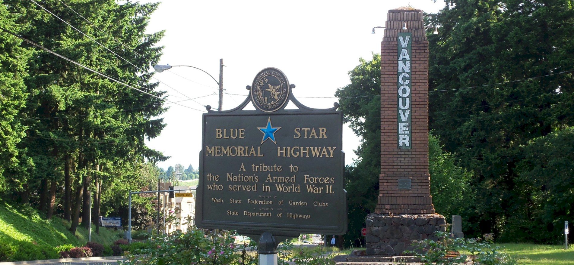
Looking north from the wayside. 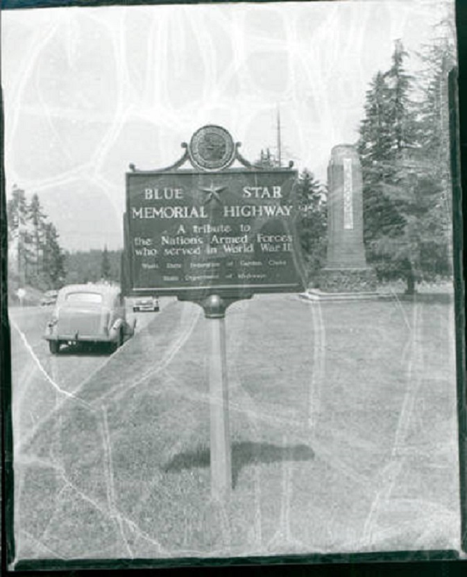
The wayside in 1938 Photo courtesy Washington Digital Archives 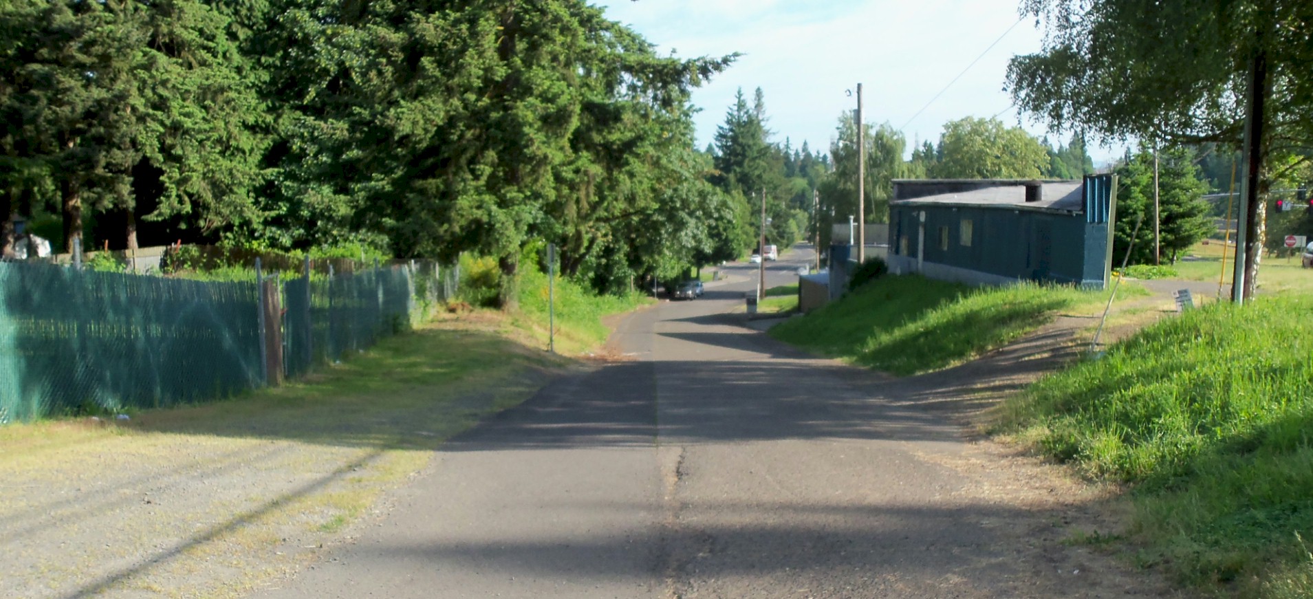
Looking north. This is where the old highway splits off from Main Street onto Hazel Dell Avenue. 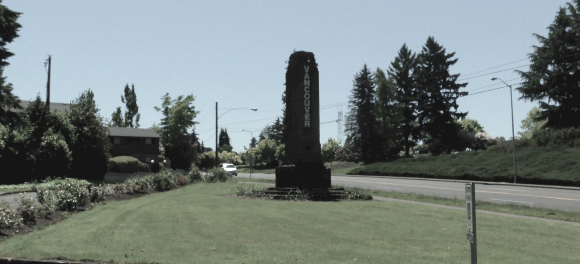
2014 Looking south at the Entrance to Vancouver at the wayside. |
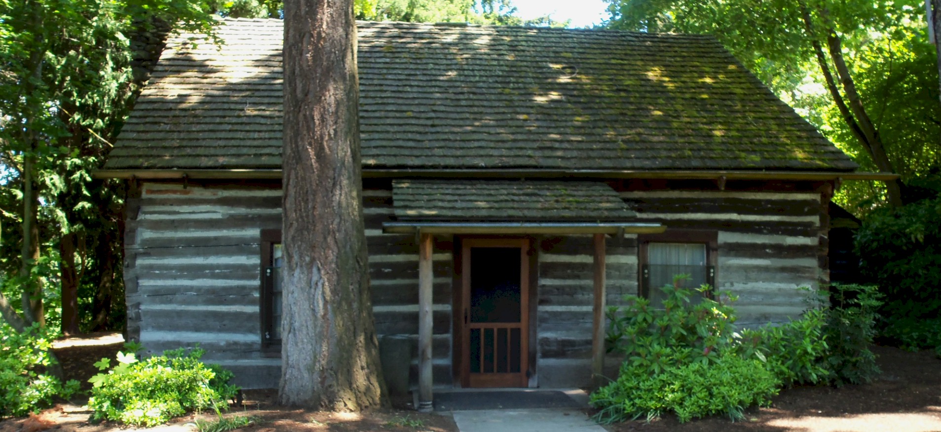
The 1848 Covington House 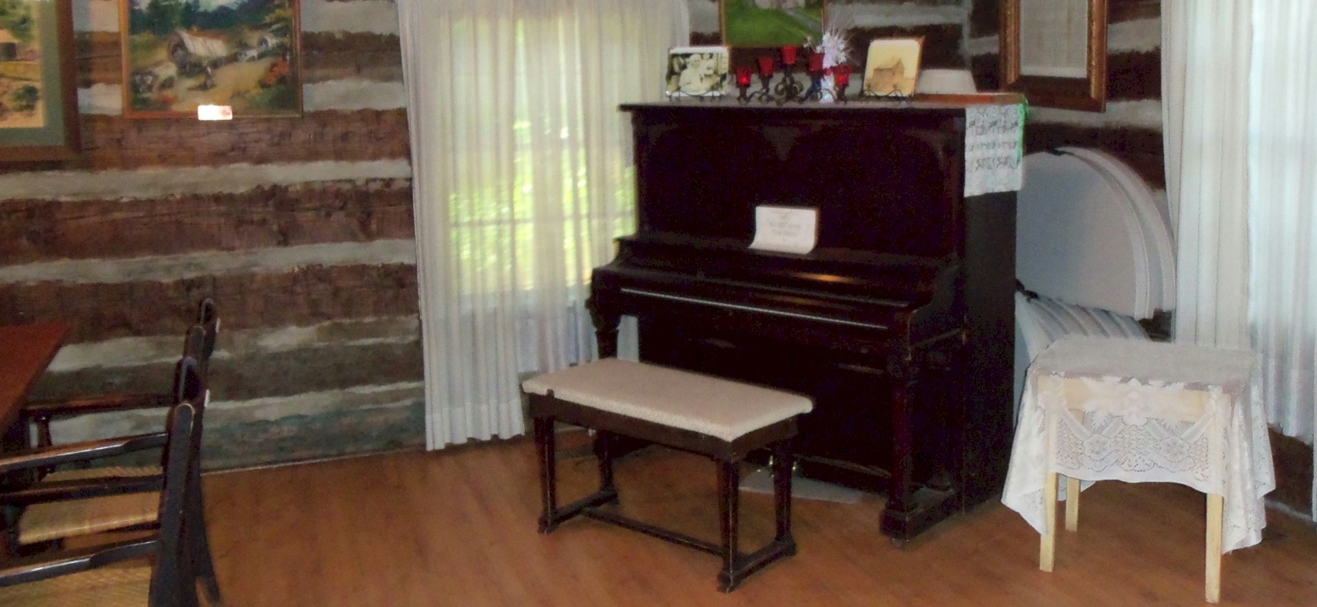
First piano in Oregon Territory. 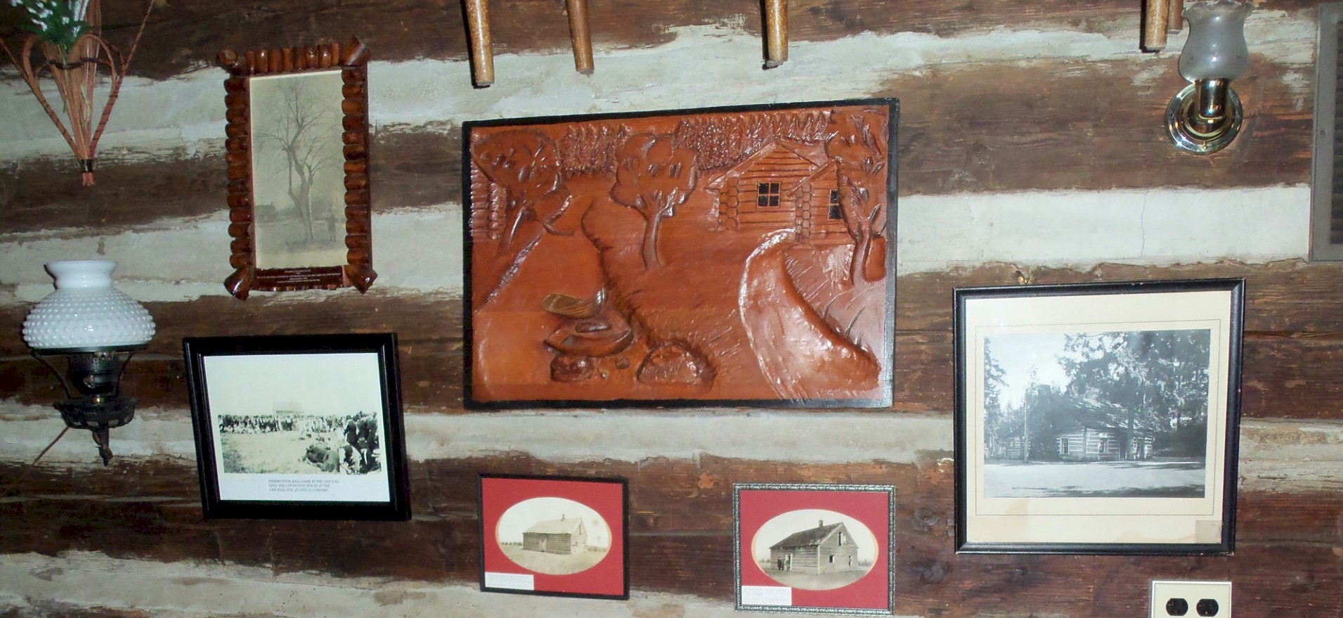
Above the fireplace in the Covington House. 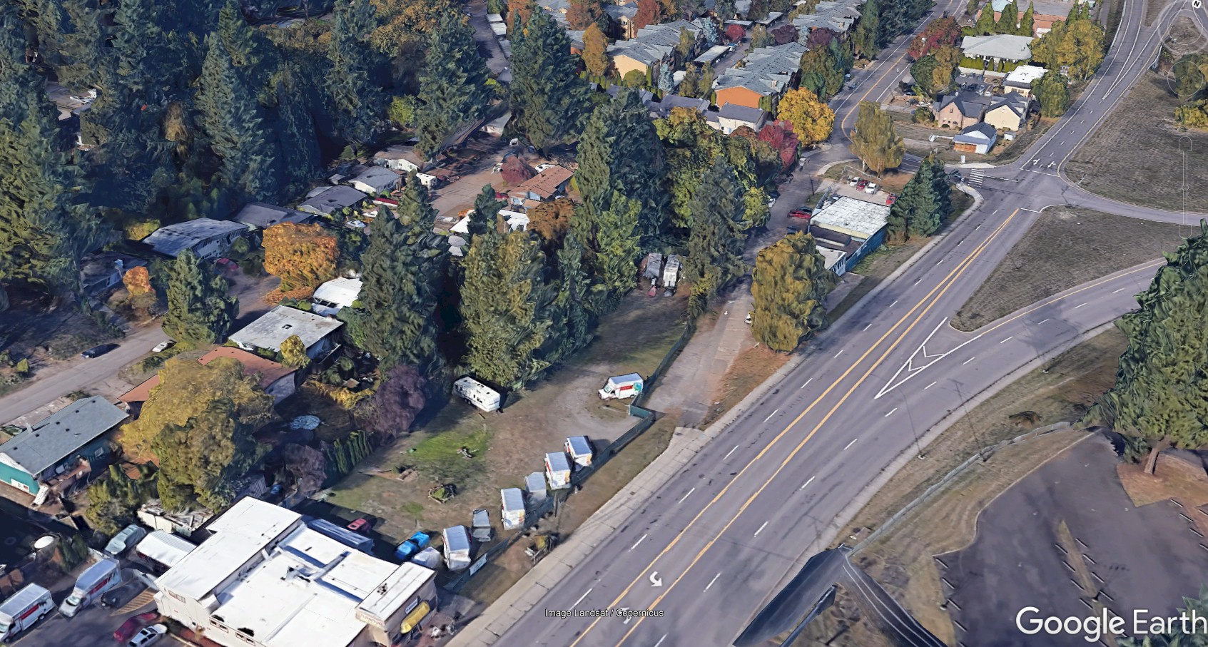
2020 Aerial showing the old highway on the left side of the road. |