![]()
The Historic Pacific Highway
in Washington
Jackson Hill
![]()
The Historic Pacific Highway
in Washington
Jackson Hill
The La Camas Schoolhouse located just off the Pacific Highway on Oyler Road. Photo taken July 2022.
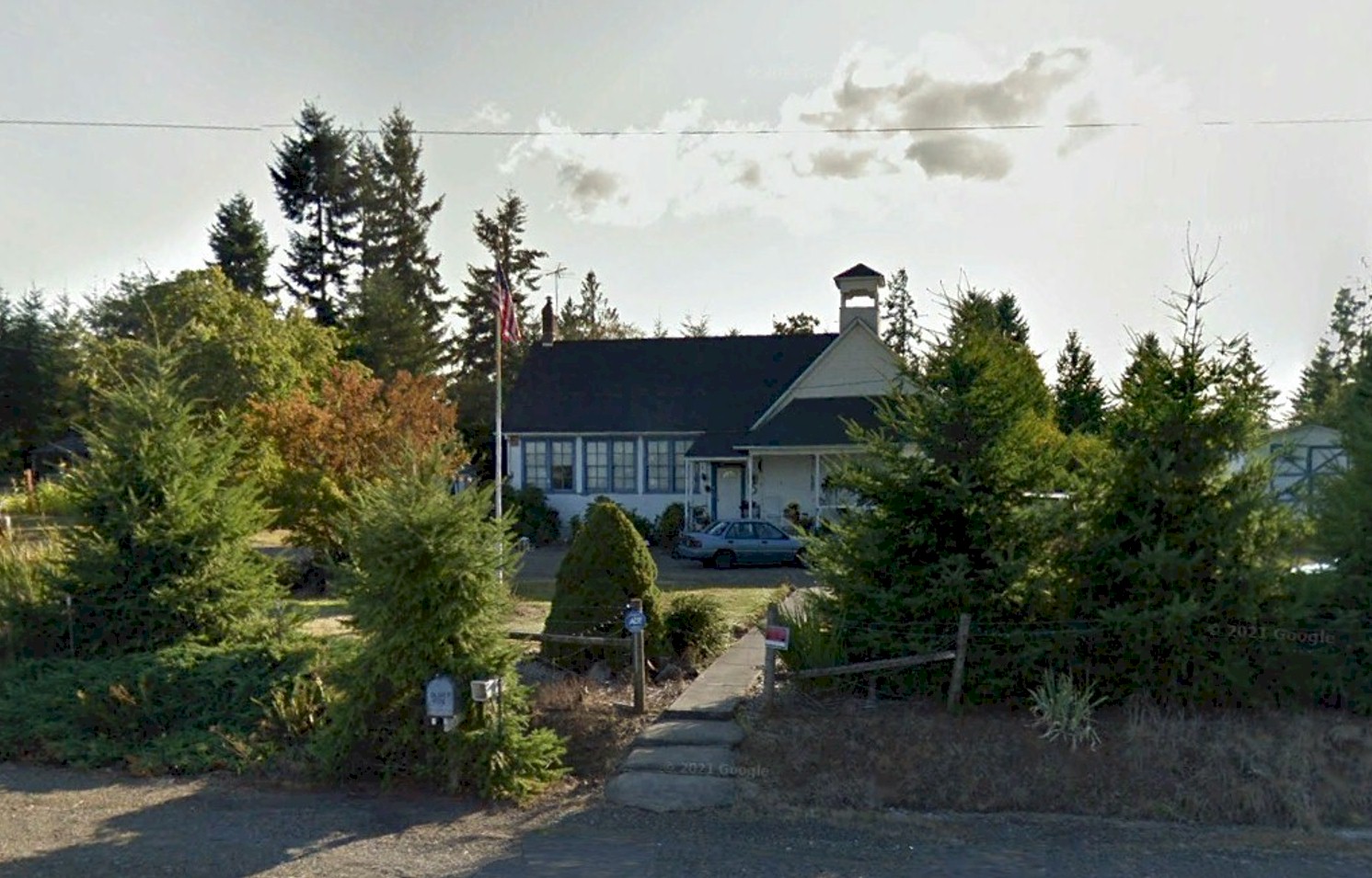
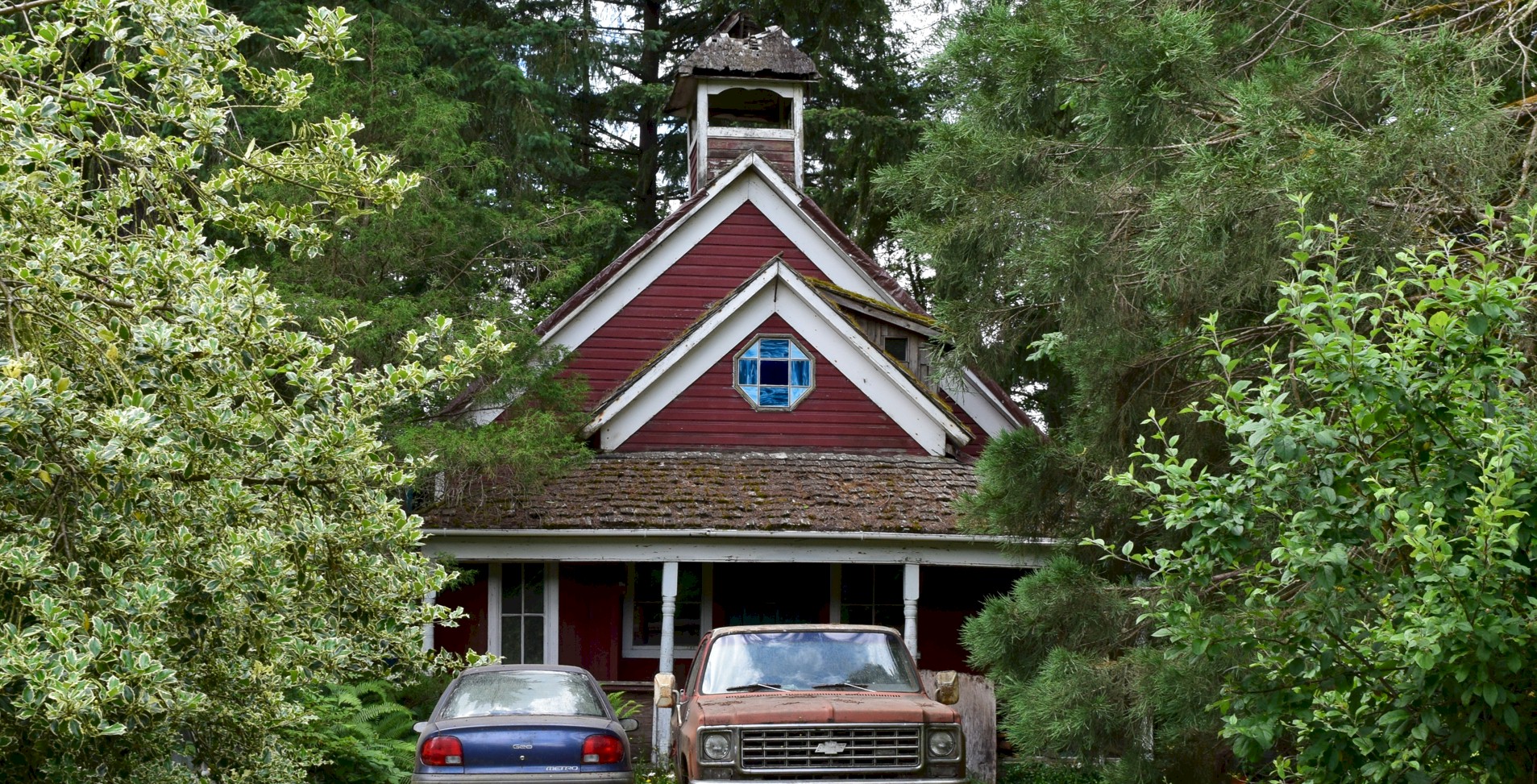
The Jackson Prairie Schoolhouse. (Google Earth Image)
History of Jackson Hill
By Curt Cunningham
Between the upper Cowlitz river and the south fork of the Newaukum river is the Jackson prairie. This prairie sits about 150 feet above the bottom lands, on a hill about 4 miles wide at the bottom and 2 miles wide at the top. In the 1850's the area was known as the Highland's. In 1845 John R. Jackson settled along the Cowlitz Trail in the middle of this prairie. Jackson's cabin was the first stop for travelers on the trail leading north from the Cowlitz landing.
Between Toledo and Chehalis the road was muddy most of the year and was one of the worst places on the Cowlitz Trail. By 1893 the road south from Chehalis was planked to the Newaukum river. That year plans were being made to plank the road to the Jackson prairie. The road was impassible during the winter and Chehalis wanted access to the farming region all year around. By 1911 the highway between Toledo and Chehalis, known as the Cowlitz-Olympia Road, had been planked for most of the way.
The North Hill
At the north end of the Jackson prairie was Jackson hill. The old grade was west of the Pacific Highway about 2 miles north of Marys Corner. This steep incline was an obstacle and many a motorist cursed at it while attempting to reach the top. The road still exists today as a private drive. At the top of the hill, the old road is now a driveway, and after crossing Koontz Road it follows Conway Road.
In 1913 the Pacific Highway was routed through Napavine and Winlock as it was a better route at the time. Late in 1913 the route of the highway was officially routed down the Cowlitz-Olympia Road to Toledo which prompted improvement of the now muddy broken plank road. By 1913 most of the planking had broken or was missing making the route even worse.
Nothing would be done to improve this portion of the highway until June 4, 1917 when bids were opened for a new grade up the hill at the north end of Jackson prairie. State highway contract, #298, was awarded to Hendricks and Ward of Centralia for 1.32 miles of highway. The original highway had a standard roadbed 30 feet wide in cuts and 24 feet in fills. The improvement was on a new alignment and reduced the former heavy Jackson Hill grade to 5%. The contract was completed on October 20, 1917. The total cost of the improvement was $8,994.42.
The South Hill
The south end of the prairie is swampy at the top and on the hill for most of the year it is muddy. The new grade is west of the old road and travels through an old growth forest. This section of the Pacific Highway would not be improved as well until the summer of 1917. Bids were opened for construction of a new 1.65 mile 5% grade on the south hill the same day as the north hill contract. Contract #300 was awarded to Standard Transfer Co. of Aberdeen. The roadway was built the same width as the north hill. The contract also called for clearing the road and paving it with gravel 16 feet wide and 9 inches deep over the entire 4.18 miles between the new grades. The work was completed on August 20, 1918.
These 2 improvements connected the already paved sections of the Pacific Highway leading north from Toledo and south from Chehalis with a well constructed roadway on a permanent location and grades.
Paving Begins
On April 23, 1919, application was made for Federal aid to pave the gap in the highway paved between Toledo and Forest. Federal approval was given June 19, 1919. The contract for paving 6.7 miles between a point 3.5 miles north of Toledo and the town of Forest with standard one-course concrete pavement 20 feet wide, was awarded on June 24, 1919, to T. M. Morgan of Auburn for $221,693.70. The paving was completed September 18, 1920.
The Pacific Highway was now a continuous paved highway between Toledo and Chehalis.
Lewis and Clark State Park
Lewis and Clark State Park was established in 1922, as part of an effort to preserve the remaining old-growth forest along the state highway system. During the 1930s, in the midst of the Great Depression, Lewis and Clark State Park was host to a Civilian Conservation Corps camp.
The park is 616 acres and features 5 miles of hiking trails and 8 miles of multi-use trails open to horses. You can walk or ride through the old growth forest and experience the greenery that is abundant there. As you walk you can imagine you are traveling the Cowlitz Trail on your way to Puget Sound. You can also walk along the old Pacific Highway grade on the hillside. Over on the west side of the new highway near the top of the hill, there is a wayside next to an old growth Douglas fir.
Photos
of the horse trail leading up the hill on the south side of the
Jackson prairie.
This gives an idea of what it was like traveling on the Cowlitz Trail to Jackson's cabin.
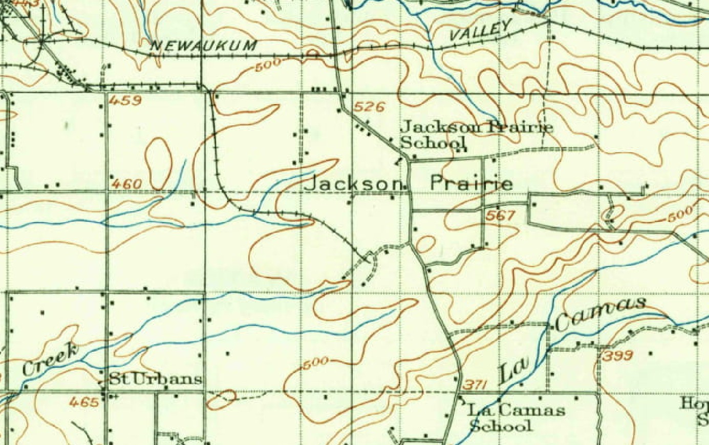
1916 map. Both school houses on this map survive today as private residences.
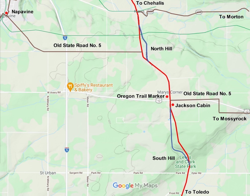
2021 map
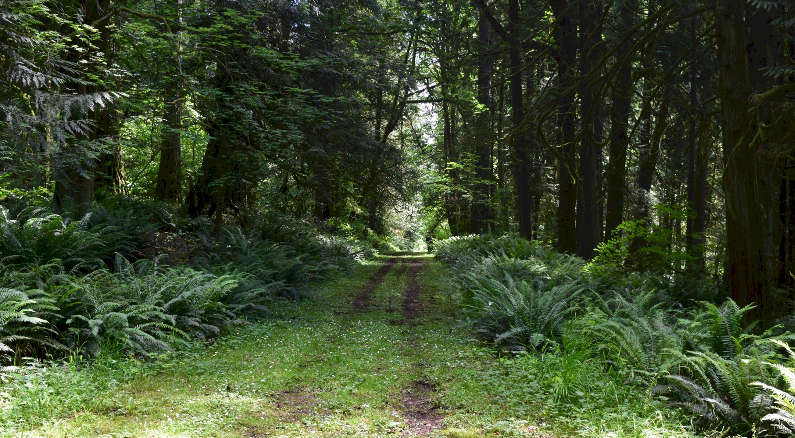
Starting up Jackson Hill traveling northbound. This is in the Lewis & Clark State Park. 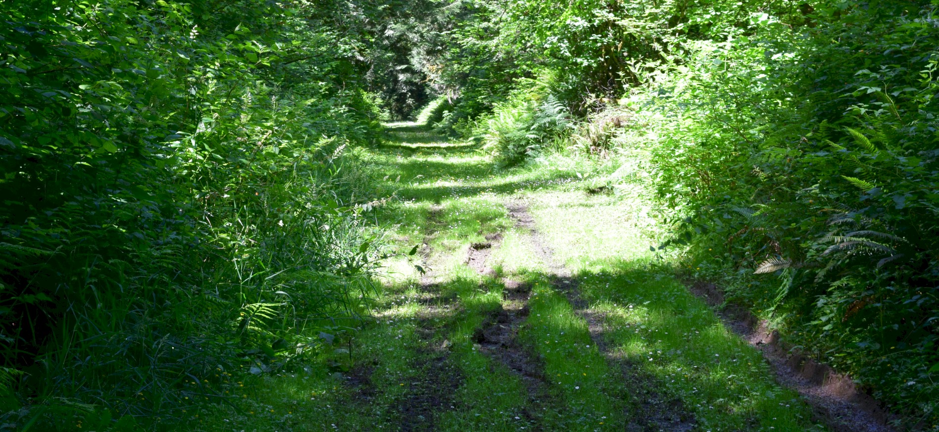
Continuing up the hill. You can see that it is a muddy place when it rains. 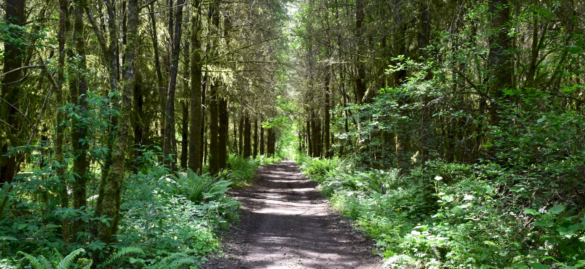
Top of the south hill traveling north. 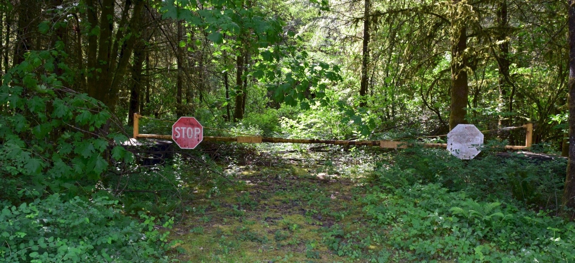
The gate at the top of the hill. This is looking south. |
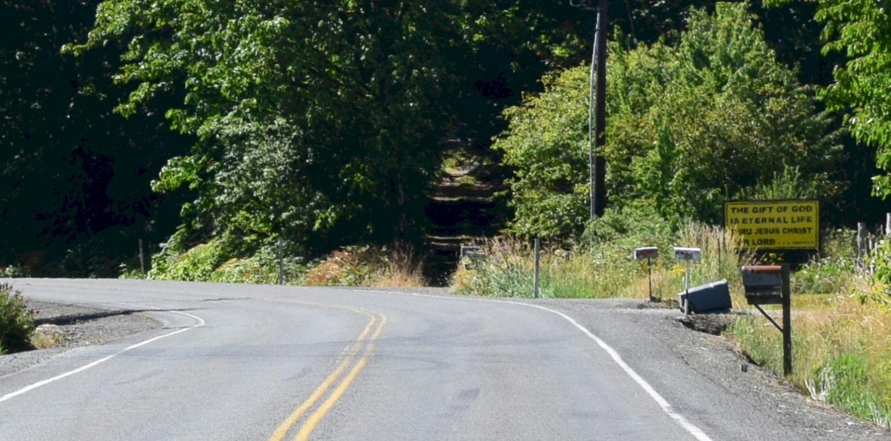
The bottom of the north hill traveling southbound. The old highway continues forward, and the new highway veers to the left. 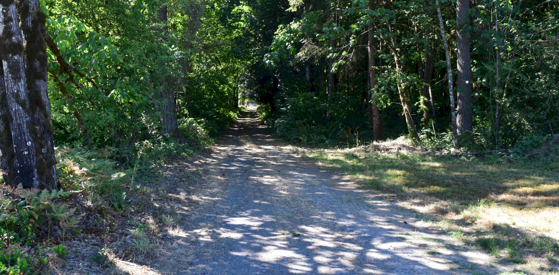
Beginning of the climb up the north hill traveling southbound. 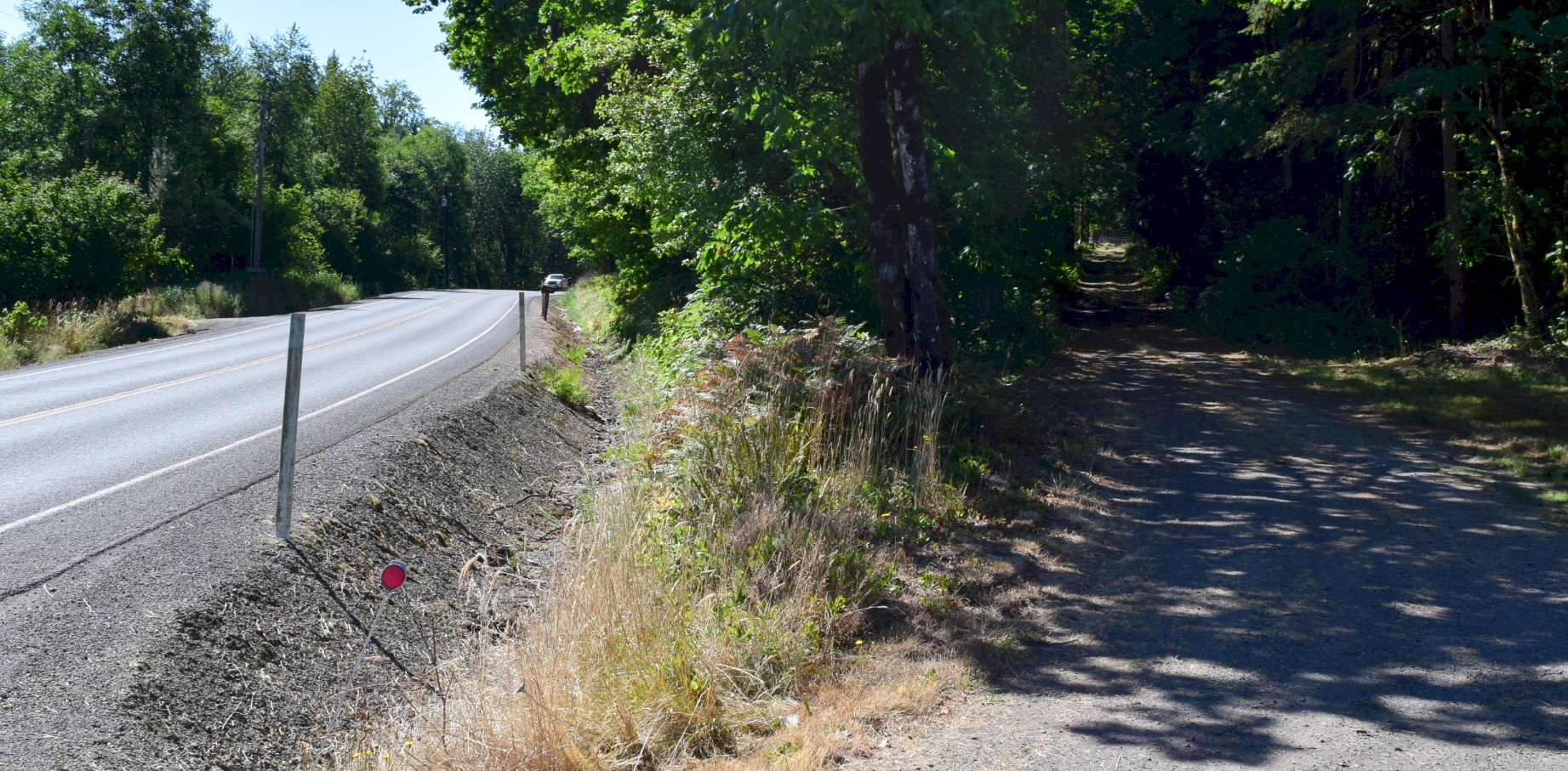
The old road and the new road at the bottom of the north hill. 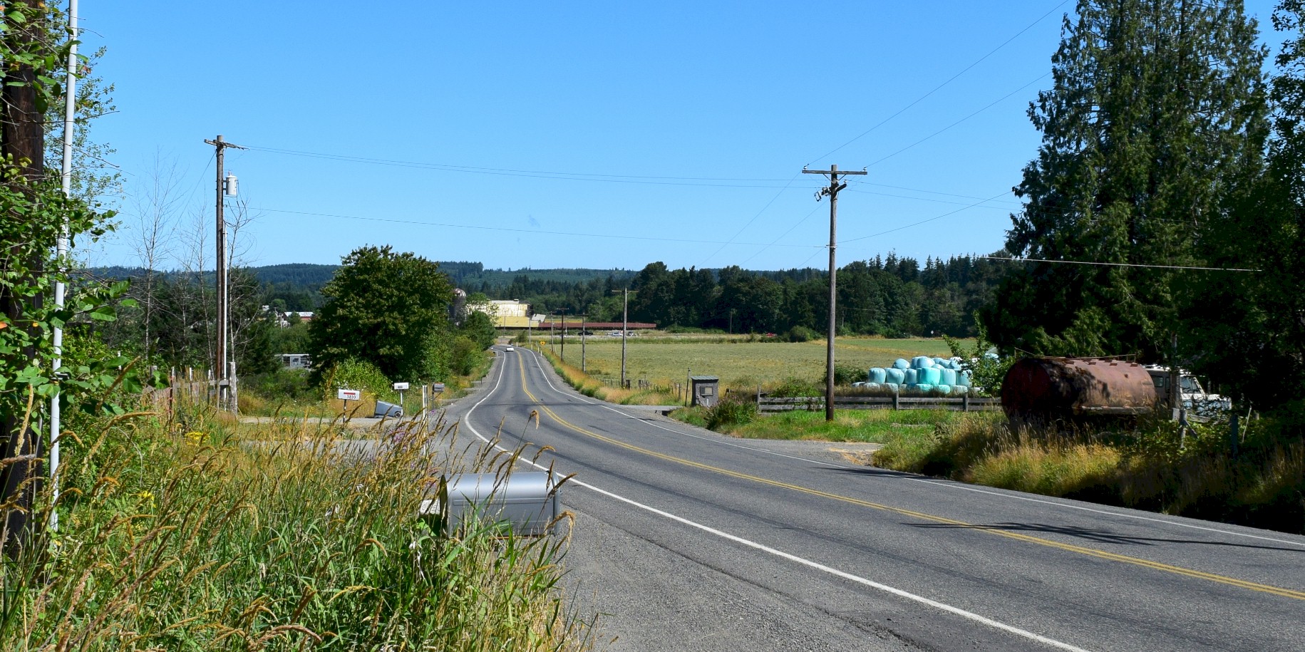
Bottom of the north hill on the old road looking northward at the Newaukum valley. |