![]()
The Historic Pacific Highway
in Washington
Chuckanut Drive Viaduct #3
![]()
The Historic Pacific Highway
in Washington
Chuckanut Drive Viaduct #3
The 1967 Chuckanut Forest Fire
By Jeffery A. Fox
The summer of 1967 was quite warm and dry. I believe I have mentioned that we lived above the Great Northern Railway's tracks where they crossed the tide flats. When the Great Northern relocated and opened their revised route in 1914 called the Chuckanut cut-off, it followed the shoreline of the bay except where it traversed four tunnels. The tracks originally ran along Padden Creek to Old Samish Highway (1st, route of the Pacific Highway before Chuckanut Drive) through Alger and then straight south to Burlington.
On an afternoon in early August of 1967 a southbound freight train developed what they called a "hot box" on a set of wheels and it ignited a small fire along the tracks below Larrabee State Park, followed by at least three additional spot fires. These all were extinguished by either the railroad or the County fire department. The final one evidentially gathered some strength from an off shore breeze and was not contained at the spur of the moment.
I was in the process of fueling my 1948 Chevy at Hansen's Texaco Station on Chuckanut Drive when Mrs. Hansen told me that the last fire in line had jumped the highway and was now making its way up the steep banks of Chuckanut Mountain. It would be a long "Uphill" (no pun intended) battle for sure to contain this baby as there was absolutely no way to utilize machinery on the steep slopes. The firefighters would need to do this one manually. Up on the mountain there still existed an old logging road that was assessable so this would become the fire line.
The fire was mostly a ground fire and crowned in places but basically left much of the growth as is but burning the roots of the trees. The real damage would not be seen possibly for two to three years later. Chuckanut Drive was always very prone to slides as the rock formations were either made up of sandstone or immature shale. The shale was the culprit but each time a slide occurred it made for some interesting fossil finds.
Viaduct #3
When the highway finally reopened, or let's say a couple hours before, the highway department allowed me to take my 1948 Chevy and drive the route and take as many photos as I desired. This meant that I could stop anywhere, get out and snap shots. I will share a few photos of viaduct #3 with you.
These photos were all snapped at the 3rd viaduct on the highway as you travel south, and you can clearly see the damage below and above the highway. In the 2nd photo looking south, that's my 1948 Chevy in the background. The railings on this viaduct were unique to say the least with the railing's pillars set at 45 degrees. Only two sections retains its originality today as the other sections were severely damaged by slides. The railing from a distance looked like it did in photos 3 and 4 except that the wall is now solid concrete.
The last photo is a shot taken by the highway dept in 2010 of the viaduct railing. You will notice the pillars are indeed set at a 45 degree angle. The treatment on the repaired section looks the same sans pillars. After the forest fire of 1967 this area became very prone to rock slides as all vegetation was burned off the face of the cliff.
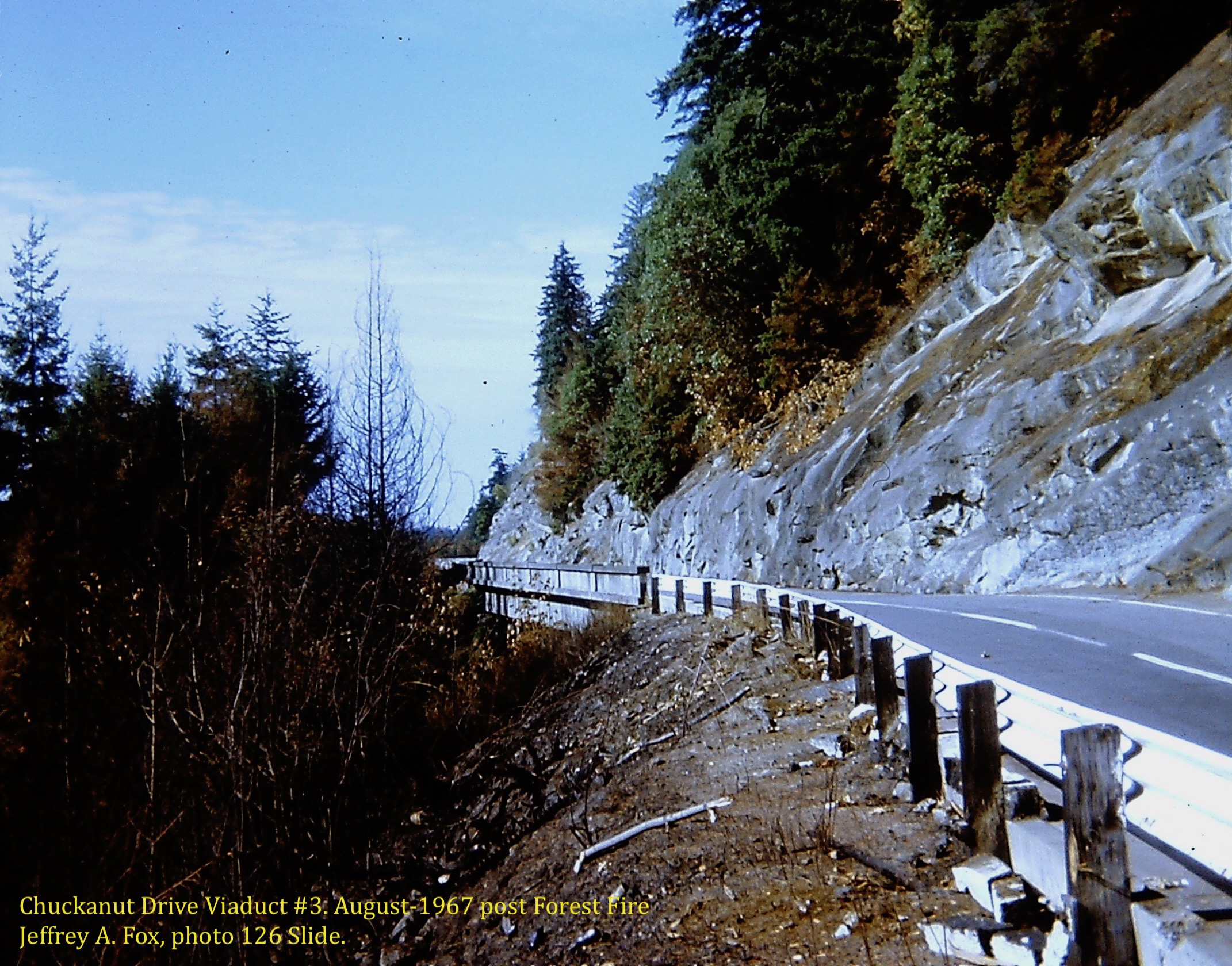
Looking north at viaduct #3 in August of 1967. Photo courtesy Jeffrey A. Fox. Photos are from 126-20 slides. 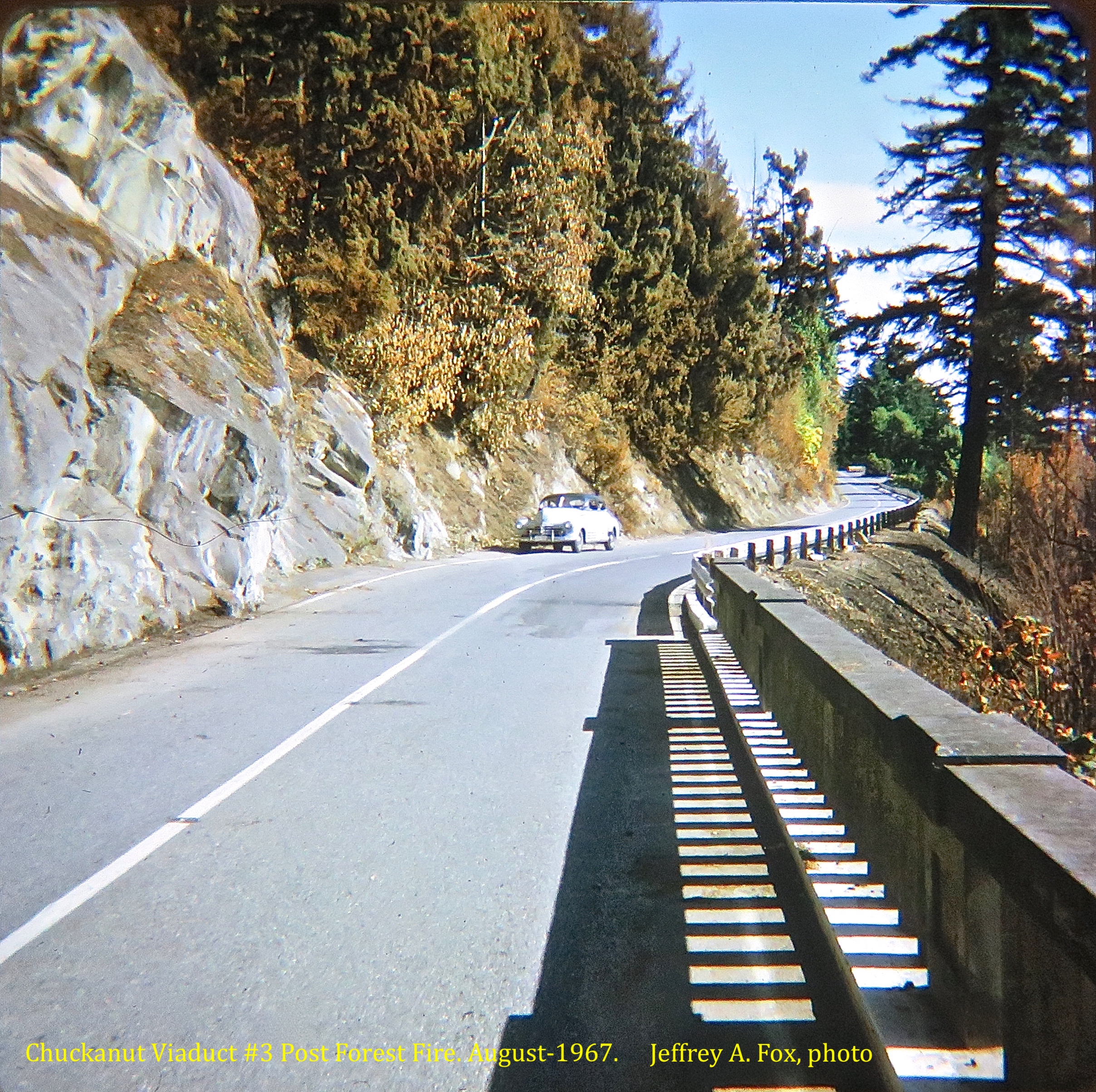
Looking south from viaduct #3 in August of 1967. Photo courtesy Jeffrey A. Fox. Photos are from 126-20 slides. 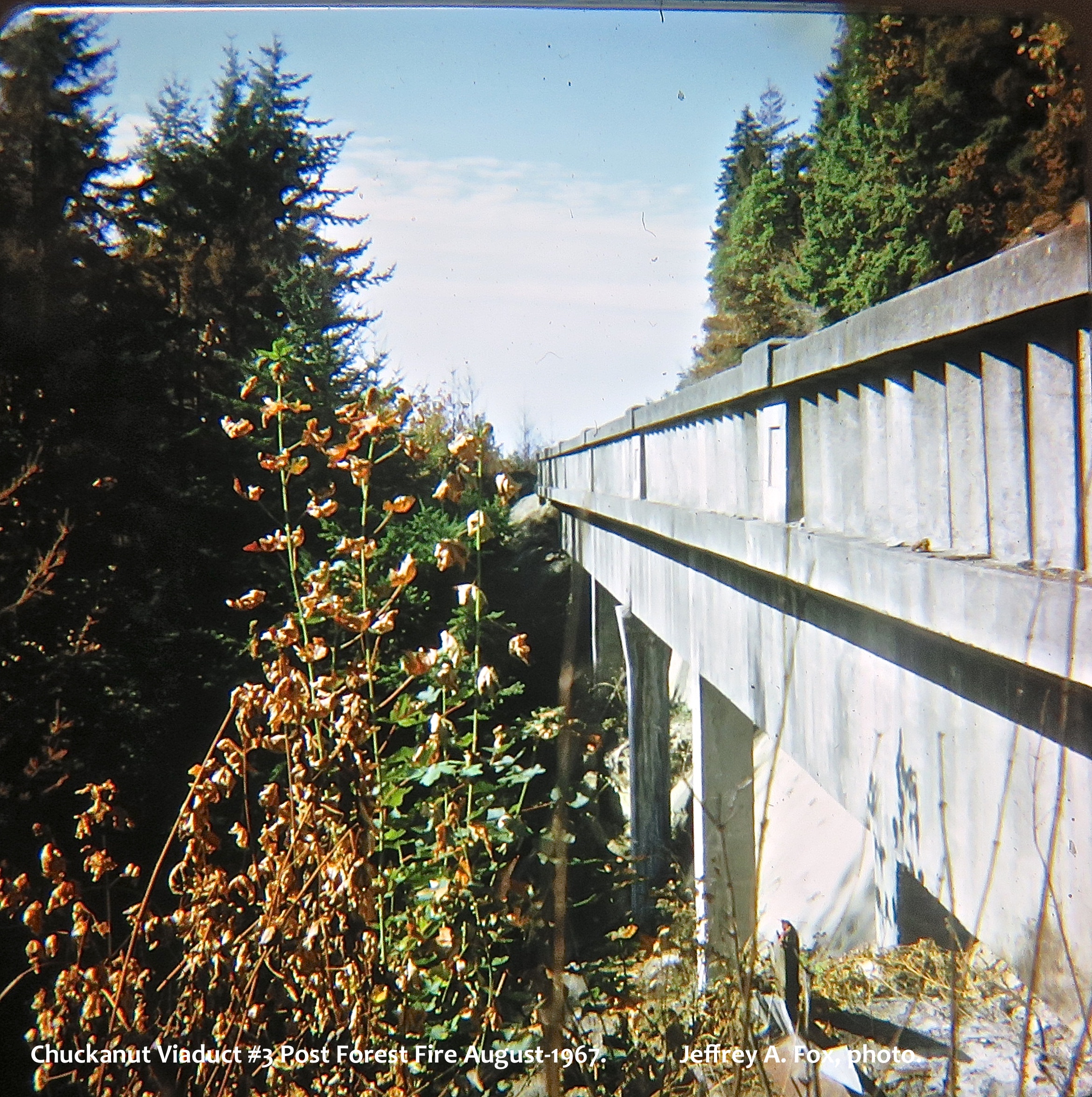
Looking north viaduct #3. Photo courtesy Jeffrey A. Fox. Photos are from 126-20 slides. 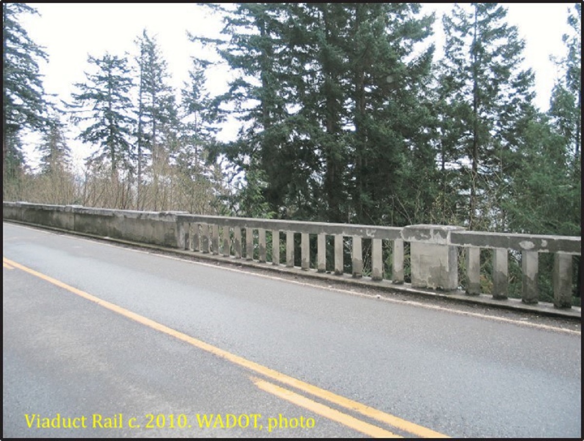
The 45 degree angle viaduct railing. WADOT, photo courtesy Jeffrey A. Fox. |
©2011-2022 pacific-hwy.net
All Rights Reserved