![]()
The Historic Pacific Highway
in Washington
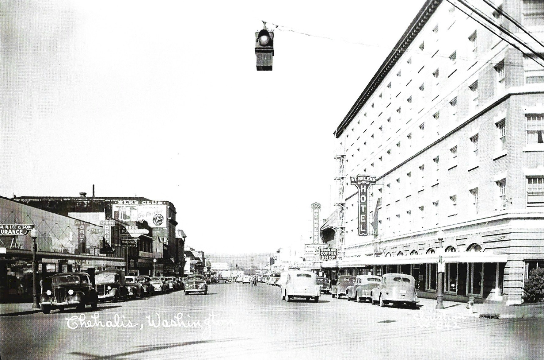
Chehalis
![]()
The Historic Pacific Highway
in Washington
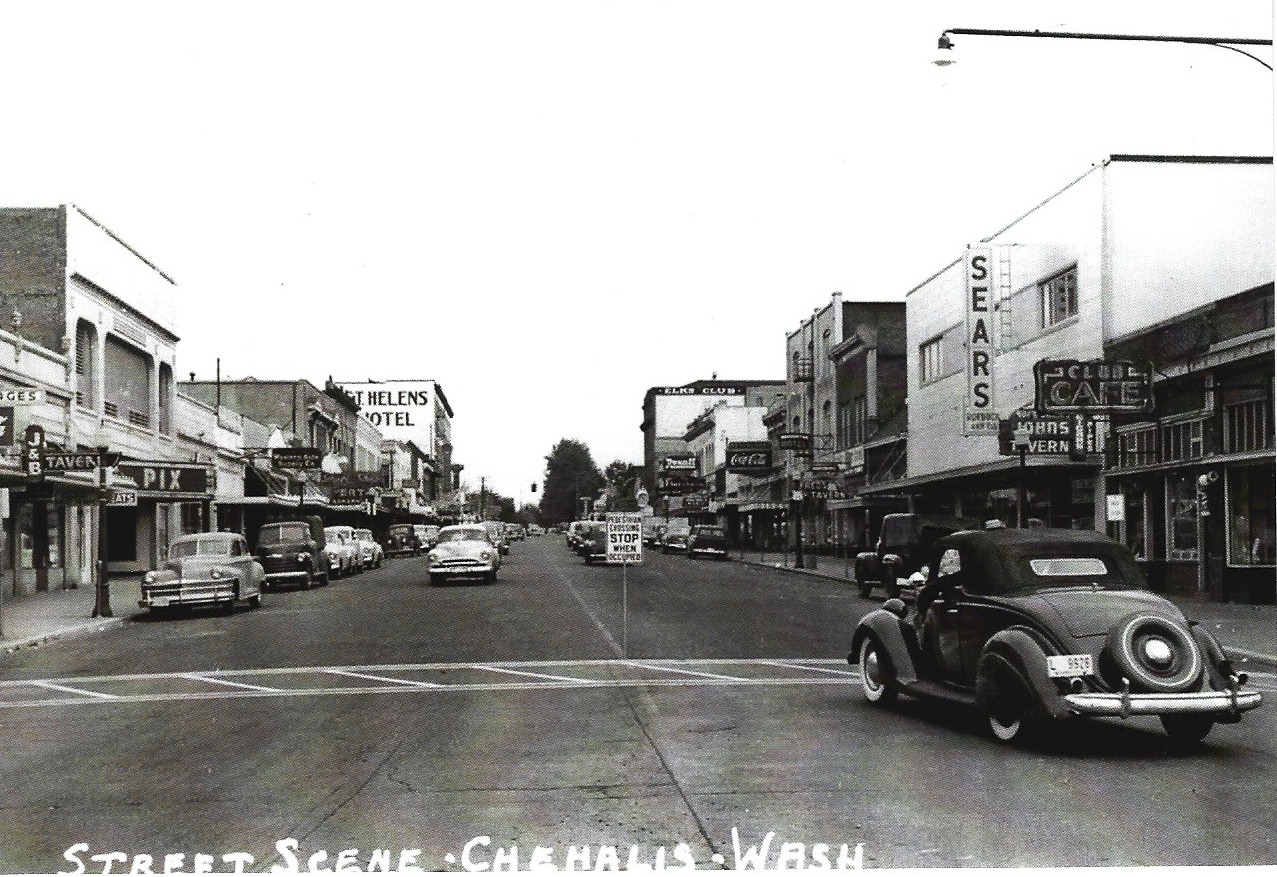
Chehalis
Market Blvd. Northbound
Market Blvd. Southbound
History of Chehalis
By Curt Cunningham
The Cowlitz Trail
Chehalis and Centralia are located on the Chehalis river in Lewis county midway between the Puget Sound and the Columbia river. The twin cities are 75 miles south of Seattle and 78 miles north of Portland. The Pacific Highway and the railroad both pass through these towns.
The Pacific Highway through Lewis county is on the route of the old Cowlitz Trail. Almost all of the overland emigrants who settled in the Puget Sound area between 1850 and 1867, traveled this road. The section of the trail that ran between Chehalis and Centralia was through soggy bottom land. During the rainy season the road was extremely muddy and almost impassible. Horses would sink past their knees. As you drive between these towns today on the Pacific Highway you will notice the road is high above the ground and on both sides of the road it is still wet and soggy.
The area between Chehalis and Centralia was known as Saunders' Bottom. One of the worst places on this road was through Wet prairie which was located just north of Saunders' claim. (The old Yardbirds store sits on top of this prairie.) The Hudson's Bay Co.'s pack trail through this section was over Mud mountain and bypassed Wet prairie. Mud mountain is now called Seminary hill. Andrew Chambers and his family built the first road around Mud mountain and the first bridge over Salzer creek in 1847, so they could get their wagons though to their claim at Olympia.
The Newaukum river at the crossing, could be forded, though if the water was high, you and your horse would have to swim across. On December 5, 1853 John Moore established a ferry at the Newaukum crossing. He operated this ferry until the bridge was built in 1857. Before 1857, the Cowlitz Trail between Mary's Corner and Bishop Road was about a half mile west of the Pacific Highway.
The Skookumchuck river has a deep channel and could not be forded. The Upper Chehalis would keep a camp at this crossing and they would ferry travelers across the river in their canoes for a fee. In 1862, a ferry was established across the Chehalis river at the Borst claim which was near the mouth of the Skookumchuck river. This ferry was operated by W. F. Donk and Henry Ties. The ferry was known as; the Borst ferry, Donk's ferry and the Blockhouse ferry, depending on who you asked. This ferry carried the traffic using the V & S Military Road between Monticello and Olympia.
By 1853, the road to Olympia from the Cowlitz Landing was the heaviest traveled in the territory, and a bridge over the Skookumchuck river had become a necessity. It would take 2 more years for this to happen. On April 14, 1855, Schuyler Saunders placed an ad in the newspaper asking for workers to help build a wagon road from his claim to the Skookum Chuck that would bypass Mud Mountain.
Saunders had to build 2 bridges; The first one was 750 feet long over the Skookumchuck river and another that was about 200 feet long that crossed Salzer Creek. In October of 1855, Lewis Johnson who lived near Dillenbaugh creek near the Chehalis Middle School, completed a puncheon floored wooden bridge over the Skookumchuck river near its mouth.
On February 2, 1857, the government placed ads for bids to construct a military road from the Cowlitz Landing to Ford's Prairie on the Skookum Chuck. The roadway was to be 25 feet wide with all stumps and roots removed within 12 feet. Corduroy (split log planking) was used on the low and marshy ground between the Skookum Chuck and the Newaukum. The first section constructed, was 15 miles from the Cowlitz Landing to the Newaukum river, where a bridge was built. The second section was 12 miles between the Newaukum river bridge and the Skookumchuck river bridge. This is when Moore's ferry went out of business and was most likely when the road between Mary's Corner and Bishop Road was moved east to its current alignment.
During the rainy season, Centralia and Chehalis were basically cut off from the Puget Sound and the Columbia river as barely anyone could get through on the muddy roads. Meetings would be held on the issue of good roads and many thought the only way to get the wagons out of the mud was to make plank roads. Puncheon or corduroy was first used. This type of planking is made with logs that are split in half and laid lengthwise with the flat side placed down so the log wouldn't sink too far. This made for an uncomfortable ride. Farmers would throw dirt over the logs to help smooth out the washboard effect.
On January 14, 1865, the Skookum Chuck & Cowlitz Plank Road Company was incorporated. The commissioners of this company were; O. B. McFadden, Marcel Chappellier, Henry Winsor, Timothy R. Winston, John R. Jackson, John McElroy, Sydney S. Ford, James Phillips, Marcel Bernier, Wesley B. Gosnell, Alonzo B. Dillenbaugh and Henry Miles. By the 1890's, there were over 40 miles of plank roads leading into Chehalis and Centralia from different points.
The Pacific Highway Controversy
When the newly formed state highway department was established in 1905, one of their first acts was to create 10 new state highways. Of these first 10 state roads, there was no north-south trunk highway through the state of Washington.
In the First Biennial Report of the State Highway Department in 1906, the need of a north-south trunk highway was first suggested. They said; "Much has been said and written regarding an improved highway extending across the state from Blaine on the British line to a point on the Columbia river. That such a highway should be built appears to be beyond dispute, but to this should be added a north and south highway in Eastern Washington from the British line to the south boundary of Walla Walla county, and an east and west highway from Puget Sound to the Idaho line. With the proper preliminary engineering to determine the best routes and probable cost of construction, the Legislature would be able to determine the feasibility and desirability of this project. It is doubtful if the state could enter upon a project which would eventually be of greater profit to its people."
On January 11, 1911, Senator Brown of Whatcom introduced the Pacific Highway bill, which called for a state trunk highway from Vancouver on the Columbia river to Blaine at the Canadian border.
On March 11, 1911, the 12th State Legislature failed to approve the Pacific Highway bill. They also failed to pass any kind of road program which left the state highway department with only enough funds for routine office work. The only road measure they passed was a substitute for the state-aid road law. This bill known as the McNeely bill, allowed counties to carry on road construction without the state participating in the work except for directing the State Highway Commissioner to determine the feasibility of a proposed road.
On April 21, 1911, at a meeting in Aberdeen of the Southwestern Washington Development Association, they held Seattle responsible for the failure of the Pacific Highway bill. In the last Legislature business people recalled hearing boasts that the Pacific Highway bill was opposed principally because it would make Portland easier to access from Southwest Washington and Seattle would lose trade to the Willamette metropolis.
These fears were unfounded. The construction of a trunk highway between Seattle and Portland would benefit both of these towns. The jealousy of a few Puget Sound senators ended up making matters far worse than if the bill had passed. Threats of a Puget Sound boycott were called for by some of the Southwest Washington citizens. Meetings were held that brought to light all the problems that Southwestern towns faced when dealing with the cities of Seattle and Tacoma.
Alexander C. Little, the mayor of Raymond said; "We never have received any recognition from Seattle or Tacoma, in any way. They have always turned us down because they had all the power."
Senator Fishback of Lewis County said; "It was Nichols of King County who was the prime mover against the Pacific Highway project. He argued that such a road would be a funnel, carrying everything into Portland, and his scheme, by having a Pacific and Inland Empire Highway, was to attract business to the Sound. But he seemed to forget that the trade of Southwestern Washington is much larger than that which he could hope to get by this highway project. Nichols fooled some of the Senators when he got them to sign up for his 'combine.' Many of these were from Eastern Washington."
Printed in the Leavenworth Echo was an article about the delineation of the Pacific Highway from Vancouver to Blaine. The placing of signposts along the line of the Pacific Highway in this state was a move to encourage further effort toward road building, as well as to stand as a rebuke to members of the 12th Washington Legislature. Whether the road was to be built or not, the posts were being set and the way pointed for future work to that end.
It was a step of not a little importance in the prosecution of a great enterprise, and in time it had a weighty bearing on the completion of this arterial thoroughfare. The Seattle Times said that; "It would have been better if the legislature had attended to business and provided for the road; but, since it did not, the signposts are a good thing, both as a matter of censure to careless and irresponsible legislators and as an incentive to further effort in completing this road.
Included in the road measures that failed, were funds to improve the old wagon road between Chehalis and South Bend. Between Pe Ell and Frances, the old stage road was nothing more than a horse trail that ran up the Rock Creek valley to the summit at Pluvius and then down a steep grade to Patton creek and then following the Willapa to Frances. One or two automobile drivers have made the trip with light machines by using the railroad part way.
This piece of road was one of the important stretches responsible for much of the ill feeling as a result of the defeat of the state-road program in the closing hours of the Legislative session. State-road No. 5 carried with it a provision for its extension to connect Chehalis and the Willapa Harbor cities of Raymond and South Bend. There was a stretch of about 10 miles near the summit at Pluvius in Pacific county where no road had ever been built, although the state had made the survey. Lewis county had a semblance of a road to the county line at Walvllle.
Pacific county continued to work on their end under the McNeely bill and reached Walville in the summer of 1912. On August 31, 1912, the road between Chehalis and South Bend was opened and the first 3 autos full of dignitaries from Raymond made a trip to Chehalis. Now it was possible to drive by automobile from Portland, Seattle or Tacoma to the beach resorts of Pacific county.
The rift between the Southwest and Puget Sound would be short lived and was put to rest in August of 1911, when at a meeting in Portland, the Seattle interests had come to the realization that there needed to be cooperation between Portland and Seattle in the building up of the Pacific Northwest instead of their individual towns.
On August 4, 1911, members of the Pacific Highway Association opened their annual meeting at the convention hall of the Commercial Club in Portland, with Judge J. T. Ronald, of Seattle, presiding. Frank B. Riley, who had just returned from an automobile trip through Washington, spoke with enthusiasm of the work that had already been done in that state. The route from state line to state line had been gone over and permanent signs were established.
On behalf of the Portland Commercial Club, C. C. Chapman spoke just before the adjournment of the afternoon session, and offered the hospitality of the club to the visitors from outside the state and congratulated the association on the good work it was doing. Joseph Blethen of the Seattle Times, responded to Mr. Chapman's speech, and gave a sincere speech about the need for cooperation between Portland and Seattle in the building up of the Northwest.
"We have found," said Mr. Blethen, "that the interests of the two cities ran parallel after all. The upbuilding of our great Northwest is a thing greater than the upbuilding of a single city, and Seattle and Portland are certainly able to work together for the welfare of the Northwest." The boycott never took place and the counties continued work on the Pacific Highway under the McNeely bill. The state would resume construction on the highway in 1914.
The Washington State Highway Commissioner report of 1912, recommended a north-south trunk highway as the most important addition to a proper system of state roads. This trunk road to be known as the Pacific Highway, or State Road No. 6, would pass through 9 county seats and the state capital, containing 48% of the wealth and population of the state, and would be for the general good of its citizens.
Concrete Paving Begins
On September 7, 1912 George Albers & William Nelson, of Chehalis completed construction of one mile of concrete paving leading from the county bridge across the Skookumchuck river north to Ford's prairie. The pavement was 5.5 inches thick, with a 2 inch crown in the center. The road was graded 4 feet on each side of the road making it a 24 foot roadway. Afterwards the roadway was coated with a sticky surfacing and binding material made from coal tar called tarvia, which was put down by Ford's Prairie resident Mr. Ipe.
Construction of this mile of road marked an epoch in road building in the north end of Lewis County, as it was the first hard-surfaced road built in the first commissioner district. Inside the City of Centralia the Commissioners had a week to let a contract to pave First street with a layer of concrete covered with a mix of crushed coal and petroleum, called dolarway pavement.
This gave a connection from the north end of Centralia with the county's concrete road. It was believed that this latter improvement would force the paving of Main street in the southern portion of Centralia. Some time ago the Centralia City Commissioners began proceedings to pave Main street, but owing to a protest of property owners, the work was abandoned.
Chehalis Has Auto Fever
On April 9, 1913, automobile fever was running rampant in Chehalis. There were a number of cars already in daily use and several other were to be delivered in the coming days. All but one of the cars went to first time buyers. Among the people who already had autos or were first time buyers were; W. E. Bishop, A. A. Hull, O. J. Albers, Francis Donahoe, W. M. Urquhart, Carroll Brown, Dr. W. B. Hotchkiss, and Mayor Coleman. Mrachek & Phillips, who were dairymen, had a truck built especially for the rapid delivery of milk.
Governor Hay Inspects the New Highway
On May 21, 1913, Governor Lister; State Highway
Commissioner, W. J. Roberts; State Treasurer Meath; State Auditor Claussen; Judge
Godnan, chairman of the Public Service Commission; Will Hoyt, engineer of the
board; plus Olympia residents, C. J. Lord and L. Chafer took a tour of the
Pacific Highway.
The party was inspecting the proposed route of the highway from Olympia to the Columbia
river.
That morning they were met by a delegation of autos from the Centralia
Commercial Club at the Lewis County line who then escorted them into Centralia.
At noon the party departed and headed for Chehalis. They were entertained
at a noon
luncheon held at the St. Helens Hotel by the Citizens' Club of Chehalis.
At 2:30pm in the Citizens' Club headquarters, a short reception was held and addresses on good roads were made by Governor Lister, Judge Godman, Auditor Claussen, Treasurer Meath, State Highway Commissioner Roberts and C. Lord. County Commissioners; Teachnor, Gray and Long, along with Lewis County Engineer Ward, escorted the party from Chehalis to Toledo, over the route of the Pacific Highway. At Toledo, a big reception was planned for that night, including a big banquet.
Chehalis and Centralia are Joined by a Concrete Highway
On September 20, 1913, informal plans to pave the Pacific Highway between Chehalis and Centralia were being discussed by the Lewis county commissioners. They planned to complete this project in 1914. Commissioner Teachnor arranged to spend $12,000 on construction of a concrete roadway from the Centralia city limits to the Southwest Washington Fairgrounds.
Commissioner Long had about $18,000 to spend, which he planned to put on the roadway extending southeast of Chehalis, an extension of the present hard surface pavement, which was completed five miles southeast from the business center of the town. Mr. Long's plan was to widen the grade for the permanent roadway between Chehalis and Centralia next year and lay the hard-surface roadway the year following, thus giving the grade time to settle during the winter.
However, it was thought that this plan would be changed and connection of the two cities with a permanent pavement be made next season. Commissioner Long figured that he could complete his part of the hard-surface roadway between the two cities and still have ample funds left to build a $10,000 extension on the paved roadway southeast of Chehalis. In the Third district, Commissioner Gray built two miles of hard-surface pavement from Toledo toward Chehalis, as the money had been set aside for the purpose, and all arrangements were made to push the work early.
Owing to questions about the final route of the Pacific Highway from Toledo to the Cowlitz County line, the State Highway Commission abandoned the idea of spending any money that year on that portion of the roadway even though they had set aside $20,000. Three possible routes were under final consideration. The one first selected crosses the Cowlitz river at Toledo on the old Lewis County bridge. The second route would lead down the north or west side of the Cowlitz river from Toledo to the old Kline ferry site (This ferry was located just west of the freeway bridge). The third route would lead along the same course, but the crossing of the Cowlitz would be made where the old railroad bridge was abandoned by the Northern Pacific at Olequa.
In 1914, Lewis county had over 1,100 miles of road to maintain, and there was little natural surfacing material available, this maintenance problem was a very serious one. Many of the main roads had been planked to a width of eight feet in the past, and there were still many miles of corduroy. The county had expended large sums in surfacing the roads in the western portion with crushed rock from the Meskill Quarry, and some surfacing material had been secured by using portable crushers. The Chehalis and Cowlitz valleys are very fertile, and had been in cultivation for many years, but the marketing of farm products had been much handicapped by the conditions of the highways during the winter and spring seasons.
On January 25, 1914, the Lewis county commissioners approved the concrete paving of one mile of the Pacific Highway from Toledo northward toward the Cowlitz store. The roadway was 16 feet wide. They also approved the concrete paving of the Pacific Highway between the Chehalis and Centralia city limits. This road was 18 feet wide. From the Newaukum bridge southward, the highway was torn up, re-graded and then paved with macadam.
On July 9, 1914, the newly paved highway between the south limits of Centralia and the Southwest Washington fairgrounds was thrown open to traffic.
On July 12, 1914 The Sunday Oregonian was warning motorists about construction on the Pacific Highway from Vancouver to Tacoma. This is what they said about the road between Toledo and Centralia. "Once across the Olequa ferry the road is quite good, if dusty. At Toledo one strikes the Pacific Highway again which should be followed into Chehalis. At Chehalis, however. It is necessary to take what is known as the old lower river road to Centralia. This has been well marked by signs from a local garage bearing the words "St. John and Titus Garage," and these enterprising men certainly deserve great credit for the way they have put up the signs. They are better and more easily followed than the Pacific Highway signs, taken as a whole."
On November 14, 1914, the Lewis county commissioners approved 2 more miles of concrete paving on the Pacific Highway. When the work was completed in 1915, there was only a gap of 13 miles left to pave.
On February 4, 1915, the Lewis county commissioners awarded a contract to the Miracle Concrete corp. of Kalispell, MT, for concrete paving between Chehalis and Centralia from the city limits to the end of the existing pavement at the south end of the fair grounds in Centralia. There were 2 other paving projects awarded that day; the concrete paving one mile of Highway 2-A (Pacific Highway) from the existing pavement 5 miles southeast of Chehalis, and the paving of one mile of Highway 5-A (Pacific Highway) north of Toledo.
On April 5, 1915, the Chehalis Auto Club elected new officers. They were; O. J. Albers, president; J. E. McDonald, secretary and treasurer; T. C. Rush, first vice president; T. J. Long, second vice president. These officers, together with W. E. Bishop and T. R. Behrend, constituted the board of trustees. The Pacific Highway between Chehalis and Centralia was closed during the paving work and the auto club took up the matter of getting the scenic River Road in good shape to be used as a detour. Arraignments were made to place Chehalis signs on all the leading roads in this district, under the supervision of the Citizens’ club and the county commissioners.
May 15, 1915, was "Good Roads Day" in Washington and the bug was working properly in the vital parts of a goodly number of Chehalis citizens that day, but the enthusiasm with which they had planned to attack the old river road leading to Centralia, was dampened somewhat by the county commissioners. They had directed their big county truck to continue to haul screenings out onto the River Road.
The truck passed back and forth and dumped its loads right where the crews wanted to work. There was nothing that the Chehalis delegation could do other than smooth out the screenings which the county hauled. Nevertheless, there was a good crowd out to help smooth up the road that afternoon. The plan to use the city grader on the road that morning was also thwarted by the county truck. But the work done by Chehalisltes improved the road and helped travelers to pass between the twin cities while the main road was closed for paving.
As a part of the good roads day activities, A. C. St. John, accompanied by a photographer, a Daily Hub correspondent and J. E. Mc Donald, secretary of the Citizens club, went over the Pacific Highway from Chehalis to Castle Rock, making a survey of the road to be reported to the Seattle Automobile club. Photographs of interesting scenes along the highway were made and these, together with the report of the road's condition, were to be incorporated in the Seattle club's Pacific Highway guide that was issued for the benefit of tourists.
On Tuesday, April 18, 1916, the state highway commission decided that the Pacific Highway into Centralia from the north shall come by way of the Western route through Grand Mound and Fords Prairie, thus turning down the request made by the people of Bucoda, Tenino and a considerable number of the population of Centralia. One reason given by the commission for refusing to consider the Bucoda route was that the roadway between Centralia and Bucoda was in poor shape while the roadway between Grand Mound and Centralia was partially paved and more paving was promised for that year.
The decision of the board cut off all chance of county road work northeast of Centralia and the Lewis county commissioners refused to do more for the people of that section than grading up the dirt roads that were already in use.
On January 10, 1920, after being closed for several months, and forcing motorists to take a bad detour by way of Winlock and Napavine, the Pacific Highway was now paved and opened to passenger cars and trucks up to 3 tons between Toledo and Chehalis. There remained only a distance of 3.5 miles that was still to be paved between the towns. Paving on this unfinished stretch began as soon as the weather, permitted and was completed by October of 1920. This new stretch of paved highway opened up some very attractive scenery, with beautiful forests that lined the road for miles.
In the summer of 1921, the Pacific Highway in Lewis county was completed. The new highway brought in swarms of tourists to Chehalis and Centralia and the scenic country of the Cowlitz Corridor. Now that tourists were flocking in, they needed places to spend the night. This is when the Auto Park came into being. These parks were basically a camping ground with showers, barbeques, etc, depending on which park you visited.
On June 4, 1921, Chehalis was maintaining 2 auto parks. One was at the southeast entrance to the city on the Pacific Highway, and contained about an acre of ground, equipped with electric lights, concrete stoves, city water and camping facilities. It could accommodate from 25 to 50 autos comfortably. The other camping ground was on the old Claquato Road at Alexander park, containing 4 acres. This park is still in operation today and is located near Highway 6, about a mile west of Chehalis on the Chehalis river.
This park, established in 1920, contained the best fresh water swimming hole in Southwest Washington and was a very popular retreat. The park had at the time; concrete stoves, a baseball diamond, city water, electric lights, etc. The park was an exceptionally fine camping spot. That summer, the park was equipped with a resuscitator called a pulmotor and lifeguards were hired for the swimming area. Plus a concession stand was opened.
Today, Alexander park is a favorite outdoor escape for the inhabitants of the area. The park's two picnic areas are consistently rented throughout the summer for family events, class reunions, church picnics and other gatherings. There is a playground that keeps the little ones entertained. Horseshoe pits are also available.
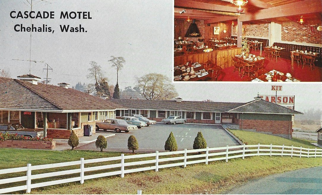
The Cascade Motel was located at 13th Street along the Pacific Highway in Chehalis. It had 25 beautifully furnished and tastefully decorated units, away from highway noise. Mr. and Mrs. Harold Hollis would have welcomed you to; wall-to-wall carpeting, thermostat controlled electric heat, full tilled bathrooms with glass door tub and shower combinations, phones and TV. It was next door the to Kit Carson restaurant when it was on Highway 99.
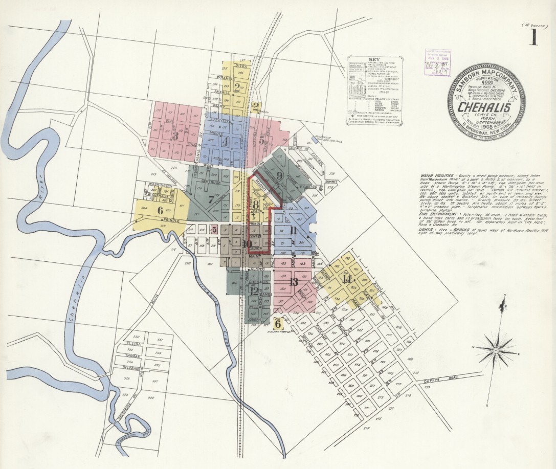
Chehalis 1908 Map courtesy Library of Congress 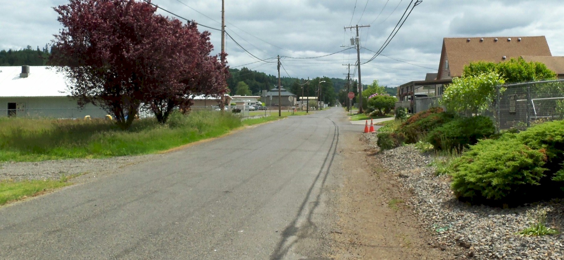
2011 south of Centralia. You are looking south down Grand Avenue. 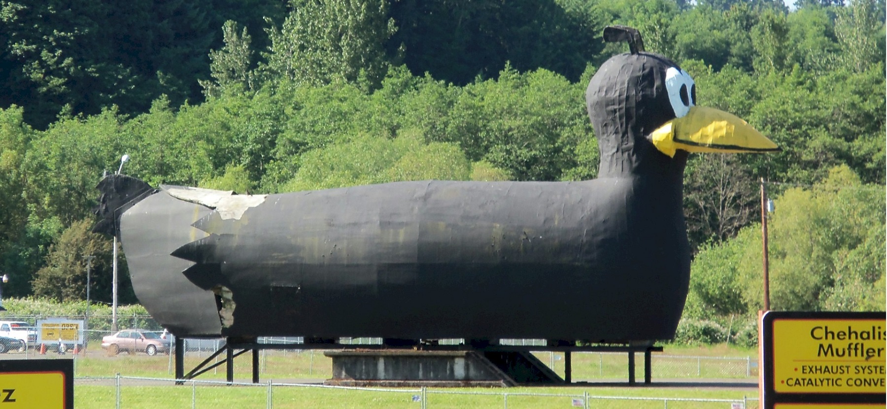
2011. The old Yardbirds store mascot. The building is now used as a second hand store. 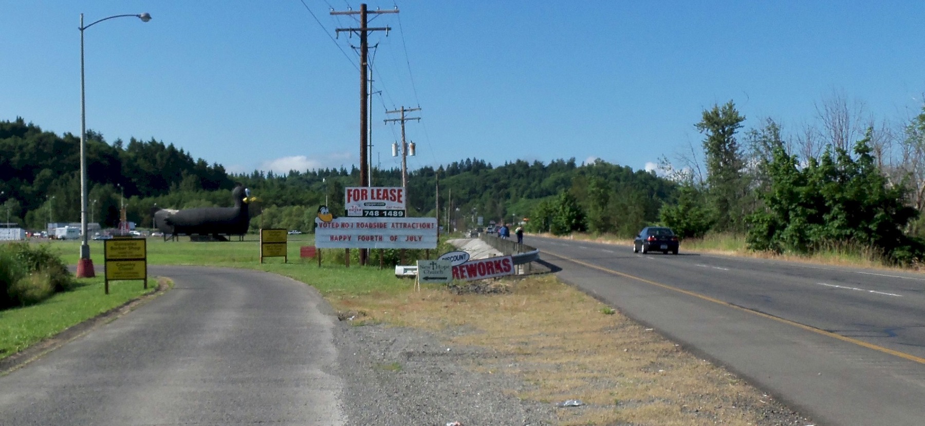
2011, looking south at Wet Prairie. The Pacific Highway is on the right. The old Yardbirds store entrance is to the left. |
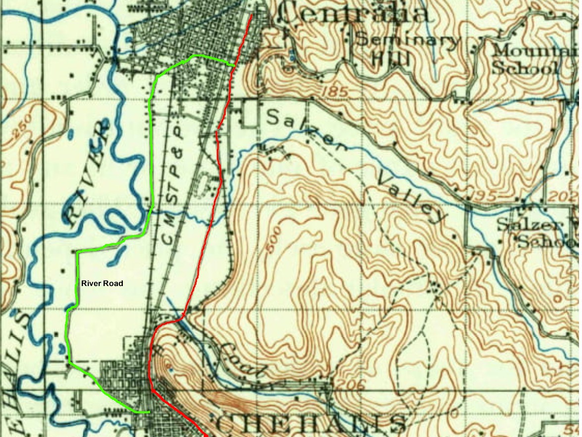
1916 map of Chehalis/Centralia 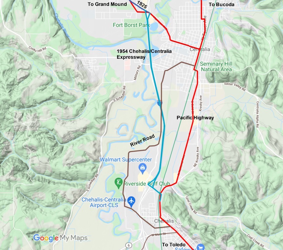
2021 map 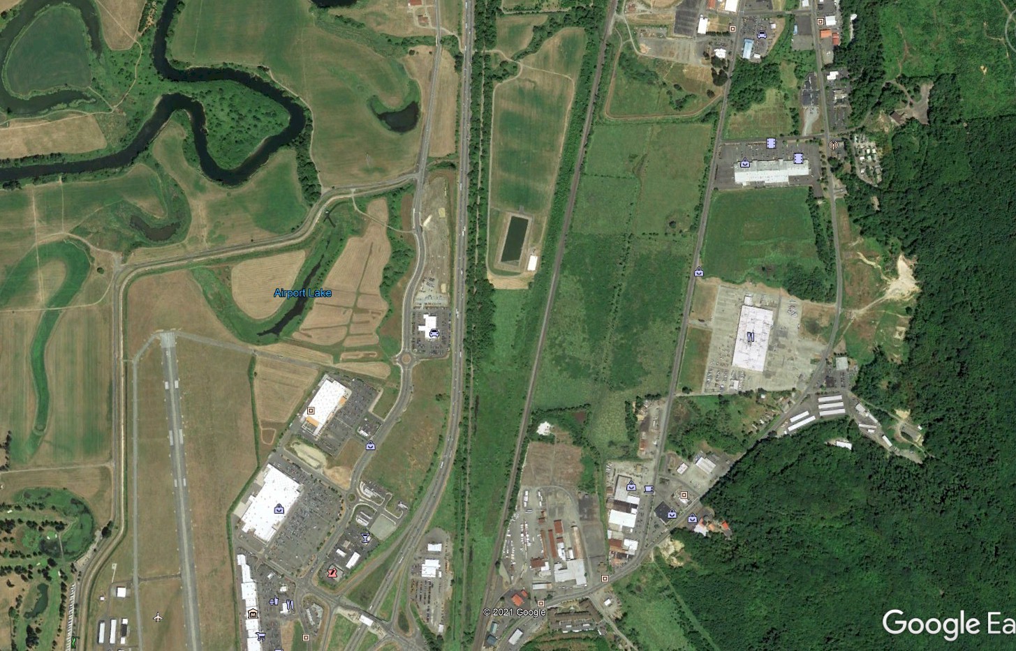
Saunders' Bottom 2020 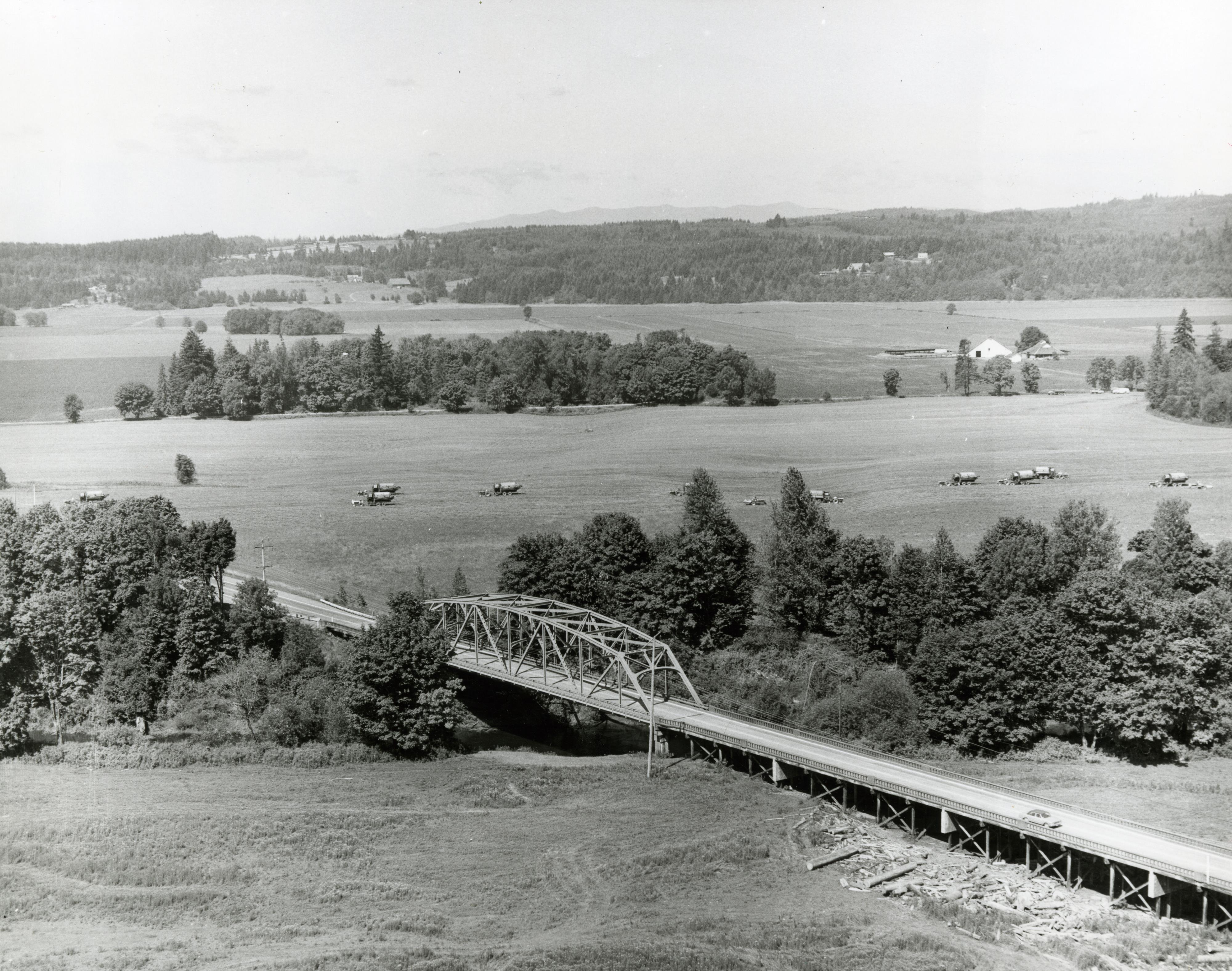
1938 Chehalis valley looking west at the Highway 6 bridge over the Chehalis river. Out in the field are pea combines. Photo courtesy Washington Rural Heritage |
©2011-2022 pacific-hwy.net
All Rights Reserved