![]()
The Historic Pacific Highway
in Washington
Through Downtown Seattle
![]()
The Historic Pacific Highway
in Washington
Through Downtown Seattle
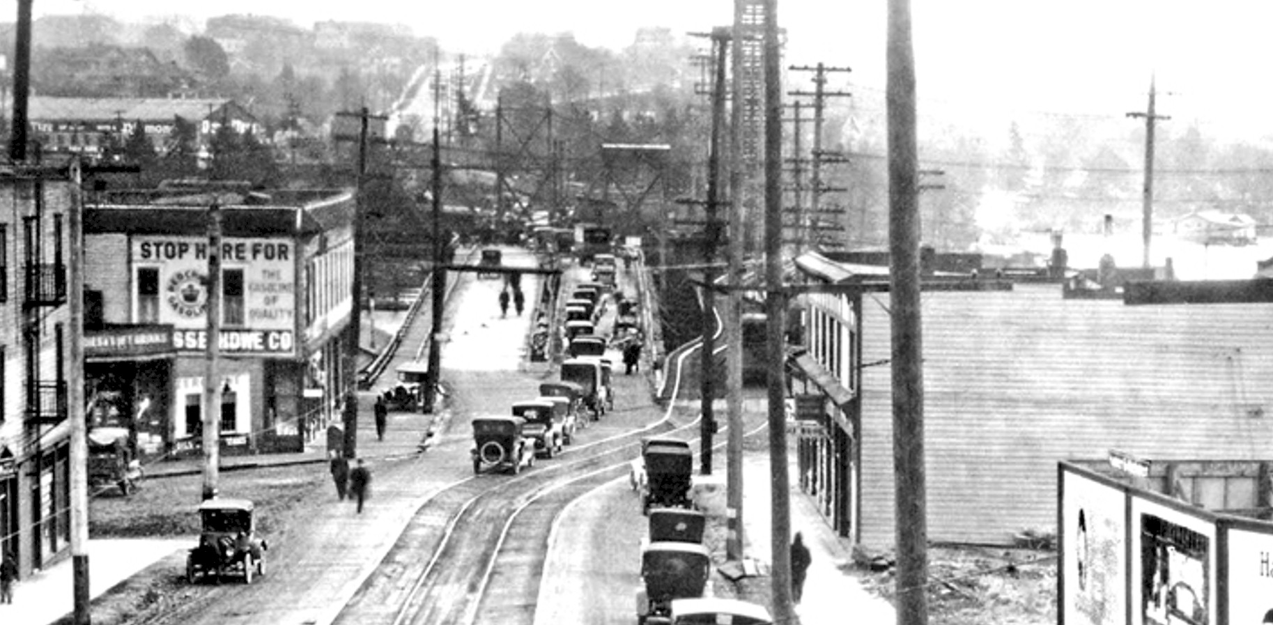
Latona Bridge 1918. Looking south.
The Pacific Highway through
Seattle
By Curt Cunningham
In the 1900's, traffic going north to Everett traveled down Westlake Ave. to Fremont and traveled up Greenwood Ave. to about N. 90th St. where the road turned northeast toward Bothell. The 1915 Automobile Blue Book shows the route of the Pacific Highway through Seattle as beginning at Yesler Way and 1st Ave., and leaving town northbound on 4th Ave. to Stewart St., where it continued northeast to Eastlake Avenue. At Mercer St. the highway veered to the right onto Lakeview Blvd. E. (the freeway was built over this spot severing the connection.) The highway then followed Lakeview Blvd. as it became Boylston Ave. E., and then followed Boylston Ave. as it made a few curves and crossed over Lakeview Blvd. (Lakeview Blvd. had not yet been extended.)
The road (now covered by the freeway) continued north down the hill to Howard St. which is now Eastlake Ave. Before the University bridge was constructed, the old Pacific Highway crossed the lake at 6th Ave on the old Latona Bridge, which was constructed in 1891. This wooden structure was where the Ship Canal bridge crosses today. After crossing the Latona bridge, the highway turned right onto N. 40th St., and then left onto 14th Ave., and from there it continued north to Ravenna, to connect with the old Bothell road.
The University bridge was completed in 1919, and the Pacific Highway was rerouted onto Eastlake Avenue bypassing Bolston and the old Latona bridge. In 1922 Victory Way was completed from the north end of the University bridge to Lake Forest Park. This new road ran north up Roosevelt Way NE, and at NE 75th St., the new highway veered onto Lake City Way and continued northeast down the hill to Lake Forest Park. This new road replaced the old Bothell serpentine highway witch had a slippery surface and treacherous curves.
Downtown the route of the highway downtown was also changed. Instead of going up Stewart St., from 4th Ave., the highway turned right at Olive Way, and continued east to 8th Ave. where it then veered to the left onto Howard St., and from there it continued east to Eastlake Avenue.
By the mid 1920's traffic through Seattle was a nightmare. Traffic was so bad it became a campaign issue. In 1926 Dexter Ave. was used as an alternate route through north Seattle. The road crossed over the canal at Fremont and traveled up Fremont Ave. to N. 50th Street. From here the motorist could take the left and follow the road to Richmond Highlands and Edmonds. But this was a longer route although it is more scenic. Taking the left, the motorist would come to Aurora Ave. and follow it north to Everett.
By the end of the 1920's plans were made to build a new highway between Seattle and Everett. This new highway would be built on Aurora Ave. and it included a new bridge over canal at the west end of the Lake Union. The Aurora bridge was completed in 1932 and Seattle traffic finally got some relief. From downtown Seattle to the north end of Green Lake, the highway is 6 lanes, and from Green Lake to Everett it is 4 lanes.
In 1936 the south approach to the city of Seattle was greatly improved through the grading and paving of Fourth Avenue South from East Marginal Way to Spokane Street and the construction of an overhead crossing of the tracks of the Northern Pacific, Pacific Coast and Union Pacific Railways. The street was constructed by dredging from the Duwamish waterway, and was then paved with concrete 40 feet in width, reinforced with wire mesh weighing approximately 51 pounds per 100 square feet. The viaduct over the railroad tracks is 2,340 feet in length, construction consisted of treated timber, steel and concrete.
In 1956 the Bell Steel tunnel was completed which gave the Alaskan Way viaduct a direct connection with Aurora Avenue. This new expressway enabled motorists to drive through Seattle from the Duwamish river in Georgetown to Green lake without a stopping for a traffic light.
The Latona and University Bridges
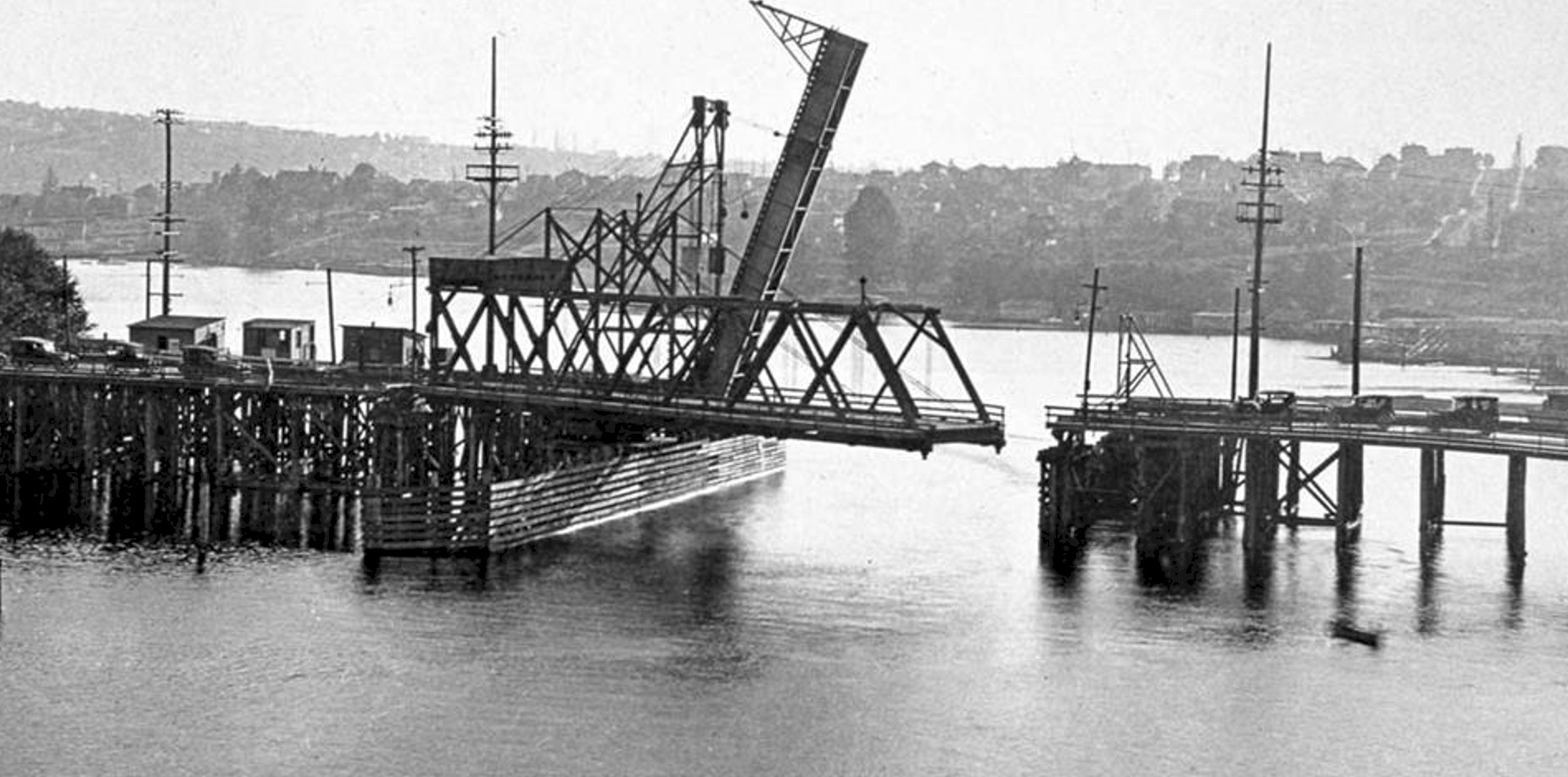
Latona Bridge - Looking west
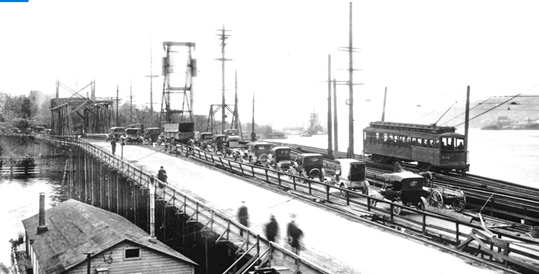
Latona Bridge 1919. Looking south.
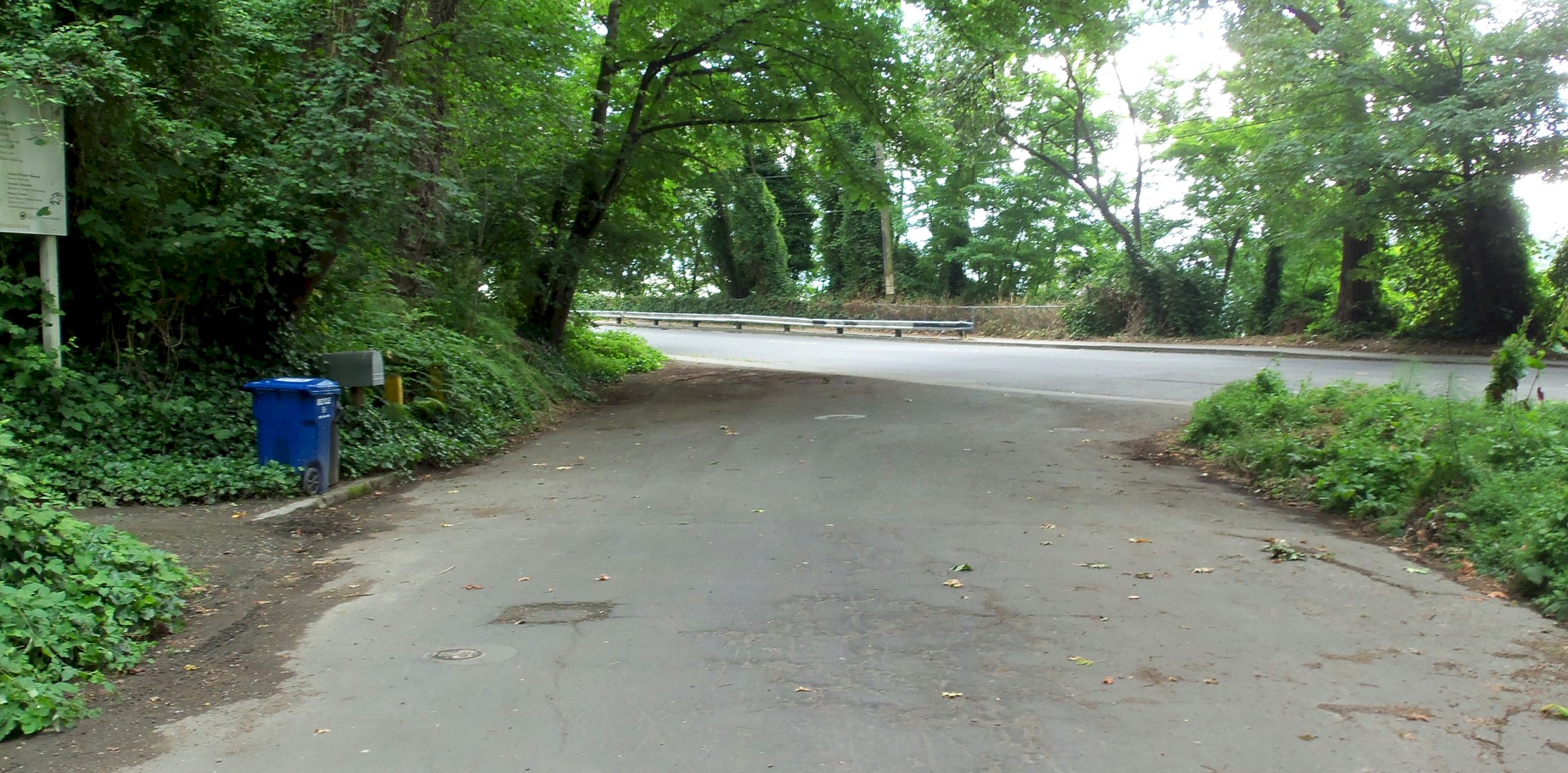
Looking southwest on Boylston Ave. in 2014. 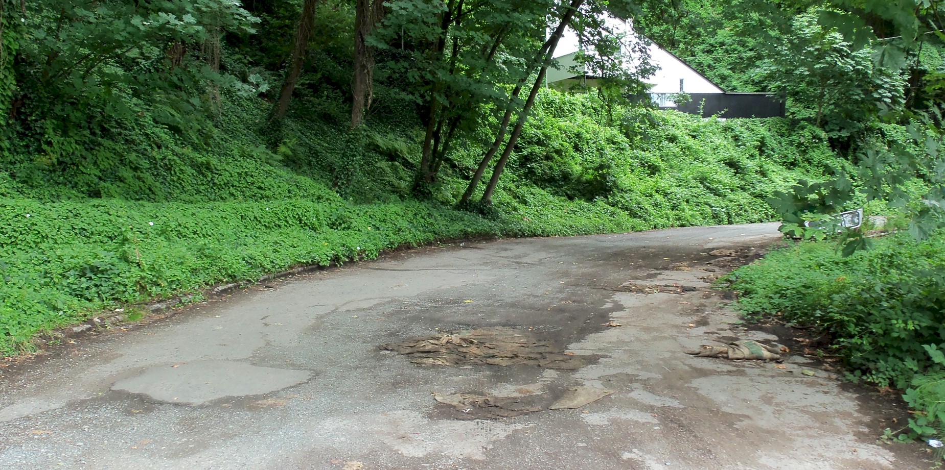
Looking southwest on Boylston Ave. in 2014. 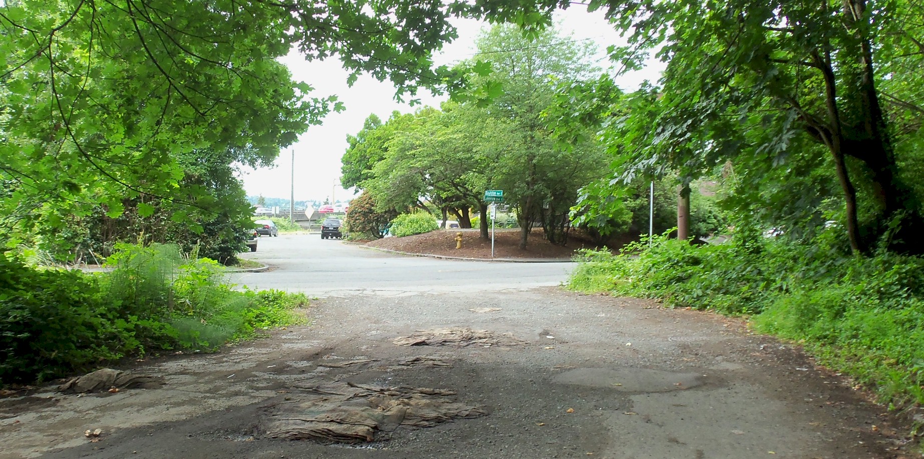
Looking northwest on Boylston Ave. in 2014. 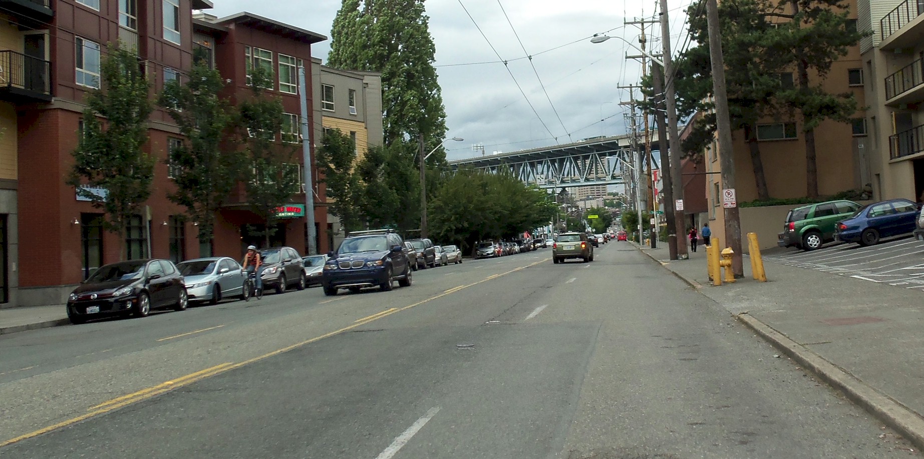
Looking north up Eastlake Ave. in 2014. The bridge in the background is the freeway bridge over Lake Union. |
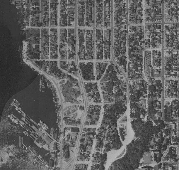
1937 aerial of Boylston Avenue. 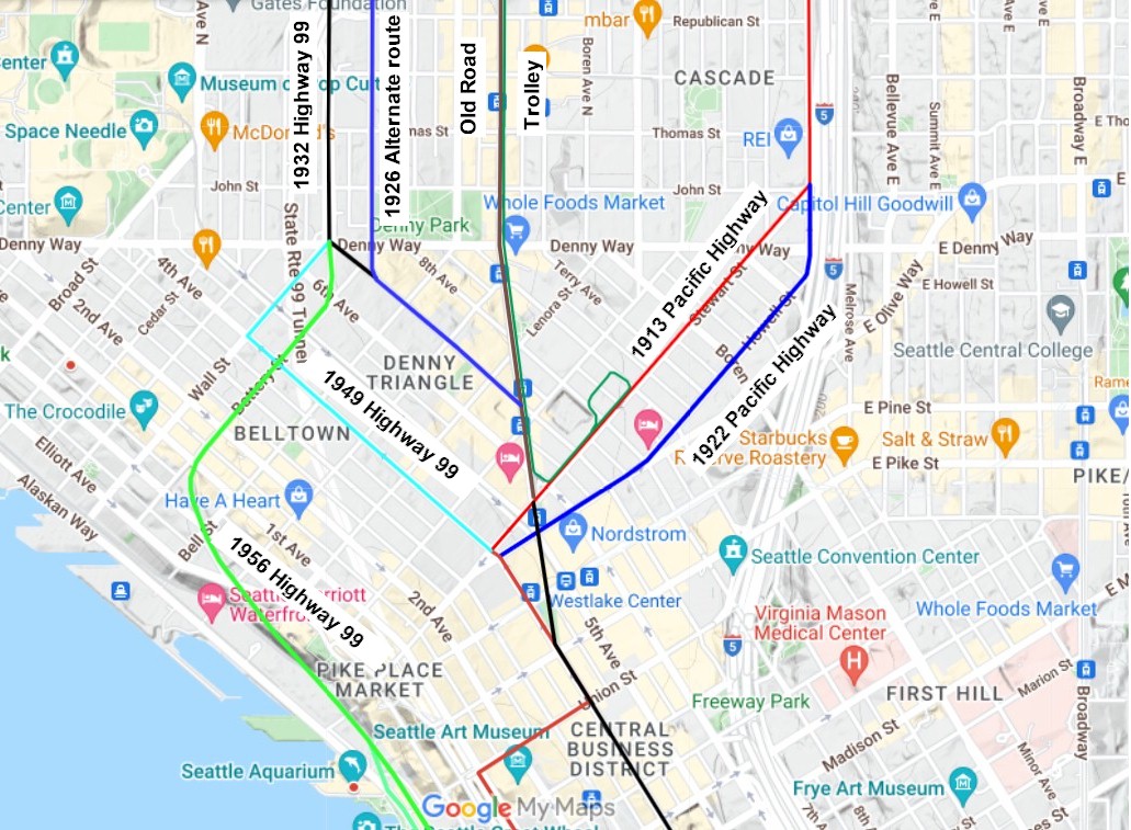
Map of downtown Seattle 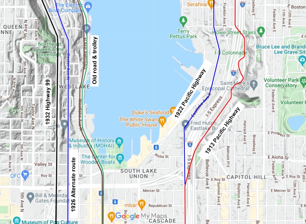
Map of south Lake Union 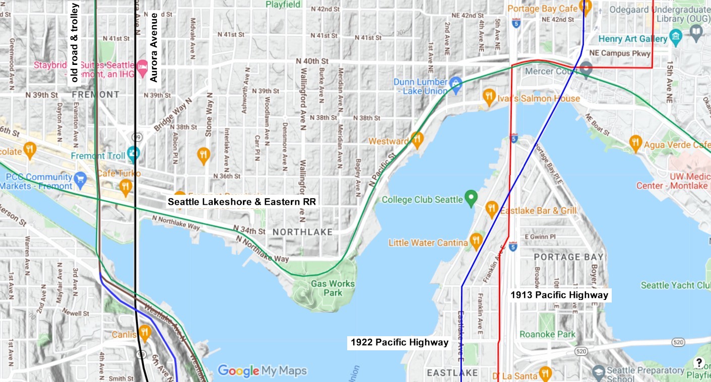
Map of north Lake Union |
©2011-2022 pacific-hwy.net
All Rights Reserved