![]()
The Historic Pacific Highway
in Washington
Austin Pass Branch of the Pacific Highway
![]()
The Historic Pacific Highway
in Washington
Austin Pass Branch of the Pacific Highway
Mount Baker Scenic Highway
By Curt Cunningham
The Mount Baker Scenic Highway begins in downtown Bellingham and travels almost 60 miles eastward, with the last 24 miles through "insurmountable mountains capped with perpetual snow." The highway terminates at Artist Point 5,100 feet above sea level and is 4 miles northwest of Mount Shuksan and 9 miles northeast of Mount Baker. The highway travels through some of the most beautiful scenery in Washington state and is a destination for hikers, skiers, hunters, prospectors and anyone who wants to get away from the hustle and bustle of city life.
Leaving Bellingham the road travels northeast to Cedarville and the crossing the Nooksack River to Nugent's Corner. From here the road continues southeast and follows up the main Nooksack River to Deming. About a mile southeast of Deming the river forks and the road follows up the north fork to the town of Kendall. Kendall was founded in 1887 by F. B. Hardmen and was named after early settler Carthage Kendall. The place was also known as Keese. Leaving Kendall the highway turns east toward the town of Maple Falls which was first settled by Herbert Everant Leavitt in 1888. From Maple Falls the highway continues eastward following the north fork 19 more miles before the road begins it ascent up the mountainside to Austin Pass and Artist Point.
In 1924 The Mount Baker Highway was added to the Pacific Highway system. The following is the official description of the highway found in the 11th Biennial Report of the State Highway Department; "A Primary state highway, to be known as State Road #1 or the Pacific Highway, is established as follows; Beginning at the international boundary line at Blaine in the County of Whatcom; thence by the most feasible route in a southerly direction through the cities of Bellingham, Mt. Vernon, Everett, Seattle, Tacoma, Olympia, Chehalis, Kelso and Vancouver to the interstate bridge over the Columbia River between Vancouver and Portland; also from a junction in the city of Bellingham; thence by the most feasible route in an easterly direction to Austin Pass in Whatcom County."
The North Cascades
Mount Baker and Mount Shuksan are beautiful mountains, the peaks of which are about 11 miles apart, and the country around them is wonderfully beautiful and attractive. Mount Shuksan is 9,000 feet tall and is older than Mount Baker. The mountain is a glaciated massif which is a group of mountains that form part of a mountain range. Mount Baker at 10,000 feet tall is an active volcano. The last major eruption was in 1843, but during the summer of 1863 it was reported that Mount Baker was in a violent state of eruption. In December of 1872 Mount Baker had erupted again. This time earthquakes were felt as far away as Snoqualmie where it was reported that tremors were felt over the course of 3 days with one shockwave lasting about a minute and a half.
Afterwards 24 aftershocks were felt with the first about as heavy as the initial quake. Very dense smoke had risen in the mountains to the north of Snoqualmie and it appeared to be 2 volumes of smoke. Mount Baker was in the direction of the smoke seen from Snoqualmie and it was thought that the earthquakes were caused by an eruption of that mountain, as all accounts of the quake said it was most violent in that direction. In May of 1880 a large heavy column of smoke was seen coming from one of the points of Mount Baker, but there were no reports of an earthquake.
The northern half of the Cascades in Washington differs much in character from the southern half. In the southern portion igneous activity has been very great and much of the topography is due to the presence of volcanoes with their attendant lava flows. In the northern Cascades there is such a marked uniformity in the heights of the loftier peaks and ridges as to suggest very strongly that they are the remnants of a plateau. In other words, the northern Cascades have seemingly been carved out of a great plateau which was the result of the uplifting of a peneplain.
The ruggedness of the topography, therefore, is not due primarily to the folding of the rocks, but to erosion. The streams have been, and are yet, large and well fed, so that the old plateau is now well dissected and transformed into mountains of extreme ruggedness. The main streams which flow out from the Cascades all have valleys noted for their depths, so that the flanking mountains stand alongside in great boldness. In ascending the principal mountain valleys, especially those on the western side of the Cascades, one notices that the grade is gentle, even into the heart of the mountains, and the ascent is nearly all made in the last few miles before the summit is attained.
Many glaciers, some of large size, occur in the higher portions of the Cascade mountains. They once filled the larger mountain valleys and eroded and modified these very materially. Amphitheatres or cirques are found at the heads of many streams, and as these basins usually contain small lakes and parks, they afford some of the most beautiful scenery that the mountains possess.
A Trip to the Mount Baker Region
On September 27, 1891 the Seattle Post-Intelligencer published an article of a trip to the Mount Baker region; "The North Fork of the Nooksack is a wild, raging stream and in the summer of 1891 it was quite high owing to the effect of the hot weather on the snow and ice of the mountains. The river is extremely sensitive to heat and cold, so much so that on a warm afternoon it is fully 2 feet higher, or a fourth greater in volume, than the next morning after the cool air of the night has checked the melting of the snow, and allowed the surplus water to run off, which is accomplished in a few hours, as the fall of the river is generally not less than 50 feet, and in many places several hundred feet to the mile.
It is purely a glacial river pushing headlong to the sea with racehorse speed. Its dirty gray color is due not alone to the dirt and sediments of the glaciers, but largely to the sulphur which seems to pervade every formation, either in pure form or in sulphurets, and the soda from the slates and shale which abound along the upper river. Every little stream dropping from the mountains is impregnated, and the gravel banks along the loot of the Bald mountain range are white with alkali. The presence of sulphur could he detected in the water by the smell from the drinking cup.
The second day camp was made at Glacier Creek, with a view to examining the surrounding country and exploring a route for a trail toward Mount Shuksan, the objective point. Among the interesting features in the lower valley is Race Horse Creek, which rises in the Baker range, flows westward to the Nooksack, leaping down the mountain side in a series of cascades, at one place falling from a height of 50 feet into a large and perfect basin worn out of the sandstone below, and about 40 feet in diameter.
The water whirls around the cauldron with a strong current, over which hangs a thick mist 15 to 20 feet high, and at last issues from the side through 2 holes, as if following plugs lately drawn by the hand of man. Bear Creek, a little further above, rushes down the side of the mountain at great speed a distance of a thousand feet on a smooth plane of rock at an angle of about 60 degrees. The width of the stream is about 12 feet and is feathery white the entire distance, without a single cascade.
As the road turns from the north valley an immense slide of sandstone can be seen for many miles, where large masses of stone, earth and trees have tumbled and slid a distance of 2,600 feet to the valley below. The extreme coldness of the water in the river and streams is very noticeable. Kendall's creek issues direct from the very interior of the mountain at its base. Maple Creek, the outlet of Silver Lake, is so remarkably clear that a pin can be seen in its bed at a considerable depth.
Gallop Creek rises on the extreme top of the divide, between the north and middle forks of the Nooksack. In reaching the valley below it makes 2 plunges; one of 60 feet and one of 250 feet. The latter fall pitches the stream into an elliptical basin of slate about 40x80 feet in size. The scenery along the creek is wild and grand. When standing at the top one can look out over the tops of the tallest fir trees growing at the base of the falls, the limbs of which its spray is drenching. Its name is appropriate, for it runs in one continual gallop from its head to the valley.
It took a full day of the most difficult climbing to reach its source, but the party was well repaid by the find of good coal samples. Glacier Creek is a stream of considerable volume, being about a third of that of the North Fork. It drains the glacier on the northwest side of Mount Baker, leaving it from a tunnel through the vast sheets of ice and snow. It runs with great speed in its descent between canyon walls a hundred feet in height, plowing its channel through its own moraine boulder drift on a plane above its own valley level. It runs with such force that when it strikes a boulder in its channel the water comes up often to a height of 10 to 20 feet.
At one point it has worn this rock in the shape of a large plow-share and mould board so that the water is sent spinning over as one great furrow 10 feet high. A little further downstream a reverse curve is made, so that the stream has the appearance of being plowed, the land being turned to the center. Those who have camped near a glacier will probably never forget the dismal and terrific sounds caused by the grinding of these great rock crushers of nature during their working hours. As soon as the sun gets full play, the stamp mill begins its work, which continues late into the night.
The work of the largest stamp mill in the world at the great Treadwell mine in Alaska, cannot compete in unearthly sounds with the munching, grinding and cracking in the insatiable maw of these monsters. The glacier on the northwest side of Mount Baker is mostly covered with rock, dirt and rubbish, though in places it stands out blue and clear, badly creased from the action of small streams and pebbles. A small creek, which we named Mineral Creek, from a spring on its bank, runs down the side of Mount Baker to Glacier Creek, in a series of continuous cascades for a distance of 2 miles, beautiful to behold.
The scenery here is wild and romantic to a large degree. The distance from the north fork to this glacier is about 10 miles, and the round trip can be made on foot in 2 days. With Glacier Creek ends the settlement. There are about 200 squatters in the valley, hailing from nearly all the states of the Union, from Canada and some of the foreign countries. Inquiries made by your correspondent at a campfire as to the natives of which prompted the different parties to settle in so wild a country, brought out various answers. One said he was "doing penal service." This referred to the solitary confinement of the forest.
The amount of strictly agricultural land is small after Boulder Creek is passed, the valley being very narrow. The chief attraction is the timber, which is clean, tall and of good lumbering size, from the valley to the mountain tops. The style of the notice of the land claimed reminds one much of the long narrow farms of Canada. Many of the claims covered a fourth of a mile on the river and run back a full mile.
This manner of claiming was, no doubt, to accommodate each of a group of claimants with river frontage. The notices are usually tacked on the doors of the log and shake cabins, often with additional matter for the benefit of the traveler. One notice carried with it a 'hospitable spirit,' asking any one who cane along to use the cabin and whatever could be found. A little cabin about 5 miles below Glacier Creek was evidently the country seat of some typo. The usual claim notice read: 'A Home for Bum Printers;' and the following showed the sumptuous state of the larder; Breakfast, mush; Dinner, mush; Supper, mush. Hours for meals; Breakfast 2pm; Dinner, 2pm; Supper, 2pm.
Your correspondent was surprised to find a young Scotch couple located on the north side of Glacier Creek, on the moraine drift slightly covered with soil which must of necessity leach any rain which falls. The little timber which stood upon it had no value. Here this man with a pair of oxen and wagon had brought his household goods, a young wife and babe, scarce 2 months old, had built a house and proceeded to clear up the land with a will. The wife seemed contented and he had all the hope of assured success. This is the last ranch, and we found it a great help to us in being able to procure matches after one of our mishaps in the river above a few days later.
In making the cut-off from Glacier Creek between 2 rocky ridges, to strike Horseshoe Bend of the Nooksack, both horses and men suffered severely from heat and lack of water. Nearly every step of the way a trail must be cut for the pack train. A severe fire had felled most of the timbers, and the blackened trunks of the trees left standing served to draw the heat with fearful intensity. Without water or food since morning we made the lower end of Horseshoe Bend at 7pm, the horses with their packs almost piling one upon the other in their haste to get down the steep descent to the water in the river bed below. At one time during the day the train made but a fourth of a mile in 3 hours. At Horseshoe Bend the Bald mountains, a sharp or comb-like range, begin on the north side of the river and run through to Mount Shuksan.
The green crowns of these mountain slopes and the many flowing streams could be temptingly seen at a height of 5,000 feet, as men and horses sweltered under the noonday sun. On the south side of the river the Baker range, in 2 sweeping curves southward, follows through to Mount Shuksan. The valley of the river here becomes very narrow, the benches which, with the gravel bars, are used for a trail, necessitated the crossing of the stream several times under difficulties.
The climbing of the horses up steep ascents, sliding on their haunches down the sharp declines, jumping over large logs and crossing the river where the current would almost sweep them from their feet were feats accomplished which well trained circus animals would be unable to perform.
The slip of a hoof from secure footing several times precipitated a horse back into the river below, the animal rolling over several times with its pack in the descent. The whole outfit went into the river several times, so that sleeping under wet blankets became no novelty. The horses left at night to browse, unfettered, several times took the back trail and thus often caused delays.
At the end of a 6 days journey from Glacier Creek, at a distance of 15 miles, the party was confronted with canyon walls and heavy cascades. Exploration showed further travel with horses to be an impossibility unless bridges were constructed. Here the north fork of the North Fork, which we named Fall River, comes in, the clear green water leaping a hundred feet or more into the canyon below. It there joins the gray and roily Nooksack from the glaciers of Shuksan, hemmed in by canyon wails several hundred feet deep. After uniting, they fall in a succession of romantic cascades over enormous green stone boulders until unconfined by the widening of the valley below.
The main canyon of the Nooksack proper is about 2 miles long, very winding, making a double curve, and is fully 1,000 feet at its deepest point. With packs on our backs we passed the falls in a half day's time with difficulty, by going over the mountain and crossing Fall River on a very small tree felled across the gorge just above the main fall. The traveling from here on was much easier, since a level valley, about 3,000 feet above the sea level, opened out from 1 to 3 miles in width and about 10 miles in length, extending very near the entire distance to the base of Mount Shuksan. The valley contained considerable timber and had a good rich soil, somewhat marshy, with a thick growth of skunk cabbage. It would supply 50 families with better ranches than many of those settled upon further down the river.
Mount Shuksan is a very bold, sharp angular peak, perhaps 9,000 feet in height. The mountain has 2 very prominent benches or shoulders, one on the east and one on the west side, with a very irregular peak between, which reminds one much of a giant clown's cap. The top of the mountain is so extremely angular that it is comparatively bare of snow, but on 3 sides of its breast is covered with snow and glaciers, save the northeast side, which is precipitous to the river below.
The main source of the river is on the east side of the mountain, a branch coming in from the south, one from around the mountain on the west aide, and a smaller one farther west, all joining nearly at the same point, then flowing first in a northerly direction, after which, to the settled townships, the course of the river is nearly west.
The whole country has been reheated, and shows the effects of much volcanic action. In the river bed fine specimens of porous iron lava and black-trap carrying perfect specimens of sea shells were found. That the ancient seashore formations should be metamorphosed and still retain their life forms seems to your correspondent something extremely rare.
The view from any of the mountaintops is extremely grand, for the family of mountains seems to have gathered on all sides. Those surroundings seem as near neighbors, though accessible only by several days hard journeying. On the upper waters they range in height from 5,000 feet to 11,000 feet, including Mount Baker. The northern slopes are mostly covered with snow, while the south sides are green and pleasant. The lower ranges are covered either with heavy timber to the very top or with steep but grassy pastures and beautiful flowers, while the higher peaks, snow-capped and in sharp angles stand out prominently as though lords of their particular tribe.
The party was only fairly successful in finding game, though the country abounded in bear, deer and grouse. Some elk signs were noticed, beginning near Horseshoe Bend, and a large pair of antlers found in the valley of Fall River, were regretfully left behind. The deer feed mostly in the pastures at great heights, a day's journey from the valley. The whistle of marmots was heard at various times, while fresh beaver work on Balm of Gilead trees and the tracks of the fur-bearing animals were seen along the river. Two of the party who ascended Mount Baker higher than the others saw a flock of mountain goats at a considerable distance on the spur beyond them.
Many incidents of the trip peculiarly exciting to individual members of the party, which will long be remembered, are not here recorded. The perilous climbing of canyon walls, the difficult crossing on slippery and springy logs over rushing waters, when a false step meant to go over falls or cascades; the novel idea of sitting astride of a mountain peak or comb, as the party did on Bear's Paw, at a height of 5,000 feet, one of the Bald Mountain range, is not to be forgotten in years.
To say that the trip was a hard one does not fully express it. Any one who has had experience in the forests of Western Washington knows well the difficulties to be surmounted in the mountain districts beyond ail roads or trails. The roughness of the country, the fallen timber and the jungle in some places made it almost impervious. Wet from head to foot with perspiration or an accidental bath, at the day's end the tired explorer devours his bacon, bread cakes and coffee with a better relish than a tenderloin in a fashionable cafe, and smokes his "Missouri meerschaum" before the campfire with greater zest than a fragrant Havana. Slumber is soothing rolled in blankets on balsam boughs and life in the mountains is not without some pleasure after all.
The Cascade State Trail
By 1884 a wagon road had been constructed from the upper crossing of the Nooksack River at Everson 9 miles upstream to Deming which was known for a short time as Hollingsworth. In 1889 the wagon road was extended along the north fork of the Nooksack River from Deming as far as the valley was settled at the time. By June of 1891 the road had been extended to A. B. Loup's ranch at Boulder Creek which is about 5 miles downstream from the town of Glacier. The squatters who were living in the valley were busy that summer cutting the trail to Glacier Creek which was completed by October.
In 1893 the State Legislature passed a law creating a state road up the north fork of the Nooksack River which was to cross the mountains to Eastern Washington. The road was called the Trans-Cascade Road. This state road would never be built to Eastern Washington as the route was found to be impracticable and the project was abandoned a year later. Before the project was scrapped a trail had been cut out for the road which would become known as the Cascade State Trail. The trail began at Glacier Creek and followed up the north fork 20 miles to Ruth Creek and then up Ruth Creek to a point about 2 miles from Hannegan Pass.
The Cascade State Trail would end up becoming the main route to reach the Mount Baker mining district and by 1898 mileposts were established along the trail which served as reference points for the many mining claims that were staked in the area.
The Trans-Cascade Road
On March 15, 1893 the State Legislature approved an act to establish a state road through the Cascade mountains, via a pass north of Mount Baker to Eastern Washington. The route was to begin on the north fork of the Nooksack River, at "Thompson's," which was located at the mouth of Glacier Creek, and running by the best practicable route, north of Mount Baker, to a point on the Columbia River opposite the town of Marcus in Stevens county. This new highway was to be called the Trans-Cascade Road.
The legislature had appropriated $20,000 for the project, but the money would not be spent until a route was first determined. So in the spring of 1893 a party of intrepid souls embarked on a journey up the north fork where a pass would be found.
Banning Austin was an experienced explorer, who was regarded as a thoroughly competent and reliable man, and had previously made some explorations in the valley of the upper Skagit for the Cornwall-Mills syndicate. The other members of the party were; William Garrett, William Thompson, E. P. Chase and H. C. Wells, who were all experienced woodsmen. The party returned on May 6, 1893 and Austin wrote a glowing report of the journey and the pass that he found. In recognition of his distinguished services the Whatcom county commissioners named the pass he discovered "Austin Pass."
Austin had wrote a favorable report in which some say he stretched the truth about the feasibility of building the road. Austin wrote; "On April 30 we discovered a pass from the north fork of the Nooksack to the headwaters of Beaver Creek, which leads into the Skagit, and we followed Beaver Creek until it became certain that the route to the Skagit is practicable for a wagon road or a railroad. The pass is immediately west of Shuksan, and between that mountain and the 2 peaks of the Baker - Shuksan range, 7,000 feet high. There are 2 creeks, without canyons, heading in a table land with scattering timber, which rise in the pass discovered and empty into the north fork of the Nooksack, about 38 miles from Thompson's. We followed those creeks from the north fork and reached these table lands."
"This was the summit, 4,590 feet
above sea level. We found that the north fork of Beaver Creek also headed in
these table lands and flowing to the Skagit, and that our task was accomplished,
although we followed down Beaver creek 15 miles to be certain of it.
(some say he only ventured 3 miles). Where we stopped on Beaver Creek it was 2,800 feet
above sea level. The mouth of Beaver Creek in my previous explorations I found
to be 2,400 feet. This would leave a fall of 400 feet in 12 miles, so that there is no
question about a splendid pass having been discovered. The snow was quite deep
in some places, and would bother wagons at this time of year unless there was considerable
travel. The pass was realty pointed out to us by the flight of birds, which generally follow the low ground."
It was later found that Austin Pass was not practicable at all for a railroad or
a wagon road. It was reported by Austin that Hannegan Pass was preferable to Austin Pass as it
saved about 8 miles in distance.
Hannegan Pass was discovered by Banning Austin and B. H. Lyle late in 1894
and was named after Whatcom County Commissioner T. P. Hannegan. Hannegan Pass leads up Ruth Creek,
which was named by Austin in
honor of First Lady Francis Cleveland's first born.
The state commissioner's report said that; "The very best that can be done on the line indicated by the law is to cross Hannegan Pass at an elevation of 5,400 feet, with 4 miles through continuous snow at the present time, then drop 2,500 feet to the Chilliwack River with in 1 mile; then go 10 miles from Hannegan Pass to Beaver Pass at an elevation of 5,750 feet with 2 miles more of snow, much of it 20 feet deep; then drop 2,500 feet in going 1,500 feet horizontally, and then drop 500 feet more; then climb another divide between the Little and Big Beavers, where there is still a mile of snow, and finally follow the Bearer to the Skagit. Several glaciers are close to the line and mountains 8,000 to 9,000 feet high are all around. It is doubtful if the snow ever leaves these so-called passes, and any further expenditures would be a waste of money."
It was eventually found that there was no practicable route for a road or trail from Whatcom to Ruby creek except by way of the south fork of the Nooksack to Lyman, on the Skagit, and then up the Skagit 40 miles to the mouth of Ruby Creek, of which 12 miles was through a dangerous canyon which had been a terror to hunters, trappers and prospectors for many years. Because of the insurmountable obstacles to road or trail construction over Austin Pass they were compelled to abandon any further hope of progress in that direction. It was said that it might be necessary to "blow in" a little more money to fully satisfy the doubts of those who still pinned their faith to the Austin reports.
On March 22, 1895 the state Legislature approved another act to build the Trans-Cascade Road. This new act revised the route which was to begin at a point on the Columbia River, opposite the town of Marcus in Stevens county and follow the already established state road to a point on the east bank of the Methow River opposite the mouth of the Twisp River, then across the summit of the Cascade mountains to a point on the west bank of the Skagit River and connecting to the present county road at Marblemount in Skagit county.
It would be 79 years before the Trans-Cascade road would be completed over the mountain range, and today the it is known as the North Cascades Highway or State Route 20. The road was opened for traffic on November 2, 1972.
State Route 20 is a beautiful and scenic drive and crosses over Rainy Pass at an elevation of 4,875 feet and Washington Pass at an elevation of 5,477 feet. Some say it is the most beautiful highway the State of Washington.
The Mount Baker Mining District
In 1896 the first significant discovery of lead, zinc, and silver was made in what was then known as the Shuksan or
Nooksack mining district of
Whatcom
county. Near the 18 mile post on the Cascade State Trail, H. C. Wells discovered the Silver Tip vein. This discovery was followed by discoveries of gold bearing quartz to the east along the
trail, as well as in the surrounding area.
On August 23, 1897, the most important discovery of gold in the Mount Baker area was made by Jack Post, of Sumas. While prospecting with R. S. Lambert and L. G. Van
Valkenberg, Post discovered the Lone Jack vein, on the southern slope of Bear Mountain above the West Fork of Silesia Creek. Gold-bearing quartz from the discovery assayed as high as $10,000 per ton, and a gold rush
soon followed; Sumas
would become the main outfitting
town for the district. Today's State Route 547 which follows on the old
wagon road between Sumas and Kendall was the route these miners took from
Sumas to reach the mining district.
As people rushed to the region, tent cities full of miners sprang up almost overnight.
The town of Gold Hill was established at the 18 mile post on the Cascade
State Trail which is about a mile downstream from the
mouth of Swamp Creek. Later the town would be renamed Shuksan for the
mountain that looks down upon them. Trail City was
established about a mile east, at the mouth Swamp Creek and Wilson's Townsite was at the confluence of Ruth Creek and the Nooksack
River. Union City was high on the hill above these towns at the headwaters of Swamp Creek.
In the summer of 1898 another gold discovery was made in the Mount Baker district near the Lambert ledge. The Flormann party brought down a large sack of ore which was assayed at $1,115 to $3.990. The excitement generated by the arrival of the party at Bellingham was go great that everyone who could get away by the end of June were in the hills. Flormann reported that 250 prospectors were already in the district and were waiting for the snow to melt further.
Stocks of goods began to be hauled in to these boomtowns and the road to Glacier Creek was in very good shape. All the streams had been bridged and there were no difficulties in the way. The town of Shuksan at its peak had a population of about 1,500, who were mostly living in tents. By 1898, a post office was established at Shuksan and on May 11, 1899 the town was incorporated. The Lone Jack Mine continued to yield significant returns until 1924 when a violent snow slide took out the stamp mill and wiped out the workings. Shuksan would become a ghost town 8 years later.
The Mount Baker Mining district was large and bounded on the north by the boundary of the U. S. and Canada, on the west by a line extending due south from Sumas to the Nooksack River, on the south by a line extending due east from the Nooksack across Mount Baker to the Skagit River, embracing abut 700 square miles.
In the fall of 1898 E. G. Wellman wrote; "The Mount Baker district was termed the 'Klondike of Washington,' and this term. I believe, is properly applied, for 2 reasons; First, richness in mineral resources, and second, difficulty of access under present conditions. The road leading into the district is quite good for about 20 miles from Sumas City to Boulder Creek, or 18 miles from Hollingsworth. The 2 roads meet at Keese about 7 miles west of Boulder Creek. Stages run regularly from Sumas City and Hollingsworth to Boulder creek, the Hollingsworth stage connecting with a stage line from Whatcom."
"On leaving Boulder Creek, packing is done on horses taking the Cascade State Trail to Shuksan, 21 miles up the north fork of the Nooksack, and from there continuing on the state trail up to Hannegan Pass, 11 miles farther up Ruth Creek. A horse trail has been cut about 4 miles up Swamp Creek and is navigable for light draft pack horses as far as the falls, where Messrs. Johnson and Jones have established permanent quarters. The Swamp Creek trail leads into the locality of the rich strike of Messrs. Post, Lambert & Van Valkenberg, Doolittle et al., Dunn & Co., McMillan et al., Harris, Mooney et al. and various others. From Sumas City or Hollingsworth to Shuksan several fairly steep hills must be climbed, the trail gradually rising till at Shuksan an altitude of 2,100 feet is reached. Thence on up the trail to Hannegan Pass the ground steadily rises, until at the pass an altitude of 5,400 feet is reached."
By May of 1899 the wagon road had been extended to mile post 8 on the Cascade State Trail, which is about a mile east of the Excelsior power plant.
On February 20, 1900 a large meeting was held in Bellingham. They had the unanimous conviction that Whatcom county should levy a special tax to provide for the construction of 2 roads; one to the Mount Baker Mining district and another to the Ruby Creek mining district. The Shuksan Road would be widened and 12 miles of the Cascade State Trail, between Glacier Creek and the town of Shuksan would be improved so wagons could pass through easier. The previous summer wagons could, with some difficulty, make it to within 6 miles of Shuksan. The improvements ended up costing about $5,000.
On May 30, 1900 Jack Post and crew of men who had been at work on the trail up Swamp Creek from Shuksan returned to Sumas for a short rest. This was partly on account of the weather and partly because of the difficulty of bringing in supplies until the work on the county road leading to Shuksan had advanced farther. About 4 miles of this trail had been completed, bringing them through the timber to the opening near Swamp Creek hill, and about 4 days more work would complete the trail to the head of Swamp Creek. That spring Swamp Creek hill was covered with snow except for 3 days when the rain had poured down continually, so that the men had been wet nearly all the time, and there was no chance to get dry in the evenings. He stated that the wagon road to Shuksan was completed and said he saw wagons within 1.5 miles of Shuksan.
Mining in the Mount Baker District would continue until around 1950 when the large metal companies had left the area followed by most of the prospectors.
The Fate of Two Artists
On Saturday September 3, 1898 the Seattle Post-Intelligencer published an article about the disappearance of 2 artists; one was drowned in Alaska and the other was lost in the Mount Baker Mining District. Artist Point may have been named after the artist who was lost in the Mount Baker district and was never found.
"From I. M. Galbraith, who came down yesterday from the Mount Baker mining district, it is learned that an Eastern artist who has been sketching landscapes around Mount Baker has almost certainly lost his life. Mr. Galbraith thinks the artist was well known in the East and says that he went to Alaska last year with an associate, who was drowned in one of the northern rivers. He is not able to recall the name of either of the artists. The two men went together from Seattle to Alaska, and there one of them lost his life."
"The survivor came back to Seattle and went out into the Mount Baker district, where he was doing some work in watercolors. He was well equipped for his work, and had a good camp. He lived entirely alone, however, and had very little association with other men in the district. A few days ago some prospectors stuck across his trail, which was near the state road, and they were surprised to find his tent empty and deserted. What impressed them was the fact that the tent seemed to have been deserted by the artist with the expectation of returning."
"His materials were scattered around on every side, and a camp kettle with food in it hung above an extinguished fire. 'I learned of the artist's disappearance from Henry Steiner, who told me that it was generally conceded among the prospectors that he was lost. I learned also that Judge Hadley, of Whatcom, was organizing a searching party to look for the body, which all hands felt sure would be found within a few days.' A special dispatch received from the Whatcom correspondent of the Post-Intelligencer last night states that the name of the lost artist is Schroeder, and that his home is in St. Louis. A letter from William T. Schroeder, of that city, is now awaiting him in the post office at Shuksan. He had been in camp three weeks when he disappeared."
The Mount Baker Highway
In 1920 a little company of public spirited citizens of Bellingham conceived the idea that Mount Baker and Mount Shuksan and the adjacent country could be made a great and popular summer playground if it were made easy to access and had accommodations for the public. Without any idea of personal gain but prompted only by public spirit, they set about to see if this was possible to accomplish. The region being in the National Forest was wholly under Government control.
The first thing was to build roads into it and this was highly expensive. They set about to persuade the Government of the desirability of building such roads. Whatcom county had a fine road part of the way and a passable road the remainder of the way to the boundary of the forest, but within the forest there was no road worth mentioning. The Government was persuaded to pay two-thirds of the cost of building a road from Glacier to Austin Pass, which was chosen as the most central and advantageous point for a resort. A condition of this agreement was that Whatcom county contribute a third of the of the cost for building this road.
Since the purpose of the Government in this expenditure was not only to open a highway into the forest but to advertise the National Forest and to furnish a playground for the people. As a condition to entering upon the project, they required the little Bellingham company to enter into an agreement in writing to construct and maintain a summer resort and a general store. The Mount Baker Lodge was the result of this agreement and would be opened to the public on July 14,1927. The ill-fated lodge would last only 4 short years when a fire started and burned it to the ground in 1931.
Prior to 1921, the Yelton and McLaughlin stage line had been operating buses from Bellingham to Glacier, and the territory east of Glacier. At the time the poorly constructed road extended to the Washington Forest Reserve beyond Glacier some 7 miles to a point known as the Excelsior power plant.
On June 16, 1920 the U. S. Forest department awarded a contract for the construction of the first 9 miles of the proposed Mount Baker Highway to a Spokane firm, and allowed them only 250 working days to finish the job. The contract price was $164,000. The road was to be built from the Excelsior power plant to Austin Pass. The contract called for the construction of a gravel road 16 feet wide, although in places the highway was 20 feet in width. The government appropriated $200,000 for the road, and part of the money was left in a reserve fund to be used for future development.
In the summer of 1921 the highway was in good shape to the old town of Shuksan and the road to Deming had been paved with concrete. Between Deming and Maple Falls the road was graveled. In 1924 a new relocated road from Glacier to Shuksan was completed, and the old, poorly constructed road which was originally a section of the Cascade State Trail was abandoned. Today Forest Service Road #37 leaving the town of Glacier follows the old trail for about 5 miles.
In 1927 The highway was extended to Heather Meadows and by 1931 it had reached its destination at Artist Point.
In 1987 the entire route, between Bellingham and Austin Pass, would be designated as part of the Washington State Scenic and Recreational Highway program, and was designated a National Forest Scenic Byway on November 1, 1988.
Today the 57 mile trip from Bellingham to Artist Point will take you about an hour and a half.
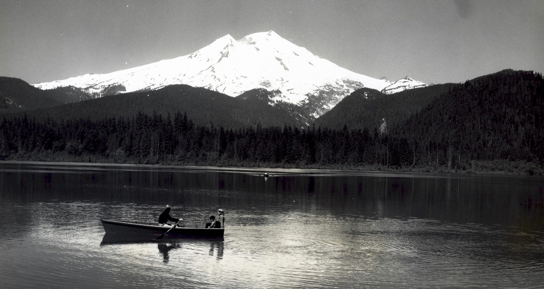
Mount baker from Baker Lake. Photo courtesy Washington Digital archives. 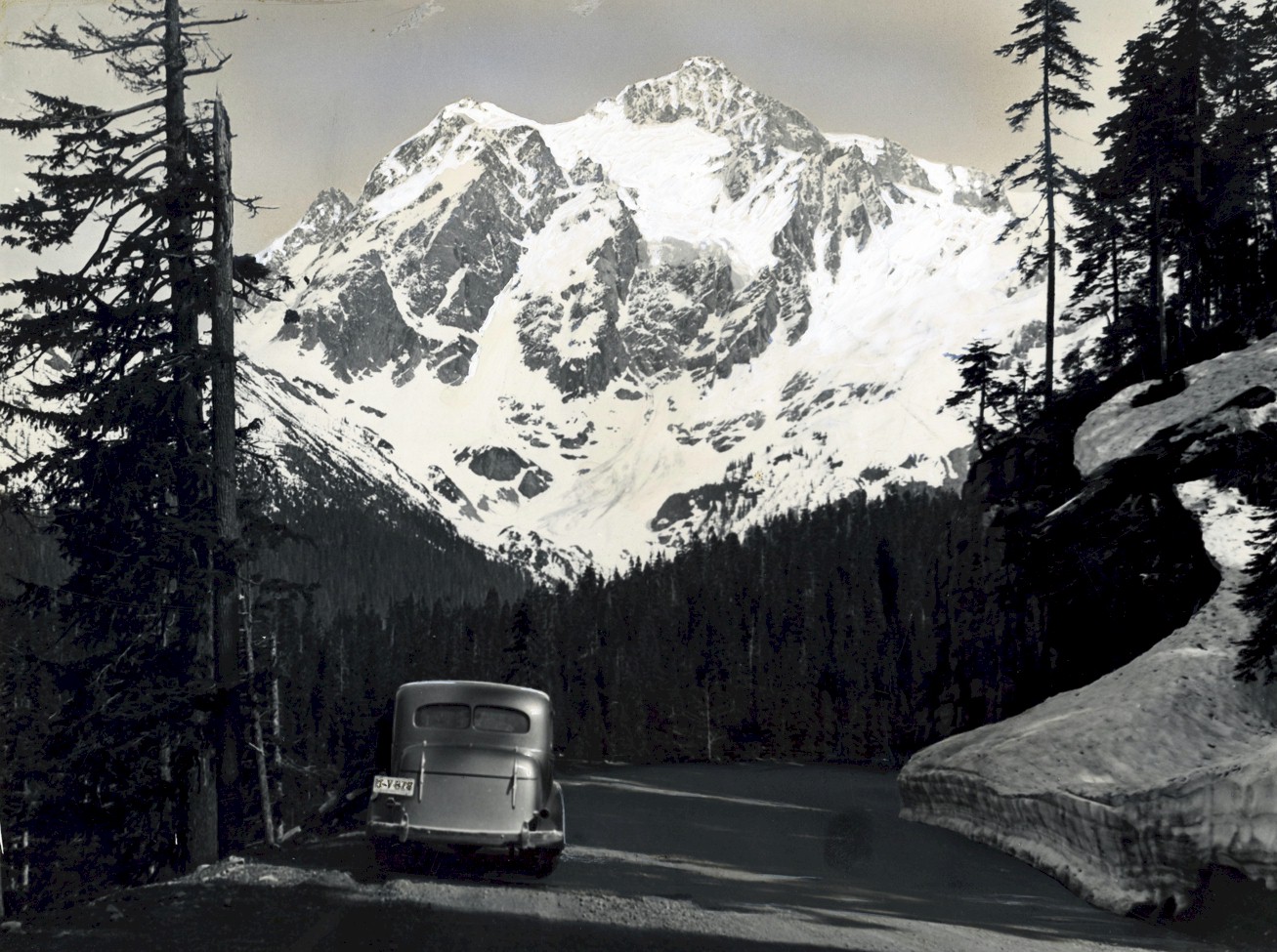
Mount Shuksan Photo courtesy Washington Digital archives. 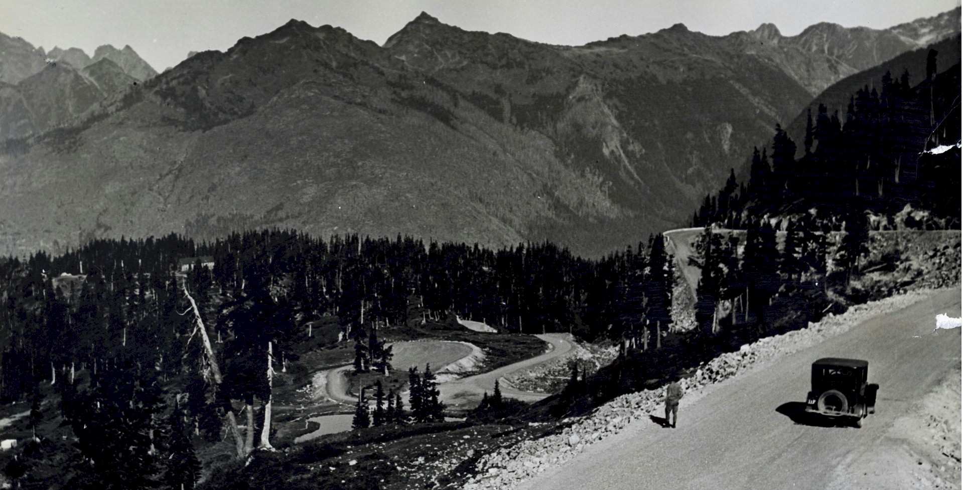
The Mount Baker highway east of the power plant. Photo courtesy Washington Digital archives. 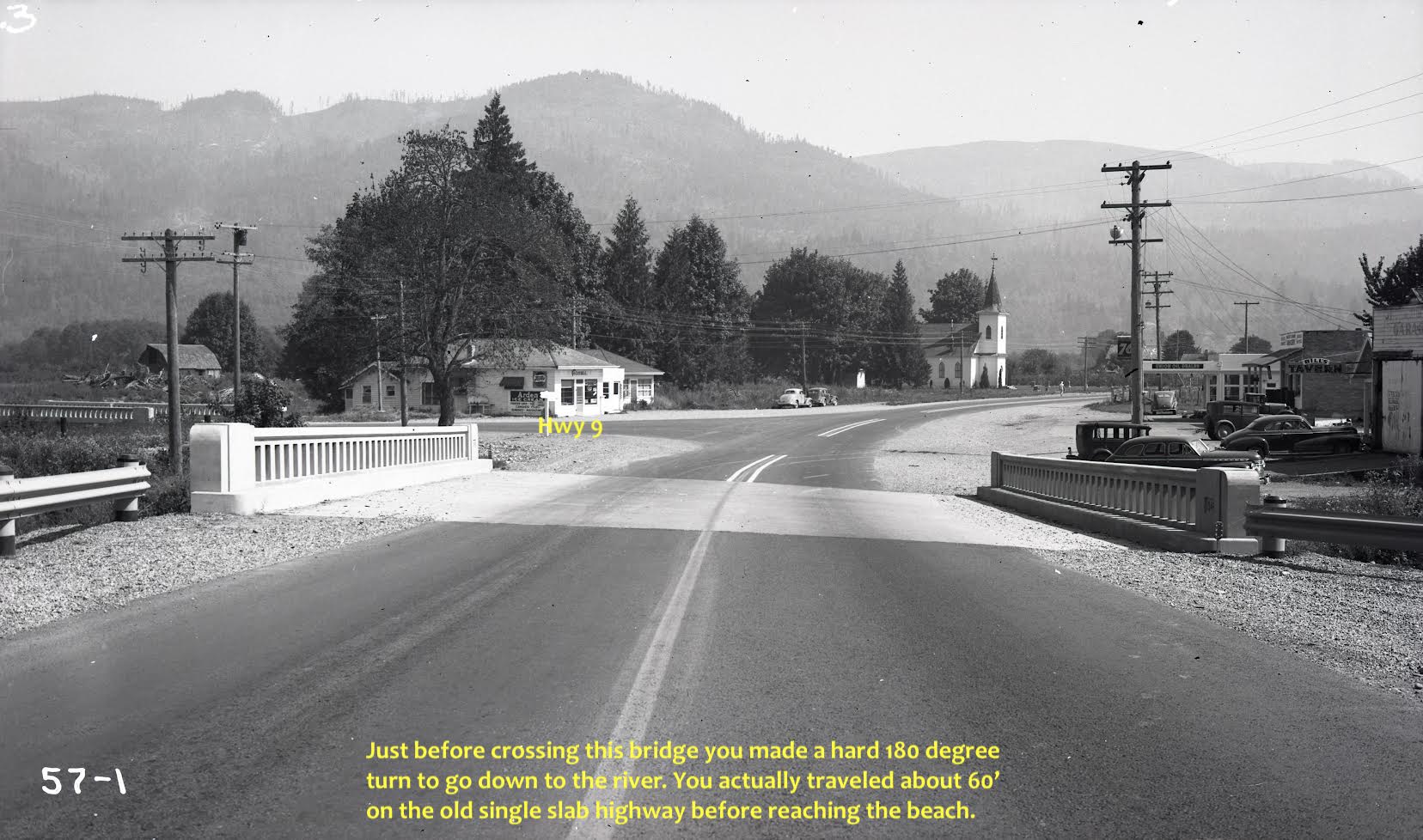
Nugent's Corner in 1947. Photo courtesy Washington Digital archives. |
©2011-2022 pacific-hwy.net
All Rights Reserved