![]()
The Historic Pacific Highway
in Washington
The Salmon Creek Crossings
![]()
The Historic Pacific Highway
in Washington
The Salmon Creek Crossings
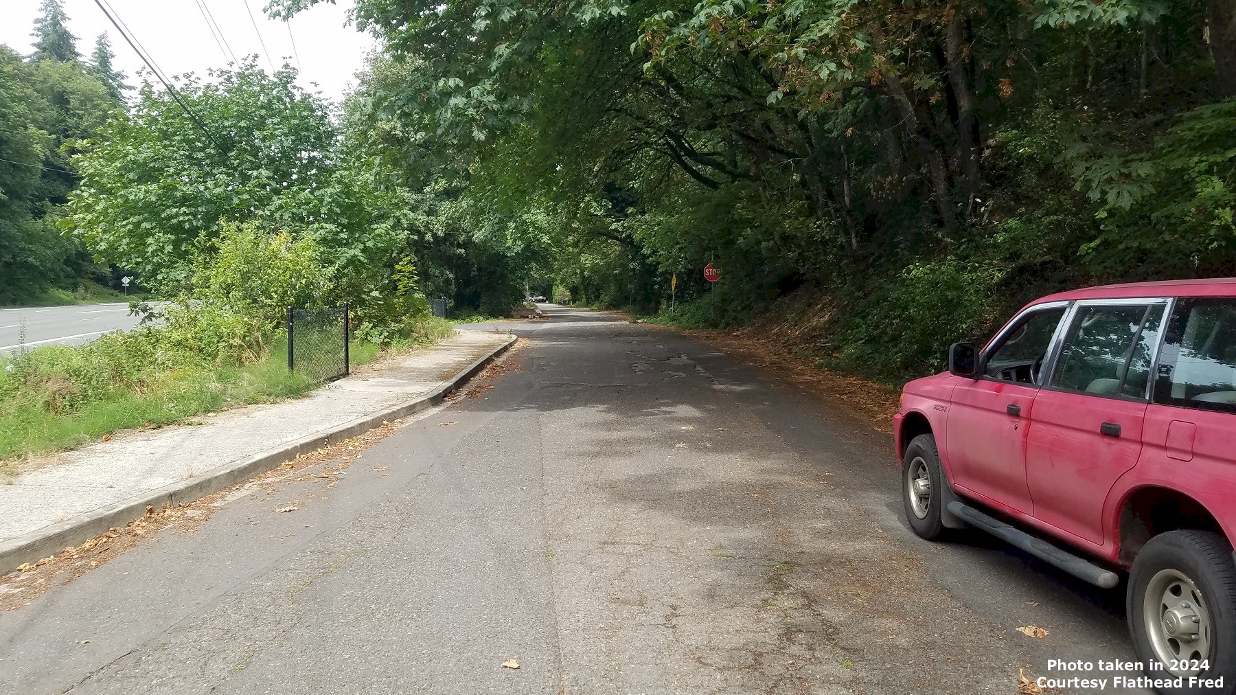
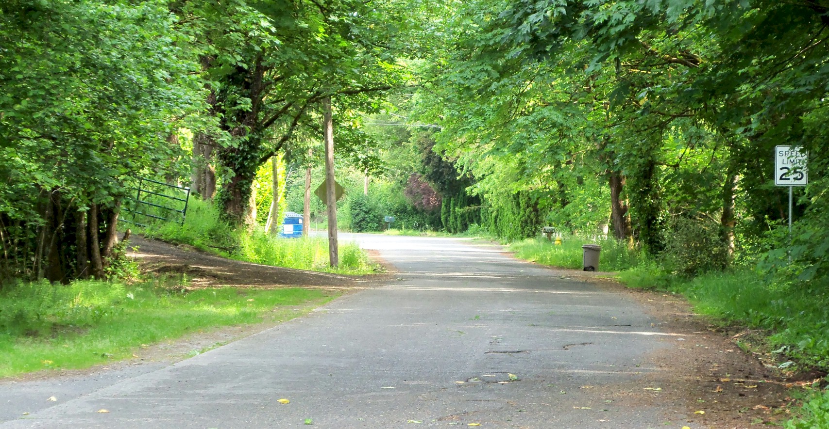
1915 alignment on the north side of Salmon creek looking northbound. Original concrete pavement can still be seen. Photo taken in 2024 by Flathead Fred.
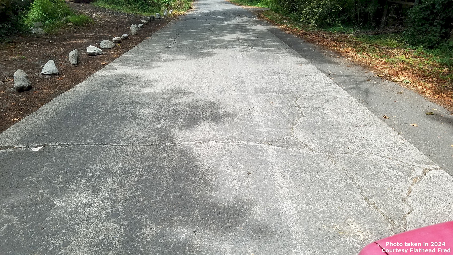
Original concrete paving on the 1915 alignment north of Salmon Creek near the Goddard church. Photo taken in 2024 by Flathead Fred.
The Salmon Creek Crossing
By Curt Cunningham
Salmon Creek
Salmon Creek, is 26 miles long and flows westerly across Clark County and empties into the Lake River about 2 miles north of Lake Vancouver. The creek's headwaters are on the northwest side of Elkhorn mountain and it is the largest tributary of Lake River. Clark County is divided by Salmon Creek and all overland traffic going between Vancouver and the Lewis River except for the Lower River road must cross over this creek.
To the west of the Pacific Highway crossing, the creek drops down into a small shallow canyon about 4 miles long and a little over a quarter mile wide. This beautiful area is a natural wildlife habitat full of green vegetation. This area has been a favorite place for the early citizens of Vancouver to get away from the hustle and bustle of city life and enjoy the wonders of nature. Many came to spend the day to picnic, pitch a tent or fish for the abundance of trout found there. In June of 1878, J. Davidson Sr. of Vancouver spent the day at Salmon Creek and bagged himself 40 trout. The following year, Jerry Slocum also from Vancouver, caught a mountain trout in Salmon Creek as long as a yard stick --- folded up in three pieces.
Camping was another recreation of the early residents of Vancouver. Many an adventurer sat by the campfire telling ghost stories along the bubbling creek. On August 19, 1880, it was said that the campers are still enjoying the solitude and sand flies of Salmon Creek. In the 1910's, there was a picnic ground just east of the Pacific Highway on NE Salmon Creek Avenue. Many fraternal organizations held picnics, trout bakes and barbeques at this park.
Salmon Creek was named for the abundance of salmon that the early settlers had once pulled from the creek. In addition to the salmon and trout, the creek today is a great place to catch steelhead. There was another species of fish that has in the past, swam up this stream. It was reported that on April 7, 1881, smelt had run up Salmon Creek, and to confirm this story, a year later on March 3, 1882, the Vancouver Independent said that Salmon Creek is now full of the strange fish mentioned a short time ago.
The residents and visitors to Vancouver can still enjoy all of this wonderful greenery and abundant wildlife by taking a walk on the Salmon Creek trail. This 5 mile round trip takes you through the lush green grasses and the beautiful landscapes of this riparian habitat.
The Early Settlers of Salmon Creek
In 1852, Joseph Hill Goddard and Hester Goddard crossed the Oregon Trail from Iowa. They arrived at Fort Vancouver in the fall and spent the winter there. In February of 1853, the Goddard family loaded everything they had onto their backs and followed the old trail leading away from the fort to the north. After walking for 6 miles through a dense forest, they came upon a beautiful place near a creek that was full of trout.
The Goddard's fell in love with the area and took a claim near the creek. In 1854, Goddard would serve as a state legislator and Clark County Commissioner. In 1855, Joseph Goddard built a schoolhouse that was also used as the church. Sadly, Joseph would live a short but fruitful life as he passed away later that year in 1855. His wife Hester continued to live on their homestead until she passed away in 1901. They left behind 11 children. In 1900, Charles Goddard, son of Joseph H. Goddard, donated some land for a church. The church was built on the north side of the creek next to the Pacific Highway crossing. This church building still stands today.
In 1854, Andrew Jackson Brinn and his wife Matilda, settled on Salmon Creek near the future town of Felida and filed for a claim on December 12, 1859. Years later Andrew filed another claim on August 1, 1869, for property at the old ford near Marble's mill. Sadly Jackson Brinn, as he was called, would pass away in 1870.
On April 27, 1852, at Council Bluffs, Iowa, Ansil Sylvester Marble married Louvisa Garner Greene. Not long after, the newlywed couple gathered their belongings, crossed the plains with his father Butler and his wife Matilda and arrived in Portland that fall. The Marble's lived there until 1855, when they took the trail that ran north to a crossing at Burnt Bridge Creek.
This is where Butler and Matilda made their claim. Ansil and Louvisa would continue on north a mile and a half farther and made a claim of 315 acres on the north side of the crossing of Cougar Canyon Creek. He filed a claim for this property on August 1, 1865. Ansil and Louvisa made 2 other claims, one for 40 acres located where the trail crossed Salmon Creek just above the Salmon Creek Avenue bridge, and just south of the WSU campus. The last claim was for 160 acres at the Pacific Highway bridge filed on July 20, 1871.
In 1858, Ansil Marble with the help of his father Butler, built a sawmill on Ansil's property near the ford. They also built a dam so water could be diverted to power the mill. During the salmon spawning season, the fish would become trapped by the dam as they tried to swim upstream to spawn. The locals took advantage of this and plucked the fish out of the creek with nets and pitchforks. They used wheelbarrows to haul the fish home. This is when the stream became known as Salmon Creek.
In 1859, Ansil built a large 2 story frame house along creek near where the Pacific Highway will cross. This wood frame building would become known as the Marble House. The house still stands today as a private residence on 119th Street near the Pacific Highway bridge. On March 24, 1866, Ansil Marble finished construction of a water powered grist mill next to the sawmill on salmon Creek. The grist mill belonged to Ansil Marble and possibly John B. Kinsey, who may have been a partner. Kinsey had lived north of Marble near NE 179th. The new flour mill was well spoken of by the farmers of the area.
In 1881, the mill at the Salmon Creek ford was referred to as Stepwalt's mill in a news account of a tragedy that occurred at the crossing. J. H. Stepwalt was indeed living near this mill in the 1880's. On March 22, 1883, Ansil Marble started construction of a new grist mill. This mill may have been located where the Pacific Highway crosses Salmon Creek. The new mill was 50 X 60 feet, three stories high, with plenty of storage for wheat. This improvement was due to the increase of business. The article that mentioned Stepwalt's mill also mentioned the ford being a mile away from Marble's mill.
On October 25, 1883, Marble's new flour mill was open for business. His son Frank operated the mill that had new machinery with 2 sets of burrs, all first class. He also did merchant and custom work. It was said that the mill was built next to Ansil's new sawmill. There was a sawmill at the Pacific Highway crossing in the 1880's. This would lead me to believe that Ansil sold his old mill to Stepwalt and built the new sawmill down by the Marble house near the Pacific Highway before he built the flour mill at that location in 1883.
The flour mill burnt down in 1885 and Ansil would retire from the business instead of rebuilding.
On April 6, 1912, Ansil Marble celebrated his 82nd birthday. This is what the paper said about him; "Mr. Marble was born in Oswego county, New York, in 1830. He crossed the plains in 1852 with an ox team and first settled in Oregon where the city of Portland now stands. He later came to Clarke county where he settled on a donation land claim four miles north of Vancouver. Later he moved to Salmon creek and erected a flouring mill and went into business. He erected the first lumber sawmill on Salmon creek and operated it for a number of years, finally selling out and locating in Vancouver where he has since resided. He is father of 13 children."
The Roads into North Clark County
After 1850, settlers began to spread out from Vancouver into the northern upper country of Clark County using the old trails. Other settlers would take canoes down the Columbia River and enter this region from the northwest at Ridgefield. Others yet would paddle up the North and East Forks of the Lewis River to settle in the highlands of north Clark County. Over time the most traveled of these trails would gradually widen from continuous use which would make them passable for wagons.
On the 1857 Government survey map of the Vancouver area, it shows a road that will become the Military Road, the Pacific Highway and Hazel Dell Avenue, as an unnamed wagon road which terminated at Salmon Creek on NE 117th Street. The section map north of the Vancouver map was made in 1853, and shows Hazel Dell Avenue as a trail that terminates at NE 117th St. on Salmon Creek.
The 1857 map also shows a "Salmon Creek Road" leaving Fort Vancouver as it meanders it way north to Burnt Bridge Creek about a mile east of Hazel Dell Avenue and crosses the creek at Arnold Park. This road continues north although the map ends at the section line on NE 99th St., which would indicate this road continued all the way to Marble's mill and the ford over Salmon Creek. This was originally the Indian trail between Vancouver and Ridgefield.
When the Government completed the Military Road in 1870 from the fort to Salmon Creek, they used the road to the west. I believe the Salmon Creek Road was abandoned between NE 88th St. and Marble's mill because of a steep hill just south of the creek at about 117th Street. The lidar shows a faint depression that would indicate a wagon road going down this hill. Sometime about 1865, this road was extended northeast to the St. John mission. You can still see the path of the old road as it runs in a NE direction along the border of the St. John cemetery called NE Maitland Road.
On May 25, 1866, the Clark County Bridge Commissioner, who was appointed by the county commissioners met with the settlers of north Vancouver's upper country to discuss the improvement of the roads into their district. The next day, the settlers met again at the home of Mr. Wilson and they decided to petition for a bridge across Salmon Creek at the ford next to Brinn's farm about 6 miles north of Vancouver. The residents said they have needed this bridge for the last 5 years as they wanted to keep an open road for communication between Vancouver and the rich swale land in the north. There was no action taken at that time to construct a bridge. It would take another 10 years before a bridge would be constructed over Salmon Creek.
In the late summer of 1866, local resident Jonathan Grant and other citizens of the upper country brought the issue of a good road leading from Vancouver to Lake River and Lewis River by way of Salmon Creek. The incoming settlers who took claims on the bottom lands of the Lake River country and Sauvie's Island did not like the mosquitoes and the frequent flooding in that area and they wanted good roads into the upper country so they could settle up there instead.
The current road leading from Vancouver to Ridgefield was through swampy mosquito infested bottom land, that was muddy most of the year. The road was improved in 1865 and the worst section between Ridgefield and Lancaster's farm was bypassed, though the rest of the work didn't amount to much improvement. By 1866, the road to Ridgefield was badly in need of repairs and was barley passable.
Horses could not pull wagons over it without great difficulty. The farmers would instead transport their produce several miles to the riverbank and then run the risk of finding some canoe of skiff to take them across the Columbia to St. Helens or against a strong current to Portland. It could take as long as 3 days to complete the round trip journey. These farmers wanted a road that they could take early in the morning and travel to Vancouver to conduct their business and then arrive back home from market later that evening.
In 1869, the U. S. Government made another improvement to the Military Road between Vancouver and the Lewis River crossing. The old road that followed the Columbia River to Ridgefield was bypassed by an entirely new route. This new road ran in a due north direction from Vancouver on Hazel Dell Avenue 6 miles to Marble's mill on Salmon Creek. After fording the stream, the military road continued in a northwest direction connecting to NW Hillhurst Road as it drops down the hill into Ridgefield.
Salmon Creek 1870 to 1900
On March 30, 1877, W. Byron Daniels Editor of the Vancouver Independent and Clark County School Superintendent, wrote about a trip from Vancouver to the Lake River country. Daniels had such an eloquent take on the coming of spring that I had to reprint it. This is what he wrote; "All hail the coming spring, making its advent fully a month earlier than is usual in this rainy latitude. The larks sing merrily, the grass is growing and covers the ground with a green mantle of velvet, beautiful beneath the rifts of sunlight and soft to the foot as the yielding turf by the gurgling brook in the copse of the denser shades of the forest giants."
"The Johnny-jump-ups lift their tiny faces and vie with the grass blades for supremacy in the nooks among the dankish and mossy logs, and the fleecy clouds above cast their ever changing shadows over the miniature worlds where dwell the millions of the floral kingdom. Blackbirds chirp on the staked and ridered fence, and the tiny squirrels come from their nests, three or four together, and play "hide and go seek" along the panels and in the corners."
"The wren has begun chirping to his mate, and the little home for the prospective birdlings is already being planned in its accustomed place under the eaves of the old kitchen or woodhouse. The snowy blossoms of the plum and apple trees and the pink ones of the peach exhale delicious fragrance as they promise a bountiful yield of fruit for the autumn season. Joy is abroad in this verdant land because spring has awakened from her slumbers, and, smiling upon her subjects, has caused a new birth of beauty and innocence whose presence shall till the eyes of men with gladness and turn to soft and tender cadences the requiem to nature's dead."
"The skeleton leaves and the broken fern stalks, reminders of last year's beauty, are warnings that all must fade and die; that all these joyous manifestations of nature must be resolved to earth again, from thence in the future to appear in their original glory. It was thus that we fell to thinking the other day, when on the way to the Lake River section of the county. The clouds threatened rain, but occasionally the sun shone bright. We carried a rubber blanket to make sure against a wetting. We carried it 40 miles and it never rained a drop while we were on the road."
"The roads are very muddy, but a "shookum" little pony wallowed successfully through the whole distance and made good time. At Salmon Creek we found a bran new school house lately completed by the enterprising citizens of that district. It is a comfortable building, large and well lighted, and is at present occupied by Walter Sparks and his 20 pupils, who are improving the time in their new quarters. Church services are conducted every Sunday in this building."
"Revs. Reese, Alexander, Allen and O'Flaherty officiating in turn. A flourishing literary society meets every Friday evening in this house. Last Friday the society debated the question, 'Resolved that fire has done more damage than water.' The question was decided in favor of the affirmative. This evening they will discuss the question, 'Resolved that intemperance is more destructive than war.' The society has a paper, entitled The Star of the West, whereof Walter Sparks is editor. After a lovely afternoon visit it was off to be among the firs on the lonely road to Ridgefield."
On May 11, 1877, the Salmon Creek Literary Society held a meeting at the schoolhouse and a large number of people attended. They had a discussion on which was more preferable, married life or single life. After much debate it was decided 'very properly' in favor of the affirmative.
Early settler Horace Dewey Tenney, once owned property along the Military Road between NE 134th and Whipple Creek. On February 9, 1877, Tenney was in the process of constructing a bridge across Whipple Creek. The bridge was 120 feet long and would be known as the Tenney bridge. On August 22, 1878, it was reported that 2 bridges were being built on the Salmon Creek Road. Most likely these bridges were at Salmon Creek and Burnt Bridge Creek.
During the summer of 1879, Horace Tenney had completed a bridge over Salmon Creek where the Pacific Highway will cross. This new bridge eliminated the old ford above Marble's mill. This bridge was also known as the Tenney bridge. In the November 13, 1879 proceedings of the Clark County Commissioners, Horace D. Tenney was paid $270 for the construction of a bridge across Salmon Creek. Tenney lived about a mile northwest of this bridge.
Also during this meeting on the second day, Alvin Betts, B. G. Wilson and William Reese Anderson were appointed to view a proposed road from Lewis River, southward to a place near Horace D. Tenney's farm and intersect with the Salmon Creek Road above Marble's Mill. This road, completed in 1880 begins at Pioneer and runs south on NE 10th Avenue to the intersection of the Military Road at NE 179th Street at the village of Baker.
On February 12, 1880, W. Byron Daniels, the schoolmaster abroad wrote about another trip up to Salmon Creek; "I again set out, and was soon at the school near Marble's mill. This is taught by A. J. Webb, who is managing it in a successful manner. The school house is frame, is well arranged and pleasantly located, but is not very large. They have a debating society there, which holds meetings twice a month, and is well sustained. I was kindly invited to dinner at Mr. Marble's, and as he has a flouring mill, readily concluded it was just the place for me to go. It was, and I shall return at the next invitation."
On Friday May 20, 1881, at the meeting of the county commissioners, and in the course of disposing of the bridge business, they came up against an unexpected obstacle that prevented them from appropriating any funding for bridge construction. The Territorial law made no provision for the building of county bridges, except out of the road funds, and there was barely enough money in the fund to keep the roads in decent shape.
The law also forbid them from levying more than a certain percentage of road tax, which was not enough to take care of both the roads and the bridges. The law prohibited the transfer of money from any other fund to the road fund so that idea was out of the question. It was then joked that the commissioners would have to hire a fancy Philly lawyer to find out how Clark County could build the bridges. The result was a great disappointment to the community, as the La Center and Washougal bridges were a crying necessity. The people could hardly get along without them.
On March 9, 1882, a petition for a bridge across Salmon Creek at Wilson's mill was denied by the county. This did not deter the residents of the area. They were very disappointed in the decision by the commission and regrouped their efforts and presented a larger and louder petition to the commissioners to make this bridge. The county commissioners probably found out about the grumbling up north as on August 9, 1882, E. J. Ricketts, Bridge Superintendent of Clarke County posted a notice for construction of a bridge across Salmon Creek at Wilson's mill.
Ricketts accepted the bids at 2pm on October 2, 1882, at the crossing of Salmon Creek near Wilson's mill. Ricketts had a farm on the north side of Salmon Creek near the Wilson Crossing. This road today is NE 72nd Avenue. On November 16, 1882, Stamp & McKinney were paid $775 for the construction of the Salmon Creek bridge at Wilson's mill.
On February 15, 1883, the Turnbull bridge was rebuilt after it was washed away in a flood. E. J. Ricketts was paid $10 for time as bridge superintendent and J. K. Alexander and George Turnbull were paid $80 and $189.59 respectively for materials in the construction of the bridge. The Turnbull bridge is today, Old State Highway 503 at Brush Prairie.
The Ward bridge was another span constructed around 1882 over Salmon Creek that was located at the crossing on NE 182nd Avenue, almost 9 miles east of the Pacific Highway crossing. This is where the Klickitat Trail had crossed the creek on its way to Chelatchie. It too was washed away in December of 1882 and had to be replaced.
Sometime between 1888 and 1894, another bridge was built over Salmon Creek on the downstream side of the old ford. Today this is the NW Salmon Creek Avenue bridge, and it was known as the Betts Bridge.
On March 20, 1884, it was said that there were now 6 mills on Salmon Creek and a 100 mill sites left, and its name should be changed to Mill Creek. Some of the mills in Clark County in the 1880's were; Wilson's mill; Lieser's mill; Walker's mill; Marble's mill; Dietrich's mill, Stepwalt's mill, Zeek's mill, and Palmer's mill. George Webber had a sawmill on Salmon Creek in 1867.
In 1888, Clark County had a total of 6 steam sawmills, 8 water sawmills, 3 planing mills, 1 paper mill, and 8 shingle mills. On April 4, 1883, the Vancouver Independent said that James Walker had bought back is old mill on Salmon Creek and once more guides the festive muley saw as of old.
Tragedy on Salmon Creek
On December 12 and 13th of 1882, heavy rains came down and the ensuing runoff had swollen the streams and rivers causing severe flooding. On Salmon Creek the new Ward bridge was entirely taken out. The Turnbull bridge was also swept out, as well as the small bridge at Dietrich's mill. The new bridge at Wilson's crossing was not damaged, as it escaped destruction because the approaches were not yet completed. The bridge at Marble's sawmill was damaged with one apron being carried away by the current making the crossing unusable.
The mill dams on Salmon creek were all damaged more or less, and Marble's mill came near being washed out. Hall's bridge on East Fork of the Lewis River was washed out, and some damage was done to the new bridge that was under construction at La Center. The Reed bridge on the East Fork near Stoughton had become rotten and dangerous a few years back and was never repaired and the ford was used there instead. On all the small creeks, nearly every culvert was gone. The water level of the streams and rivers were at the highest level anyone had ever known.
For a week the Columbia river remained at a record level, and this rising of the waters was only from the heavy rains. At Vancouver, the river was 18 feet above the low water mark. Repairs were costly and the county would have to spend in excess of $4,000 that coming season. There would be no reliable report on the extent of damages to private property throughout the greater county.
On Saturday morning December 16, 1882, Thomas Betts and his lovely new wife, together with Paul Young and his charming bride, had to take the ford at Marble's mill due to the bridge being damaged by the high water. The recent flooding had created a large hole at the crossing and one of the horses stumbled and fell as they were half way across, causing the wagon to turn over spilling everyone out into the dark freezing waters of Salmon Creek.
Mrs. Betts and Mrs. Young were caught under the box, and were carried down the stream some distance, when Mrs. Young was able to shove the box off of them, and as they got out from under it they caught hold of the box again and floated along until they came to some brush which was leaning over the creek. This they grabbed a hold of, letting the box go, but Mrs. Betts being badly stunned by the freezing water that she failed to hold on, and was carried on down the stream, about 50 yards, when she sank for the last time.
Mr. Betts after untangling himself from the harness and wagon, started out to rescue his wife and he did everything in his power to save her, and when she sank down for the last time he was about 4 feet away from her, but she sank quickly as the current was so swift he could not reach her. After seeing his wife drown, he went to the rescue Mrs. Young, who was also numbed with cold and nearly drowned. He got to her just in time to save her. After getting Mrs. Young out and seeing he could not find his wife without assistance, Mr. Betts went to Mr. Stepwalt's mill for help.
The news spread fast and in less than two hours there were about 25 men and boys searching for Mrs. Betts, and at 4pm after about 7 hours of diligent searching, her body was found underneath some logs. Mrs. Betts was young, only being married 2 months and 1 day. She was a good, kind and gentle companion and a splendid neighbor. The sad accident had cast a great gloom over the settlement in which they lived. She would be buried in Flatwoods graveyard.
Stepwalt lived on the north side of the ford. The Brinn's were south of Stepwalt, the Betts were his neighbors on the north side of his property and Ansil Marble lived on the west side of him along with the Goddard's. Horace Tenney lived to the northwest of all of them. People were coming and going all the time and the properties in this little area had changed hands many times.
Tracy and Merrill
On June 15, 1902, the notorious convicted murderers "Tracy and Merrill" escaped from the Oregon penitentiary at Salem, killing some guards in the process. David Merrill was from Vancouver and Harry Tracy was his brother-in-law. They were able to elude their Oregon pursuers and forced a couple of men to row them across the Columbia into Clark County at the Leiser farm. They wasted no time and held up a farmer on the Fourth Plain Road, obtaining food and clothing. The posse was hot on their trail as they played a game of 'hide and seek" throughout the county for several days.
Unwearied by the long chase after them and full of determination and fight, Tracy and Merrill had at one time come within 30 yards of 2 of their pursuers, Bert Blesecker and Luther Davidson, of Vancouver. At about 11pm on the edge of Salmon Creek, between the Tenney and Betts bridges, the hunters and hunted exchanged 11 rifle shots. One bullet from one of the outlaws rifles passed under Blesecker's left arm, and went through his sleeve, without injuring him.
His horse was struck 4 times, but the wounds inflicted were slight. Blesecker was employed by the surveying department of the Oregon & Washington Railway, and his friend Davidson was an ex-soldier who had seen service in the Philippines. They were 2 of the most persistent hunters who chased after the convicts, and worked together, usually apart from the regular posse. On Sunday night June 26th, Blesecker and Davidson patrolled the ground near the Vancouver Poor Farm, but saw no traces of the convicts.
During the greater part of the day before, they worked through the brush along Salmon Creek between the railway track and Felida. Blesecker had a theory that the convicts would undoubtedly make for the Salmon Creek country on their way north. About 11pm on the 27th, Blesecker and Davidson were watching the surrounding country from an open spot, when they noticed 2 men walk down to the creek and take a drink of water.
The guards thought the occurrence suspicious, and walked down to the road in the direction of the suspects, to make sure that they had met the right men. When Blesecker was 30 yards away, he was at that point, dead sure that the men he saw through the gloom were indeed Tracy and Merrill. Blesecker found it difficult in getting enough light to adjust the sights of his rifle, but guessing the distance as well as he could, he sent a bullet whizzing at the convicts.
His fire was promptly returned, and a bullet cut his left coat sleeve. Davidson also fired as both parties scrambled for shelter, each evidently unaware whether their shots had hit anyone. After hiding in the darkness for a little over half an hour the hunters concluded there was not enough light to get a satisfactory shot at the convicts, and walked to the spot where they had tied their horses, which were now about a quarter mile away. Here, almost by accident, they discovered fresh tracks made in the road, as if the outlaws seen the horses and were going to take them, but had been scared away by approaching men.
After a wild chase throughout Clark County, the posse lost their prey at La Center. The convicts would end up slipping away from their pursuers, but things would not go well for them as Tracy would end up killing Merrill in a duel near Napavine. Tracy continued to elude the posse and was tracked over the Cascade mountains to Creston on the Sunset Highway. Here he met his maker when he committed suicide after being wounded by the posse after being surrounded on Aug. 5, 1902.
The Felida Bridge
The Felida bridge is located west of the Pacific Highway about 1.5 miles from the mouth of Salmon Creek. the first bridge was built sometime in the early 1880's. This would become known as the Ridgefield Road and was used as a detour route during the paving operations on the Pacific Highway in 1920. Felida was once the Prune capital of the world and where the Prunarians began their organization in 1919.
On April 4, 1909, C. V. Hamilton of Los Angeles and his driver Scott narrowly escaped death on the Felida bridge over Salmon Creek. Hamilton was taking a tour of the Pacific Northwest and had partially recovered from a train wreck he sustained in North Dakota. After arriving in Portland, he hired Scott to take him for a drive through Clark County. Leaving Vancouver, they took the Ridgefield Road. Today this is NW Lakeshore Avenue.
Everything was going well until they reached Felida hill. Scott was unable to shift to a lower gear before they started down the worst hill in the section, and to add to their plight, the brakes went to pieces and both Mr. Hamilton and Scott quickly realized the situation was a most dangerous one. Down the long steep hill the car shot like an arrow jumping and swaying from aide to side, the descent of the hill was made in record time and with but a few inches to spare, the front wheels righted themselves on the bridge spanning Salmon Creek and the occupants of the car were safe.
"I never expected to get out of that car alive," declared Mr. Hamilton. "It was a miracle, the way we got onto that bridge. Instead of shooting off over the bluff and into the river, had there been a team on the bridge, we would have all been killed. Farmers along the road shed tears as we went by never expecting to see us alive again." After the machine came to a stop, Scott, while attempting to turn around, ran off the bank and smashed through a fence and drove into a field and got stuck. The car had to be rescued with the help of some farmers. Scott was able to drive the disabled automobile, and they limped back to Vancouver in 2nd gear.
On November 2, 1910, the John D. Eaton Road was opened for traffic. This road, now called NW Lakeshore Avenue included a new bridge over Salmon Creek at Felida. The new bridge was constructed a few hundred feet downstream from the old bridge and a new alignment was made to connect the road to the approaches of the new bridge.
The Steel Bridge
In the spring of 1914, a large truck carrying a load of wood drove over the Pacific Highway bridge at Salmon Creek. After the truck made it across the bridge, it collapsed into the gully below. Travelers now had to drive 2 miles out of their way and cross the creek at the Betts bridge. The state and county quickly began work on a new replacement that was to be a steel reinforced bridge.
On June 27, 1914, the concrete abutments for the new Salmon Creek bridge were completed for a cost of $2,000. On July 7, 1914, the new bridge was completed. Walter A, Schwarz, County Engineer said the total cost for the project was $5,800. The new bridge had a capacity of 20 tons and the span was the type used by the American Bridge Company, which was built by the Coast Bridge Company.
The Pacific Highway Through Salmon Creek
By 1914, the Pacific Highway had been paved with concrete from Vancouver to Salmon Creek. On January 20, 1915, plans were underway to eliminate the steep grades at Salmon Creek and Whipple Creek, and then pave the road from the Salmon Creek bridge 7.5 miles to Pioneer. Both of these creeks had steep hills on their north banks that made travel difficult. This section was the worst place on the road in Clark County south of La Center hill.
Work was progressing smoothly that summer, and at the beginning of August 1915, the heavy grading work was completed east of Salmon and Whipple Creeks and the work camp was moved north 4 miles so the men and teams could be closer to the operations at Pioneer. After the roadway was completed, graveling was necessary so that the road would be available for travel during the winter months. The state received no bids for the work and by a force account contract, the General Construction Company did the work at cost plus 10%.
The state borrowed 2 crushers from Clark County and the gravel hauling started on August 15, 1915. The gravelling began even before the grading was completed. The highway for 6 miles was surfaced with crushed gravel 16 feet wide and a 1.1 mile section was surfaced with a strip of gravel 8 feet wide. The remaining .4 mile was planked in January, 1916. The grading and graveling work except for the last half mile was completed on September 30, 1915. During the summer of 1916, the remaining 1.1 mile strip was widened to 16 feet, and then that section, along with the .4 mile planked strip were graveled. The project was completed in October of 1916.
Stuart and Leslie
On October 8, 1916, a young man and young woman, giving names as Stuart Holmes and Leslie Holmes, "brother and sister," were arrested after a 2 day joyride down the Pacific Highway. The duo stole 2 automobiles, and then promptly wrecked them, and led the authorities on an all night chase through the brush at Salmon Creek. The girl was captured and thrown in jail and her so-called "brother" was taken to St. Joseph's Hospital to nurse a bullet wound above the knee. Stuart, who was 24, and Leslie, his "sister," who was 22, say they were from Seattle.
They admitted the next morning
that they stole a
car in Tacoma and started down the Pacific Highway for Portland. When they
were within 2 miles of Kelso, they ran the stolen car into the ditch. They
then had to walk
to Kelso, where they entered the garage of Dr. Davis, and
"borrowed" his small runabout and started for
Vancouver. Dr. Davis quickly learned his car was stolen and he
telephoned Sheriff Studebaker at Kalama, who in turn telephoned Sheriff
Blesecker and Elmer Barbeau, Chief of
Police at Vancouver. J. Andy Carter, Deputy Sheriff at Kalama, started out after the Holmes pair. Sheriff
Blesecker and Deputy George Johnson went to Salmon Creek
and waited for them to pass. Carter, leaving 25 minutes behind the Holmes couple,
gained on them until he was only 6 minutes behind.
When the Salmon Creek bridge was reached. Holmes refused to stop for the
Sheriff, and instead of hitting the Sheriff straight on, Holmes decided to
swerve away from him and then the car skidded out of control, and struck a stump. The car then went into
a ditch and threw the
occupants out onto the dirt. They then crawled into the
brush by the roadside and not seeing the drop off, fell over a bluff and
tumbled down 18
feet onto the rocks below. They quickly rose up unscathed, crossed the creek
and disappeared into the underbrush. Sheriff Blesecker and his deputies,
George Johnson, Hoyt Blair, Mr. Carter and Police Officer McCurdy quickly surrounded
the area.
Officer Burgy arrived to assist in the hunt and remained at Salmon Creek until about 1am. Then, in the morning at about 10am, the couple came from out of the bush. Stuart was carrying Leslie's muff, in which he had concealed a hammer. He neared Carter faking a surrender and when he was close enough to him he attempted to hit him with the hammer, but failed. He then started to run, with Carter fast on his heels. Seeing that his man was about to get away, Carter fired a few shots into the air, to try and stop him. This had no effect so Carter put a bullet through the flesh of his leg above the knee and down he went.
Stuart was carried to the road and placed in the car of J. Frederick Paige, who happened to be passing by. Paige, now an impromptu ambulance driver, took him to St. Joseph's Hospital at Vancouver. The bullet caused no lasting injuries. Leslie was taken to the Clark County jail and later to the Cowlitz County jail in Kalama by Deputy Carter, under instructions from Sheriff Studebaker, of Kalama. Stuart was also to be taken to Kalama for trial when his wound permitted travel.
Stuart and Leslie maintained the story that they were brother and sister, but the officers did not believe a word they were saying, and they wondered if the names they gave were even real. Leslie practically admitted after a lengthy interrogation, that she was not Stuart's sister. She said she had worked in a restaurant in Seattle and had also done some general housework. Afterwards they would no longer talk about themselves.
Stuart was recuperating at the hospital and his so-called sister was stuck in jail. The sheriff was anxiously waiting for the hospital to call and say he was ready to be transported. When on October 12, 1916, and only using a safety pin for a key, Stuart Holmes, managed to unlock his manacled hands, broke a chain, and escaped from St. Joseph's Hospital sometime after midnight. His only clothing was his night robe and a blanket taken from the bed.
Fingerprints sent by the Sheriff to Seattle brought back information that the prisoner was not Stuart Holmes. His real name was Harley Sapp, who was 23 years old. Sapp was convicted in Seattle, on November 28, 1910, of grand larceny and sentenced to serve 3 to 15 years in prison. He was paroled in 1912, and on June 24, 1913, was arrested in Berkeley CA, on 2 charges of grand larceny in connection with the theft of 2 cases of jewelry from a salesman. He was then returned to Seattle, where he served 17 months in the King County jail. After his release, he met Leslie at a bar in Seattle and they somehow made it to Tacoma where they stole a car to take the joyride down the Pacific Highway.
Accidents Happen
Long before the automobile and the Uber driver were invented, travelers would take the stagecoaches. By 1920, the old stagecoaches had evolved into what was called the "auto stage." These vehicles were the precursor to the bus. There were many transportation companies that would operate auto stages throughout Clark County and many more were in business throughout the country.
On April 14, 1920, the Ridgefield-Vancouver auto stage, which was owned and driven by Al Blauvelt, went over the embankment at Salmon Creek with 7 passengers aboard. The car rolled over as it went down the embankment 20 feet into the creek. Nobody was killed and 5 were injured. E. Northrup had his right leg broken, Harvey Perttu bruised his ribs, Robert Lutrell was badly shaken up, Lena Mayes and Fred Holstein were not hurt and Tom Lane was only slightly injured.
Blauvelt suffered some internal wounds and was taken to Ridgefield. John Petro, a farmer who lived about a mile from the Salmon Creek bridge was hauling piling to his farm and as he turned off the Pacific Highway and as his tractor left the pavement he got stuck, leaving the piling sticking over the highway and blocking the road. Blauvelt upon seeing the obstruction drove around it to the right and the soft bank gave way sending them on down into the stream.
Concrete Paving Begins
On July 28, 1920, the Pacific Highway between Salmon Creek and Pioneer was closed for concrete paving. One crew began at Pioneer and another started at Salmon Creek. Cars were detoured over the covered bridge at Felida and followed the road to the Tenney Schoolhouse and continued north to Sara and then Ridgefield. From Ridgefield the detour ran east to the Pacific Highway at Crabb's Corner in Pioneer. Crabb's corner was named after Steven Crabb who had homesteaded there. Today this corner would be where S. 5th St. meets N. 85th St. (Pacific Highway) at Pioneer.
Crabb's corner was once known for a number of years
as the "Death Knoll." This is due to several accidents which occurred there. The corner was graded in 1930
to the level of the highway and then presented an obstructed view of traffic in all directions.
On November 20, 1920, the paving work on the highway was
completed, although there was a 3/4ths mile section that was still gravel.
This was from the end of the pavement to Crabb's Corner. The new paving would take
40 days to cure before it could be opened for traffic.
On January 5, 1921, the pavement was ready, and the road was opened for traffic between Salmon Creek and Pioneer. This made the Pacific Highway from the Interstate bridge on the Columbia river, all the way north to Pioneer, a continuous stretch of concrete pavement, about 21 miles. The opening of the road was hailed with joy from the citizens of Vancouver and with relief from the farmers in the upper country.
The Salmon Creek Cutoff
On April 20, 1925, a major highway improvement project on the Pacific Highway was taking shape. Federal Aid Project No. 147-B otherwise known as the "Salmon Creek Cutoff," which is the 4.47 mile stretch between Vancouver and Salmon Creek. This new route bypassed Hazel Dell Avenue. The Johnson Contract Company of Portland did the construction which consisted of a roadway 56 feet wide in the cuts and 50 feet wide on the fills. This was to be a 4 lane highway. When this project was completed and opened for traffic on June 30, 1925, it was only paved with gravel. This new alignment eliminated the old crooked, narrow road between Vancouver and Salmon Creek.
Although the new cutoff was completed, the new bridge that would complete the link had not yet been built and a detour was made over the old bridge. On August 1, 1927, concrete paving work began on the cutoff between Vancouver and Salmon Creek. This section was paved with 2 courses of 20 foot wide concrete, 10 inches thick on the edges, and 7 inches thick in the center. The work was completed on December 10, 1927.
After 2 years of using the old steel bridge as a detour, in August of 1927, the contract for the construction of a new concrete bridge over Salmon Creek was awarded to Lindstrom & Feigenson, of Portland. Work commenced on August 8, 1927. The new bridge which cost $22,927.50 was a concrete T-beam bridge, 131 feet long and 48 feet wide, with 2, 5-foot sidewalks. The bridge was completed on January 23, 1928.
The bridge supports were placed in the creek bottom which made the structure vulnerable to the spring freshets that flooded the creek every year, and in 1956, the creek got the best of the bridge, and it collapsed during one of these flooding events. The bridge was quickly rebuilt and it continued to be battered by the floods until it was replaced again in 2008.
The Woodland Cutoff
In the spring of 1930, the old
Pacific Highway between Vancouver and Salmon Creek was changed to Hazel Dell Avenue.
On May 11, 1938, the state highway engineer announced plans to re-route the Pacific Highway between
Salmon Creek and Woodland on a new straighter alignment. The "Woodland
Cutoff" would be the precursor to the future freeway. Work began between Pioneer and Woodland
in 1939. In 1940, 2 lanes of the new 4
lane highway were opened for traffic. This is when the once important
trading center named "La Center" was bypassed by the modern road.
The section between Salmon Creek and Pioneer would not be completed until 1954, which could be said was the year that the nostalgic days of the old Pacific Highway came to an end.
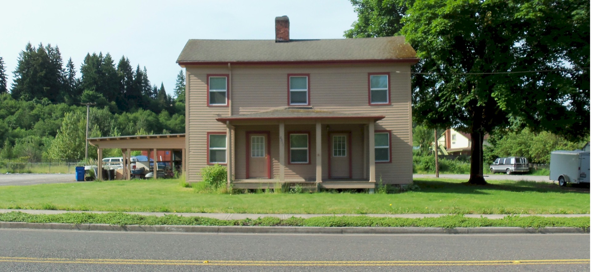
Marble House
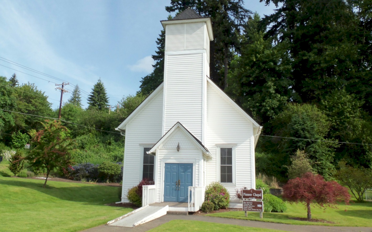
Goddard Church
Looking south on Klineline Avenue at Salmon Creek. 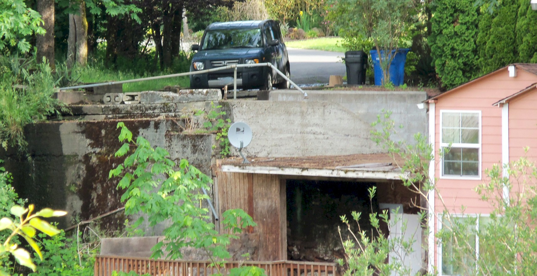
Looking north at the old 1915 bridge abutment. 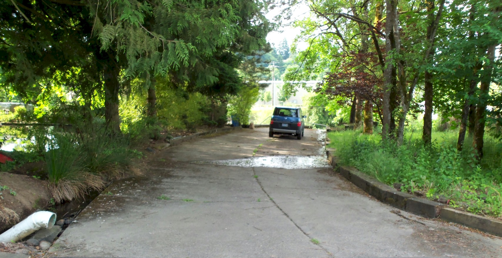
Looking south at the 1915 highway that was paved in 1920. 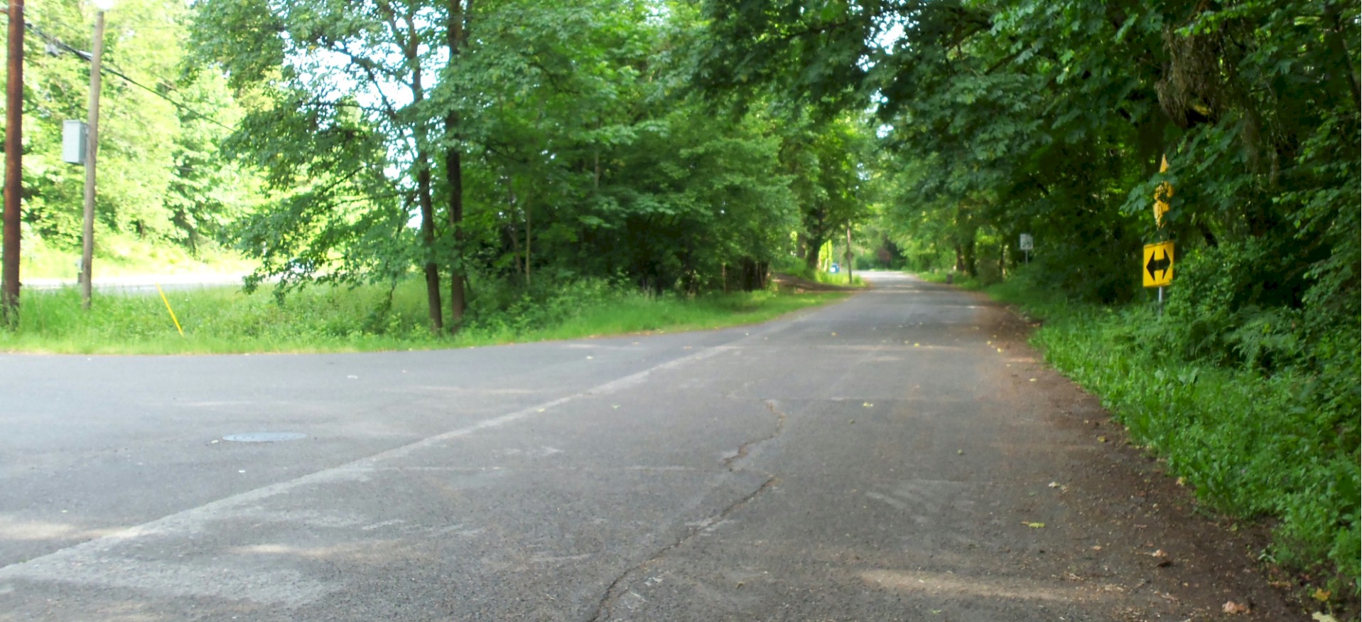
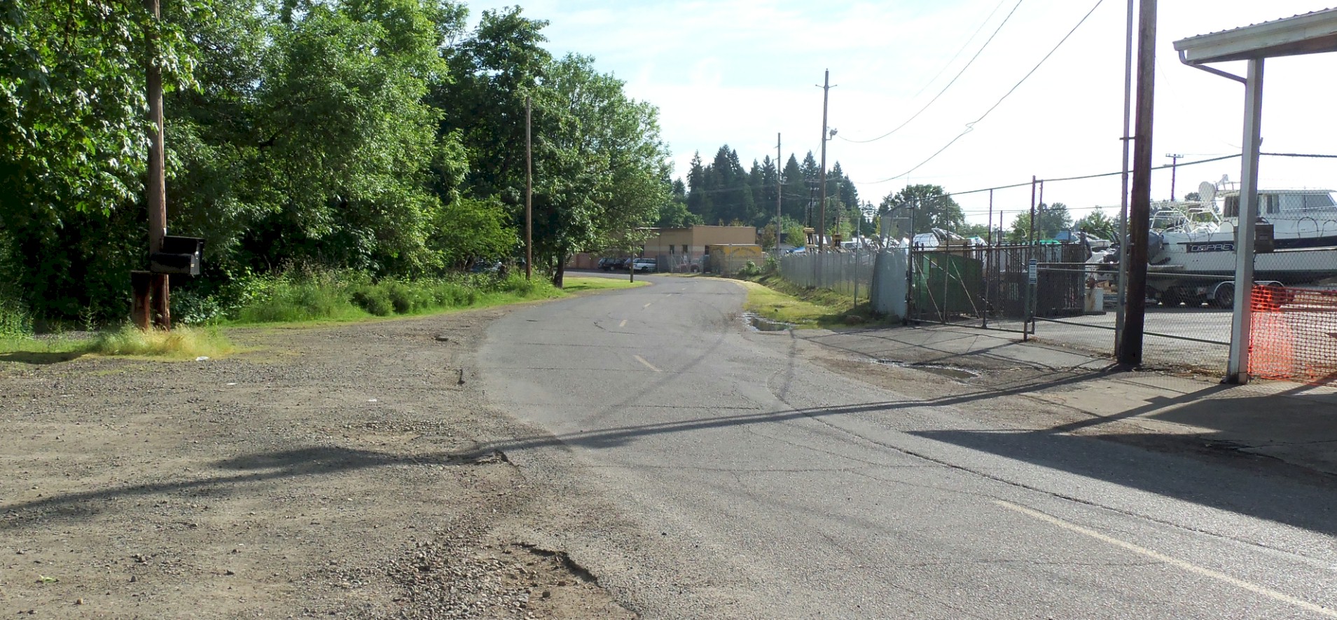
Looking north up the 1915 alignment |
Looking north up the 1915 alignment. 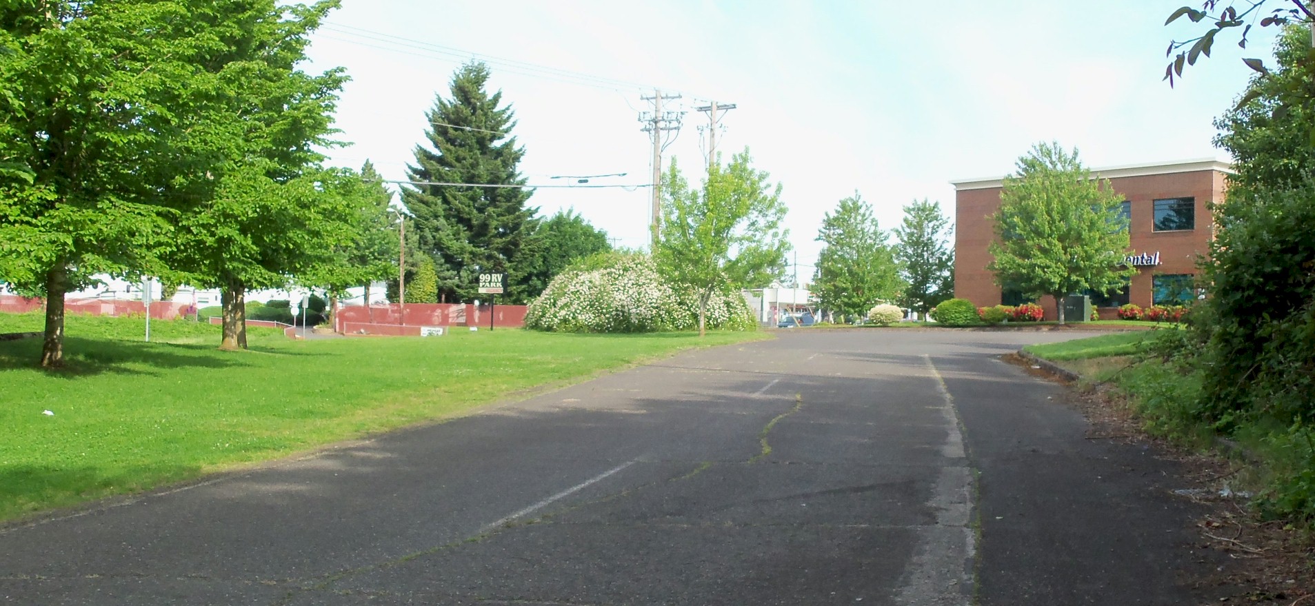
Looking north up the 1915 alignment 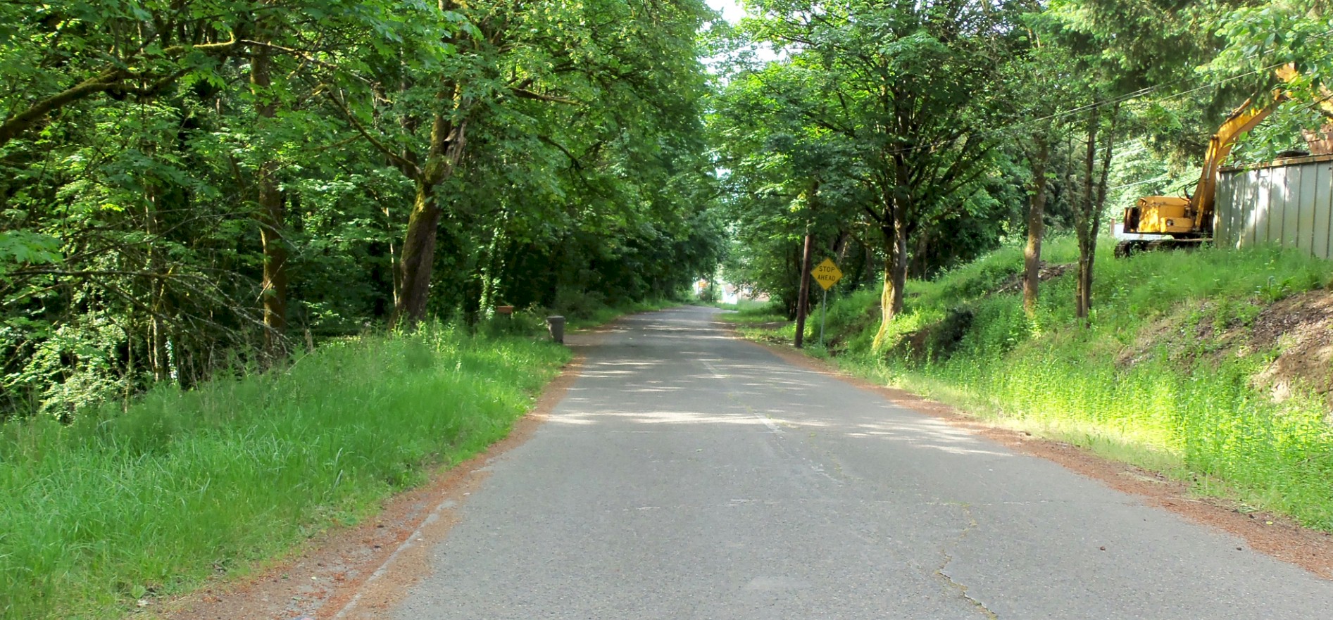
Looking south down the 1915 alignment. 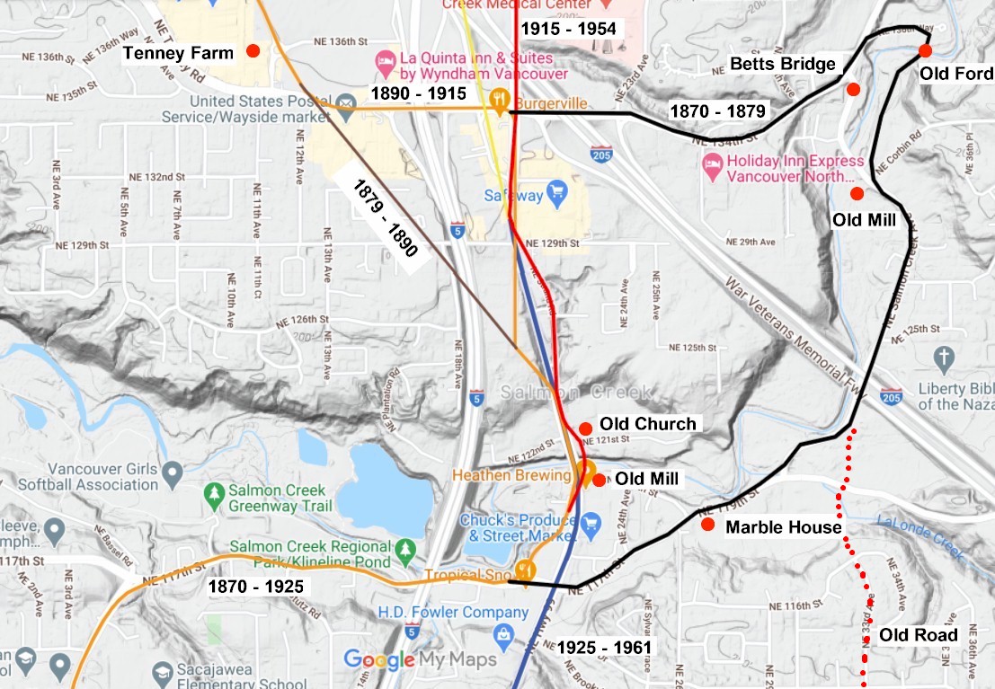
2020 map. |