![]()
The Historic Pacific Highway
in Washington
The Pioneer Highway
![]()
The Historic Pacific Highway
in Washington
The Pioneer Highway
The Pioneer Highway
By Curt Cunningham
The Pioneer Highway is a 10 mile section of the original Pacific Highway between Smokey Point and East Stanwood. This section of road begins at the north end of Smoky Point Blvd. and travels eastward through Silvana to East Stanwood. This road was built in the 1890s and roughly follows the path of the railroad across the bottom land of the Stillaguamish River. The highway crosses the Stillaguamish River a mile north of Silvana, and travels along the foot of Prestliens Bluff passing through 4 miles of rich farmland before the the road climbs out of the valley and makes its way to East Stanwood.
Snohomish to Stanwood
From 1860 to about 1890 the main route north from Seattle followed the Military Road to Martha Lake where it turned eastward to Fiddler's Bluff and then down the hill and across the valley to the city of Snohomish which back in the early days was called Snohomish City. This is where the road ended. From Snohomish there was an Indian trail which ran northward to Bellingham Bay. Today SR-9 roughly follows the old trail between Arlington and Sedro Woolley. Almost all travel in Snohomish county until the 1890's was by canoe and steamer.
The first wagon road leading north from Snohomish was called the Pilchuck Road and was constructed in 1877. This road ran north about 5 miles along the west bank of the Pilchuck River and terminating near Dubuque Road. They just made the Indian trail a little bit wider to accommodate wagons. Corduroy was placed in the muddy places which made the rough road even rougher. From the end of this road the Indian trail continued northward to Kent's Prairie which is about a mile south Arlington which back then was called "the forks of the Stillaguamish." From the prairie, the trail crossed the Stillaguamish River to the west of Highway 9 and continued northward to Bellingham Bay.
In 1878 calls were made by the citizens to build a wagon road from Snohomish City to connect with Stanwood and the northern parts of the county. The authorities heard the call and in September of 1878 surveyors began the work on locating a road between Snohomish and Stanwood. The route they took followed the Indian trail up the Pilchuck River to Kent's Prairie. In 1858 during the boundary dispute with Great Britain this trail was cut out by the Military from Snohomish to the crossing of the Stillaguamish River north of Kent's Prairie. Today Old Burn Road is a section of this old trail. From Kent's Prairie the route turned west and followed the Stillaguamish River to Stanwood.
In the spring of 1891 the Arlington Times said that; "the road which comes down from the Burn past Kent's Prairie was cut through for McClellan's army, way back in the early fifties, during the trouble with the northwest boundary. That was the day before crosscut saws, the logs were all chopped out with axes. Many of the logs are lying alongside the road yet. The fir logs have mostly rotted, but the cedars, though much overgrown with moss, are as sound as when first cut and show how well the old-time choppers could wield an axe."
It was on September 1, 1878 when the Snohomish Northern Star printed the following article about the survey of the road to Stanwood; "In accordance with the general wish of most of the settlers of the Snohomish and Stillaguamish river valleys, the board of County Commissioners appointed a surveyor and viewers to view out, locate and survey a county road connecting the two parts of the county, heretofore separated by an almost impassible wilderness. The viewers were; Charles Neymier, E. S. Gregory, and William A. Clark, with W. F. Brown as surveyor."
"About two weeks ago, this party with D. Bartlett and J. Stafford as chainmen, started from the Pilchuck River, to make the preliminary examination, and find a suitable route, preparatory to the final survey and location of the road. The point of commencement was at the end of the Snohomish City and Pilchuck Road, at the northwest corner of Section 3, Township 29 north, of range 6 east, to which point, some nine miles distant from Snohomish City the above road is already located and surveyed, and opened for teams five miles, with a trail for the whole distance."
"The parties were thirteen days before they reached Stanwood and eight days from the Pilchuck to the Stillaguamish prairies, which are situated about twelve miles in an air line upriver from Stanwood. It is about 11 miles from their starting point to the prairies, in an airline; but they traveled about 20 miles in examining a route for a road. They expect finally to locate a road on that part of the route within 12 miles; making the road from Snohomish to the prairies, 21 miles, and from the prairies to Stanwood, about 35 miles."
"One half day out from Pilchuck, they struck dry high land, and went through some very clean burn to get to it. They had no water to drink or cook with from noon of the second day out, or 34 hours thereafter. Once after that, they were 36 hours without water. It had been a heavily timbered region; but a windfall and fire passed over it 10 years or more ago. They passed through some very fine farming land. On the Stillaguamish side at the divide. they passed for one mile through a White Pine forest."
"The Stillaguamish Prairie is occupied by a man by the name of Kent and another by the name of Lynch. It contains about 200 acres and a nice spring runs through it. It will make two first class dairy farms. The route from the prairie down to Stanwood is remarkably good for a road. There is already a bridle path on that part of the route and a feasible route can be secured the rest of the way. The party will start out again in a few days for the final survey with the addition of an axeman, probably Mr. Kent of the prairies."
The final survey began on Monday September 9, 1878 when the party which now included Kent, as axeman, left Snohomish. Before they departed, D. B. Bartlett had dried 86 pounds of beef which ended up being 45 pounds when dried. This saved weight and the beef stayed fresh, the only problem they had was keeping the flies away. The final survey began from the same spot as before, which was on Pilchuck River near Lake Conner. From this point the line was carefully surveyed north to Kent's Prairie.
They reached the prairies on Sunday evening, six days after they began. They found the route good for a wagon road at a reasonable expense. Much of the way was open burns, where you could ride through on horseback. The point of starting was on the divide between the Pilchuck valley and the streams flowing into the outlet of Lake Stevens. The survey line from the starting point to Kent's house was 11.75 miles. On the preliminary survey, the line had been surveyed on existing trails from the lower prairie 3/4ths of a mile from Kent's house, westward to Stanwood.
This line was corrected and shortened nearly one half mile and the new route was adopted. The whole length from the starting point on Pilchuck to Stanwood was 29.75 miles; or nearly 39 miles to Stanwood from Snohomish City. The corrections on the trail from the prairies to Stanwood would require some two or three miles of new cutting to make it conform to the survey. Extreme forest fires had blocked up much of the route and it required 7 to 8 miles of new cutting besides clearing out and widening the old trail. The survey party was gone for twelve days returning Thursday September 19, 1877.
In December of 1878 Snohomish county called for bidding on two road building contracts. One was to cut out a road from Stanwood to Kent's Prairie and the other contract was for cutting a road from Kent's Prairie to the end of the road in the Pilchuck valley north of Snohomish. The roads were to be twelve feet wide.
None of the bids would be accepted because the lowest bid was too high and there was not enough funds to cover it. Nothing would be done until the following year on November 23, 1879 when Snohomish county decided to set aside one half of the 1880 Territorial tax of the county to be used toward the building of the road to Stanwood. This was under the Territorial Government's stipulation that the county appropriate enough funding to complete the road. On October 25, 1881 House Bill 33 was approved which allowed half the Territorial tax of Snohomish county to be used for the purpose of building a territorial road from Snohomish to Stanwood.
It was said that this road would enable travelers to go from the county seat at Snohomish to Stanwood in one to three days by wagon. Travelers going between these towns would have to take a steamer down to Mukilteo and wait there to connect with another steamer, which would take them north to Stanwood. This occupied the best part of a week to make the round trip.
The road from Snohomish to Kent's Prairie was completed sometime between 1882 and 1890. There seems to be no information about its completion. It must have been a terrible road and it was mostly abandoned by 1909. The 1909 maps (the earliest I can find) only show small sections remaining of the old road. Another reason for its abandonment was that by 1893 there was a good road from Snohomish to Cavalero's Corner (Bickford Road) connecting with the road from Everett to Marysville and from Marysville to a connection with the Stanwood - Arlington Road at Smoky Point.
In 1888 the Seattle Lake Shore & Eastern Railroad was building a line from Woodinville to Sumas and had reached a point 6 miles above Snohomish following the Pilchuck River. This point is about a mile north of Machias. This is also where the railroad and the wagon road to Kent's Prairie split. Construction of the railroad would not be completed to Sumas until April of 1890.
On June 6, 1888 a party of tourists took a trip to Snohomish from Seattle by rail and steamer, and then traveled north from Snohomish by wagon to the railroad construction camp at the end of the track 6 miles away. The story begins as the steamer Mame of Snohomish had spent the day traveling down the Snohomish River from Fall City; "Six hours from the time of starting Fiddler's Bluff hove in sight and shortly after the true and tried Mame drew up at the wharf in Snohomish City."
"Supper partaken of, through the courtesy of Mr. Cathcart, the Yesler of the town, a wagon was found in waiting, the river crossed and with 'Boys, three cheers for old Snohomish,' a plunge was taken into the wilderness with the end of West Coast track a point of destination. Past gigantic cedars, magnificent ferns and over a valley country with soil surpassingly rich, the company was hurried until the logging road was reached. Here not daunted by the corduroy road with cross logs three feet apart and 6 inches above the ground, the teams continued on and the real fun of the day began."
"Up and down, thrown here, jerked there, the poor occupants of the cart were tossed and heaved about like peas in a can. Would the end ever come?" It seemed not so a firmer brace and a stronger hold was taken, the teeth clinched tighter and the worst prepared for. There is an end to all things, however, and the cart, after what seemed hours, coming to a final halt, it occupants in a slow, solemn, painful, rheumatic sort of a fashion straightened themselves out and gently lowered their battered bodies to the ground."
"The marsh on foot was taken up through the forest and after an hours' trudging over and under logs, down embankments, over unfinished cuts, around trestles, through bogs with now and then a bit of decent walking the construction camp was reached and a tent taken possession of till a locomotive could be run from Woodinville. The time was whiled away with remarks by the most of the party, including Mr. Mcleod, who had gallantly acted as guide through the forest and along the line of the railway."
Stanwood to Arlington.
The first road between Stanwood and Arlington was completed sometime between 1882 and 1885. The original road leaving Stanwood followed 271st St NW which is also the Pacific Highway across the flat to East Stanwood. From East Stanwood the road followed the Pioneer Highway to Miller Road. At this point the original route may have ran down into the valley on Miller Road as it becomes Norman Road and follows the river east to where the Norman store used to be. There was a ferry which was used to cross the Stillaguamish until a bridge was built and was only a half mile from the Norman store. The crossing would have been a half mile west from the current bridge on Norman Road. If this is correct then the Pioneer Highway along the foot of the bluff was constructed in the 1890's when the first bridge was built north of Silvana. The following story of a trip from Stanwood to Arlington gives reason for this theory.
On May 28, 1890 The Seattle Post-Intelligencer printed an article written in December of 1889 by C. S. Gilman who spent three months touring Western Washington. Part of his journey took him from Stanwood to Arlington. He said; "the valley was destined to be one of the finest farming sections on the Sound, and anyone who has taken a trip from Stanwood to the Forks (Arlington) and beyond can doubt. So thought the writer as he surveyed the broad meadows and fertile fields which greet the eye of the beholder in all directions for a distance of twenty miles. Starting out in early morning when nature wears her brightest smiles, the trip is both invigorating and pleasant, and is recommended to all."
"From Stanwood the road for a mile or more, is straight as an arrow, and goes over the rich marsh land which is noted throughout the world for its abundant crops. At the end of that distance it strikes the highland and divides, one branch going through a dense timber country to Pillchuck, and the other to the Forks. The latter passes through an upland country, for two miles, known as the burn, and here a fine opportunity awaits the small dairyman and farmer."
"At Gilchrist's place, the road reaches a clearing from which a magnificent view can be obtained, and then descends into the river bottom, which is followed for the remainder of the route. Directly beyond the place of Gilchrist's is a wretched piece of bottom, which causes no little inconvenience to teamsters. The stage is stopped and the passengers are obliged to get out and walk, while the driver picks his way along as best he can. To a disinterested person it would seem that someone is to blame for this flagrant disregard of the road, and steps should be taken to obviate it at once."
"As soon as the stage comes out of this ocean of mud and water and reaches terra firma, the passengers resume their seats and soon obtain a sight of the Stillaguamish. One of the many improvements made here is the establishment of a ferry at Peterson's place, making communication with Florence far easier than before. For a considerable distance the road winds along the north bank of the river, every now and then reaching large clearings, where various improvements are noted."
"The barns along this section of the road are very commodious, indicating that tremendous crops are taken from a comparatively small acreage of land. The valley here is about three miles wide, and the dense growth of cottonwood with which it was formerly covered is rapidly disappearing under the hands of the farmers. Half a mite from Norman the road crosses the raging river on Olsen's ferry. We are now eight miles from Stanwood. From here, for a distance of nine miles the road is on the 'island,' for it has no other name than that."
"At several points the swift current of the river has made several inroads in the bank, and little by little the land is being carried off. A mile beyond Olsen's, the Stillaguamish post office and store is reached. At this point considerable clearing has been done, and a large settlement is scattered about in the immediate vicinity. At Cook's place an attempt has been made to grow hops, and a fine looking field is to be seen of ten or fifteen acres. Cook has erected a large dry-house on his place, and also has a bearing orchard."
"A little beyond the hop field, the road crosses the only decent bridge on the whole trip, and here it is where the boys and girls assemble at hop picking and trip the light fantastic to their hearts' content, using the smooth boards of the bridge as their floor, and bright autumn nights as the occasion. From here on nothing worthy of note is seen. The road still winds along the banks of the river, surrounded by the cabins and rapidly growing clearings of the ranchers. It is noticeable that the frame structures which had heretofore lined the road are no longer to be seen. Sawed lumber is difficult to get, and the farmer prefers to stick to his first home, the log cabin."
The Pacific Highway
Improvements to the Pacific Highway between Marysville and Stanwood began in 1918 when a location survey approximately 7.20 miles in length was completed between Stanwood and Silvana. This location followed very closely the general route of the wagon road which ran along the foot of Prestliens Bluff. That year plans were also prepared for a 240-foot steel bridge across the Stillaguamish River at Silvana plus an 80-foot reinforced concrete arch bridge over South Slough near Reinseth's Place.
On April 8, 1918, bids for the two bridges at Silvana and Reinseth's Place, were opened. The contract for the construction of the Silvana bridge was awarded to William Monson of Portland, Oregon, doing business as the Monson Construction Co., for the sum of $39,135.50. On September 30, 1918, the contract was about 20% completed. It was estimated that this contract would be completed about December 1, 1918. The contract for the 80-foot reinforced concrete arch bridge over South Slough was awarded to Reinseth and Hoversland of Arlington, Washington, for the sum of $11,918.00. This contract was 90% completed on September 30, 1918. In January of 1919 the bridge over the Stillaguamish River north of Silvana was completed. This bridge lasted for 60 years before it was replaced with the current concrete and steel bridge in 1979.
In the spring of 1919 construction began to replace the remaining wooden bridges over the creeks and sloughs between Marysville and Silvana with new reinforced concrete arch bridges. The South Slough bridge would be extended by installing another 80 concrete span. These bridges were constructed under one contract. The Union Bridge Co. of Seattle was the successful bidder for this work and the contract was awarded to them on May 19, 1919, for $27,920.00. This project was completed on November 20, 1919. Conditions encountered in construction had made it necessary to increase some of the quantities above those called for in the plans, and the final estimate for the contract amounted to $30,848.88.
As you travel north from Marysville, you first cross over a fill at Quil Ceda Creek which was constructed in 1921 by the McDonald & LaRue Co. of Seattle. This project was completed on November 1, 1921 for $27,821.02. Next is the Portage Creek bridge which is 6.5 miles north of Quil Ceda Creek. The Portage Creek bridge is 106 feet long and 27.9 feet wide. The largest span is 60 feet and the structure was refurbished in 1972.
Just a half mile north of Portage Creek is the South Slough bridge. This bridge now has 2 spans 80 feet long for a total length of 224 feet. The first 80 foot span over the creek was completed in 1918 and in 1920 the second arch was added to the bridge. The approaches must not have been satisfactory because on November 13, 1920 construction began to grade the roadway at the bridge and replace the approaches with new fill. This project was 1.2 miles long and was completed on December 31, 1920.
By 2005 the narrow 20 foot roadway over the South Slough bridge was deemed unsafe and plans were made to replace the structure. It was then decided that instead of replacing the bridge, the deck could be widened which shortened the construction time by 4.5 years. The original width of the bridge was 22 feet and today the bridge is 32 feet wide.
After crossing the South Slough bridge the highway turns to the west and after 2 miles you arrive at the Thomsen Slough bridge. This bridge is 80 feet long and 27.9 feet wide. This bridge was refurbished in 2003. The last of the 4 bridges between Marysville and Silvana is the Cook Slough bridge which is 127.9 feet long and 39.4 feet wide. This bridge was refurbished in 1998.
Paving Begins
In 1915 the Pacific Highway between Stanwood and the railroad tracks a mile east of town was paved with brick. The first concrete paving of the Pacific Highway between Marysville and Stanwood began in 1916 when one mile of highway north of Marysville was paved. The next paving project on this section was 4 years later on April 25, 1920 when work began on the paving of 3.09 miles of the highway from Marysville northward. This project was completed on August 30, 1920. Beginning in the fall of 1920 a one mile section of highway north of Silvana was being paved. This section of the highway was opened to traffic on January 14, 1921.
The paving of the last section of highway between Marysville and Stanwood began on May 9, 1921 when the Independent Asphalt Paving Company of Seattle started paving the Pacific Highway 20 feet wide for 6.14 miles. This work was completed on November 1, 1921 for $220,945.89 with an average cost per mile of $35,984.67.
During the paving work vehicles traveling between Marysville and Mount Vernon were detoured through Arlington and Big Lake. Tourists had said that the opening of the route between Marysville and Stanwood would be a considerable relief for them. The detour through the old English camp to McMurray and Arlington and the one over the hill from Mount Vernon to the Big Lake road, had become impassable under the heavy traffic.
Although great quantities of gravel had been poured onto the bad spots and over the slippery stretches, the wet condition of the ground kept the road soft. Deep ruts quickly formed and caused many automobiles to get hung up on the oil pan or the differential. However frequent dragging and more gravel had made it possible to get through by careful driving.
The Flooded Highway
On December 15, 1921, just a month after the 6 mile paving project was completed, the Stillaguamish River overflowed its banks flooding the towns of Silvana and Stanwood. The Pacific Highway south of Stanwood was heavily damaged and cars were routed through Arlington. At Silvana the roadway was covered in 5 feet of water and it was 8 feet deep on either side of the road. Conway and Milltown were both deep under water.
Flooding of the roadway occurred again the following year on December 8, 1923 near Silvana which caused the Stillaguamish bridge to be closed for traffic until repairs could be made. Vehicles traveling between Everett and Mount Vernon were routed over the road through Arlington and the Lake McMurray road to Conway. To reach Stanwood motorists were being directed to take the road to Bryant, about 4 miles north of Arlington, and then turn westward.
The Stanwood Cut-Off
In 1931 a new 2.5 mile section of the Pacific Highway was constructed from the end of the Pioneer Highway at East Stanwood to connect up with the old highway just after it crosses the railroad tracks 2.5 miles north of Stanwood. This new section of the highway was known as Highland Drive and was called the Stanwood Cut-off.
The New Stanwood Cut-Off
In 1932 the state highway dept. began construction on a new 12.7 mile highway between Smokey Point and Conway. The new alignment when completed in 1936 avoided East Stanwood and Stanwood altogether. Starting at the north end of Smokey Point Blvd., the new road followed close to the path of the freeway. At first the new highway was only 2 lanes when first opened, but plans were already in the works to expand the roadway to 4 lanes before work had begun.
The new bridge over the Stillaguamish completed on July 29, 1933 was built as a 4 lane, 3 span, thru truss steel bridge which is now the northbound lanes of Interstate-5. The new cut-off would not become a 4-lane road until 1954 when the freeway had been constructed between Everett and Mount Vernon bypassing much of the 1936 road.
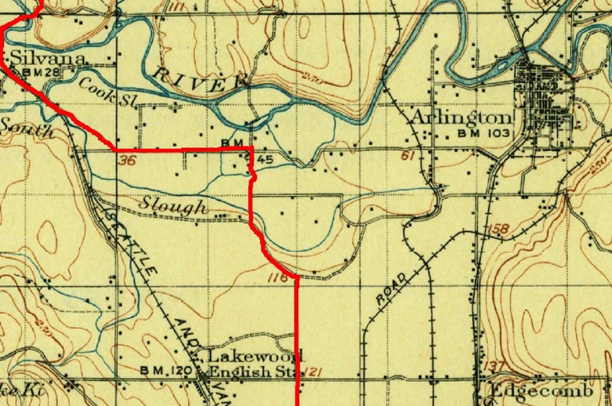
1911 map showing the old route between Marysville and Silvana. 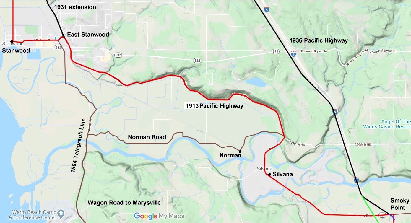
2022 map of the Pioneer Highway. 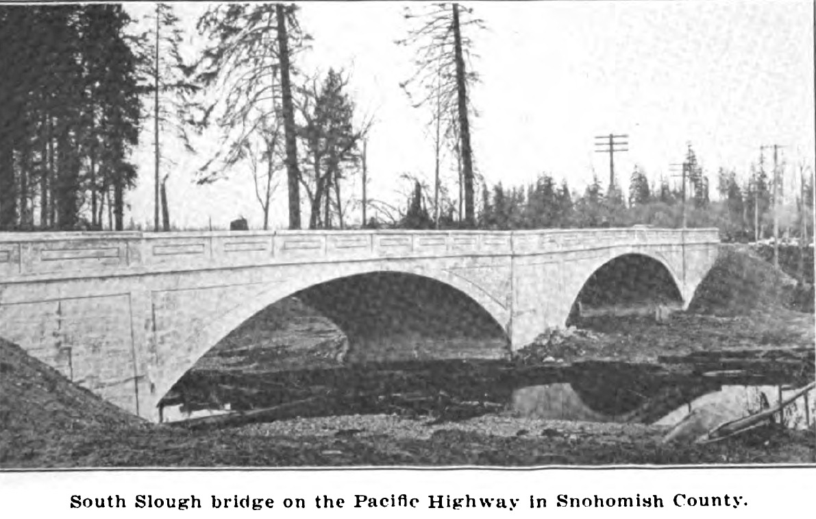
1920 photo of the South Slough Bridge. 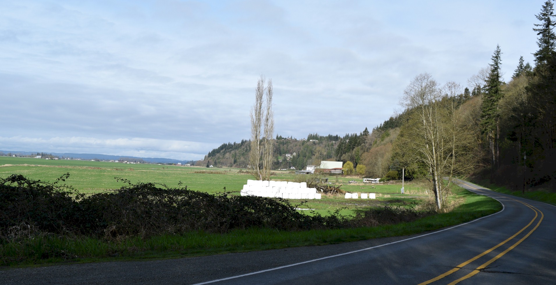
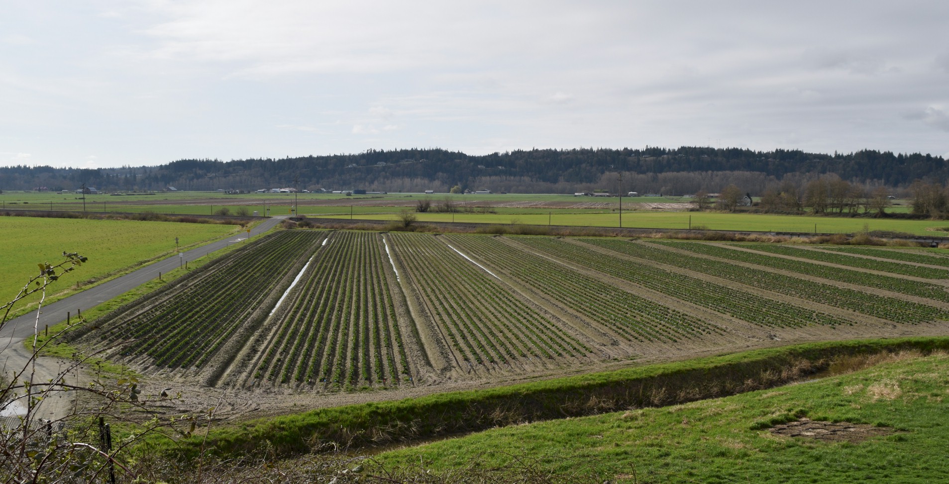
Looking west across the Stillaguamish Valley. Prestliens Bluff is the ridge on the right. |
Looking south acoss the Stillaguamish Valley. 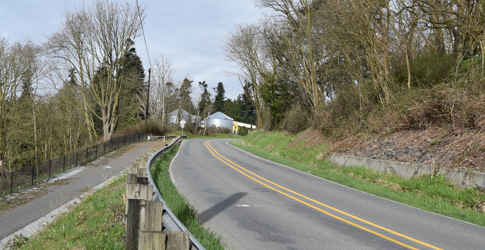
Looking west at where the Pioneer highway climbs out of the valley. Miller Road is to the left and may have been the original route of the wagon road. 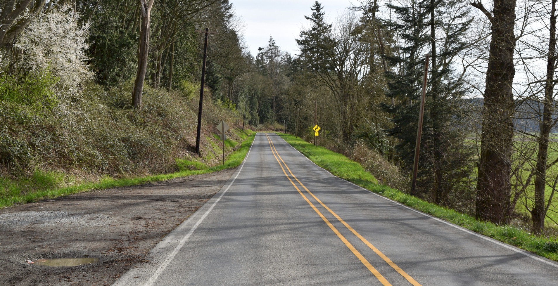
Looking southbound on the Pioneer Highway along the foot of Prestliens Bluff. 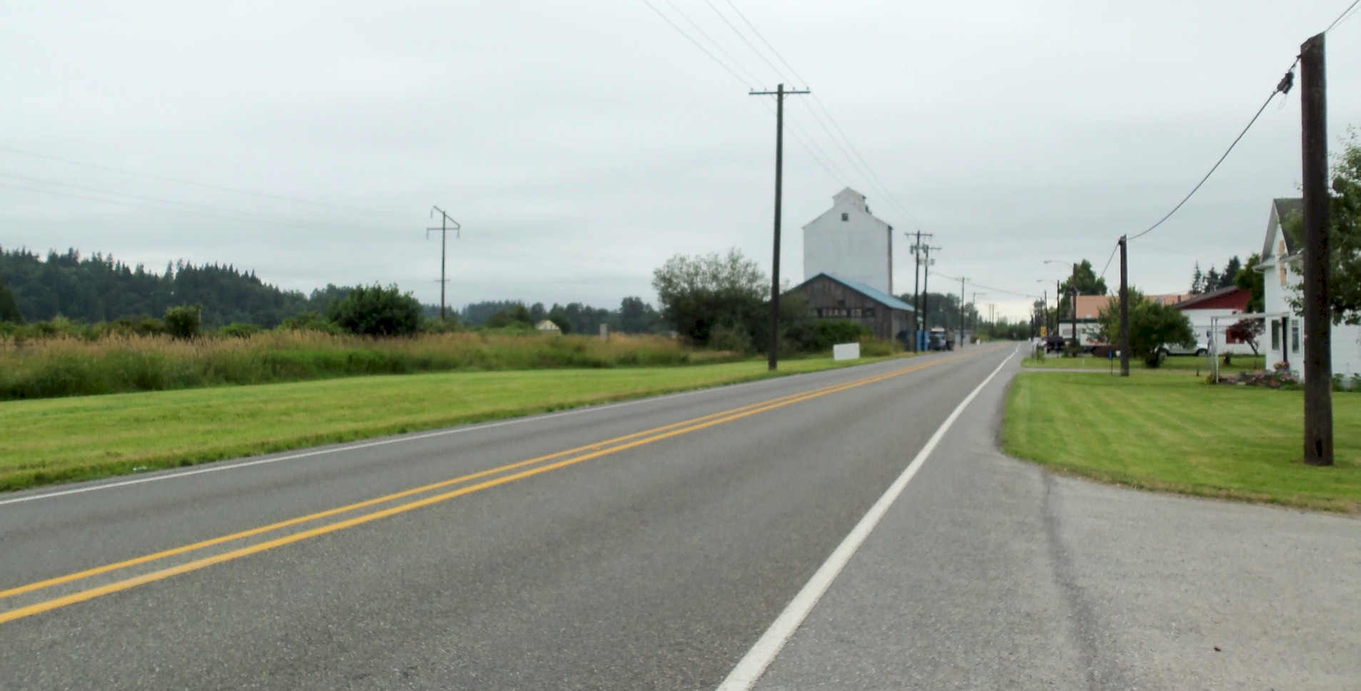
Looking west at the entrance to Silvana. |