![]()
The Historic Pacific Highway
in Washington
The Duwamish River Crossings
![]()
The Historic Pacific Highway
in Washington
The Duwamish River Crossings
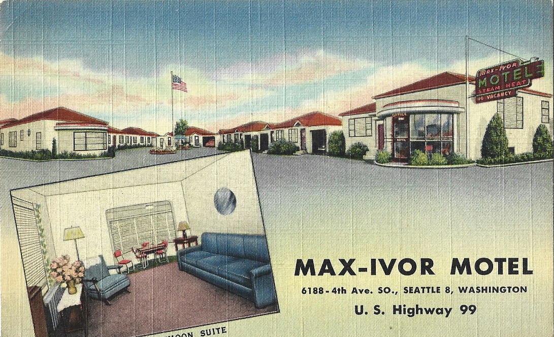
The Max-Ivor opened in 1943 and served weary travelers until 1988 when it closed. They offered 20 beautifully furnished suites, and had maid service, steam heat, private baths and showers, and they also had radios and refrigerators. It was one mile inside the city limits on Highway 99, just 5 minutes from the city center.
History of the Duwamish
River Crossings
By Curt Cunningham
The Duwamish River
The Duwamish river is about 8.5 miles long and flows northerly through a valley about a mile and a half wide where it empties into Elliott bay. It begins in southeast Tukwila where the Black and White rivers had once merged. The White river prior to 1899 flowed north through the Kent valley, and today this section is now called the Green river. The Black river was once the outlet of Lake Washington and it met the White river at Tukwila. This place was once known as the forks of the White river, and is about a mile north of where Interstate-405 crosses the Green river. In 1916 the locks were completed in Ballard, which lowered the level of the lake, and the Black river dried up. Today there is a mile section of the river within the Black River Riparian Forest and Wetland located at the mouth of the old river.
In 1913 the Duwamish waterway project began, which straightened out the Duwamish river for 5 miles from Elliott bay to S. 98th Street. It would take about 7 years to complete the digging of the new channel and the filling in of the old channel, and by 1920 it was mostly completed. In 1916 enough land was reclaimed and E. Marginal way was completed through to Seattle. The waterway project had also straightened out the Pacific Highway which was routed onto this new road. This section was paved between 1917 and 1919, and during that time cars would be detoured in various places.
The Tacoma-Seattle Road
In 1913 the Pacific Highway between Tacoma and Seattle was routed through the Kent/Auburn valley which had 4 river crossings. The first was over the Puyallup river at Indian Ferry, the next crossing was over the Green river in Kent, the third crossing was again over the Green river at Renton Junction in Tukwila, and the last crossing was over the Duwamish river at Allentown. This section of the highway had 4 dangerous railroad crossings, and one deadly trolley crossing at Allentown. The one good point of the road was that it was paved the entire distance between Tacoma and Seattle.
The Highline route completed in 1912 was about 10 miles shorter than the "Valley line," and it had only 2 river crossings; the Puyallup in Tacoma and the Duwamish in South Park, and there were no dangerous railroad or trolley crossings making it a safer and shorter road to drive on. When the Highline was completed it became a popular route between the cities, and until 1924 it was just a dirt road which was muddy during the rainy season. By 1924 the Highline had been paved the entire distance between Tacoma and Seattle, and the Pacific Highway would be rerouted over this shorter and safer road.
The Duwamish River Bridges
In 1890 the first bridge between Georgetown and South Park was completed. This wooden bridge had a long viaduct across the marshy ground on the south approach. The bridge was located on the old channel at the south end of Myrtle St. in Georgetown. This bridge replaced Miller's ferry which had been operated by H. H. Miller since the 1870's. It was the only way wagons could get across the river from the west side of the Duwamish valley, and the farmers from Freeport, Alki and West Seattle depended on this bridge. The crossing had become a part of the White River road, known as the George Frager Road or County Road #76, which was opened in 1880. This was the wagon road down the west side of the river to Pialschie in the Kent valley.
In 1903 The wooden swing bridge at Allentown was completed. This bridge would be used by the Pacific Highway in 1913 and was a part of the highway until 1916 when a new bridge over the Duwamish was completed. This bridge was west of the trolley tracks and it eliminated the Macadam Road with its narrow road and sharp curves and the dangerous trolley crossing at Allentown. This bridge, now part of E. Marginal Way was replaced in 1989 which continues to carry traffic across the Duwamish river
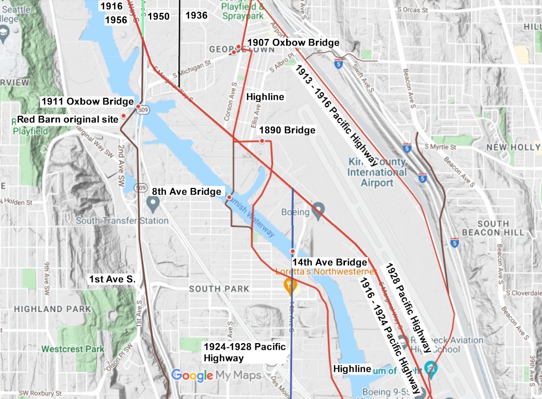
In 1906 Joseph McLaughlin purchased the land inside the big bend of the river which was known as Oxbow. This part of the Duwamish river had made a mile and a half loop northwest of Georgetown. It was called the "Big Bend" and the "Oxbow Bend." Michigan St. runs directly through the center of it.
In 1907 his real state company platted out the McLaughlin's Waterfront Addition to the City of Seattle and began selling lots. Also that year a new bridge was built over the old channel from Corson Ave. to Michigan Street. In the spring of 1907 McLaughlin's company placed ads for their new lots in Oxbow. The ad said to take the South Seattle trolley to the new Oxbow bridge, then cross the bridge and walk down Michigan Avenue where sales agents would be waiting for them. The bridge would be removed in 1916 when the channel was filled in.
On February 2, 1910 the Seattle City Council approved $5,000 for their contribution of a new steel bridge across the Duwamish at 1st Avenue. The county had already set aside $18,000 for the structure which was also called the Oxbow bridge. The bridge was completed in 1911, and in 1916 it was moved to accommodate the new channel. The bridge lasted until 1953 when it was replaced by the current bridge.
Around the same time a bridge was built across the Duwamish river at 8th Ave. South. This bridge would be removed sometime between 1938 and 1940. During construction of the 14th Avenue bridge, the 8th Avenue bridge was used as a detour. Today the 8th Avenue South Park is situated at the west end of this old structure. The gears on display are probably parts from the swing mechanism.
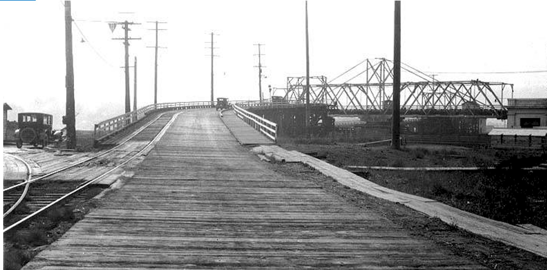
On September 3, 1915 the wooden 14th Ave. S. bridge was completed over the Duwamish at South Park. This was when the Oxbow was almost filled in and the following year, the old 1890 bridge and the 1907 Oxbow bridge were removed. Michigan St. was now for the first time connected to Georgetown by land. The Highline road now crossed the Duwamish on this new bridge. By the 1930's the old wooden bridge linking Georgetown with South Park had become so dilapidated that it was becoming dangerous, and a new bridge was planned to replace it. The new bridge was built from 14th Ave. in South Park to 16th Ave. in Georgetown. On March 21, 1931 the new 14th/16th Ave. bridge was opened for traffic. The old wooden span was used until the new structure could be completed and was removed by the end of the year.
This new bridge would become a part of the Pacific Highway in 1924. This is when the route of the Pacific Highway was moved to the "Highline route." The bridge would remain a part of the highway for 4 short years. This is when the new 4-lane structure over the Duwamish was opened for traffic on October 18, 1928.
Map of Oxbow area 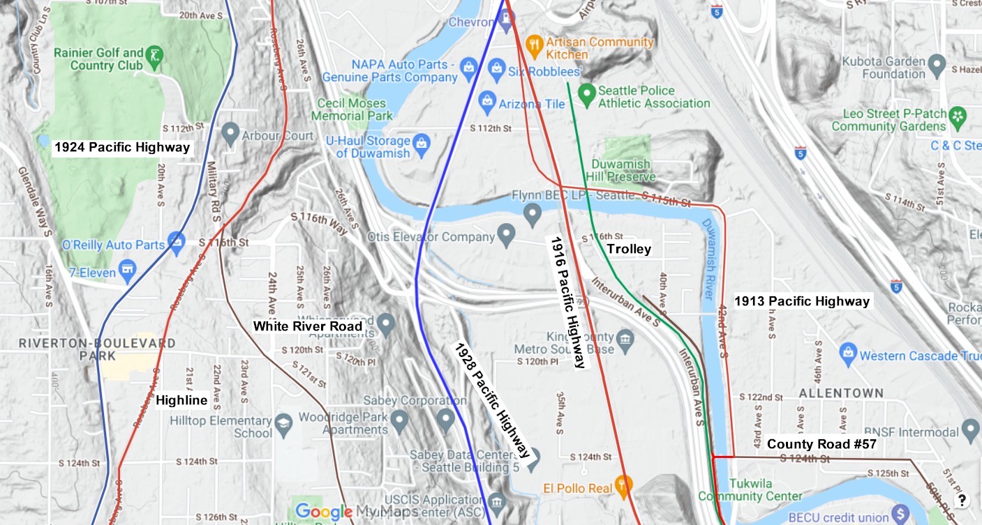
Map showing the new 1928 highway. 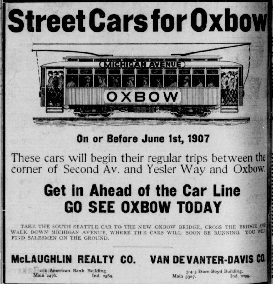
1907 newspaper ad 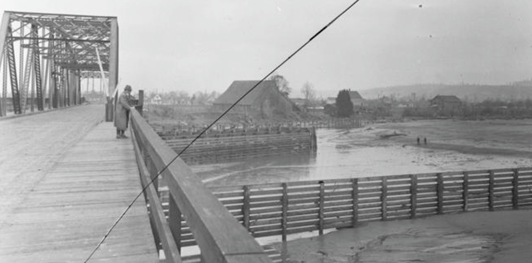
1916 Oxbow Bridge 1st Ave S. Photo courtesy Seattle Municipal Achieves . No 3215 |
1920 8th Ave. bridge. Looking north from the west side. The bridge is in the open position. 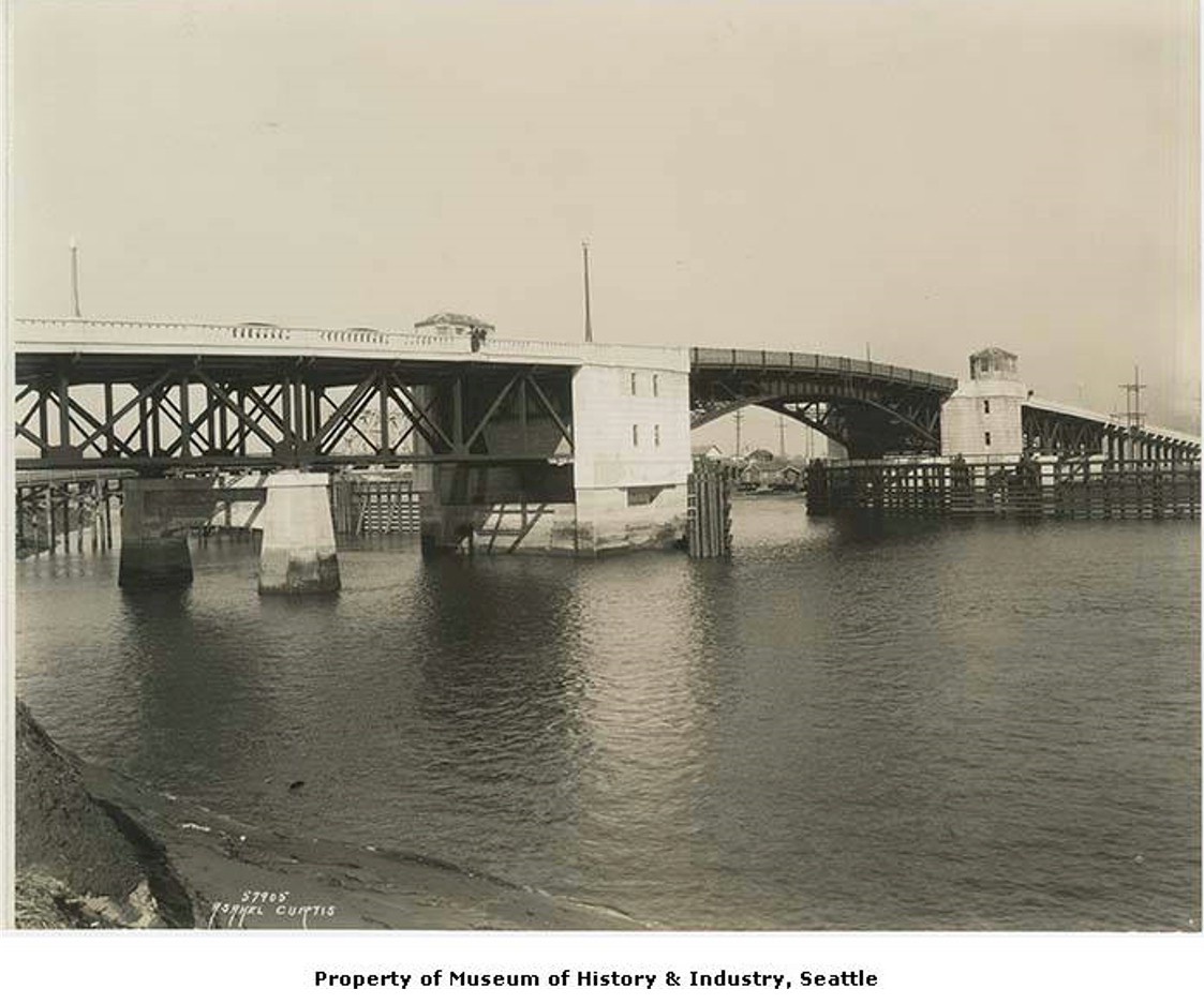
1931 14th Ave. Bridge. Photo courtesy Museum of History and Industry - MOHAI 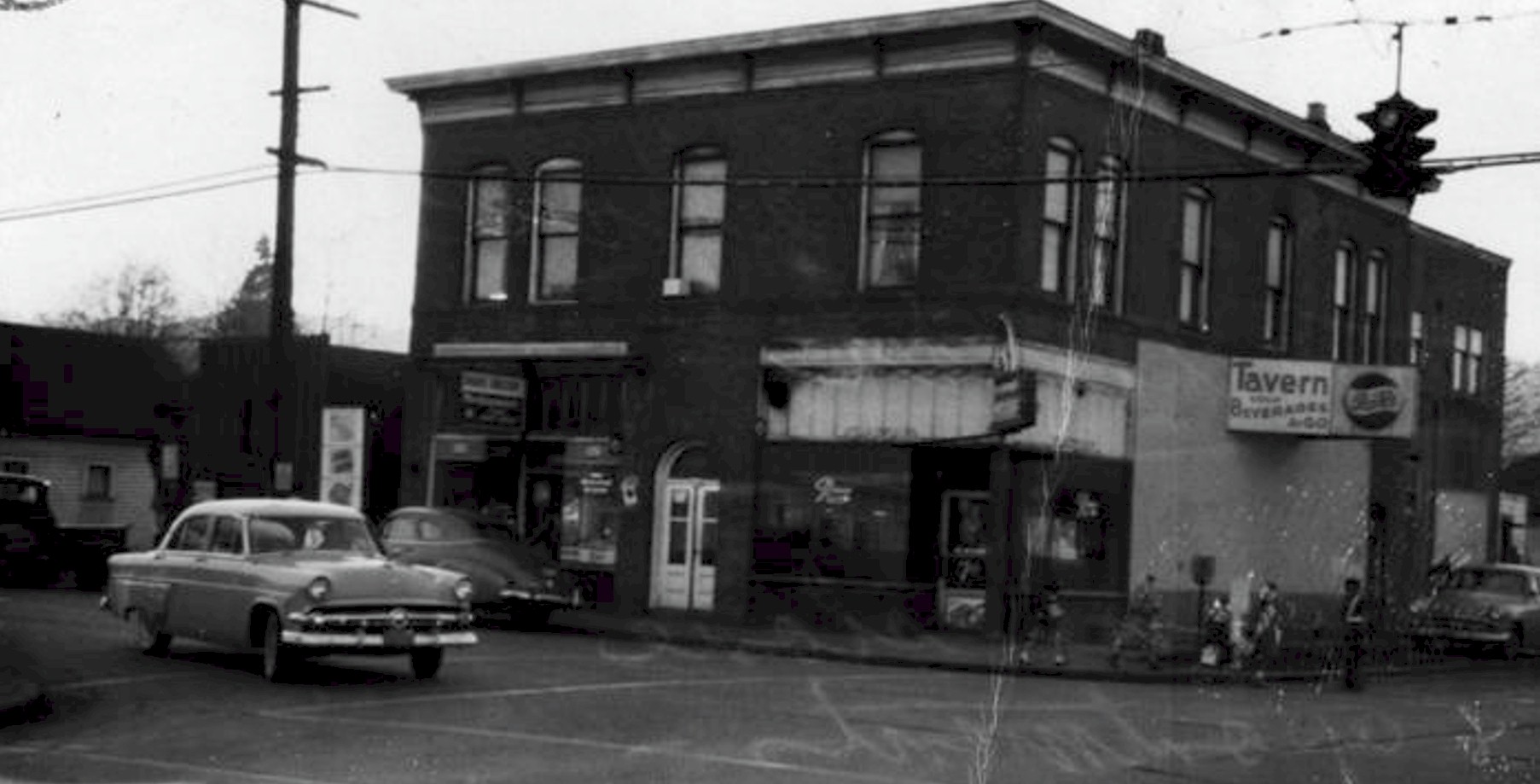
1957 South Park. Photo courtesy Seattle Municipal Achieves . No 75837 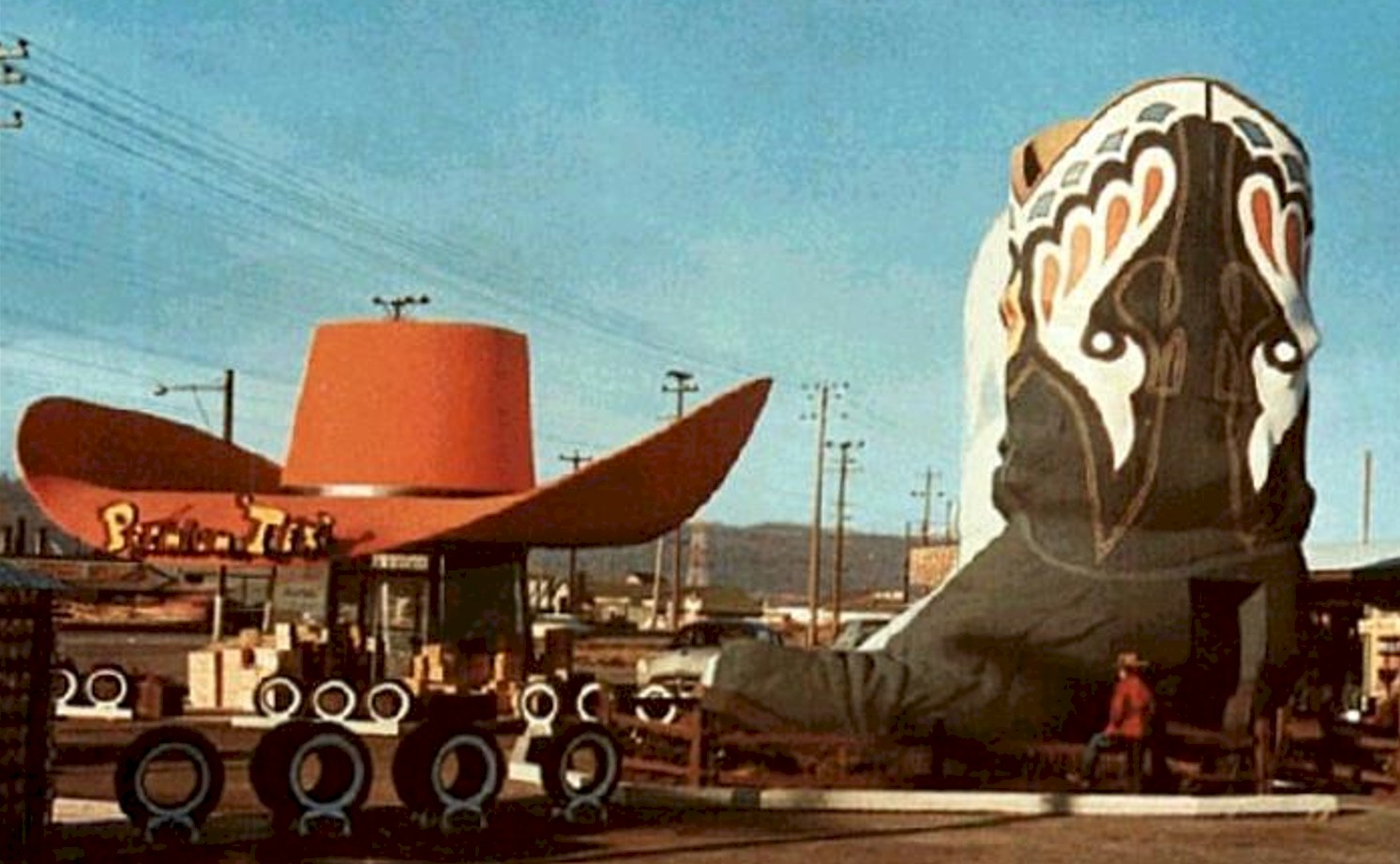
The Old Hat & Boots gas station. This was located on Highway 99 in Georgetown. Today the quirky structures are in Oxbow park on Corson Ave. This photo was taken in the 1970's. Photo courtesy Seattle Municipal Achieves . No 178262 |