![]()
The Historic Pacific Highway
in Washington
Highline Road
![]()
The Historic Pacific Highway
in Washington
Highline Road
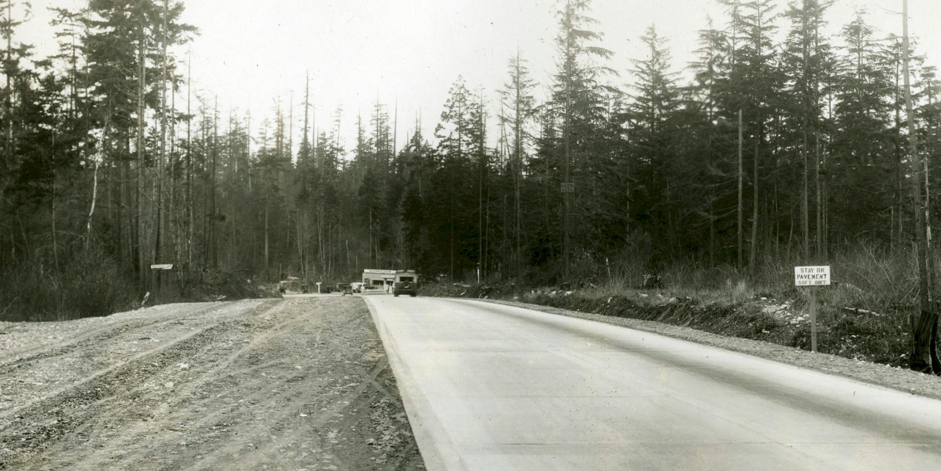
The 1927 Pacific Highway somewhere between Federal Way and Des Moines.
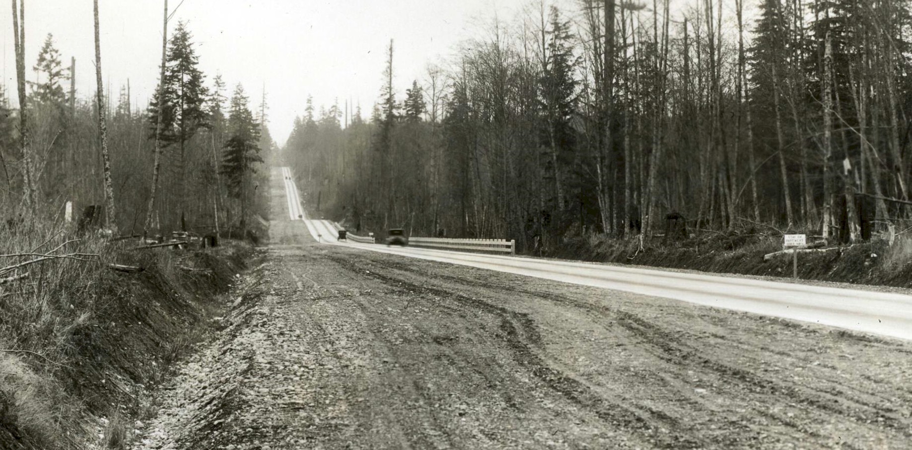
The 1927 Pacific Highway somewhere between Federal Way and Des Moines.
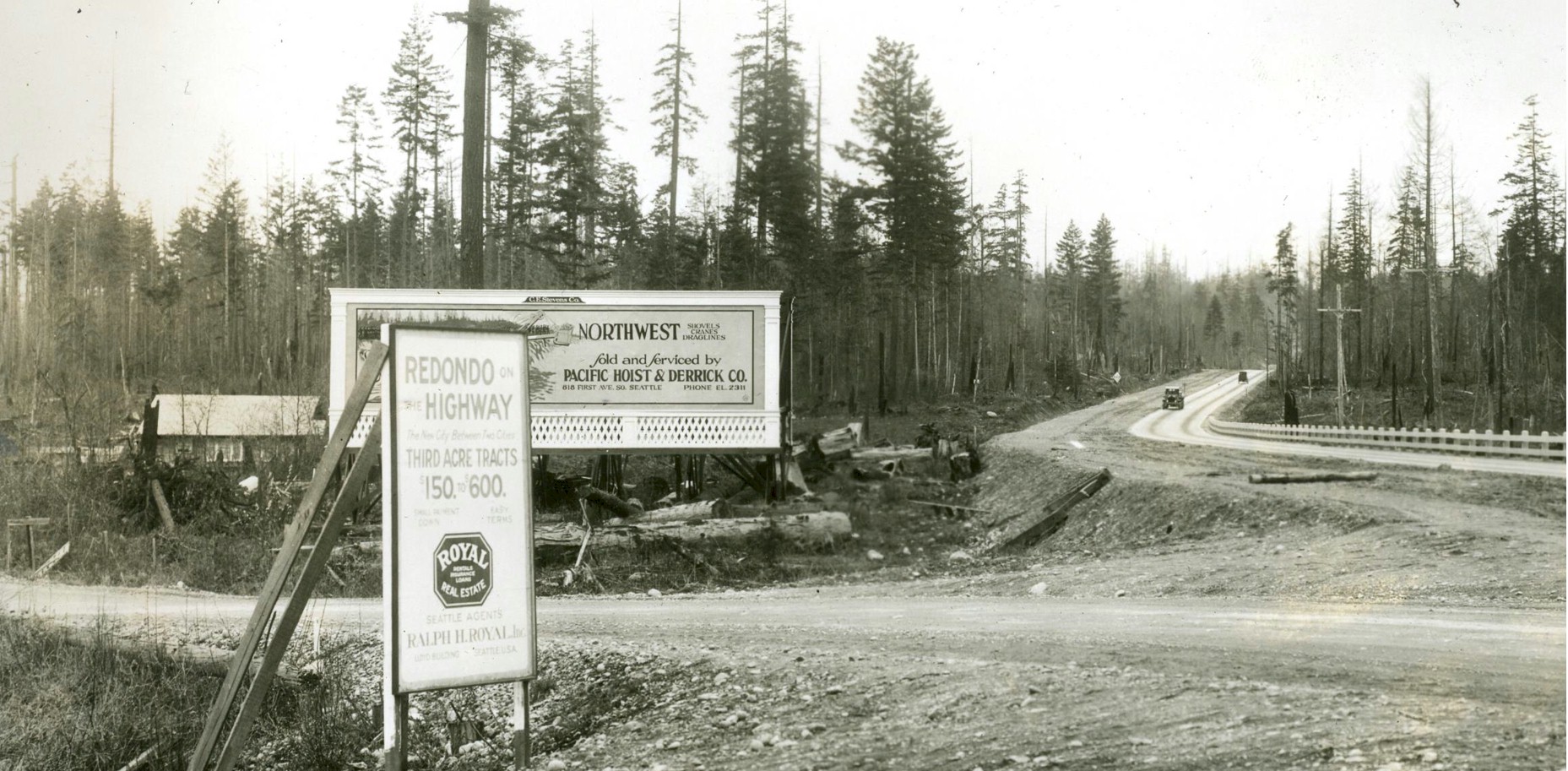
The 1927 Pacific Highway somewhere between Federal Way and Des Moines.
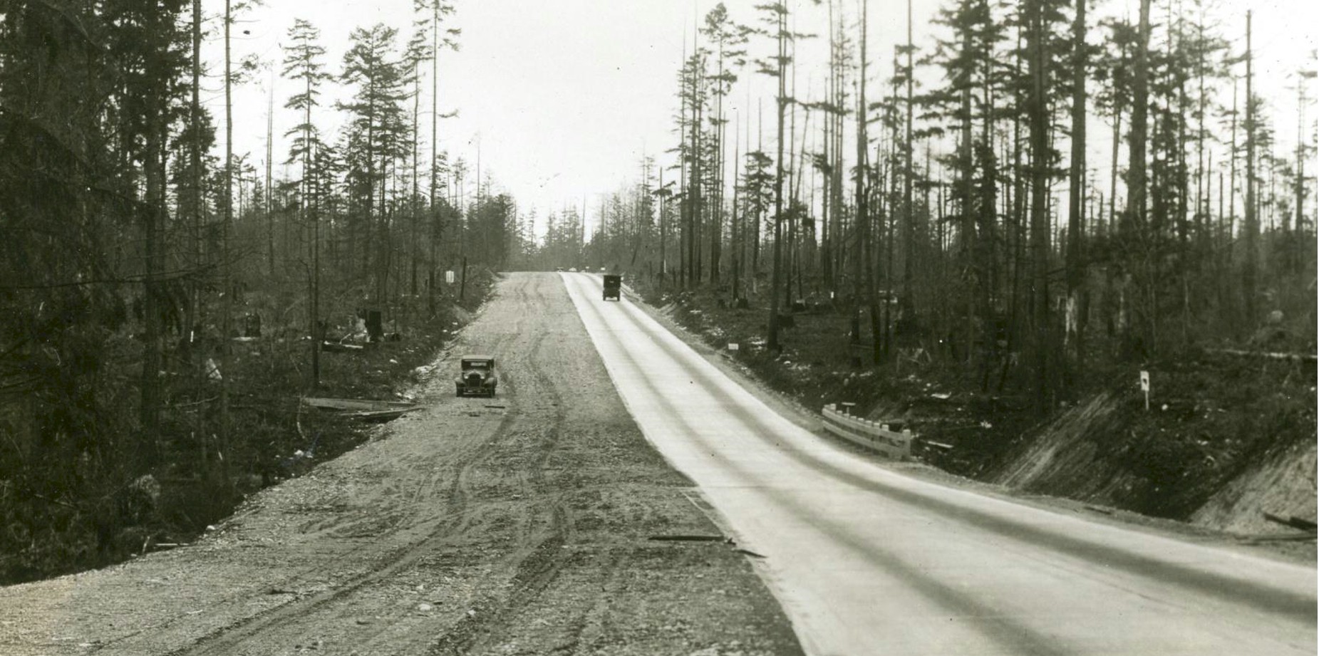
The 1927 Pacific Highway somewhere between Federal Way and Des Moines.
History of the Highline Road
By Curt Cunningham
Bridging the Tideflats
The first bridge to the tideflats east of Tacoma was the 11th Street bridge which was built over the Thea Foss waterway in the 1890's. The road on the east side of the bridge was St. Paul Ave., which meandered southeast to River Street. Today this intersection is E. River St. and Portland Avenue. River Street once continued southwest and connected to Puyallup Ave.
On July 16, 1904 County Surveyor Thornton had completed his preliminary survey and contour map of the proposed road running from the Puyallup bridge across the tide flats. The road was 1.5 miles long and was built on piling and will become known as Lincoln Avenue. The piles used were driven down 15 feet and the width of the road was 18 feet. In 1917 the viaduct was removed and replaced with a gravel road.
On August 1, 1904 the Lincoln Avenue bridge over the Puyallup river was completed and the road was opened for traffic. By 1910 the road up the hill to Northeast Tacoma was completed, and by 1912 it had connected with the roads in King county leading north to Des Moines. The first "Highline Road" utilized the existing county roads, and the Military Road was used between S. 288th St. and S. 216th Street.
The New 11th Street Bridge
The Tacoma Times on February 3, 1913 printed a story on the opening of the new 11th Street bridge; "The opening of the 11th street bridge to traffic today marks the dawn of a new era of development in Tacoma. It is the first link in the chain that will draw unheard of prosperity from the great tideflat area into this city. Tacoma today is the industrial city of the Northwest. Her payroll is equal to all the rest of the cities on Puget sound put together. And her tideflats are largely responsible for this. But development has hardly started there."
"When the old bridge was first built there was much croaking on the part of the short-sighted. No one now fails to recognize the important function it served in making Tacoma the industrial city of the Northwest. The new bridge will do all the old accomplished and much more, for it is built to do it. When Tacoma has a million people this bridge will still be adequate to carry the traffic over the flats. Coupled with the project of its construction is the erection of the second vertical lift structure at the Puyallup river."
"This will be finished in a couple of months. The great tideflat area heretofore inaccessible will then be within a few minutes' walk of Pacific avenue. The new bridge also makes adequate water facilities available. Nothing will then be required to force this to be covered with manufacturing but the reduction in price by those who hold it so industries can afford to utilize it. The bridge, however, will make it more valuable, will make it possible to tax it higher and sooner or later it must be utilized. The bridge has cost over a half a million in money and at least two lives. It stands there a monument to the coming greater Tacoma. It is up to the people to now get busy and utilize it."
On July 23, 1913 the Tacoma City Commissioners officially rejected the attempt of certain self-appointed interests to foist the name Lincoln bridge on the 11th street "High bridge." Commissioner Freeland said that the bridge was officially named the "11th Street bridge," but Mayor Seymour said it was dedicated as the "Tacoma High bridge." Now that there were two 11th St. bridges the "big one" was christened "Tacoma High bridge," insisted Owen Woods. "We already have a Lincoln bridge on Lincoln Ave., and cannot have two bridges with the same name," said woods. So the big bridge above the Municipal dock was officially named the "Tacoma High bridge."
The Highline Road
The Highline Road was an alternate route between Tacoma and Seattle between 1916 and 1924. In the beginning many thought the "Highline" was more important than the Pacific Highway, which was in the valley a few miles to the east. Well they were right and between 1924 and 1927 the road became a section of the Pacific Highway. The Highline Road was the shortest distance between Seattle and Tacoma, and for a time it was one of the most heavily traveled roads between Tacoma and Seattle.
The Highline Road was muddy most of the year making travel difficult, and only during the dry summer months was the road faster than the Pacific Highway. The "Valley Line" was paved the entire distance between Tacoma and Seattle, and even though it was about 10 miles longer, it was a pleasant drive in any kind of weather.
In 1915 Permanent Highway No. 14, which was the official name of the Highline between Seattle and Des Moines, was extended southerly from Seattle over Bond roads Nos. 12 and 13 to the Des Moines dock, a distance of 9.63 miles. Later that year the road was paved with monolithic brick, for a cost of $222,691.22. This is when the Highline was rerouted from Roseberg Ave. to the new alignment which is now Des Moines Memorial Drive.
In 1920 the Highline Road was improved From Northeast Tacoma to Des Moines and a new alignment was constructed. At Buenna which is located a mile north of Mirror lake the new highway is now called SW Dash Point Road. At S. 288th St., the new Highline road traveled due north on what is now 16th Ave. South. Originally 16th Ave. S. had extended to S. 288th Street. The new alignment follows 16th Ave. S. to Des Moines. From Des Moines, the road follows the original route to Sunnydale where it connects to the new alignment now called Des Moines Memorial Drive.
The new road continued north on Des Moines Memorial Dr. for 2 miles as it descended the hill and veered right (over the freeway) onto 14th Ave. S., and continued north on 14th Ave. S. and crossed the Duwamish on the wooden bridge which was completed in 1915 or 1916. After crossing the bridge it connected to the Pacific Highway, which is now called E. Marginal Way. Before this bridge was completed the original Highline route crossed the old Duwamish channel on the wooden 1890 bridge which was located at the south end of Myrtle Street. From 1913 to 1920 the Duwamish was straightened and the the old channel was filled in.
On June 5, 1923 the State Highway Commission decided that the new trunk highway between Tacoma and Seattle would cross the tideflats east of Puyallup Ave. parallel the interurban tracks to Milton, go north to Redondo and connect to the Highline Road.
On August 16, 1923 the Automobile Club of Western Washington had taken down its road signs pointing to the Highline road between Seattle and Tacoma. This was done because the Highline was in such bad shape that it was dangerous to drive on. The club had earlier issued a warning that motorists should not attempt to travel the Highline, but the warning was disregarded or it did not reach all drivers. The Tacoma Times then said; “The Highline road is a disgrace. It would be difficult to find a worse road anywhere in the state."
"Two years ago a new county commissioner was elected in King county on the pledge that he would clean out petty politics in the court house at Seattle and repair the Highline road. And he didn't do either. He has let the Highline road inside King county get into the worst condition in its history. The Pierce county line is just at the top of the Julia's Gulch hill and Pierce county commissioners could repair the hill road, but that would not do much good. They cannot well be blamed for falling to keep up their short section of the road when Seattle is utterly failing to do her part."
“The Highline road is badly needed. The Pacific Highway through the valley is congested. It might be a good idea for the Tacoma Chamber of Commerce, the service clubs and the automobile club to demand that Seattle put the Highline in good condition again. If Tacoma let the main highway get in as bad shape as the Highline is now, Seattle would be yelping at us constantly about it."
Nothing would be done to improve the Highline road until a year later in the summer of 1924, when the State Highway Department changed their minds and routed the Pacific Highway between Tacoma and Seattle via Lincoln Ave. instead of paralleling the interurban to Milton. This was because there was an existing bridge across the Puyallup river at Lincoln Avenue. That year paving began on the new route and entire Highline between Tacoma and Seattle was paved with concrete. At Tacoma the highway was routed onto River St. from Puyallup Ave. and it crossed over the rail yard on a long bridge.
From Northeast Tacoma, Dash Point Road and 16th Ave. S. were used to Des Moines. This new route diverted the main line travel away from the Valley Line, and eliminated 4 railroad crossings with the Milwaukee Road ( C. M. & St. P.) between Tacoma and Auburn, one interurban crossing at Auburn and one Northern Pacific crossing at Auburn.
On January 12, 1925 it was announced that another near super-highway was to be added to the Pacific Highway within the next 3 years. This is when the State Highline road between Tacoma and Seattle was to be completed. Like the new Everett construction, this road was 50 feet wide and included shoulders for parking on either side, and a dividing space in the center. The new road did not follow the present Highline road, and it cut out a good many of the curves, and was built up on the hills, to avoid grades. This road bypassed Des Moines 1.25 miles to the west and shortened the distance between Tacoma and Seattle over the valley road by about 10 miles.
The proposed highway along the interurban tracks to Milton would be built in 1926 and completed in 1927. This is when a new 4-lane highway between Tacoma and Seattle was completed and opened for traffic. At first the new highway only had 2 lanes paved with concrete with the other 2 lanes to be paved the following year. This new highway bypassed the Highline road entirely. This new 4-lane Pacific Highway would remain the main trunk road until the freeway was constructed between Tacoma and Seattle in 1964.
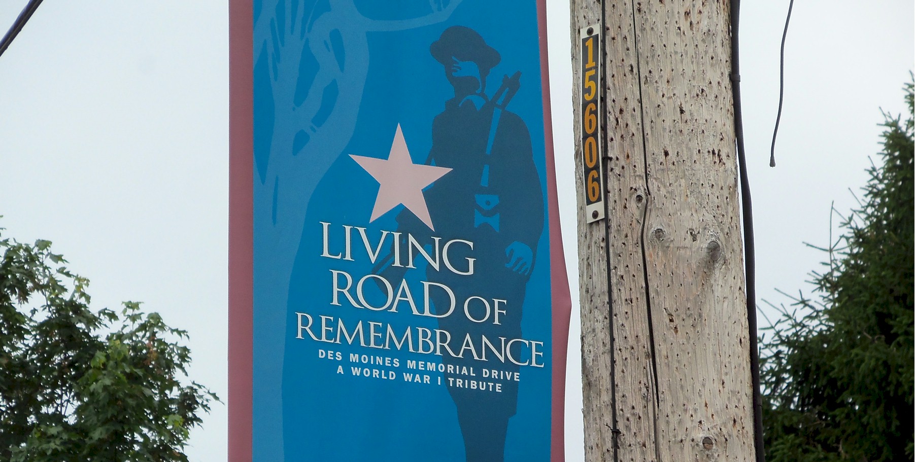
The Road of Remembrance
After World War I ended in 1919, new road construction began all across the country. Many retuning soldiers found work building these new roads, which were being built to replace the "elbow joint" way of travel. The American Forestry Association had petitioned to have trees planted along the road sides in remembrance to the fallen soldiers.
On Armistice Day, November 11, 1921 the Seattle Garden Club chose the 10 mile meandering Highline Road between Seattle and Des Moines for a tree planting effort to honor those Seattle area men and women who were killed during World War I. This is when this 10 mile section of the Highline Road became Des Moines Memorial Drive, and a "Road of Remembrance."
In 1922 The Seattle Times reported: "Along the Pacific Highway for miles between Seattle and Sunnydale, thousands of small American flags fluttered in the breeze, these flags marked the place where a memorial elm was planted in memory of our state’s heroes who made the supreme sacrifice.
Also in 1922 a one mile stretch of the Pacific Highway roadside north of Seattle between N. 137th and N. 160th was planted with elms and dedicated as a Road of Remembrance which was called "Victory Way.
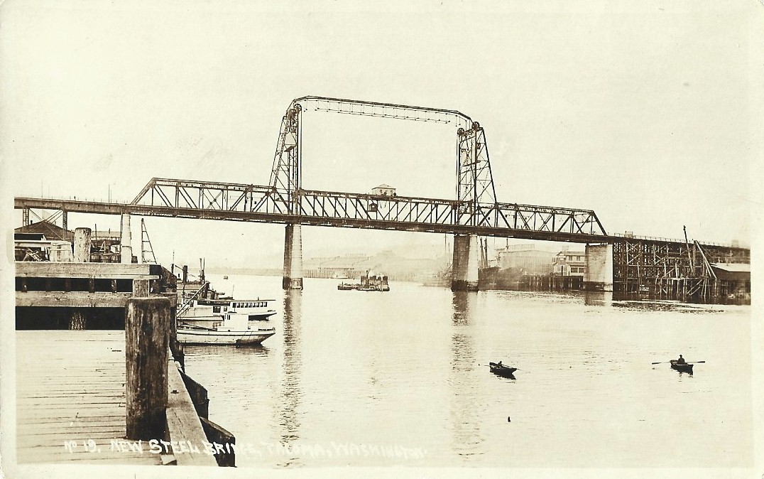
11th Street Bridge Tacoma 1913
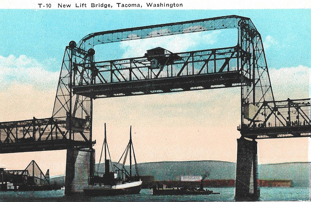
11th Street Bridge 1913
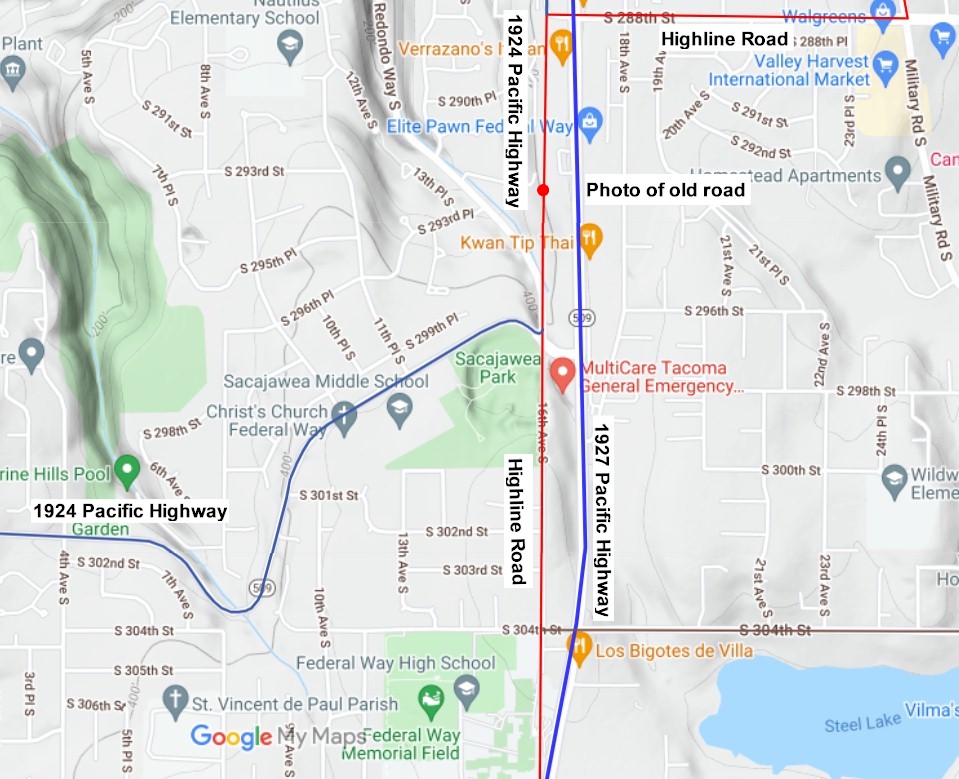
2022 map 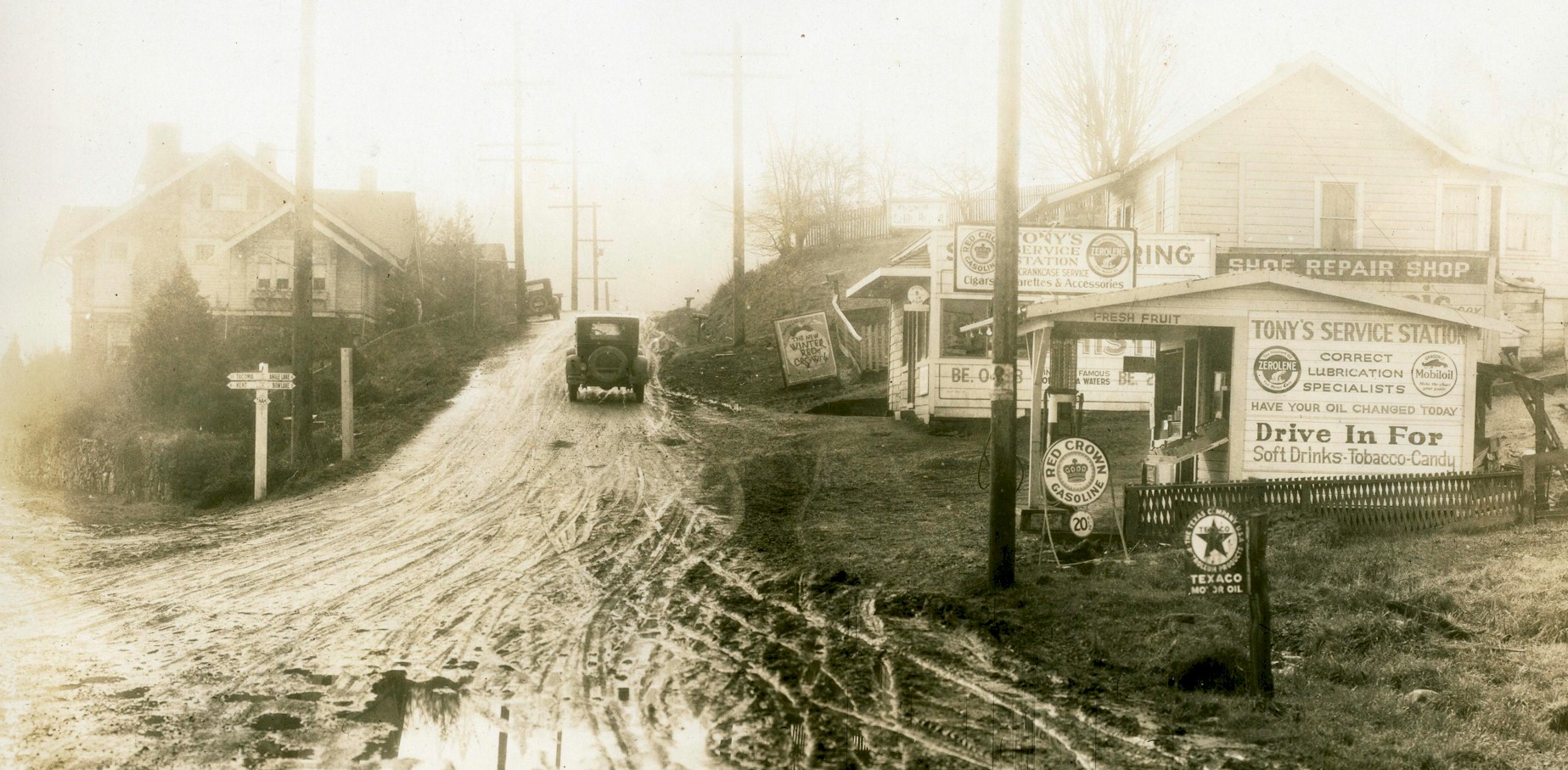
Photo taken from the Highline Road. The road to the left leads to Tacoma and Kent. The road going up the hill leads toward Angle and Bow lakes. 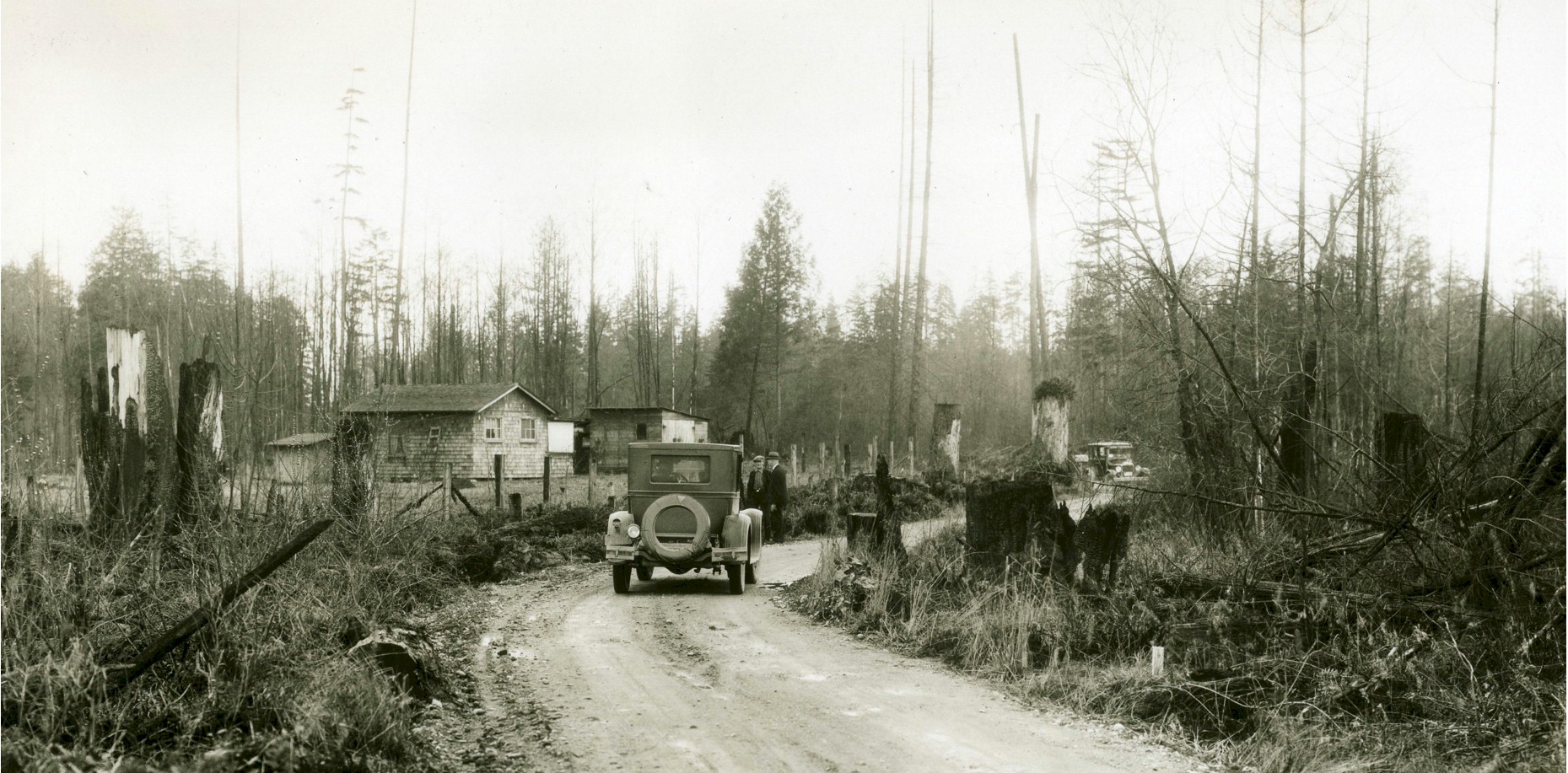
Highline Road 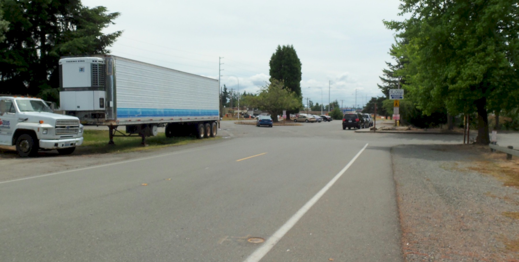
Highline Road north of S. 304th St. Looking south. 2011 |
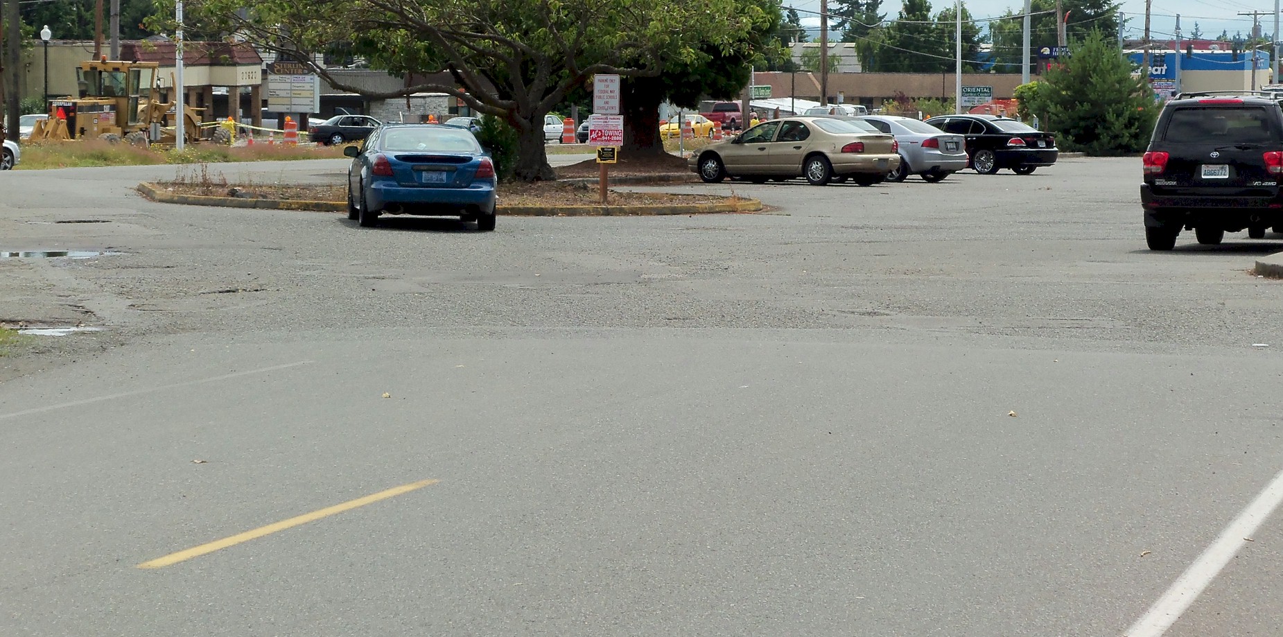
The original Highline Road at S. 305th St. looking south. Photo taken in 2011. 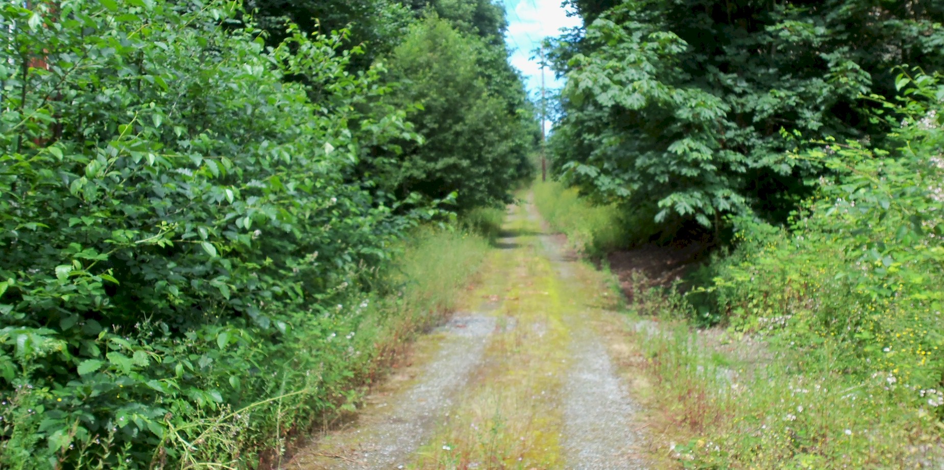
An original section of the Highline Road between Redondo Way and S. 288th St. This was the Pacific highway between 1924 and 1927. Photo taken 2011. 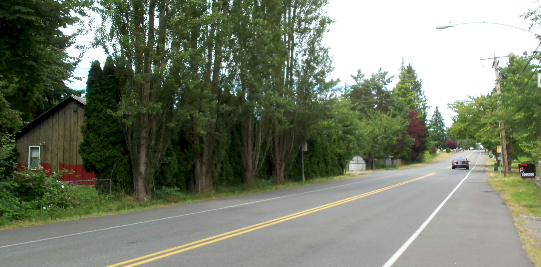
Road of Remembrance. There are 4 elm trees still growing along the road in 2011. Looking north. 
Des Moines Memorial Drive. Looking north. |